Brich Burcina
Access
Exit Carisio (if you're coming from Milan) or Santhià (if you're coming from Turin) from the Turin-Milan motorway and continue along the state road as far as Biella; in Biella there are brown signs everywhere indicating the route; however, once on Corso San Maurizio, take the western ring road towards Pollone, and in Pollone park in the large space near the park (parking is paid for; there is also a sector dedicated to camper vans).
Introduction
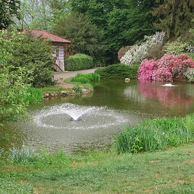
The Brich Burcina is the culminating point of a hill to the east of Pollone, purchased and laid out as a park in the mid-1800s by the owner Giovanni Piacenza, a descendant of the founders of the wool mill of the same name (founded in 1733), a cashmere manufacturer, in accordance with the taste of landscape gardens of the time.
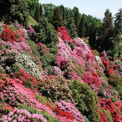
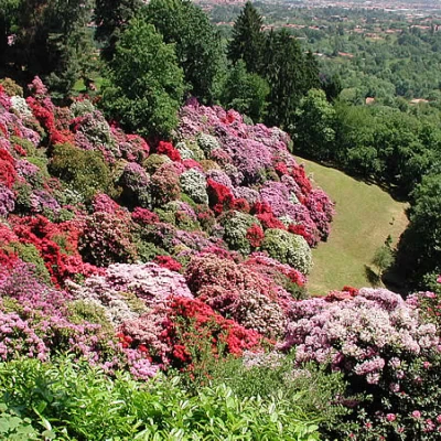
In the beginning, the paths, the pathways, the pond were created; his son Felice continued the work by building more paths and pathways, created the rhododendron basin, inserted trees of all species, especially exotic ones, with an eye more to aesthetics than to a botanical project. The hill has belonged to the Municipality of Biella since 1935, and has been a regional park since 1980. During some work, in March 1959, several archaeological finds came to light on the summit, including axes, spits, iron tools and a beautiful bronze jug, currently on display at the Museo del Territorio in Biella. After these findings, investigations were carried out, uncovering several remains of pottery, which allowed us to hypothesise that the hilltop had been inhabited for several centuries by a people dedicated to sheep-farming, hunting and agricultural activities, and that the pottery was presumably produced locally. A different provenance is that of the Etruscan jug, with a three-lobed mouth and a very raised spout, from the 5th-4th centuries BC; coming from Vulci, a widespread trade product in the Iron Age, it was much coveted by the Celtic aristocracy and was often part of funerary goods; the one from Biella, precisely because of the preciousness of its workmanship, must have belonged to a high-ranking chief. Also in other areas of the Piedmont, ceramics of the same type from the same period have been found in sites with the same characteristics (elevated with respect to the surrounding territory and easily defensible), all dating back to the period of Celtic settlement and expansion.
.Description
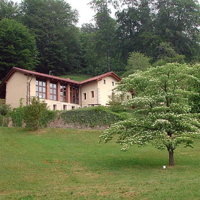
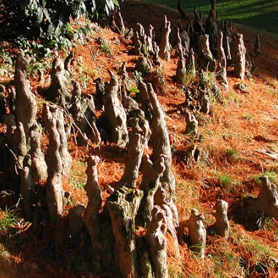
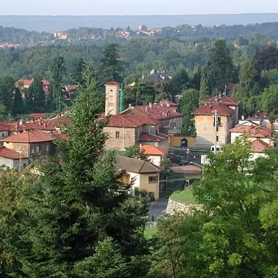
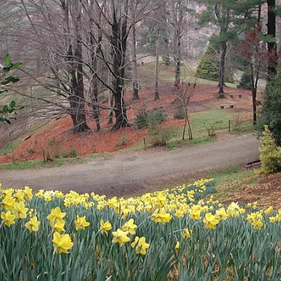
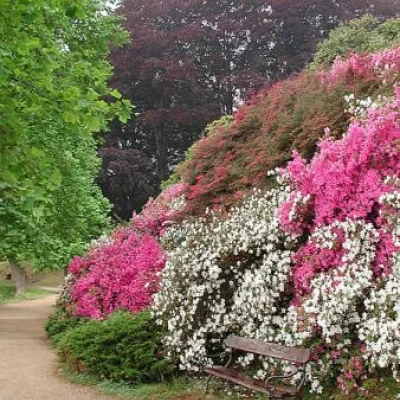
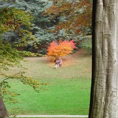
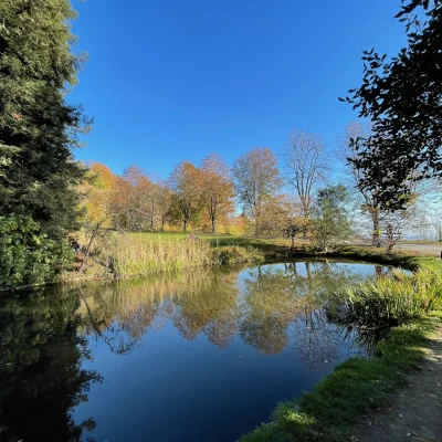
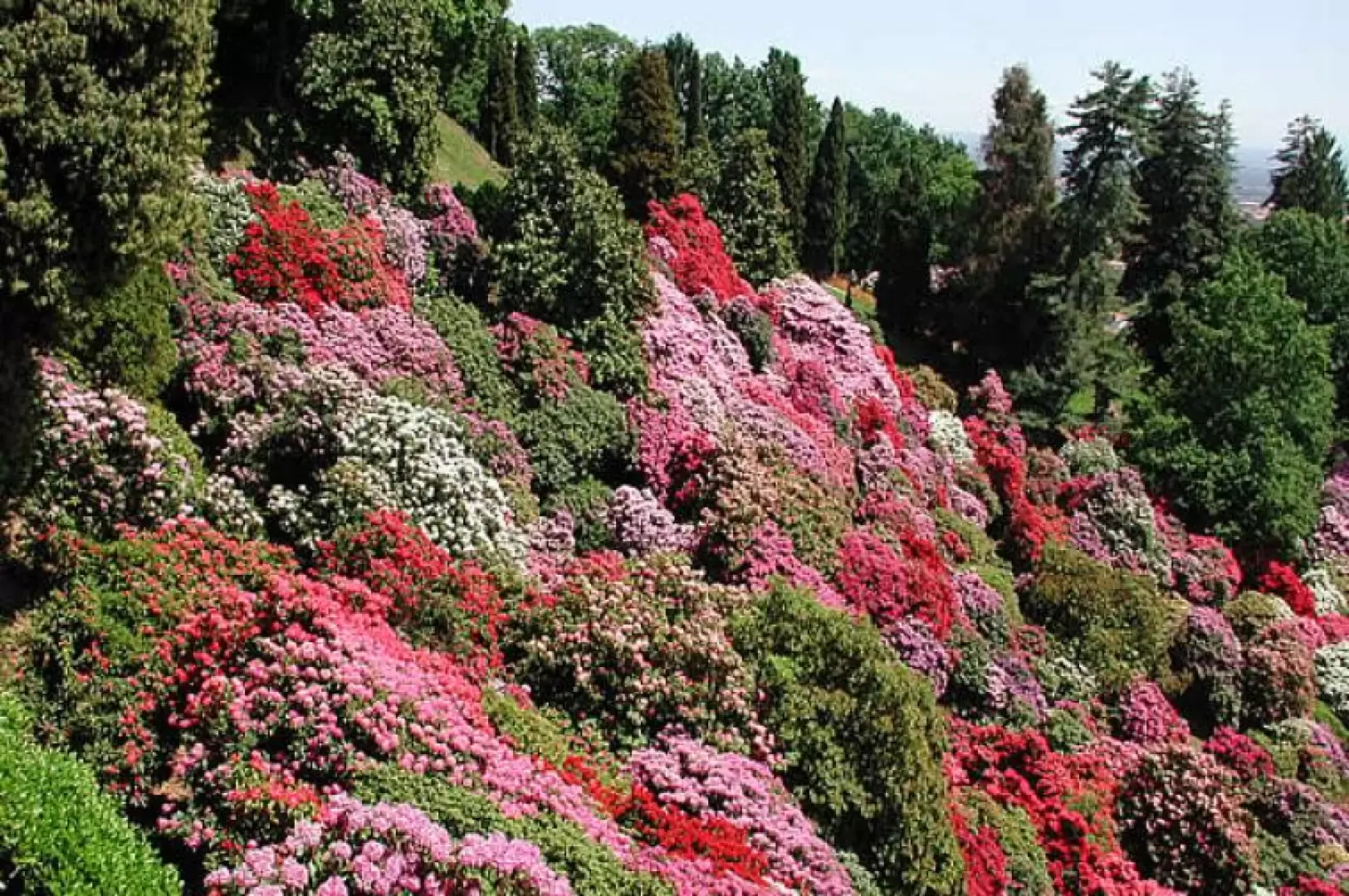
Entering the park (570m), take the wide avenue leading to the first little house, opposite the pond; it is inhabited by goldfish, and has camellias and azaleas all around. The road makes a wide bend to the left and immediately above, to the right, is the Park headquarters in the renovated Cascina Emilia, which is also a reception centre for school visits. There are many paths; I recommend we ignore the shortcut and continue along the road, which climbs with a moderate gradient, graveled, until we reach a bend to the right, where there is a bald cypress tree with oddly shaped roots; all the trees have plaques with their common name, family, species, and origin. We continue on and above us, to the left, in another recently renovated farmstead, there is a bar; further on, to the right, the park services. To the left, a wide path leads to a beautiful beech forest; we follow it downhill. We continue almost level until we come to a diversion: in front of us, another wood of splendid beeches; to the left, an enormous specimen; to the right, after a wide scenic area, the tulip tree avenue begins, which has to the left, a string of splendid azaleas, and to the right, the rhododendron basin, which in years when it does not rain on the blooms, offers an incomparable spectacle. Walk the entire avenue looking out from the little balcony: below you in late May, early June, a lake of colours in all shades from white to pale pink to purplish red, and further on Biella and the Biellese, as far as the Serra and the Vercelli plain. At the end of this avenue, cork oaks have recently been planted. Continue until you reach the gates of the other entrance to the park, called I Galinitt. The road makes a wide bend to the left and goes uphill. After about fifty metres, when it becomes flat again, a small path zigzagging uphill branches off to the right: you can follow it quietly and enjoy the views below as it climbs. It passes not far from a farmstead still inhabited by farmers, and joins a wider path behind it, coming from the left; follow it for about fifty metres, and then leave it for another fairly marked path that climbs to your left, still zigzagging. Continue along this path uphill, ignoring the detours or following them to the right only long enough to find the path going uphill again. You will soon reach the road, which makes a wide turn. At this point, cross the road and descend slightly onto another wide path, which crosses the south-eastern slope of the park, passing through the middle of another rhododendron basin. Follow it all the way to the end, there is also a log-bench for a nice rest; the view over the Biellese here is enthralling. At the bottom, take the steep path to the left and you will soon reach the top of the hill. It is all covered with birch trees, with a wide path around it, and several benches; at the extreme north-eastern end you can see the site of the archaeological finds. From the summit the view sweeps over the Biellese Alps, the Cucco, the Oropa basin with Tovo, Camino and Mucrone, as far as Mombarone to the west. To the north is Torre Martini (835m). Descent: I recommend descending along the road, which starts near Torre Martini. With wide hairpin bends, passing farmsteads still inhabited by farmers (it is not uncommon to see grazing cattle), near the trattoria, which is situated a short distance from the first farmstead you come to on the right as you descend, you arrive after a bend to the left at a beautiful meadow overlooking the village of Pollone and the mountains. We descend further, and after about a hundred metres on the left, we find the handkerchief tree, an oriental plant that in spring seems to have many white handkerchiefs hanging under its leaves, and which is also beautiful in autumn. Here every season has its colours, starting in early March with a carpet of yellow trumpet daffodils, and ending with the autumn fire of maples, beeches and cherry trees. Descending further we find the redwoods, and the beautiful beech forest. The road crosses to the left the continuation of the one coming from the Galinitt; we go right again, until we find halfway down the traverse below, to the right, a diversion that takes us into another beech wood, and which comes out near the little house that houses the services: immediately afterwards, downhill, to the left, another stepped shortcut leads to the road that we travelled uphill, which we cross to enter the last shortcut that arrives near the entrance. Doing the whole tour at a leisurely pace takes a couple of hours. At the entrance, there are explanatory boards where other paths are also marked: this circular tour of mine is a suggestion not to take the same route out and back, and to get a complete idea of the park. For further information on the blooms, see the website: www.parcoburcina.piemonte.it and, if necessary, call the park authority for more precise information, because the timing can also vary depending on the weather, anticipating or delaying. The visit to the park, which, even if done at a leisurely pace, does not take more than half a day, can be combined with a walk among the daffodils of the Oropa basin: the Muanda alpine pastures.
Galleria fotografica
