Leave the motorway at the Châtillon-Saint-Vincent tollbooth. Turn left and continue for 300 metres to the roundabout. Take the third exit onto via Émile Chanoux and follow it for 600 metres through the centre of Châtillon. Turn slightly right onto via Menabreaz and continue for 450 metres to the roundabout with the Matterhorn monument. Take the second exit onto Regional Road in the direction of Valtournenche. Continue along for about 27 kilometres, passing through the municipalities of Antey-Saint-André and Valtournenche, until you reach Breuil-Cervinia, where, just after the avalanche tunnel, on the left is the entrance to the large free car park 🅿️ located near the bus terminal.
The starting point of the itinerary is served by public transport. To consult the timetable, visit the aosta.arriva.it
The information provided has been checked on the date of the survey of the route. Before departure, it is advisable to check for any changes to the route. For up-to-date and detailed directions, we recommend the use of Google Maps or Apple Maps.
.
Introduction
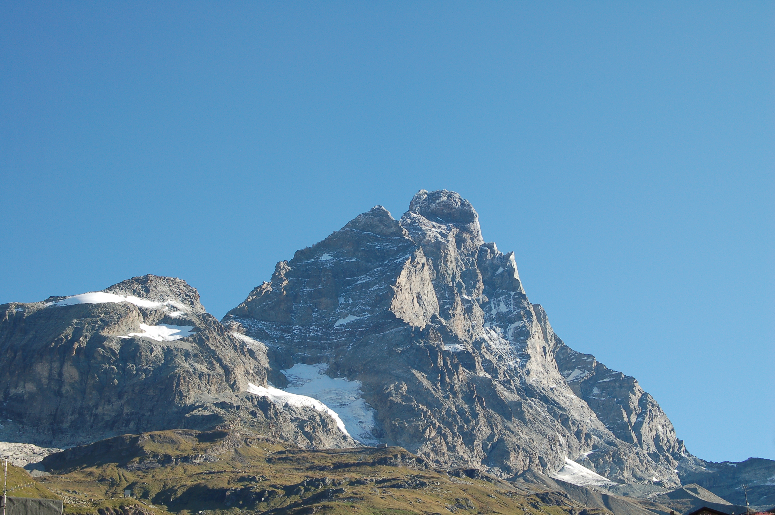
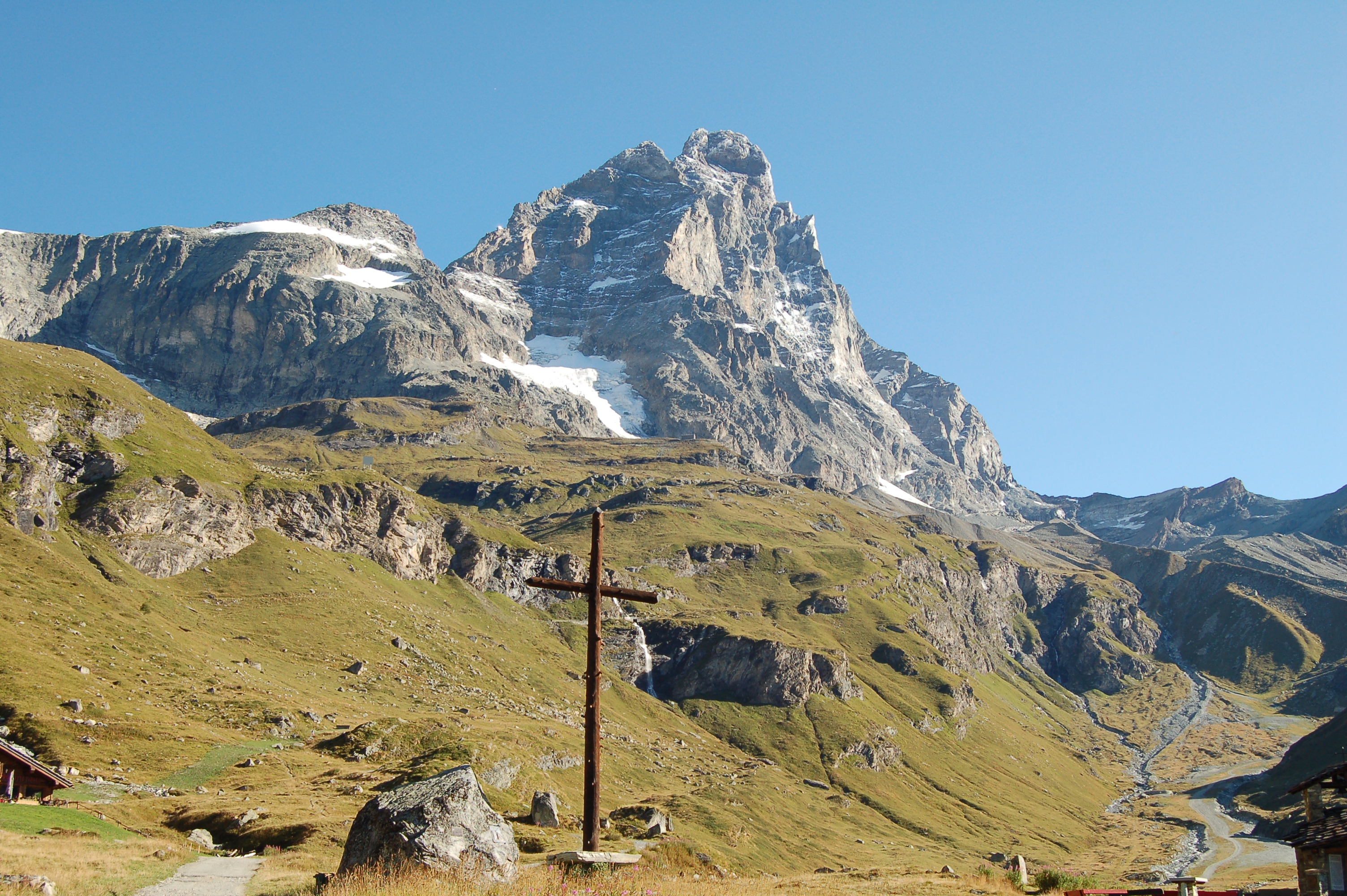
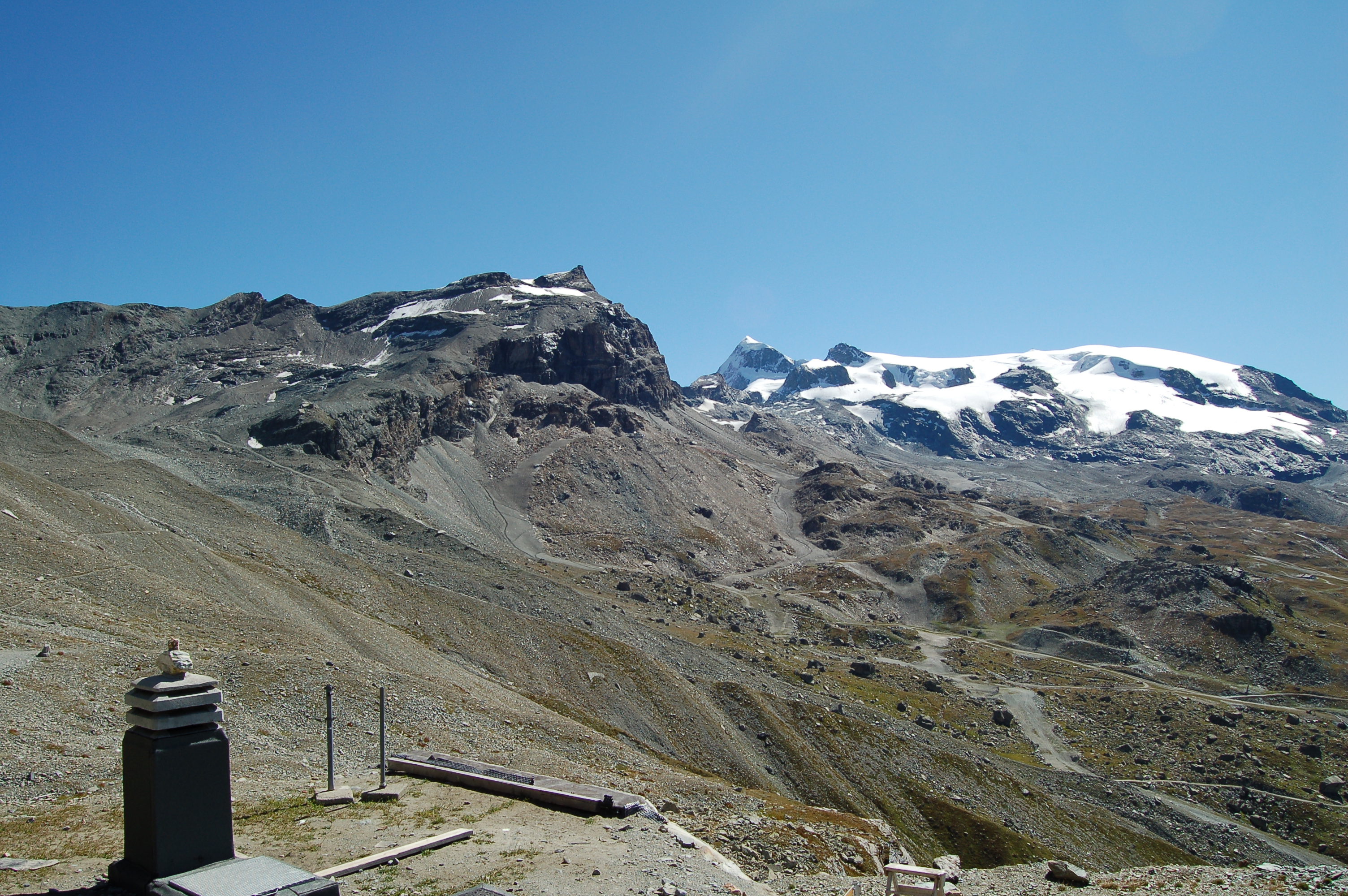
A classic and unmissable route for those who visit Breuil-Cervinia and wish to get closer to the high mountain environment without facing technical difficulties. The Duca degli Abruzzi Refuge at Oriondé is reached by a steady ascent along a farm road and a well-marked path, culminating in one of the most breathtaking viewpoints on the Aosta Valley side of the Matterhorn. The ascent develops entirely on the south-west side of the Gran Becca, allowing close admiration of its imposing mass, but also a view of the Plateau Rosa and, further down, the glacial basin of Breuil. The hut marks the start of the Italian normal route to the Matterhorn: the attendance is varied, including hikers, mountaineers and the curious, but the environment retains an austere and majestic character.
.
Description
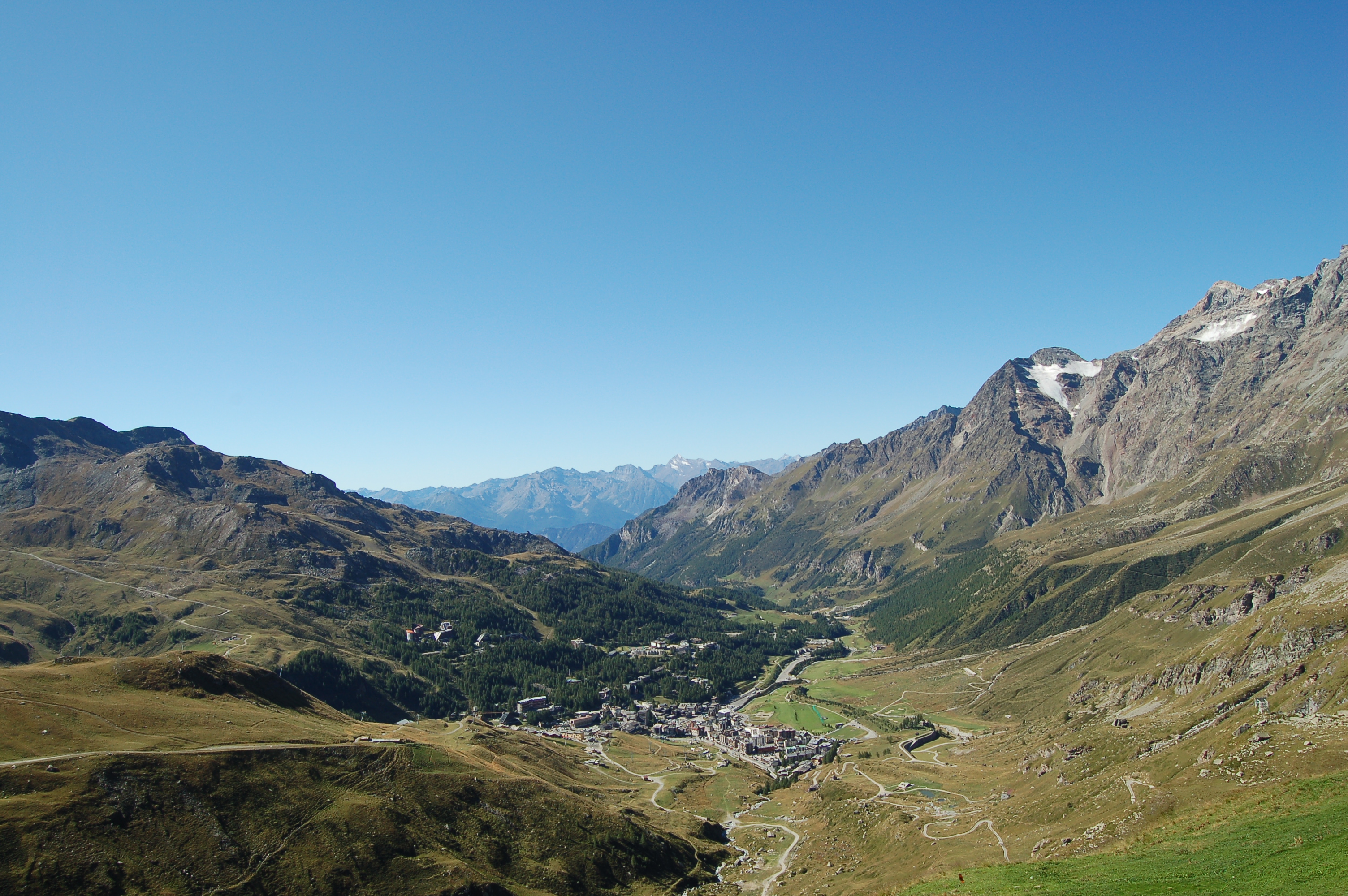
0h00'0.00km From the central car park, walk towards the bus terminal and pass the roundabout. Then continue along the left pavement of Via Guido Rey, skirting the first buildings in Cervinia, until you reach the roundabout in front of the chapel dedicated to Maria Regina Vallis Augustanae (2,002m). In the small adjoining park, on the left, you will also notice a half-bust dedicated to Mike Bongiorno.
0h05'0.32km Turn left into via Carrel and then via Battaglione Monte Cervino, until you reach a crossroads in front of the Hotel Europa. Here, turn left, skirting the tennis courts, and spot the signposts indicating the start of paths
and
.
0h15'0.85km
and
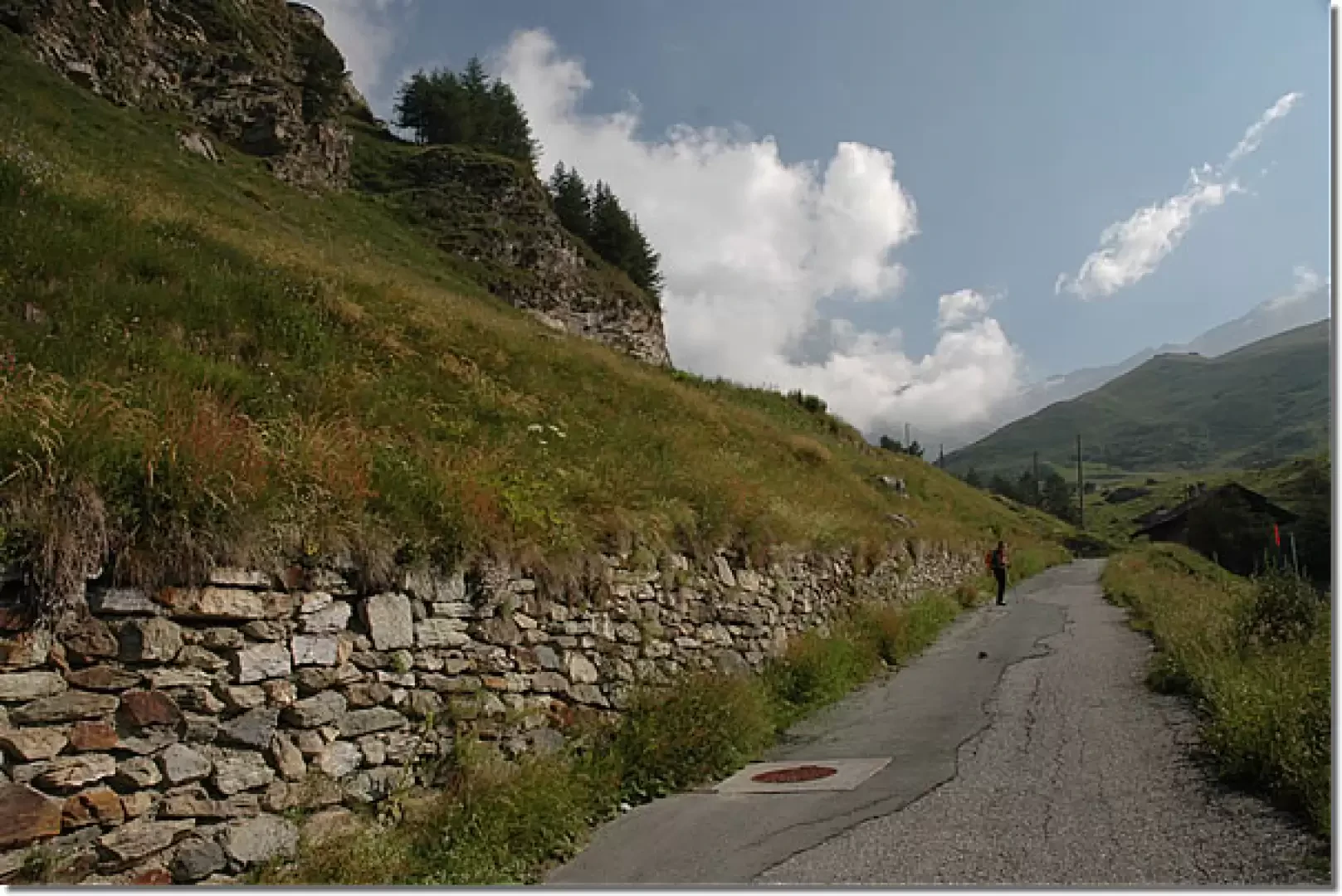
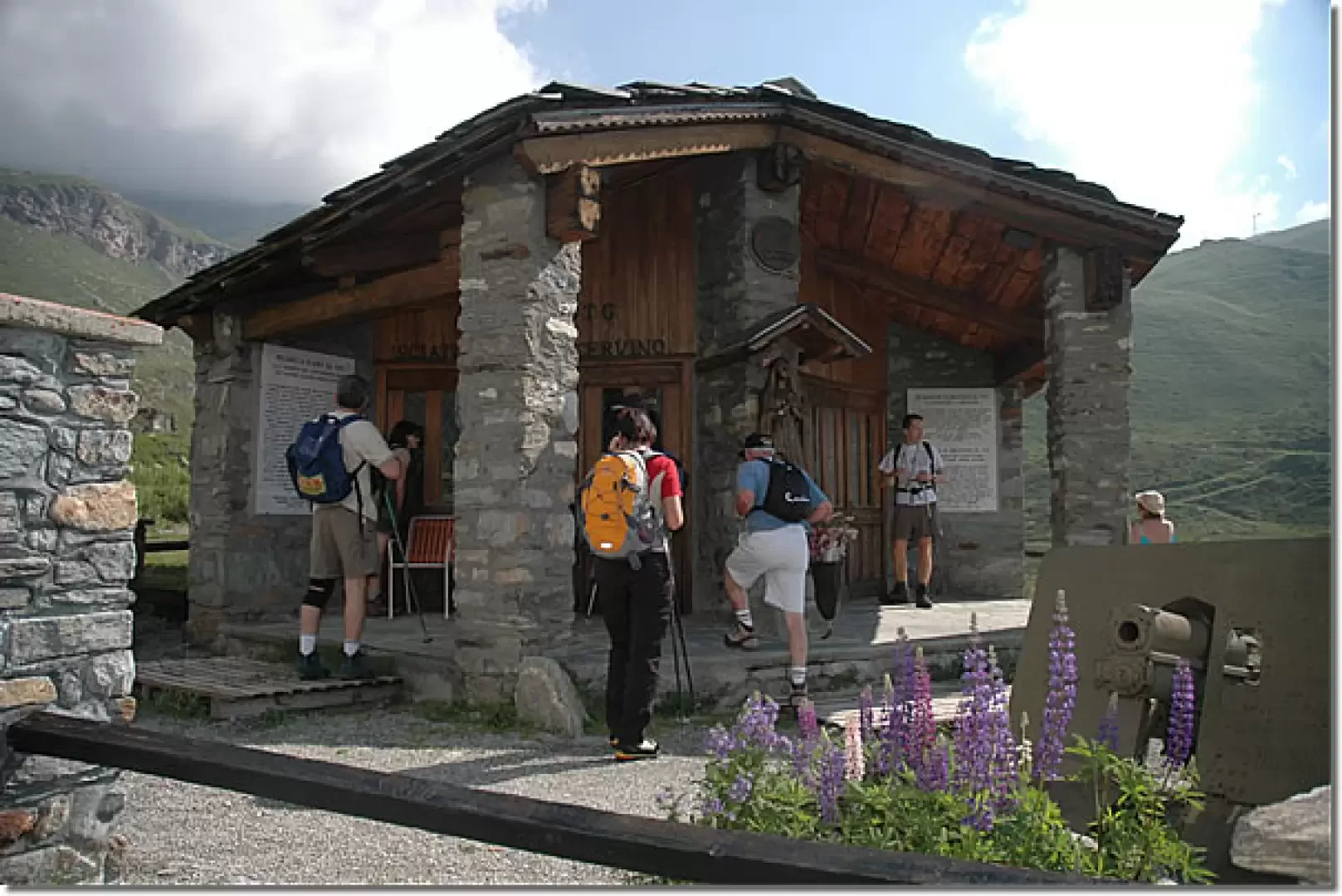
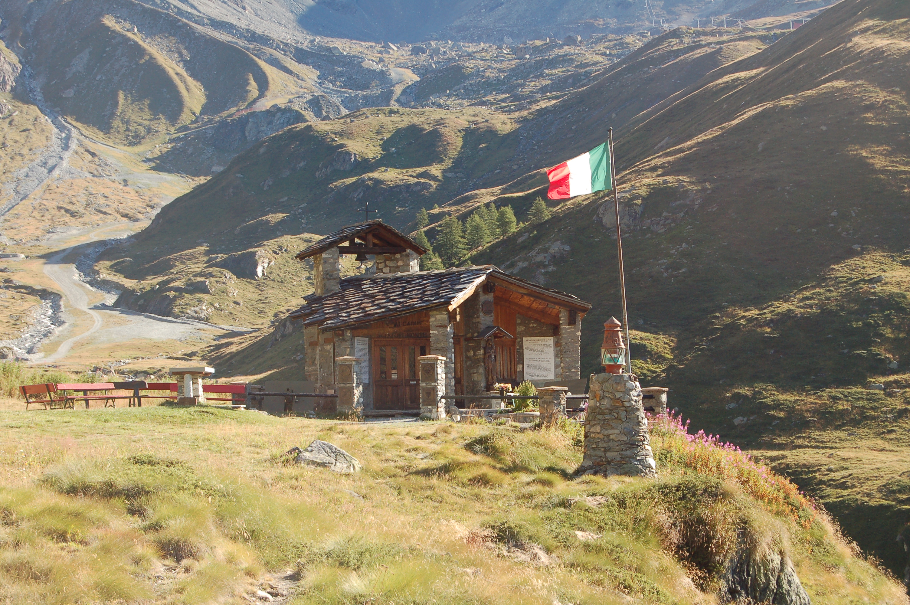
Take the small tarmac road, following the first two hairpin bends. Shortly afterwards, signposts direct you onto some cut-off paths that make the ascent more direct. After crossing the small road again, now unpaved, you reach a small shelf. Follow the road for a short distance, then cut a hairpin bend to the right, taking you in front of a metal barrier. From here, make a short turn to the left and gain the plateau on which stands the Chiesetta degli Alpini (2.14 m), dedicated to the Monte Cervino Ski Battalion, flanked by a high cross commemorating the mass celebrated by John Paul II.
0h40'1.63km
and
Beyond the chapel, the road veers to the right, passing the "Royaume du Cervin" restaurant and reaching a small bridge over the Fossu stream. Here, numerous path cuts begin, alternating with the cart track and reducing the length of the route. With a long diagonal cut across the pastures, you return to the dirt track, reaching the fork to the Cherillon glacier (2,285m).
1h15'2.42km
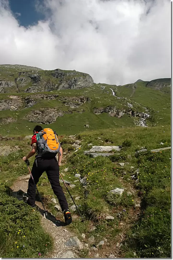
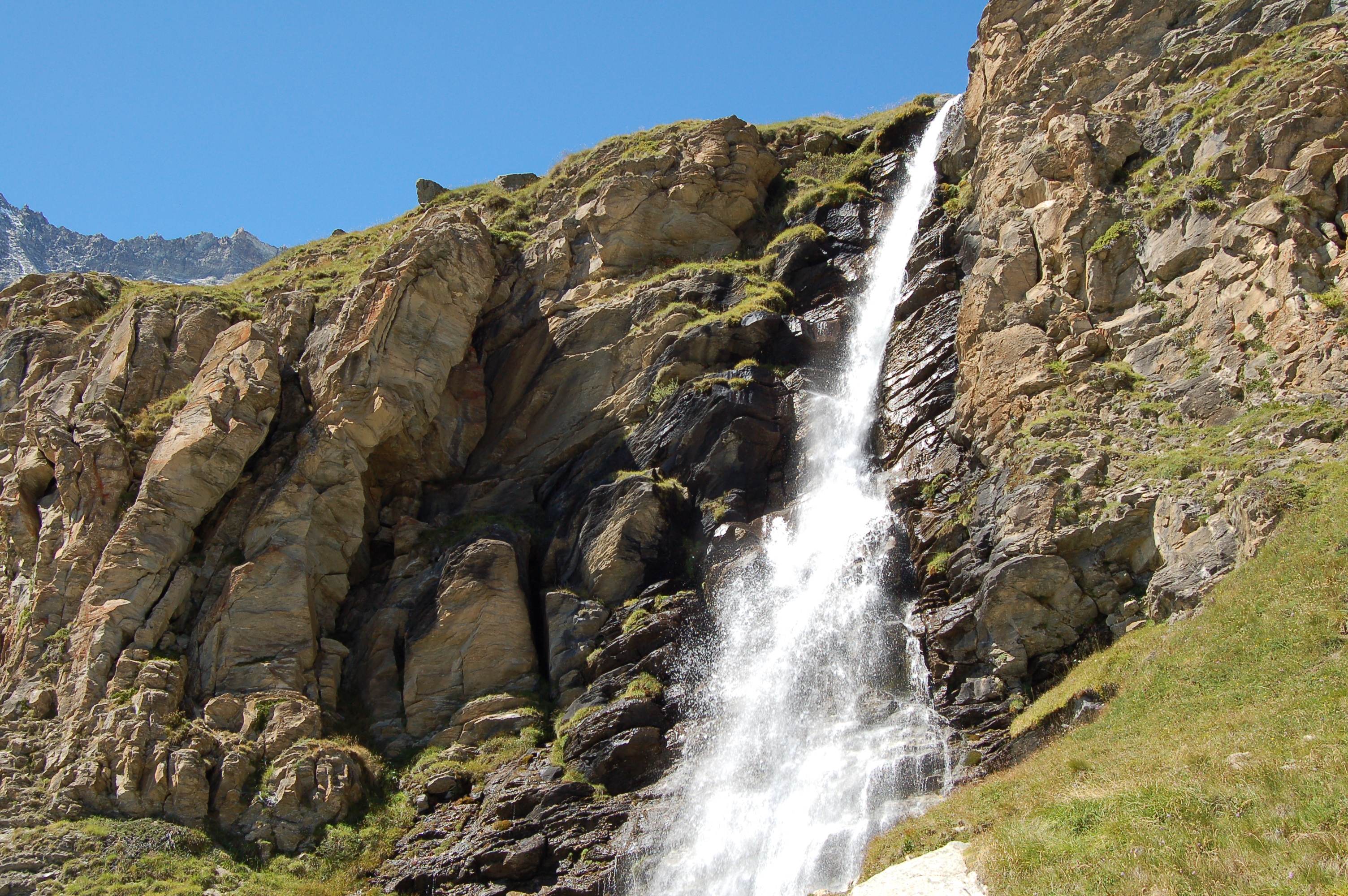
Neglect the path to the left and continue to the right on the dirt track along a section with a slight incline until reaching the waterfall created by the Porteiller stream (2,355m). Turn left and take the path that continues to cut across the road until reaching the pastures of Mont de l'Eura. After a short stretch on the dirt track, turn right onto the narrow path leading to the pastureland of Mont de l'Eura (2,546m), located at a hairpin bend. From here, continue along the path, which climbs steadily, as interesting views open up over the Cervinia ski resort and the Breithorn. After crossing the road, turn left: an ascending diagonal takes you to the junction with the Carrel path, signposted
.
2h40'4.65km
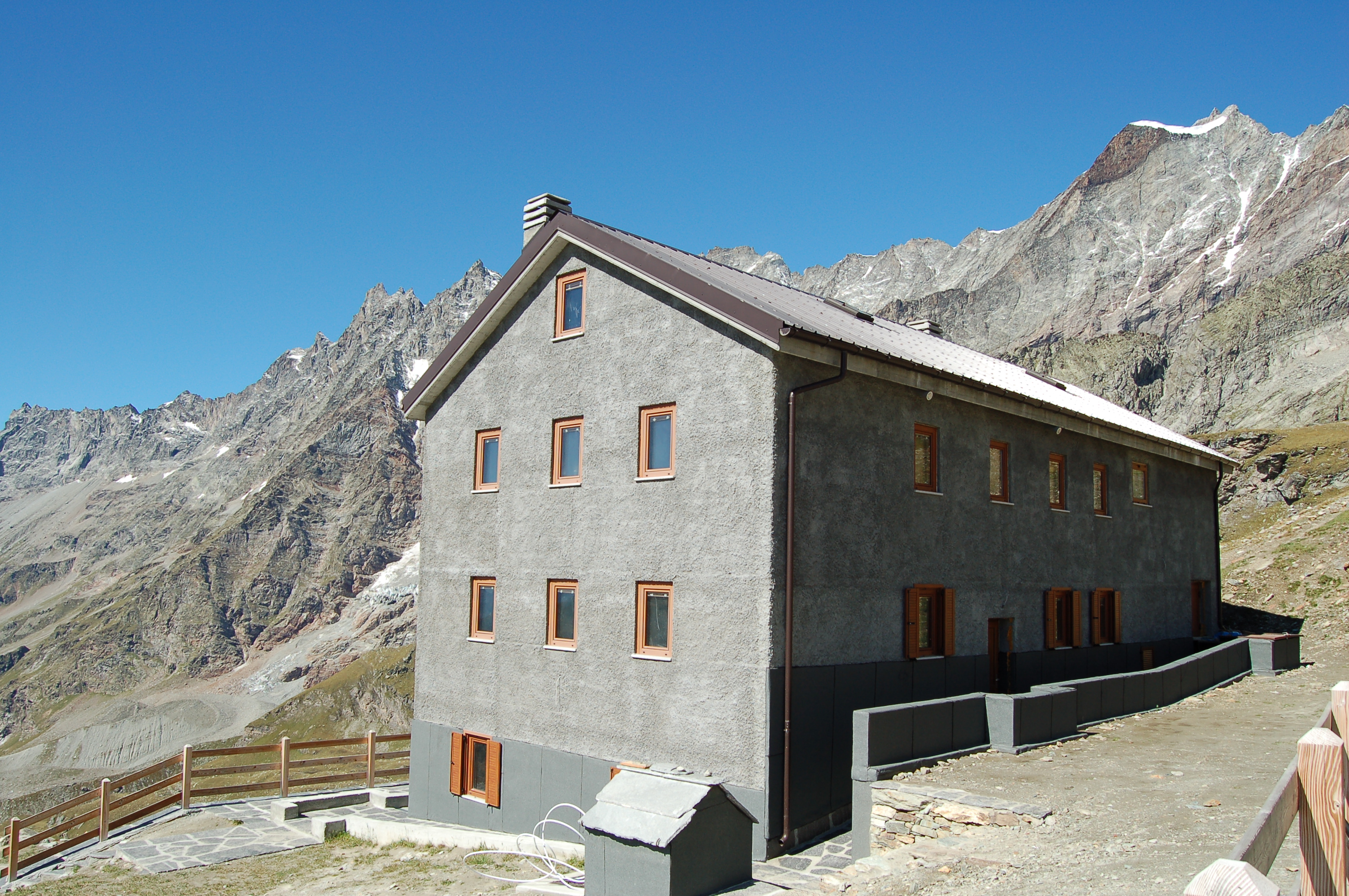
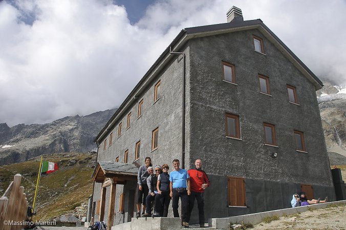
Turn right and cross the dirt track. The path then climbs the barren slope with a long diagonal; at the end, turn left and, having reached the road for the last time, you are in front of the Duca degli Abruzzi hut at Oriondé (2.810m) 2h50'4.97km .
The return follows the same route as the outward journey: from the Duca degli Abruzzi hut, descend to the pastures of Mont de l'Eura and the Cherillon glacier crossroads. Continuing along paths and cart tracks, you return to the Chiesetta degli Alpini and from here to the Hotel Europa crossroads. Finally, we return along via Battaglione Monte Cervino, via Carrel and via Guido Rey to the central car park in Breuil-Cervinia 3h20'5.76km .
Rifugio chiuso questa estate per lavori di ristrutturazione. Vedendolo dall'esterno i lavori sono stati fatti molto bene e si presenta molto bello. Avvistati diversi alpinisti in cima al Cervino e incontrato altri 2 italiani e 3 spagnoli che salivano alla Capanna Carrel per scalarlo l'indomani. Discreto l'affollamento al rifugio nonostante la chiusura.
Rifugio chiuso questa estate per lavori di ristrutturazione. Vedendolo dall'esterno i lavori sono stati fatti molto bene e si presenta molto bello. Avvistati diversi alpinisti in cima al Cervino e incontrato altri 2 italiani e 3 spagnoli che salivano alla Capanna Carrel per scalarlo l'indomani. Discreto l'affollamento al rifugio nonostante la chiusura.


Comments (0)
Sign in to leave a comment