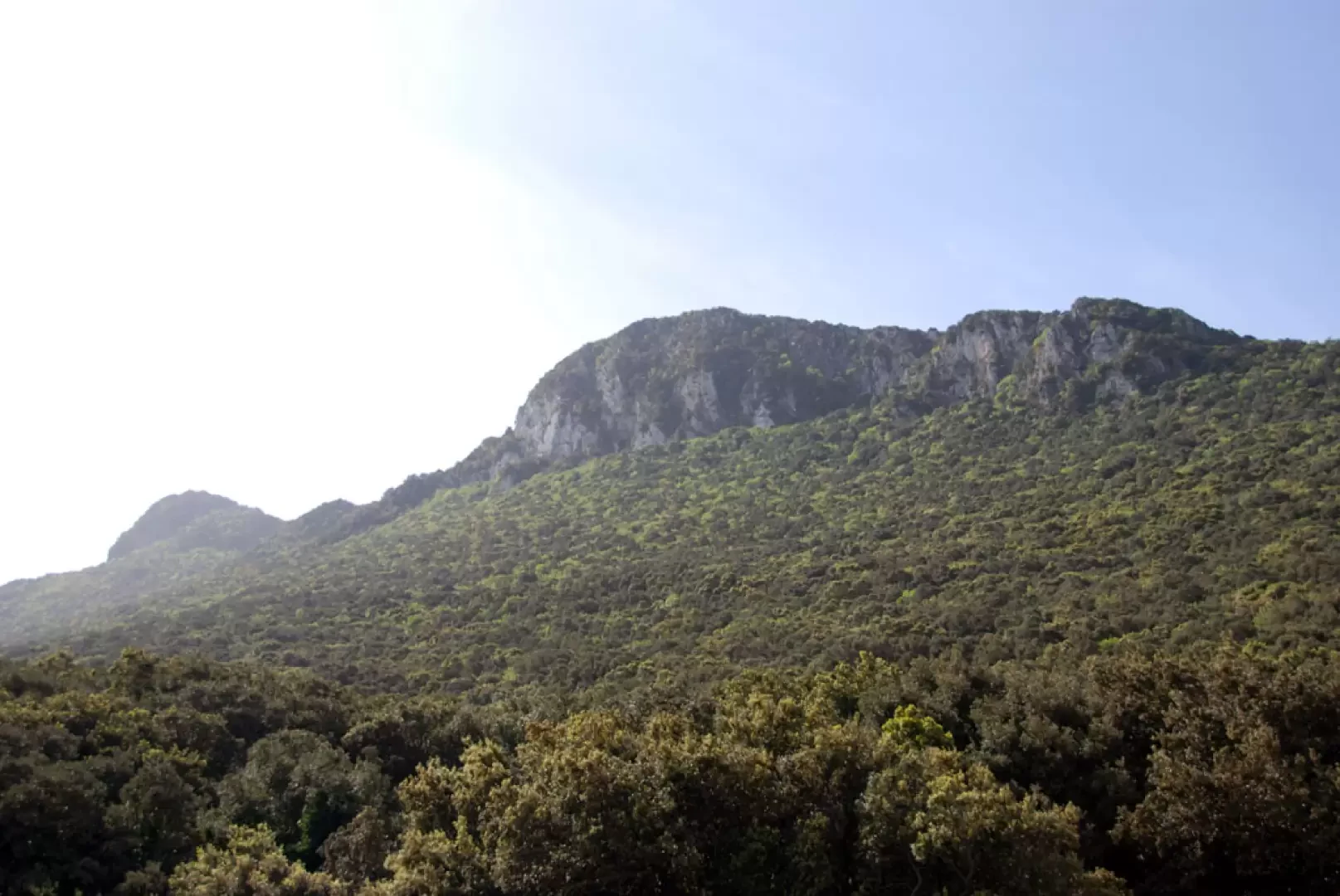
Monte Circeo, from Torre Paola

Edited by:
Massimo Martini
Updated at: 19/04/2025
Access
From Latina, proceed south along the state road (Via Pontina). When you reach Sabaudia, turn right and follow the Migliara road until you take (just before Sabaudia) the Via Litoranea that leads to the foot of the Circeo. When you reach Via Sabaudia, turn left and follow a nice stretch of road through the woods until you get near Torre Paola: here you can look for a car park near the restaurant or along the Lungomare road.
.Introduction
An itinerary among shady woods, rocky outcrops and breathtaking views of the Tyrrhenian Sea
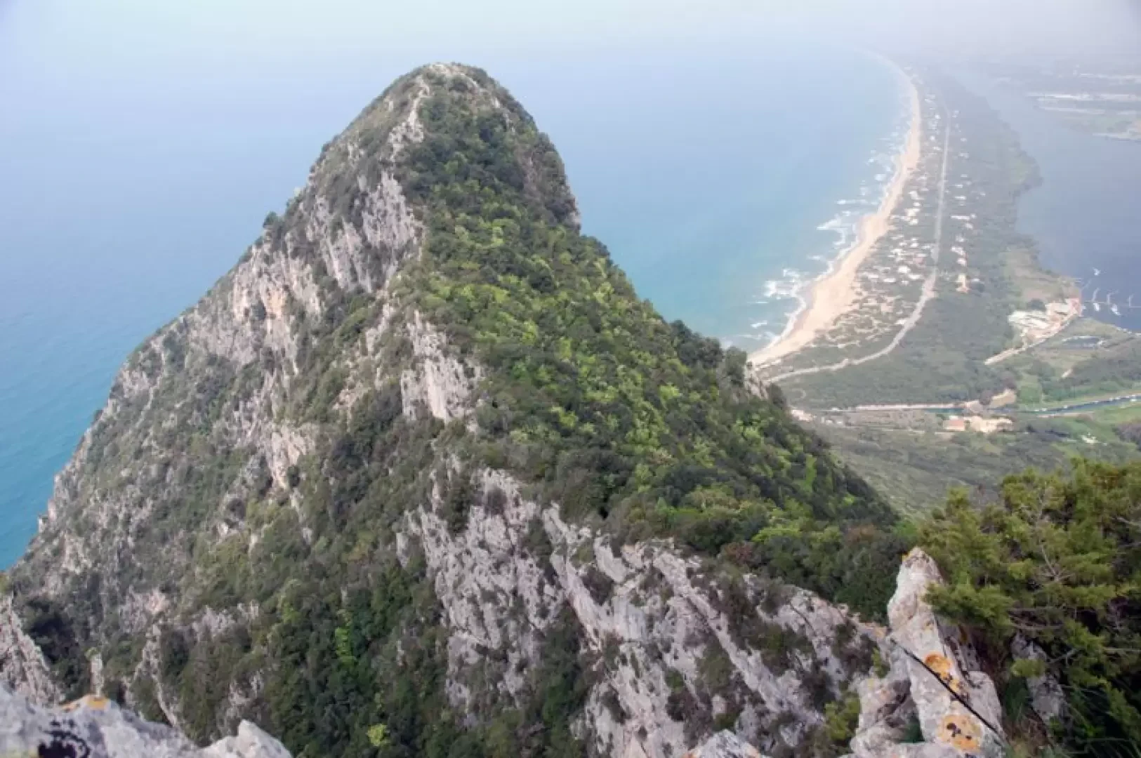
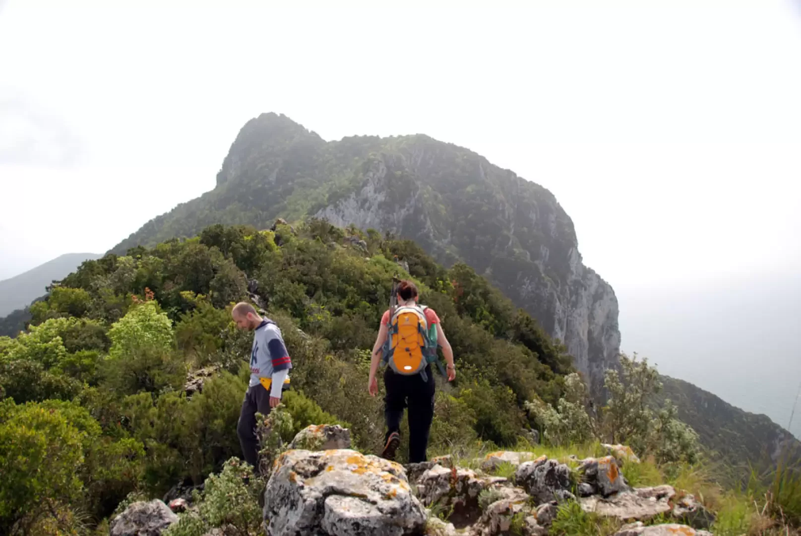
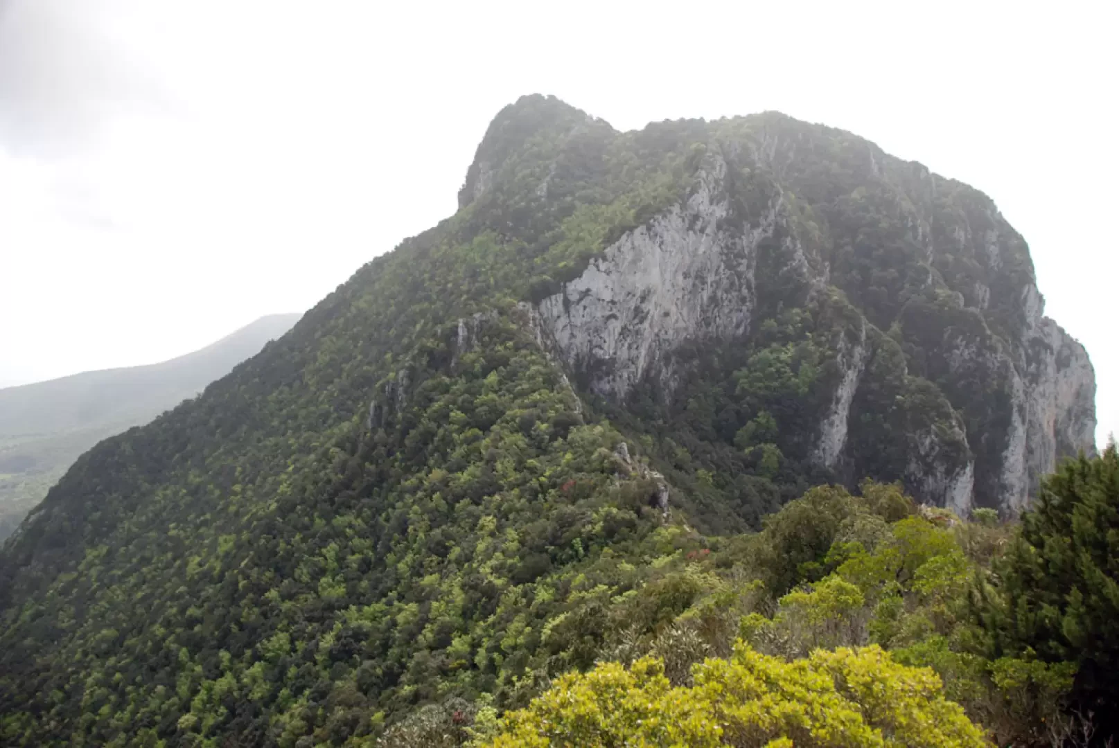
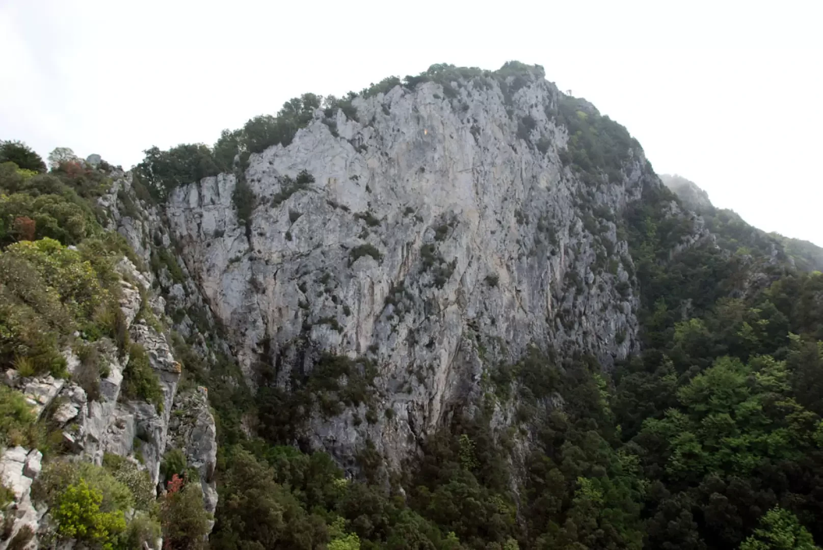
This hike leads to the summit of Monte Circeo (541 m), the symbolic peak of the promontory of the same name that rises isolated on the Latium coast, between Sabaudia and San Felice Circeo. Starting out near Torre Paola, on the western edge of the Circeo National Park, the route initially winds its way through the dense foliage of the coastal holm oak forest, then climbs decisively up the northern slope of the mountain. It is a path that alternates shadows and bright crevices, limestone rocks and Mediterranean scents, until it conquers the long panoramic ridge.
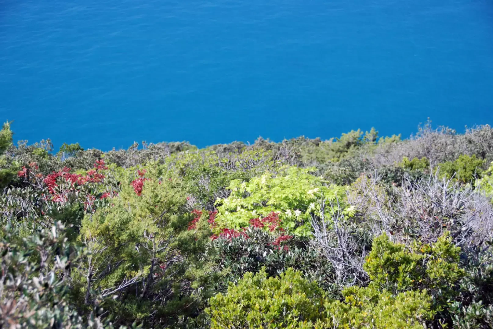
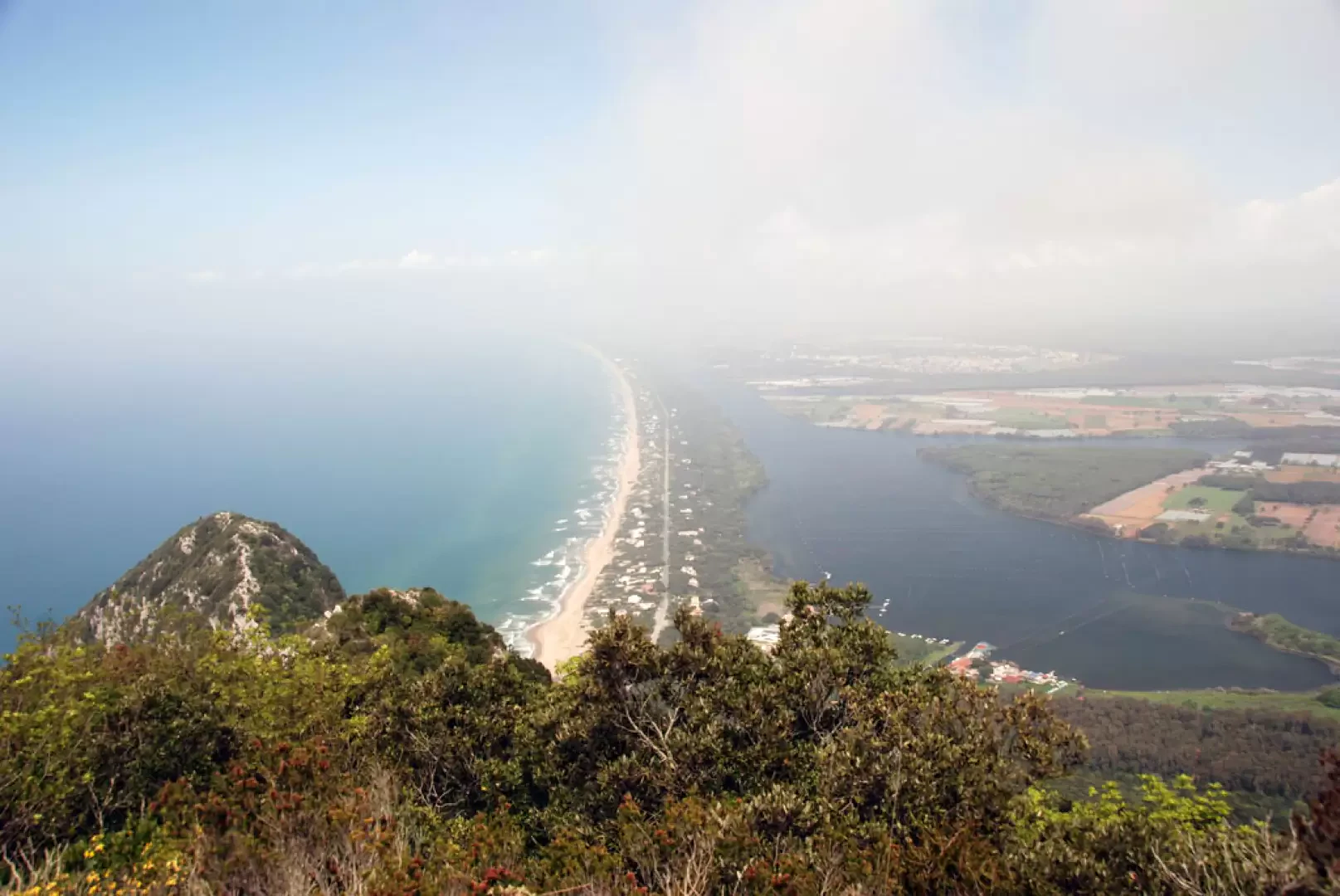
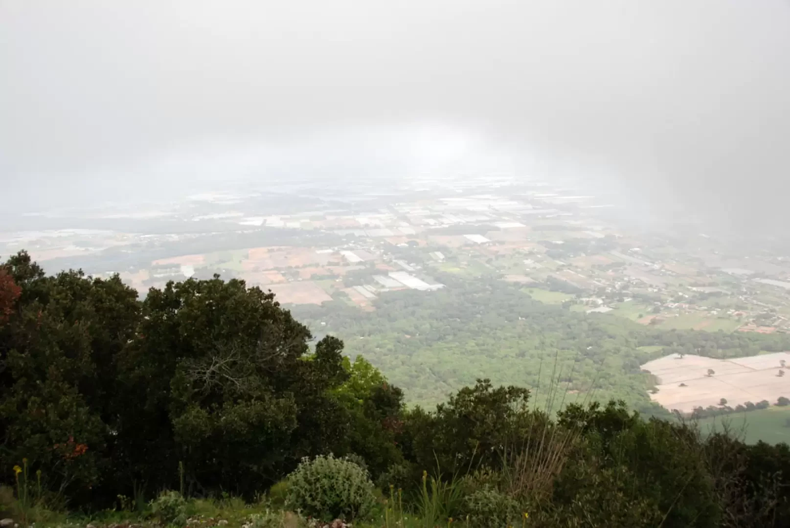
From the summit, under clear skies, the view opens generously: to the south, the deep blue of the Tyrrhenian Sea embraces the Ponziane islands, while to the north-east the outlines of the Monti Lepini and Simbruini can be distinguished. Lower down, the Pontine plain stretches out in all its breadth, punctuated by coastal lakes and wetlands of ecological value.
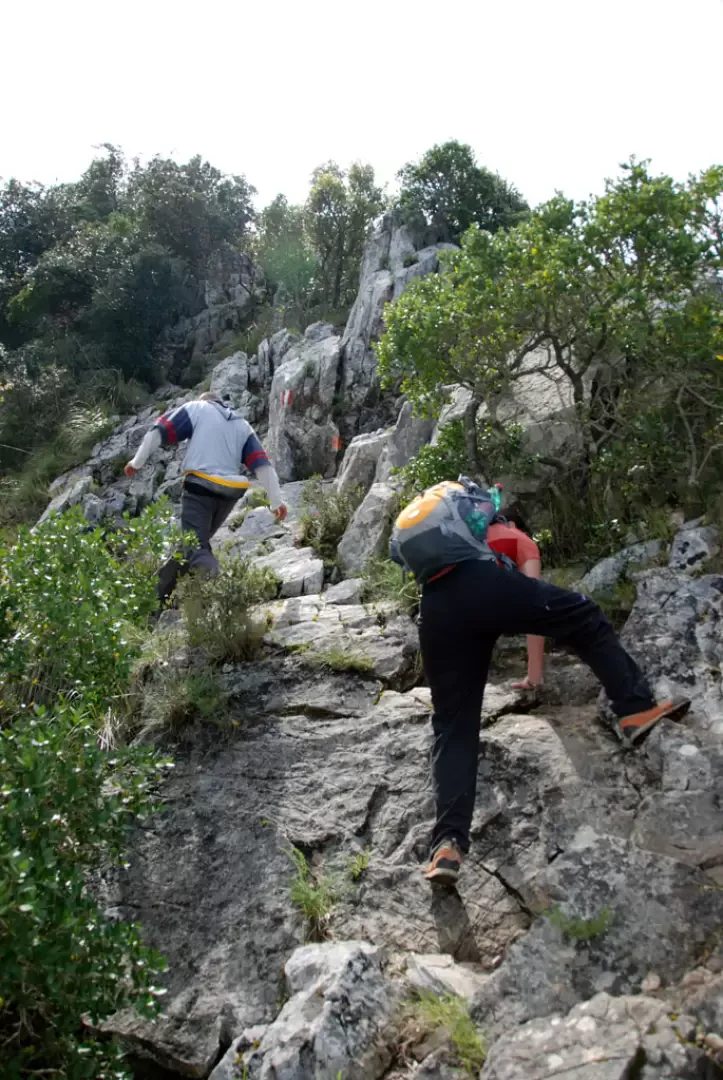
The trail is short but demanding, especially in the initial stretches where the humidity makes the ground treacherous. It is an itinerary that requires sure-footedness, but in return it offers a great variety of landscapes in an evocative environment, where myth and nature are inextricably intertwined.
Description
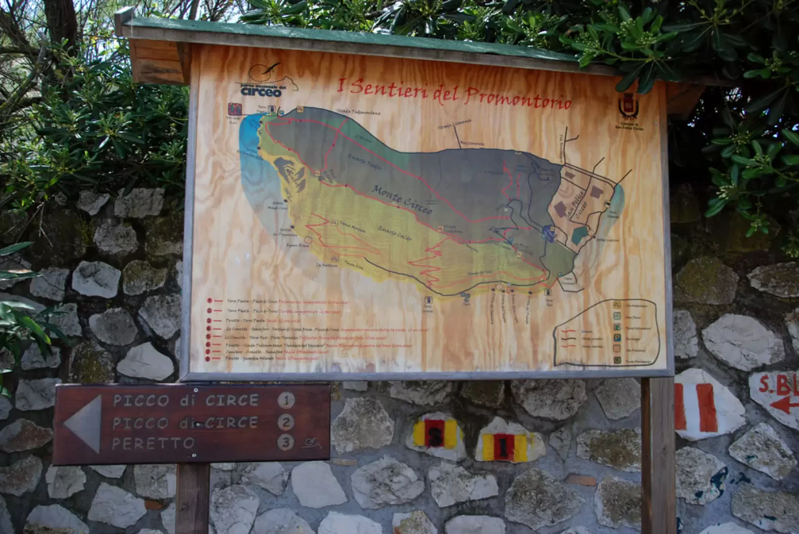
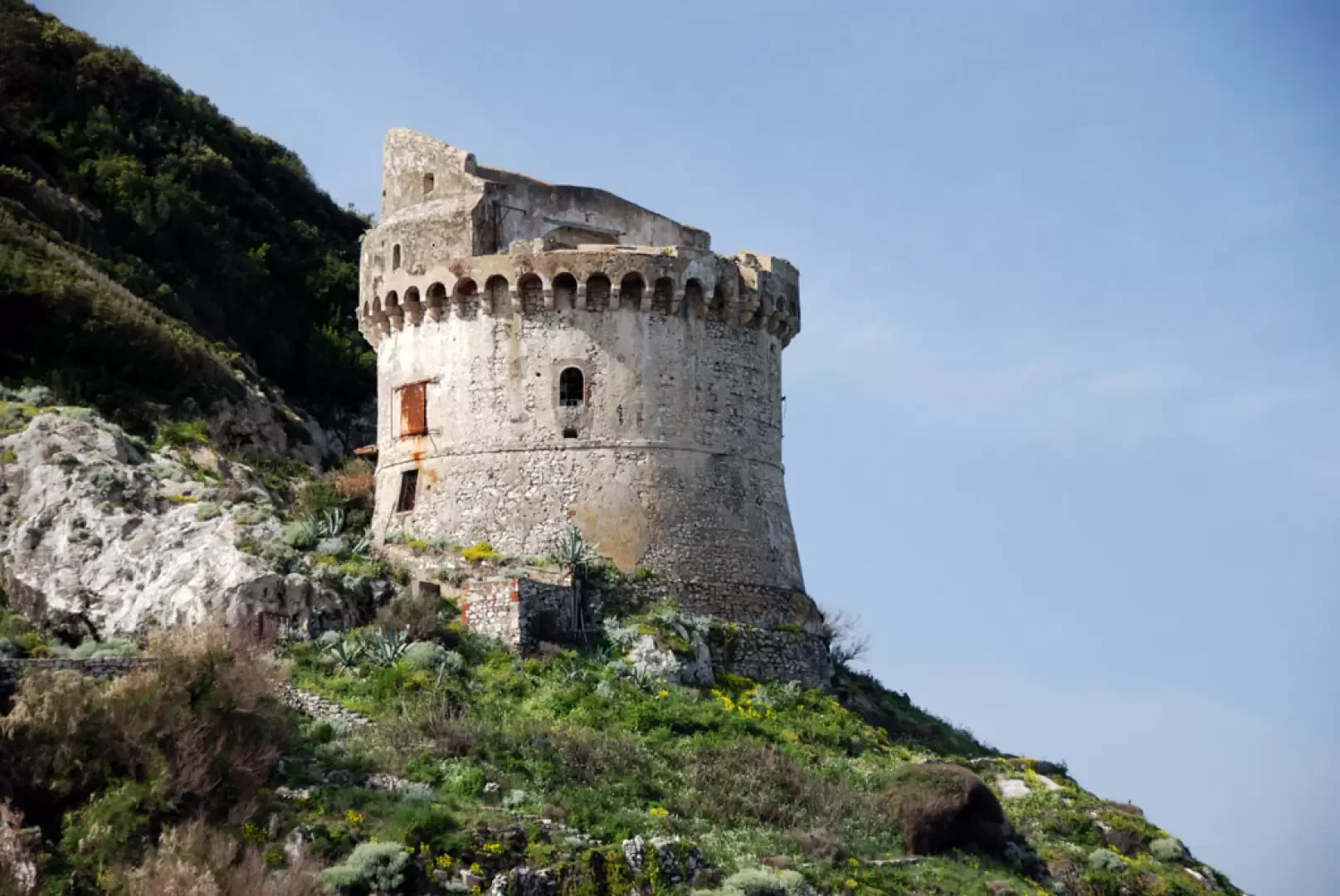
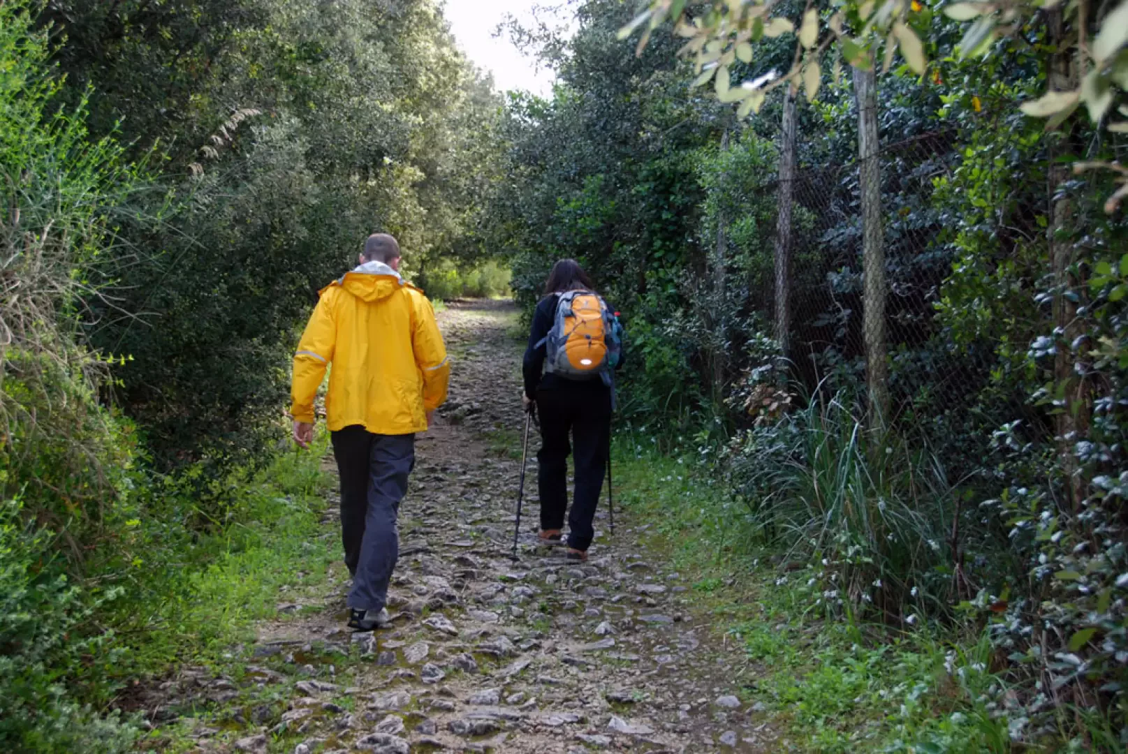
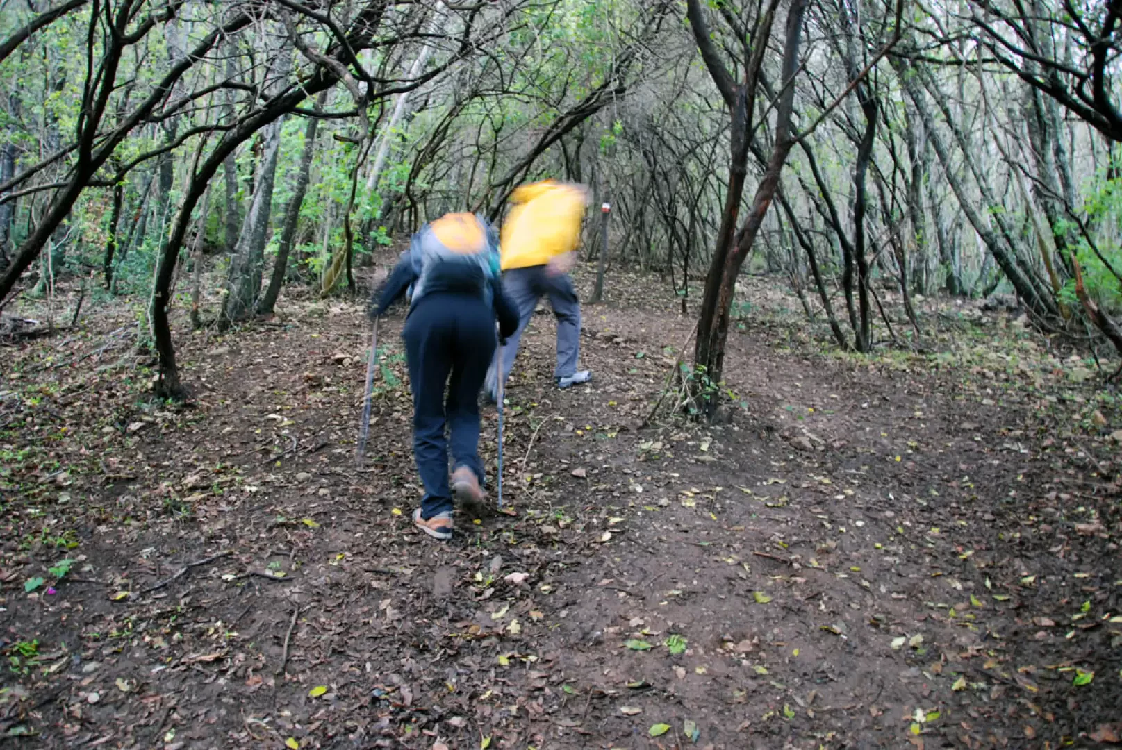
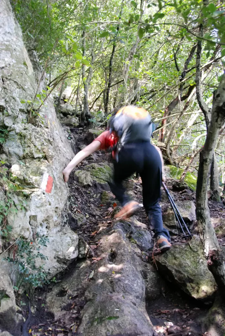
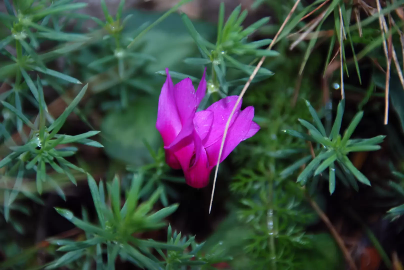
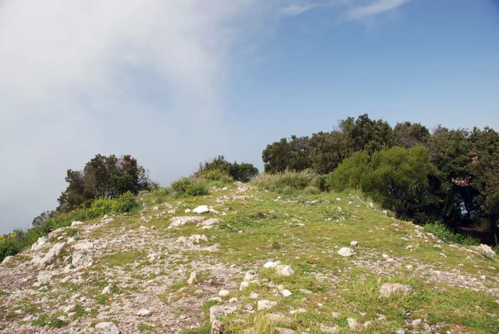
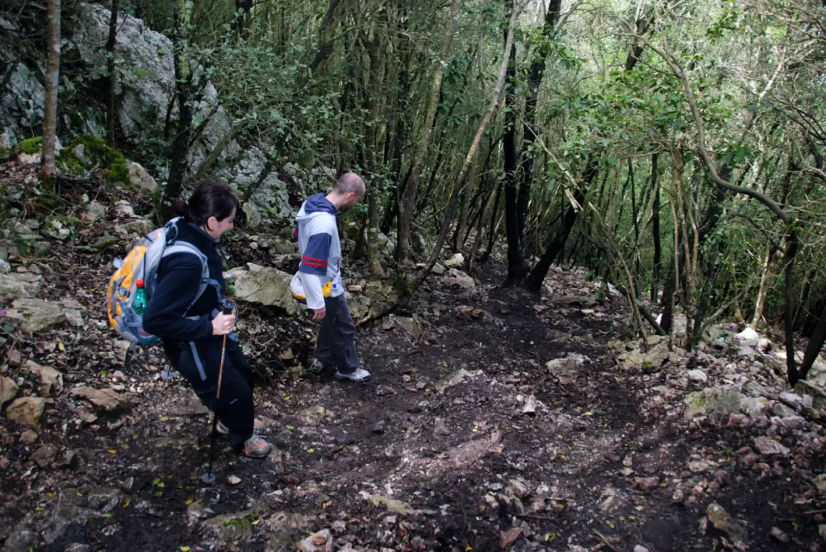
Leaving the car near the 'Approdo di Augusto' restaurant (in summer, it is advisable to park in the blue zone along the shoreline), we head towards a signpost set up by the Park Authority. You pass near the Paola Tower (not accessible, but certainly clearly visible from the edge of the sea). We take a small road that enters the thicket, but leaves some glimpses of the peak and summit of Monte Circeo. We follow the narrow road until we reach a fork (30m, 0h15'): we turn right and begin to climb up through the dense north-facing wood. The ascent into the forest is not very easy, especially in the presence of wet ground that makes it rather slippery. The ascent is immediately sustained and for a good moment all that can be seen is the dense vegetation; however, the route is always clear, thanks also to the markers on the trees. Slowly one gains height, tends to the right and encounters some short passages between limestone rocks that require the use of one's hands at times. As the forest becomes covered with splendid cyclamen blossoms, clearly in season, we reach the attack of the ridge crest and the resulting interesting views of the coastline below. We continue on out of the thicket and begin to make our way through the Mediterranean scrub. On the right, there is a splendid view of the Tyrrhenian Sea and the not too distant Ponziane Islands. The ascent slowly subsides until reaching the so-called anticima or Picco d'Istria (418m, 1h15'): from here you can see the rest of the way to the main summit. Descend slightly, entering a saddle that is slightly exposed in places. We start climbing again, overcoming some not too easy passages (grade I) in front of the "Precipizio" (a limestone rock face on which there are interesting alpine climbing routes). Once the uncomfortable passages have been overcome, one arrives at a 'plateau' that precedes the summit. Continue walking in a south-easterly direction, aiming for the summit, and you will come to a fork in the path (493m, 1h30'): neglect the descent (it will be taken on the way back) and proceed straight ahead, reaching the flat summit of Monte Circeo (541m, 1h45') in a few minutes.
From the summit, the view is nothing short of exceptional (with a clear sky, of course): it sweeps from the Tyrrhenian Sea to the Ponziane islands, along the coast as far as Terracina and distant Vesuvius. To the east, on the other hand, you can see the Apennine offshoots of the Simbruini Mountains, the Colli Albani and above all the Pontine plain and the Circeo Park... not bad...
The descent is along the same route as the outward journey to the previously mentioned fork: here you turn right and begin a steep and rapid descent through the woods. Again in wet conditions, the descent becomes rather uncomfortable. Towards the end of the descent, we reach a small grassy terrace and finally join the small road which, taken to the left, will lead the hiker to the starting point of the itinerary (20m, 2h45').
Riferimenti Bibliografici
- Lazio sud le più belle escursioni - Marcello, Emanuele e Gianfranco Zampetti -
Galleria fotografica
Mappe
We have been there
Edited by:
Massimo Martini
Monte Circeo
Ci sono stato!- Consulta le altre gite su questa meta
- Consulta le altre gite di Silvia Deplano
- Consulta le altre gite di Massimo Martini
- Consulta le altre gite di Antonio Caramoni