From the Châtillon motorway exit, turn left onto Via E. Chanoux. Go past the roundabout, take the third exit and continue through the town centre for about 600 metres, then turn right into Via Menabrea. Follow this road to the roundabout with the 'Matterhorn' in the middle. Continue along the regional road for 18.7 kilometres to Valtournenche, where, towards the end of the town centre, at Hotel des Neiges, turn right and up the municipal road to Cheneil. Follow the road for 6.5 kilometres to the 🅿️ car park at La Barma, the starting point of the hike. The car park is large, but due to the large number of people, it is advisable to arrive early enough on peak days to avoid having to leave your car further down the ascent road. Just beyond the starting point there is a tourist lift, always in operation, which saves 50 metres of ascent.
[0h42'] - [26.9km] How to get there with GMaps How to get there with Apple Maps
The directions provided have been carefully checked as of the date the route was taken. However, it is highly recommended to check for any changes that may have occurred since then, especially regarding the route to the starting point. Before embarking on your journey, it is advisable to consult up-to-date navigation tools for accurate and up-to-date directions. We recommend the use of satellite navigation apps, such as Google Maps or Apple Maps, to ensure the most accurate and safe routing.
Introduction
This is a demanding route both in terms of the total height difference and the delicate and exposed passage below the summit. Vertigo sufferers are advised to stop at the pass between the Grand and Petit Tournalin, where the splendid panorama of the Monte Rosa massif is worth the effort of the hike alone. Abbé Gorret reports in his Aosta Valley guidebook: "En 1871, le Club alpin d'Aoste, en suite d'une souscription, a fait tracer un sentier depuis le plan dou Sapé jusqu'au sommet du Grand Tournalin; les montures peuvent aller jusque près du col entre les deux Tournalins ... L'intrépide alpiniste Joseph Corona a fait l'ascension du Grand Tournalin le 12 Février 1874, accompagné des guides Maquignaz et Carrel; le thermomètre sur la cime marquait 24 degrés sous zéro; c'est la première ascension de ce genre executée au printemps"Italian translation "In 1871, the sez. Aosta section of the CAI, thanks to a subscription, had a path traced from the Plan dou Sapé to the summit of the Grand Tournalin; on horseback one can climb up to below the pass between the two Tournalins ... The intrepid mountaineer Joseph Corona climbed the Grand Tournalin on 12 February 1874, accompanied by the guides Maquignaz and Carrel; the thermometer on the summit read 24 degrees below zero; it was the first ascent of its kind made in spring'
.
Description
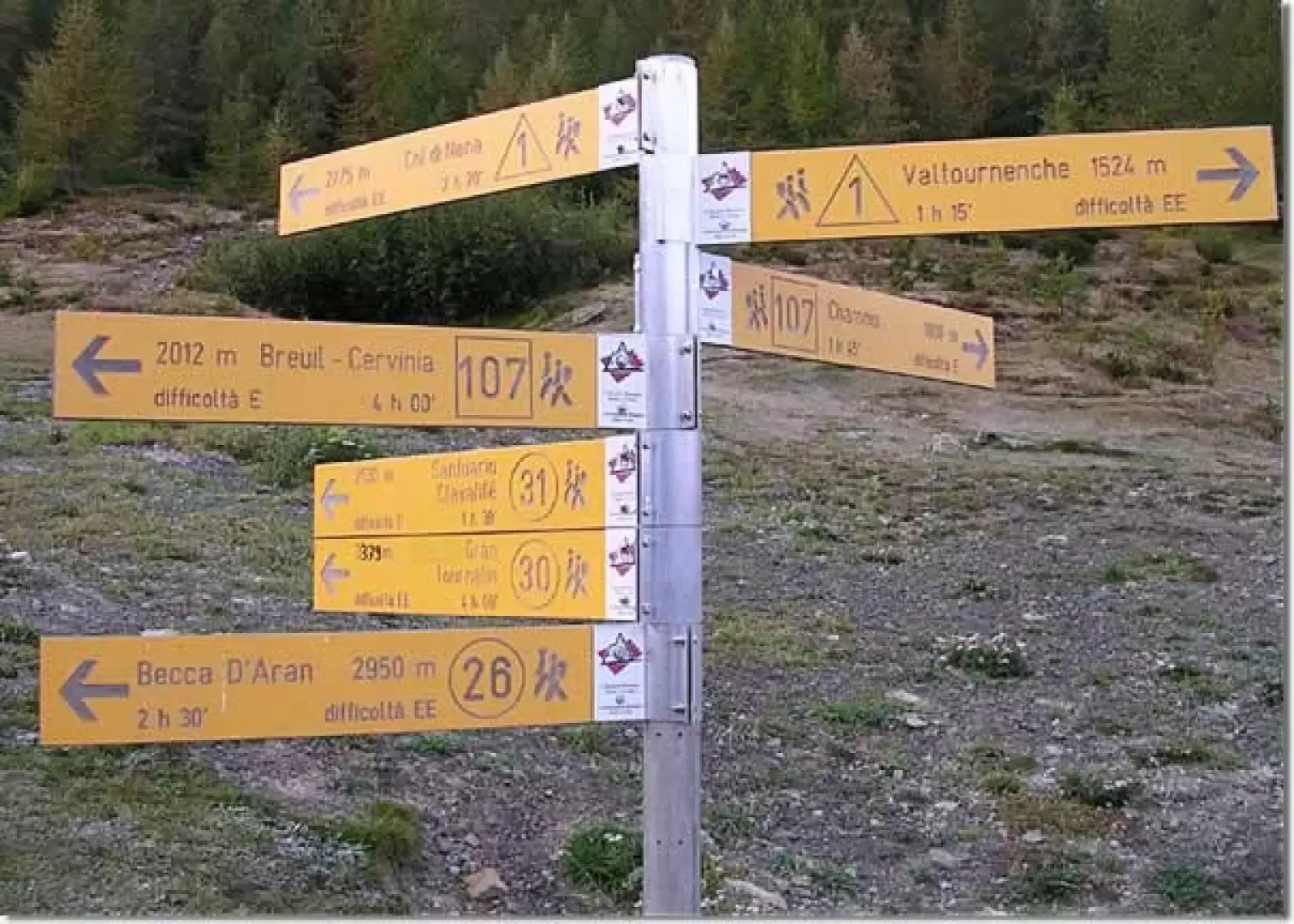
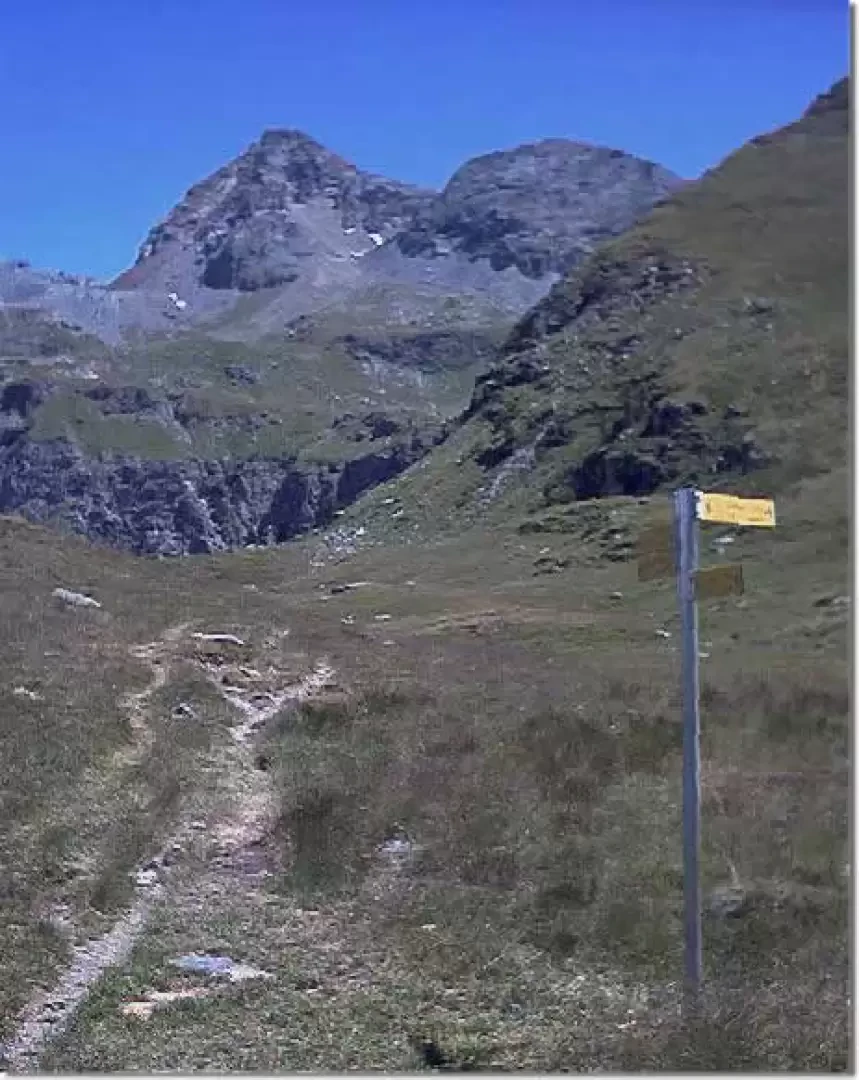
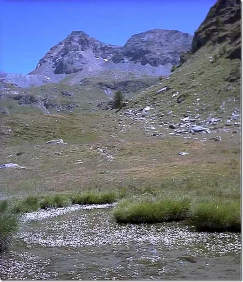
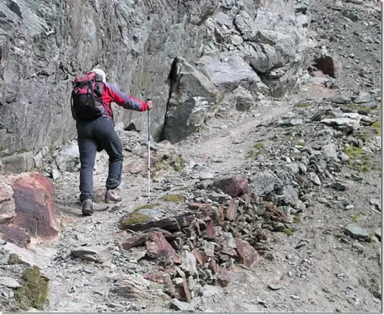
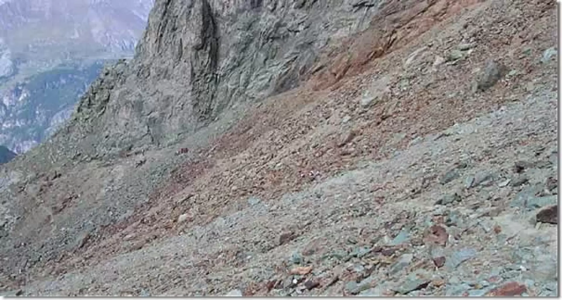
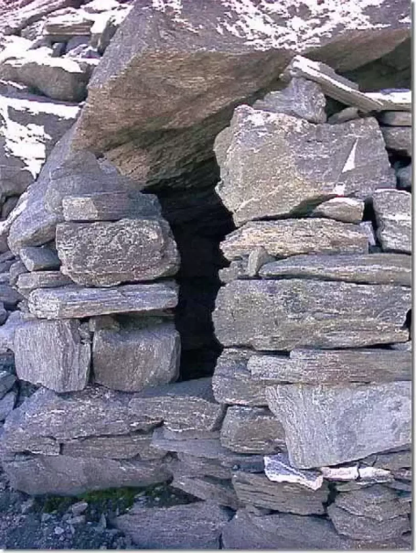
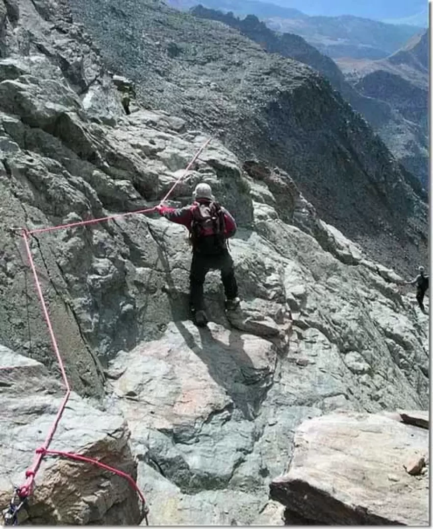
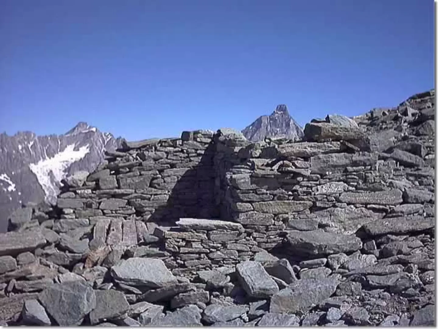
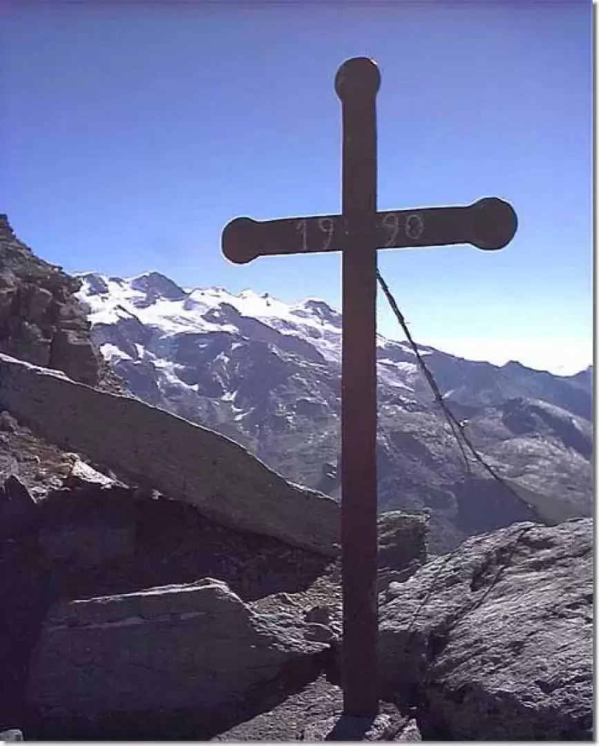
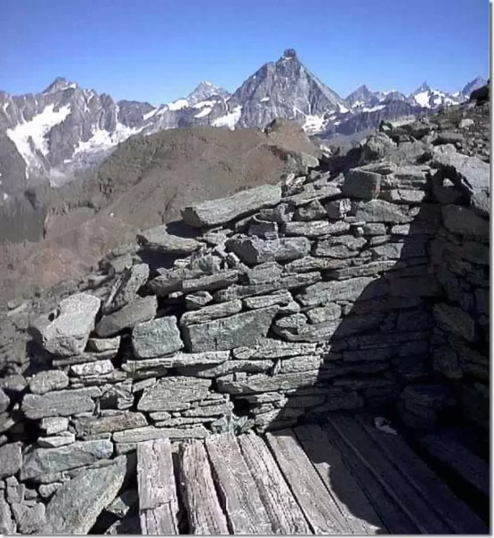
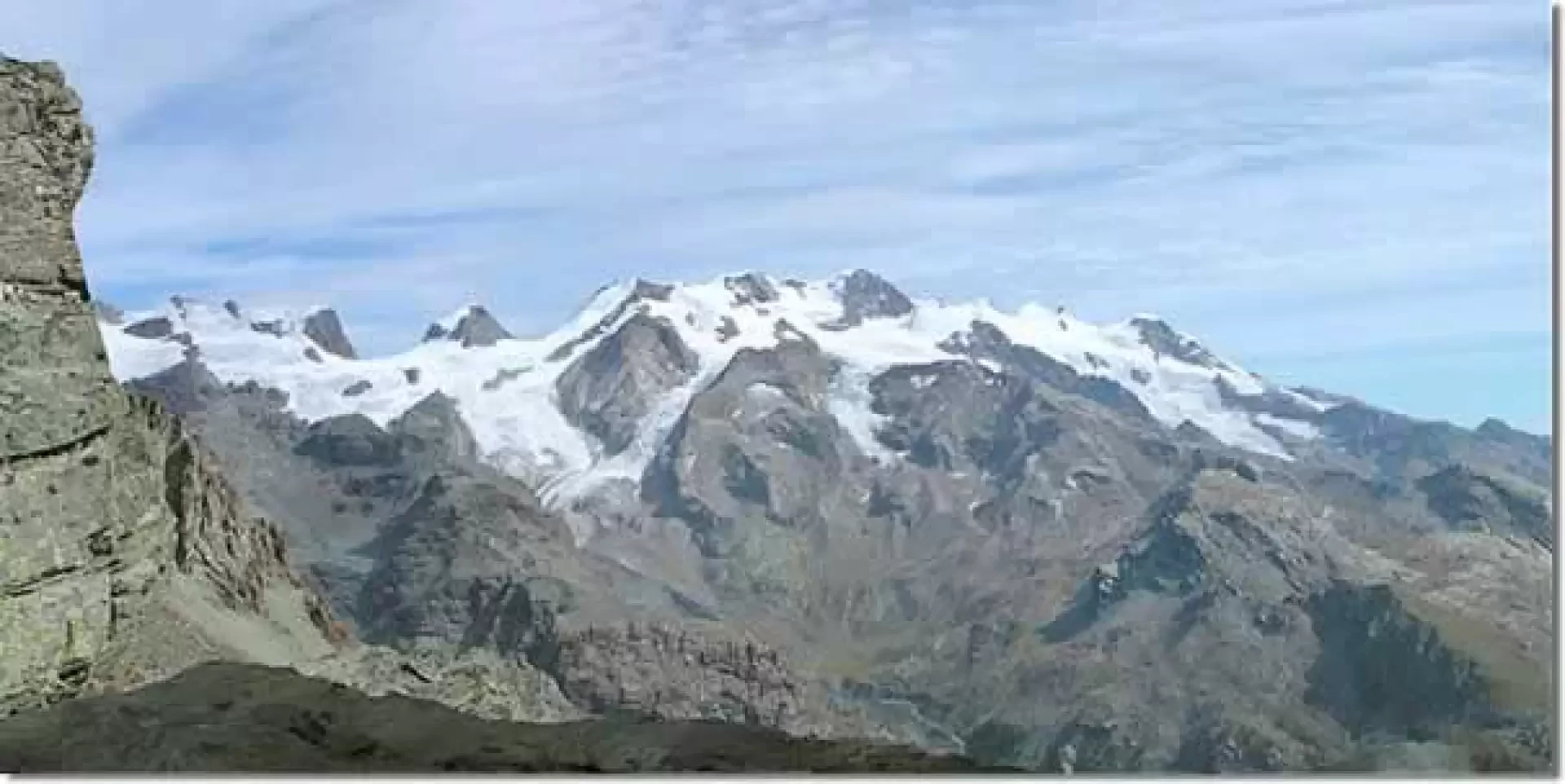
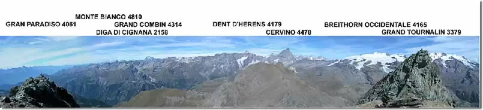
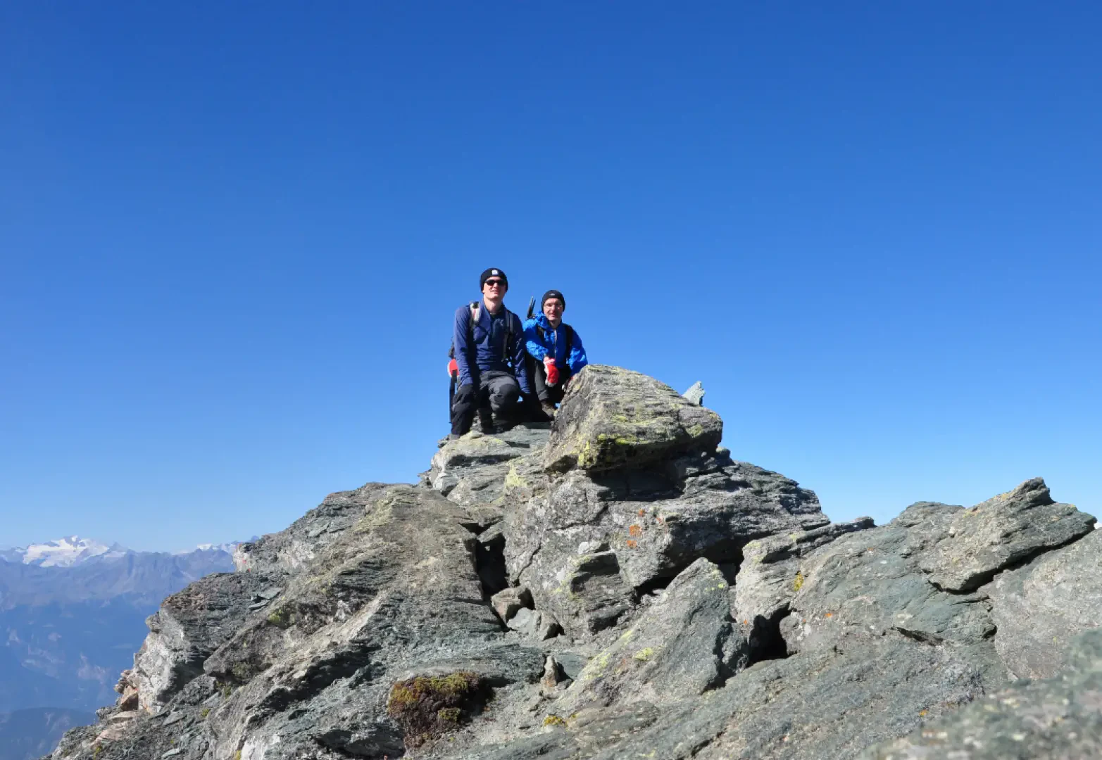
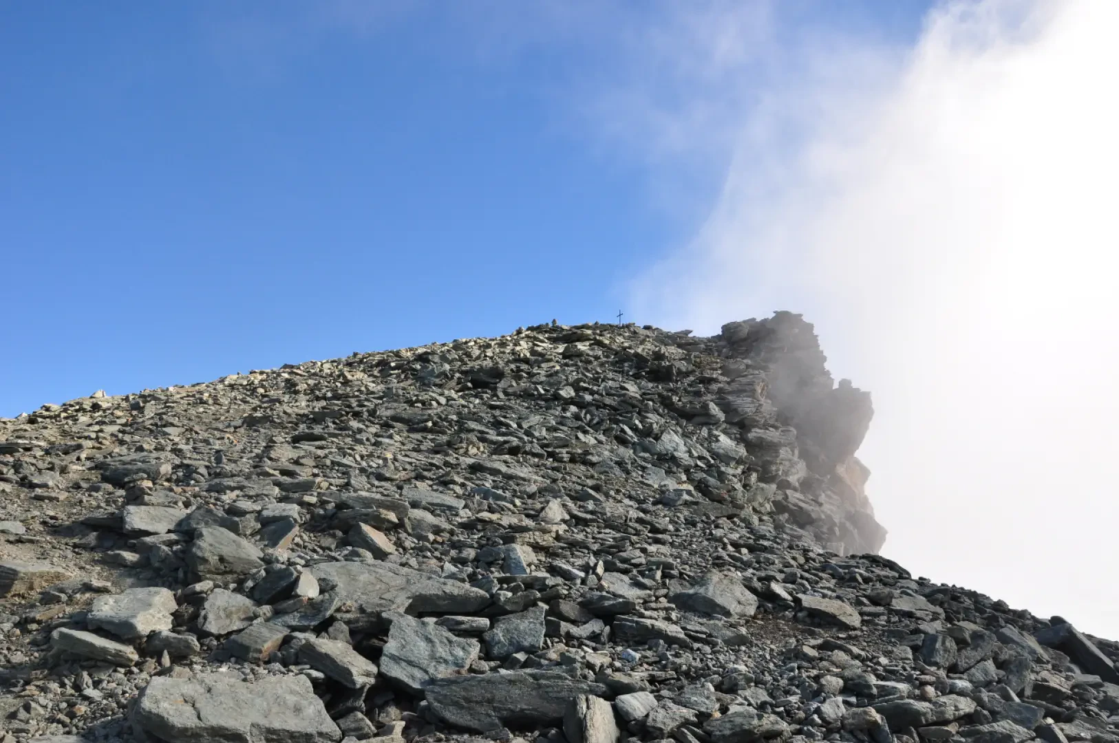
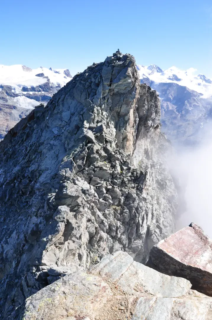
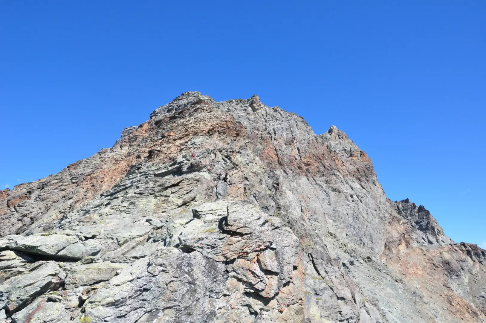
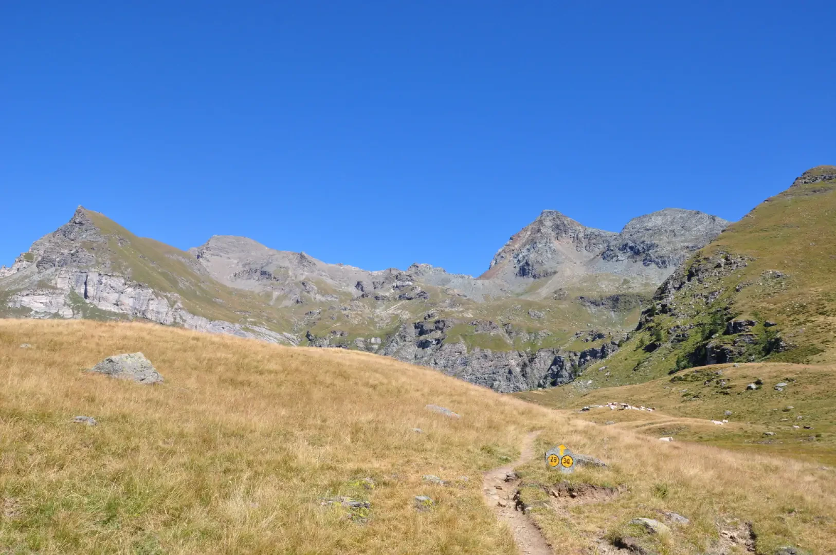
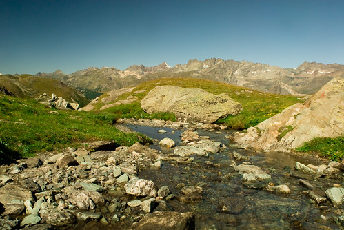
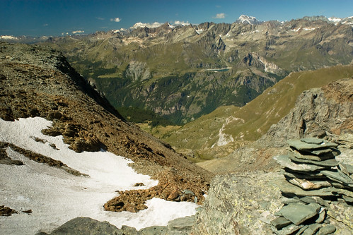
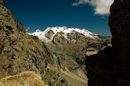
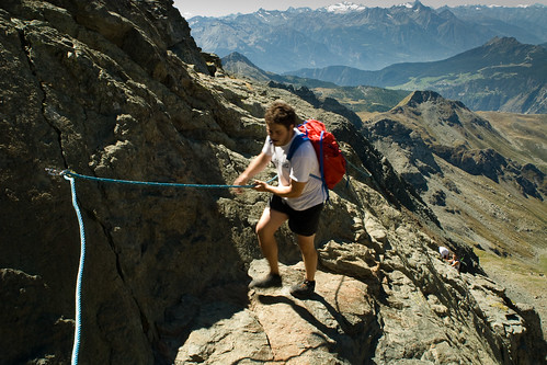
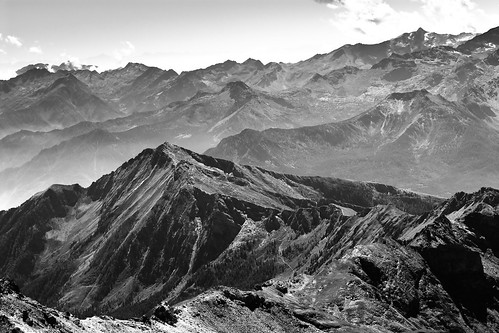
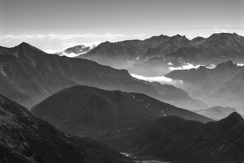
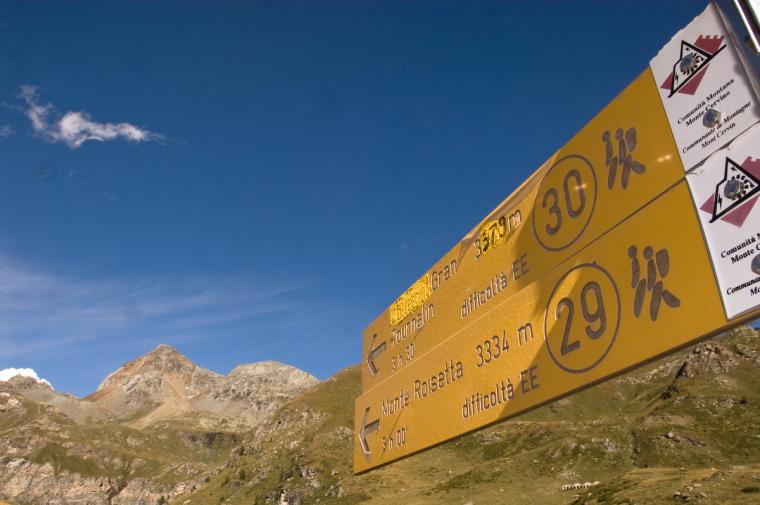
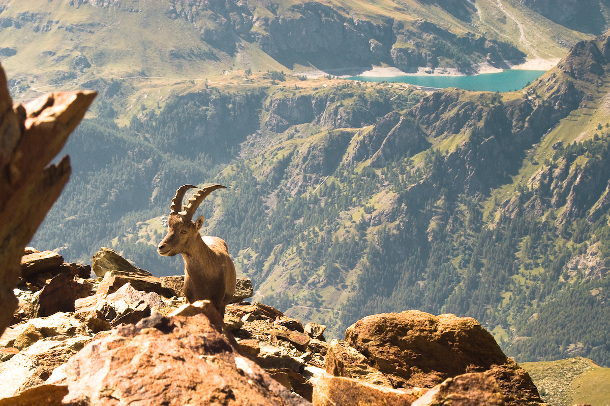
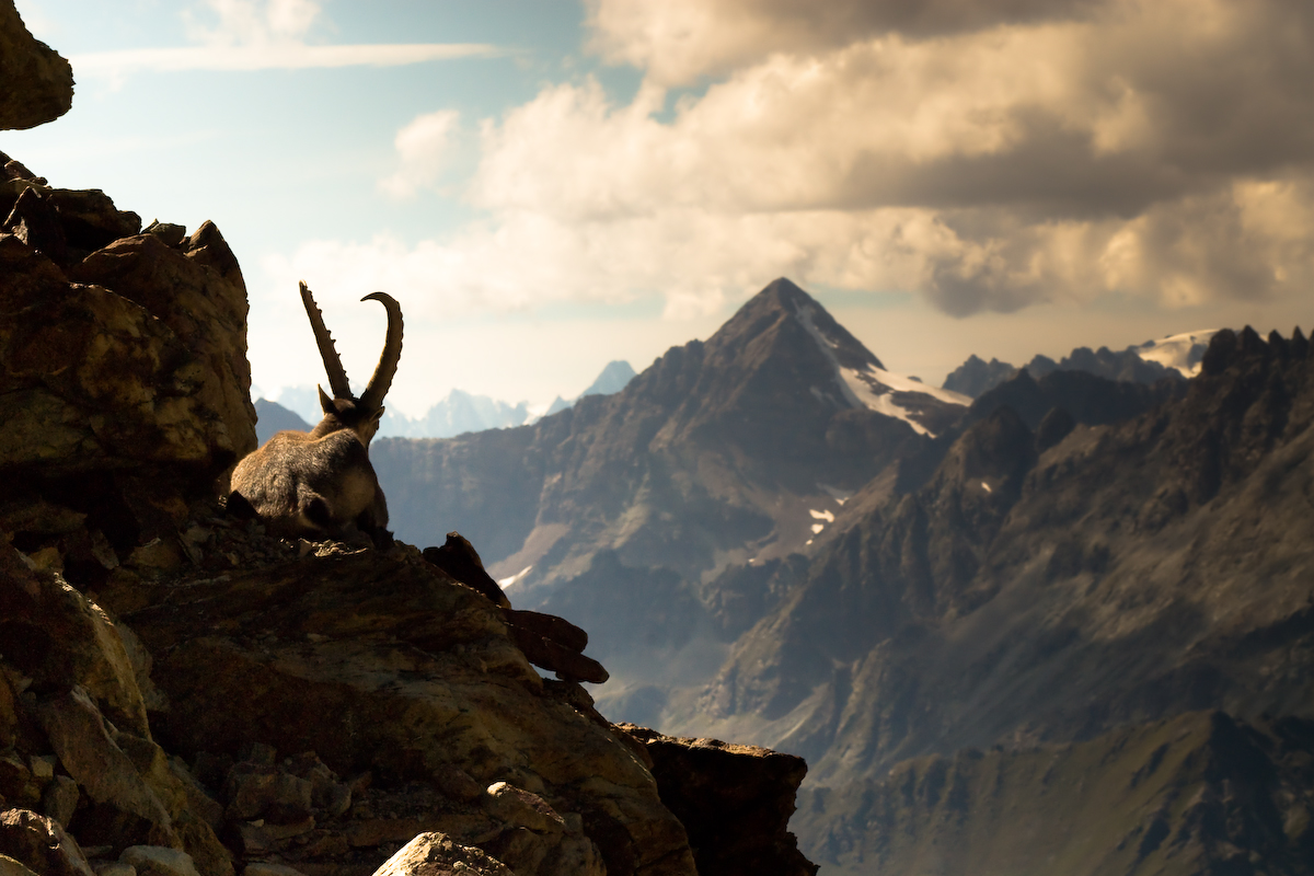
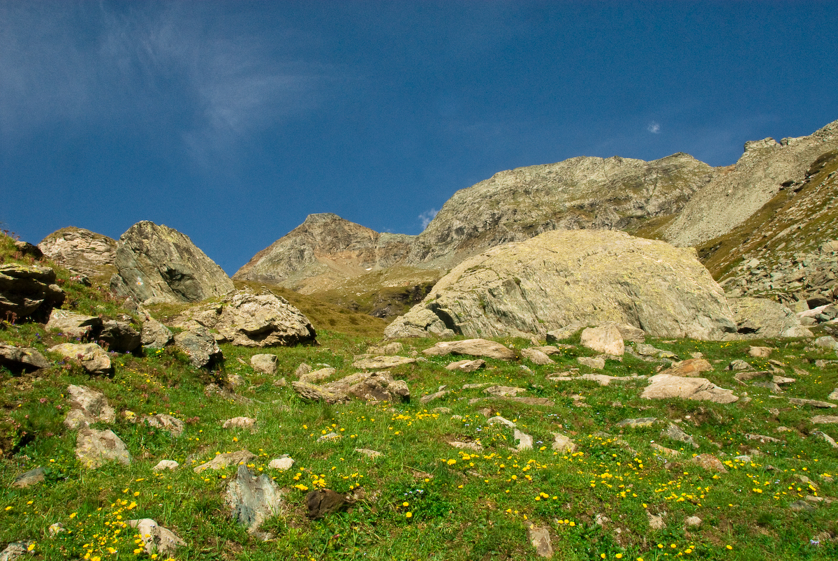
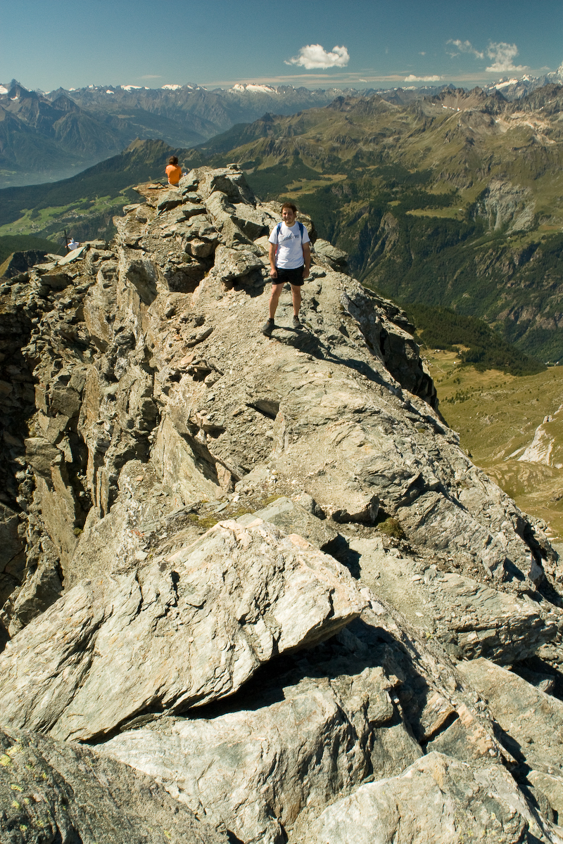
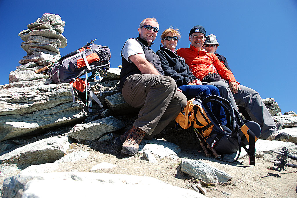
Leaving the car behind, head to the right following the signs for Cheneil. After crossing the stream that descends from the two Tournalins on a small bridge, a steep but short stretch begins that leads to the plateau where the village of the same name is located, a starting point for numerous hikes. Across the meadows, we head towards the village, where there are several restored houses and some still in ruins, overlooked by the Albergo Panorama al Bich, the last witness, the only one still open, of a holiday of yesteryear, made up of long walks and very few motors. At the exit of the village, to the south, you will find the signpost that holds among others the sign for path no. 30 to the Grand Tournalin. Following the yellow arrow, take the path that plunges into the shade of a grove of larch and alder trees. One crosses it in a few minutes and then comes out into the sunlight where the trail marks the slope of narrow bends between blueberry bushes, rhododendrons and junipers punctuated here and there by larches and clumps of low alders. After passing the diversions to the sanctuary of Clavalité and continuing on the wide trail of the high trail, walk accompanied by the chatter of water flowing between the stones until, after crossing the stream and leaving the valley, you come to the crossroads marked with a signpost from which the trail for the Grand Tournalin branches off to the left. One crosses the pastures on the level, heading towards the silhouette of the mountain, which from this perspective appears more squat and ungainly than the beautiful, regular pyramid that can be seen from the valley floor. After reaching a waterhole dotted with the white flowers of the eriophorum, continue along the path, which begins to climb gently. At the next fork, continue to the right in the direction of an isolated larch, the last tall tree to be encountered on the ascent. A little further on, the path widens out and climbs steadily upwards, cutting across the flank of the Trecare becca. You pass a rock on which markers 29 and 30 are painted and from which you can see a small piece of the Cignana dam, built on the other side of the Valtournenche. With a wide curve to the left, the trail crosses the higher pastures until reaching the fork where trail marker 29 branches off for Becca d'Aran and Roisetta. Continue following the yellow tracks until you cross the last meadow at the foot of the moraine: a small green garden dotted with flowers and cut in half by a meagre stream flowing quietly over a bed of stones. At this altitude, the panorama becomes more severe, dominated by rocks and scree on which only a few high mountain herbs grow. The path gently climbs the side of the moraine left by the glacier that descended into the valley between the Grand and Petit Tournalin. The eastern flank is now overgrown and dotted with large boulders, and numerous steep short cuts branch off from the main path, which, if breath permits, shorten the ascent time, if only slightly. After walking along the entire shoulder of the moraine, one arrives at the base of the rock face where the first, well-preserved section of the path built in 1871 is located. Unfortunately, years of neglect have reduced this splendid succession of stone steps and paved sections that led up to the summit to just a few remains that would need careful restoration, especially in the section between the hill and the summit, to allow tourists to climb to the summit easily, as they did for many years thanks to the labours of our ancestors. Following the traces of the old paving stone half-buried by landslides and the cairns, we climb up the entire left side of the valley to the barma, which is just below the col. The term barma indicates, in Valle d'Aosta dialect, a shelter carved out by digging under a large boulder that acts as a roof and closed on the sides by one or more dry stone walls; it was used at low altitudes for sheltering animals or fodder, and at this height it can be a good emergency shelter in the event of bad weather. There is a splendid panorama of the Monte Rosa massif from the pass. From the eastern Breithorn to the Piramide Vincent is a succession of rocky peaks piercing the glaciers towards the blue sky, framed by the ridge that joins the two Tournalins. This is where the route ends for those suffering from vertigo. Continuing along the path that leads to the summit, one encounters a short section of slab where the path has collapsed. Here, to make the ascent safer, a few bolts have been fixed but the chain is still missing and inexplicably, these few metres of track have not yet been restored, which would allow the ascent to be carried out without placing one's hands on the ground. To continue towards the summit in its current state, after reaching the plaque dedicated to Giampiero SALGONI, it is necessary to follow the ridge for about 5 metres along a crack and then descend with two steps onto a sloping terrace a couple of metres long that leads to the saddle where the path resumes. In just under half an hour, you first reach the remains of the bivouac and then the cross fixed just below the antecima where the itinerary ends. The actual summit climbed by Whymper in 1863 is only a few metres higher but separated by a vertical wall that allows access only to mountaineers with equipment. The panorama offered by the summit of the Grand Tournalin was described as "grandiose and splendid" by the first climber of the Matterhorn, who recommended its ascent to all tourists who had a day to spend in Valtournenche. The view overlooks all the peaks of Valtournenche and the Ayas valley, reaching as far as the eternal snows of Gran Paradiso, Mont Blanc and Grand Combin in the distance, and then returning to the Matterhorn pyramid and the Monte Rosa massif. All that remains of the small refuge built in 1876 are the perimeter walls and some larch shingles. Once used as a roof covering, they are now lined up on the ground to form a raised platform about two metres by two useful for pitching a tent. The bivouac dedicated to Jean-Antoine Carrel was financed by the CAI of Aosta and the municipality of Valtournenche and was used by hikers of the time to admire the setting and rising of the sun over the western Alps. Curiosity Abbé Gorret writes in his guidebook of the Aosta Valley: 'En 1871, le Club alpin d'Aoste, en suite d'une souscription, a fait tracer un sentier depuis le plan dou Sapé jusqu'au sommet du Grand Tournalin; les montures peuvent aller jusque près du col entre les deux Tournalins ... L'intrépide alpiniste Joseph Corona a fait l'ascension du Grand Tournalin le 12 Février 1874, accompagné des guides Maquignaz et Carrel; le thermomètre sur la cime marquait 24 degrés sous zéro; c'est la première ascension de ce genre executée au printemps" Italian translation "In 1871, la sez. di Aosta section of the CAI, thanks to a subscription, had a path traced from the Plan dou Sapé to the summit of the Grand Tournalin; on horseback one can climb to below the pass between the two Tournalins ... The intrepid mountaineer Joseph Corona climbed the Grand Tournalin on 12 February 1874, accompanied by the guides Maquignaz and Carrel; the thermometer on the summit read 24 degrees below zero; it was the first ascent of its kind made in spring'
Dal piazzale si imbocca il sentiero che parte dopo un piccolo ponte e ripido conduce nella conca di Cheneil (2105m), qui tenete la destra, camminando verso sud e verso gli edifici presenti, per incontrare una palina ricca di indicazioni. Prendete quindi il sentiero n° 30 che inizialmente ricalca l'Alta Via n° 1, entrate nel boschetto e fate tesoro dell'ombra in quanto sarà difficile trovare altri ripari dal sole. Dal piazzale si imbocca il sentiero che parte dopo un piccolo ponte e ripido conduce nella conca di Cheneil (2105m), qui tenete la destra, camminando verso sud e verso gli edifici presenti, per incontrare una palina ricca di indicazioni. Prendete quindi il sentiero n° 30 che inizialmente ricalca l'Alta Via n° 1, entrate nel boschetto e fate tesoro dell'ombra in quanto sarà difficile trovare altri ripari dal sole. Fuori dall'abbraccio di larici, rodendri, mirtilli e pulsatille si accenna un certo panorama che, verso nord è dominato dal Monte Cervino e dalla Becca d'Aran.


Comments (0)
Sign in to leave a comment