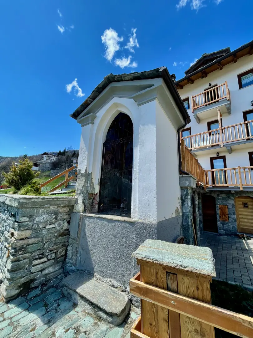
Chapel of Saint-Pantaléon, from Mognod


Edited by:
Massimo Martini
Updated at: 13/10/2025
Access
Leave the motorway junction at Châtillon-Saint-Vincent, turn left and continue for approximately 300 metres to the roundabout. At the roundabout, take the third exit onto Via Émile Chanoux. Drive along Via Émile Chanoux for 600 metres, crossing the historic centre of Châtillon, then turn slightly right onto Via Menabreaz. Continue for 450 metres to the roundabout with the "Matterhorn" monument in the centre and take the second exit, joining the regional road in the direction of Valtournenche. Follow the for 7.8 kilometres until Antey-Saint-André, then turn left and take the regional road to Torgnon. Drive up the valley for 6.4 kilometres until you reach the village of Mognod. At the entrance to the village, turn left and take the regional road . After about 100 metres, turn right to access the free car park 🅿️ located near the ski resort and the main services.
The place is served by public transport. To consult the timetable, visit aosta.arriva.it
Distance and travel time
🕒 Travel time: 24 minutes
📏 Distance: 16.60 km
GPS navigation
📍 How to get there with Google Maps
📍 How to get there with Apple Maps
ℹ️ Important note
The directions given were verified on the date of the route survey. Before departure, it is advisable to check for any changes to the route. For up-to-date and detailed directions, we recommend the use of Google Maps or Apple Maps.
Introduction
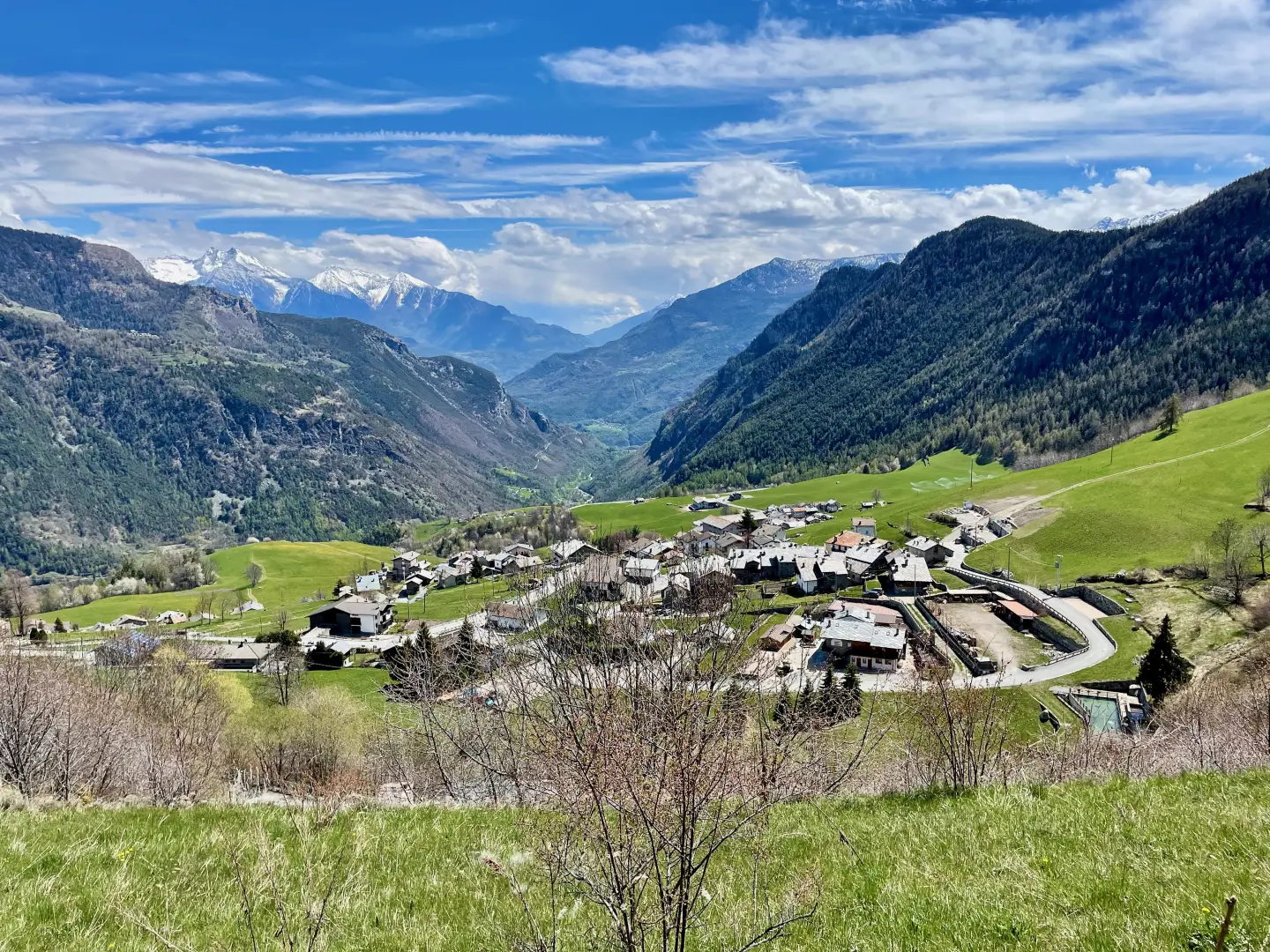
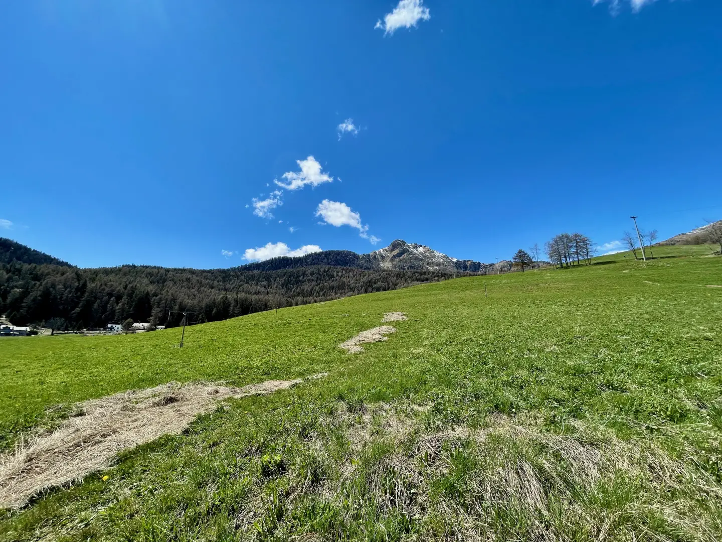
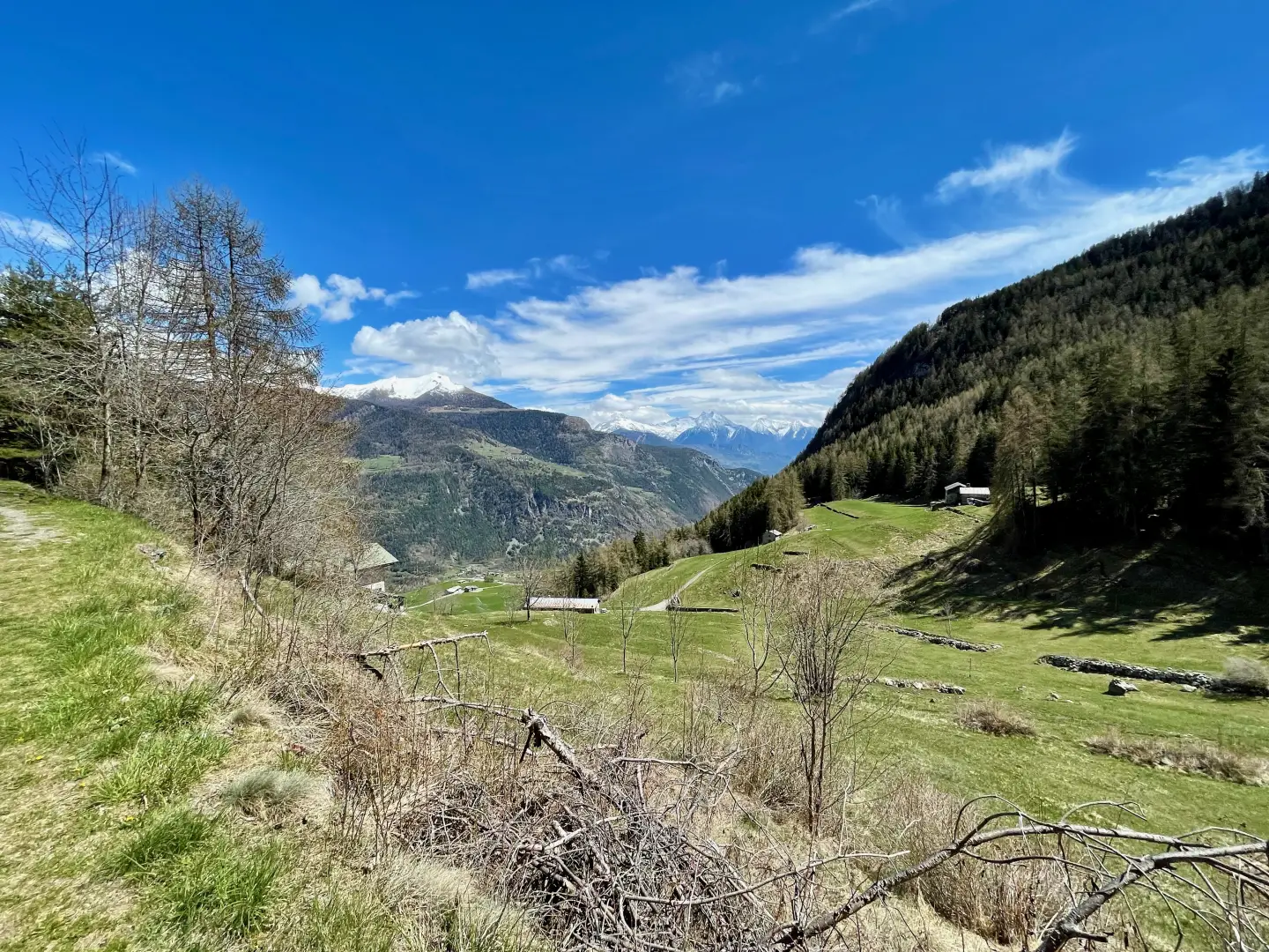
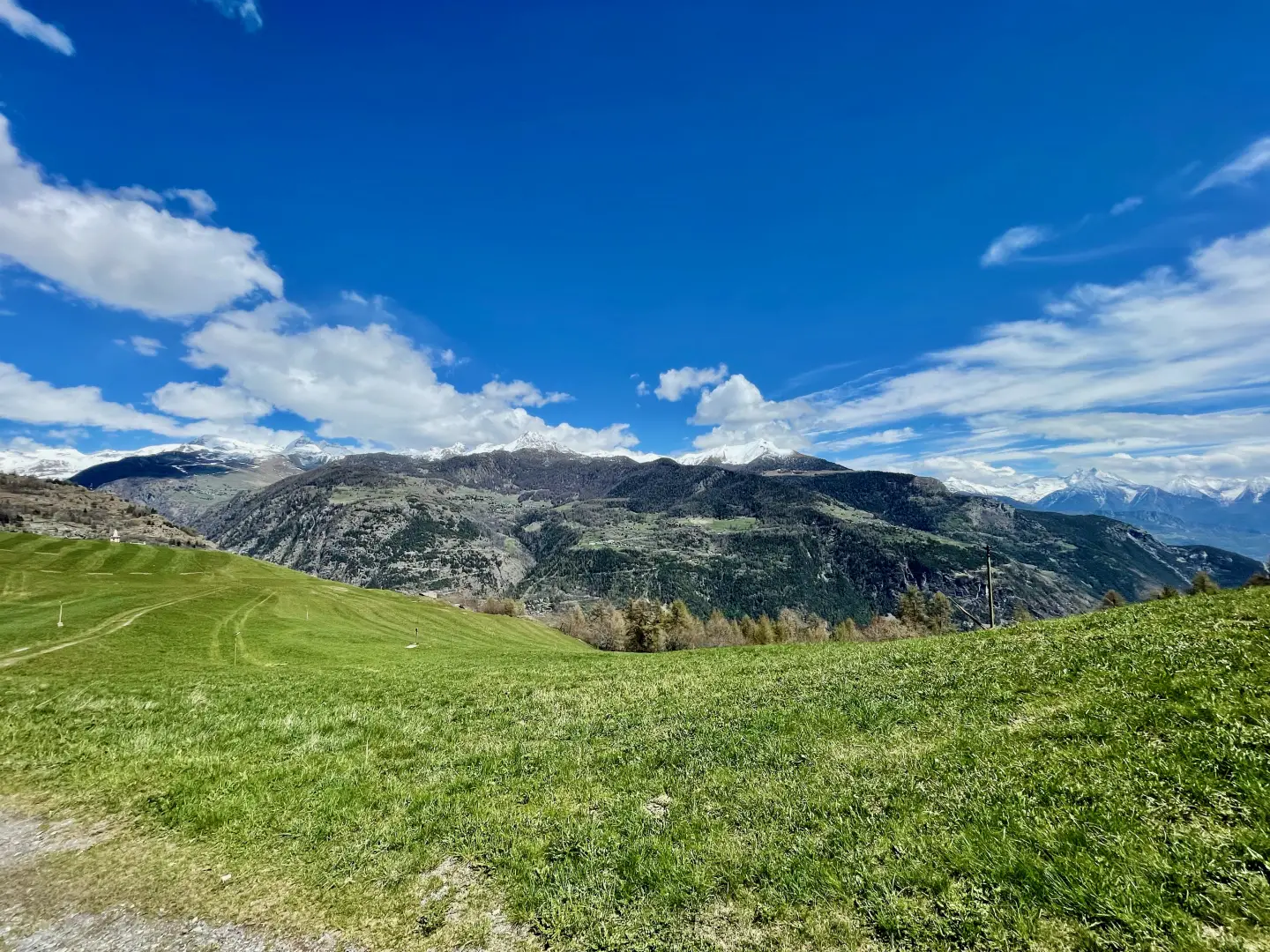
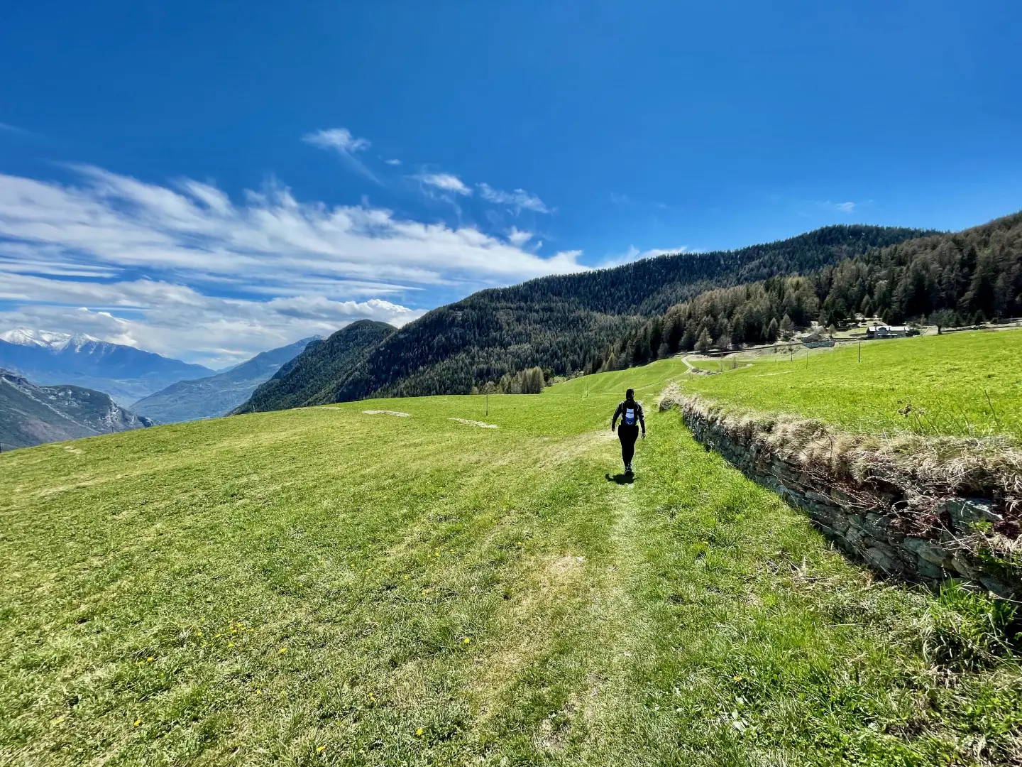
The hike to the chapel of Saint-Pantaléon winds its way between the houses of Mognod and the open pastures dominating the central valley, alternating shady stretches in the forest with sunny clearings, fountains and silent glimpses of the Becca d'Aver. The short and accessible route is particularly pleasant in spring, when the Ronc meadows are tinged with yellow from the blossoming. Along the way, benches and votive shrines invite you to stop for a rest, while the view widens over the Valtournenche and the surrounding peaks. A proposal also suitable for the mid-season, for those seeking a simple walk but capable of narrating, step by step, the link between nature and devotion in this secluded corner of the Aosta Valley.
Description
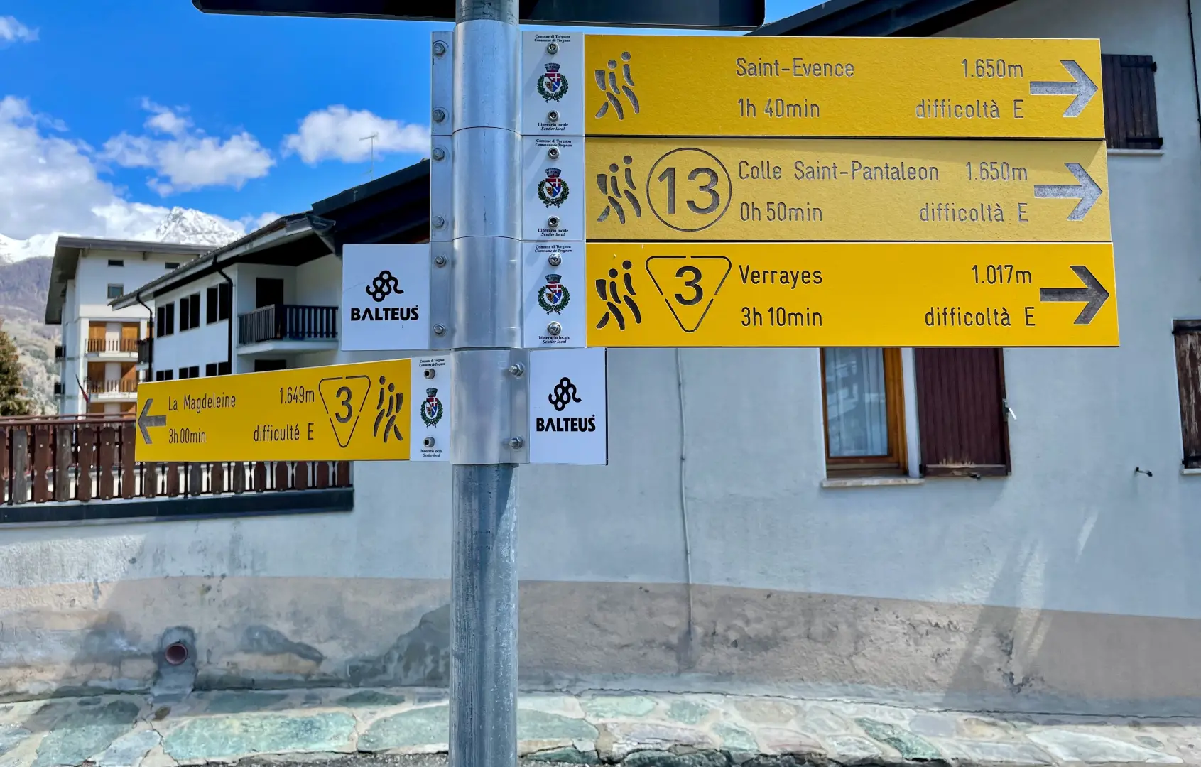
0h00' 0.00km From the car park, go down the again, turn left and reach the Office du Tourisme, where there is a signpost with directions to the hiking trails.
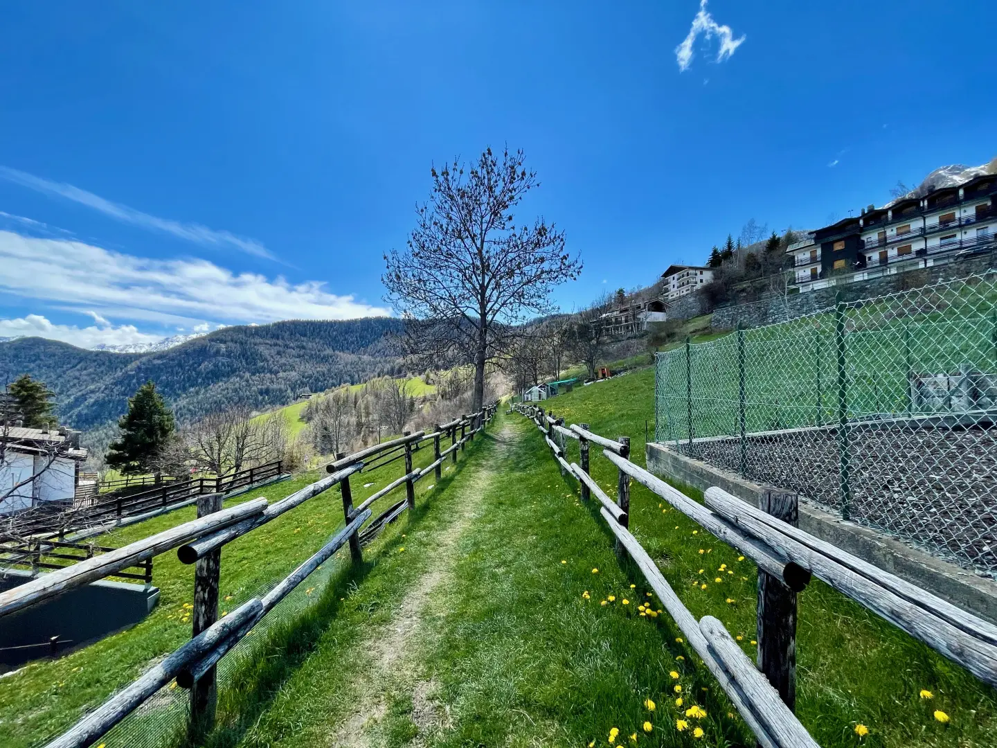
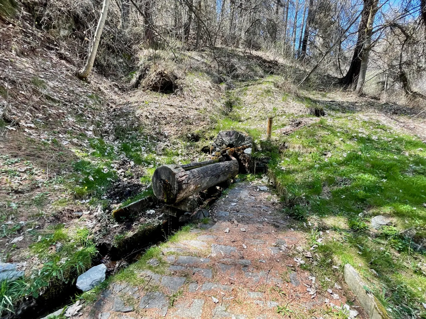
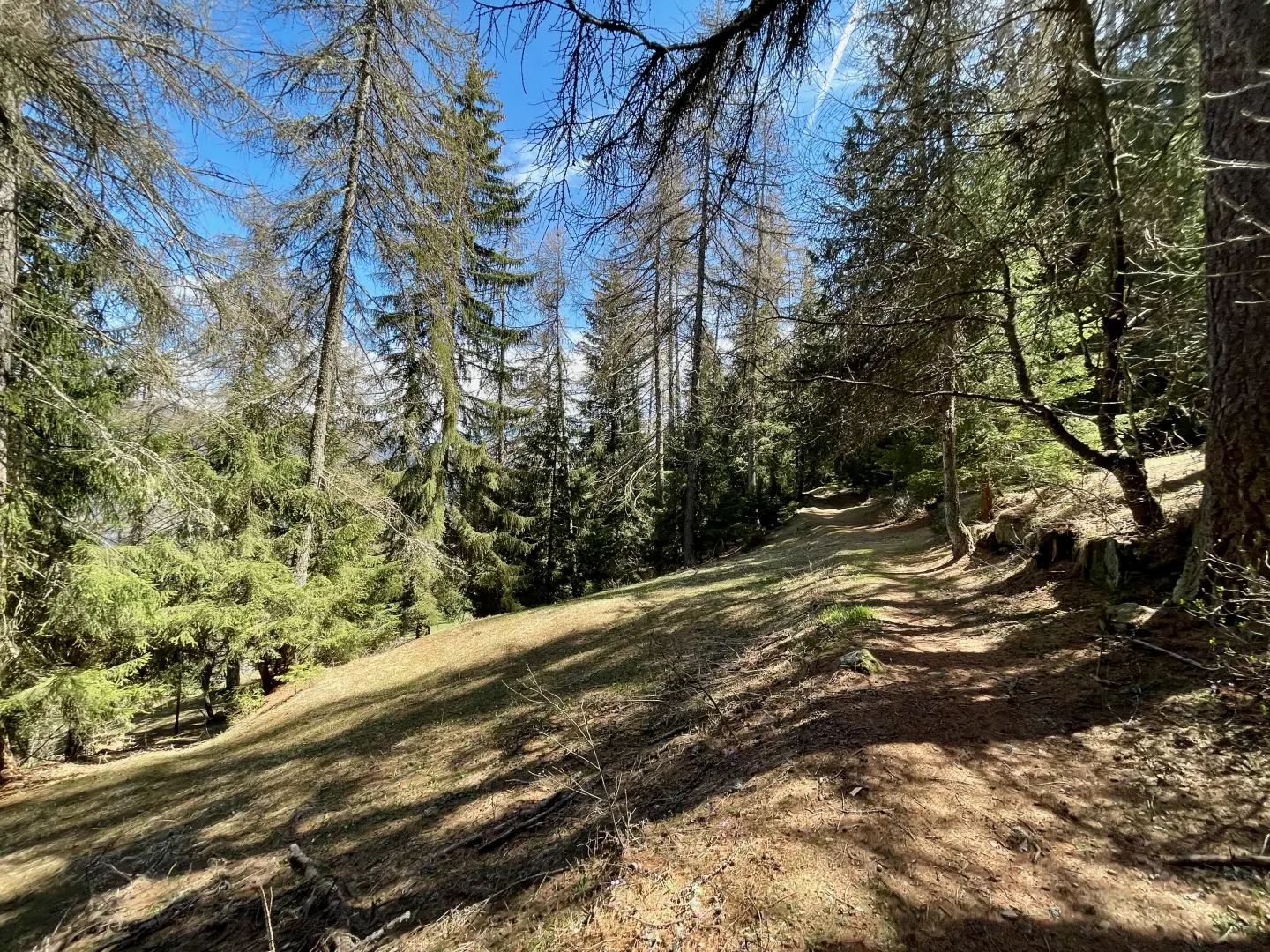
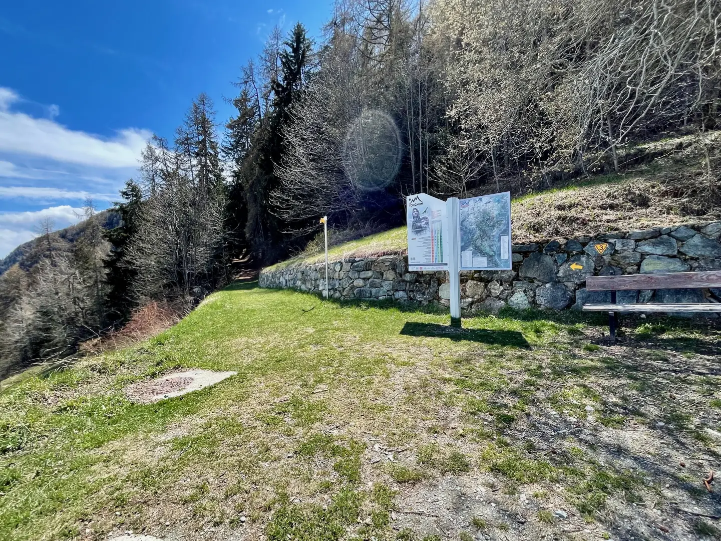
0h02' 0.14km Continue turning right along a small road between the houses of Mognod, skirting a couple of fountains 💧 and passing the last houses. After passing a votive shrine, take a well-marked path with wooden railings leading southwards. Follow the path, alternating with short ups and downs, taking advantage of the panoramic benches with a view of Valtournenche and the village of Verney. Continue into the forest, pass a larch grove with a fountain 💧 and come out onto the Ronc pastureland, which is particularly suggestive in spring due to the yellow blossom in front of the Becca d'Aver. Climb up briefly until you come to a farm road with an information board.
0h20' 1.32km Continue straight on along an evident mule track, face a short climb followed by a descent skirting the Fontin pastureland, then re-enter the wood with a change of gradient. Climb up the cool stretch of fir wood, meet a votive shrine and, a little further on, stop at a natural viewpoint over Valtournenche. Proceed for the last few minutes on a steady ascent until reaching the Chapel of Saint-Pantaléon (1,644m) 1h00' 2.84km .
The return is along the same route as on the outward 0h45' 2.84km .
Points of Interest
Collections
Photo gallery
Comments (0)
Sign in to leave a comment