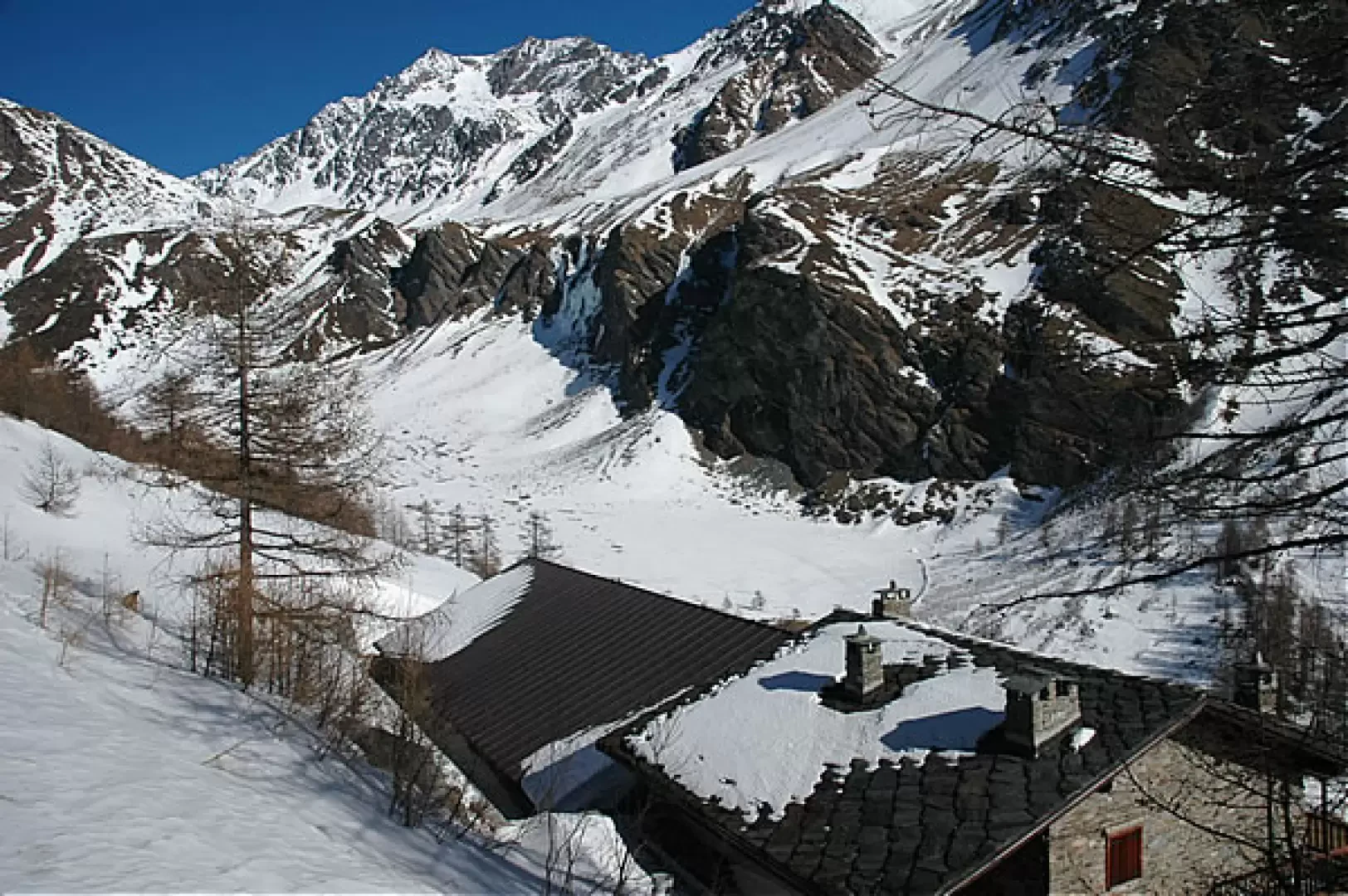
Tsa Nouva, from Prailles dessous


Edited by:
Massimo Martini
Updated at: 12/05/2025
Access
Lasciare l'autostrada alla barriera di Aosta Est, svoltare a destra e imboccare la superstrada , da seguire per 8,40 chilometri. Raggiungere Signayes e proseguire dritto sulla Strada Statale , superando gli abitati di Gignod ed Etroubles fino a raggiungere, dopo 21,90 chilometri, il bivio per Pallais, Prailles Le Bezet ed Eternod. Svoltare a destra e risalire la strada comunale per 3,2 chilometri fino a incontrare il bivio per Prailles Dessous. Girare nuovamente a destra e percorrere la stradina per circa 300 metri, fino ad arrivare al villaggio, dove è disponibile un parcheggio 🅿️ gratuito con circa 8 posti auto.
Distanza e tempo di percorrenza
🕒 Tempo di percorrenza: 31 minuti
📏 Distanza: 26,2 km
Navigazione GPS
📍 Come arrivare con Google Maps
📍 Come arrivare con Apple Maps
ℹ️ Nota importante
Le indicazioni fornite sono state verificate alla data del rilievo dell’itinerario. Prima della partenza, è consigliabile verificare eventuali variazioni del percorso. Per ottenere indicazioni aggiornate e dettagliate, si consiglia l’uso di Google Maps o Apple Maps.
Introduction
Long hike in the Menovy valley. Following the summer farm roads, one ascends the valley through the world of mountain pasture: in fact, on this route one crosses the various mountain pastures used in the summer, during the inarpa, for grazing cows.
Description
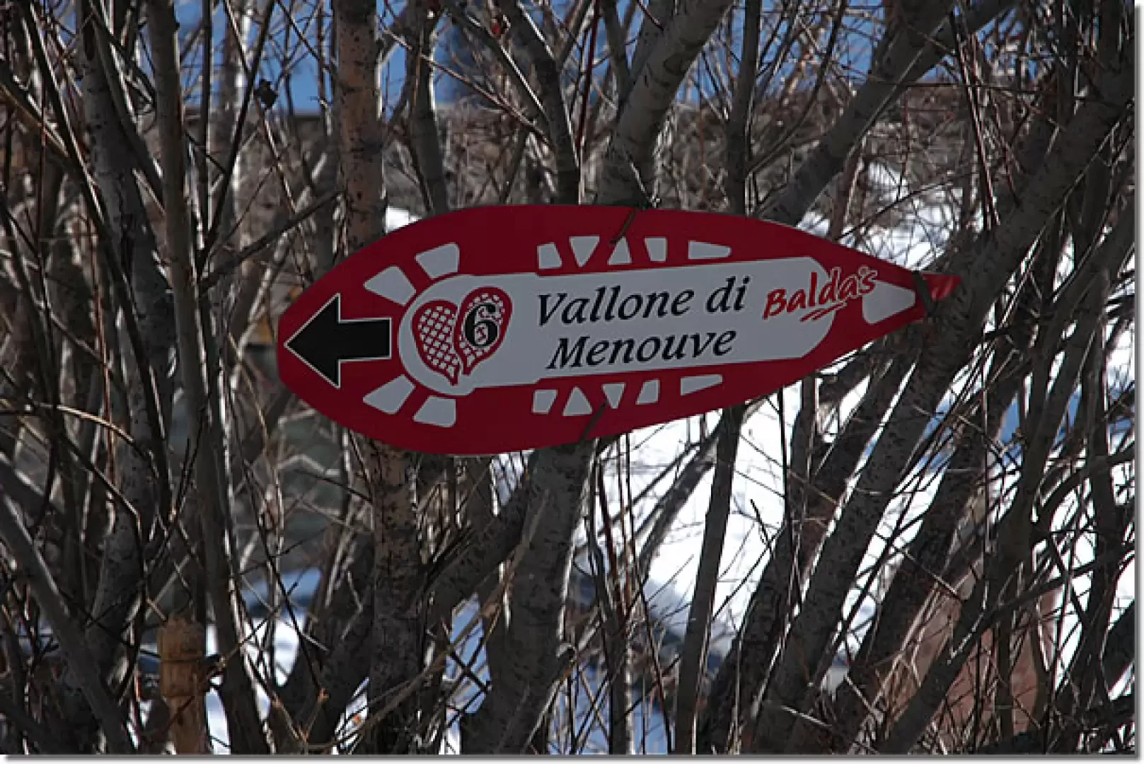
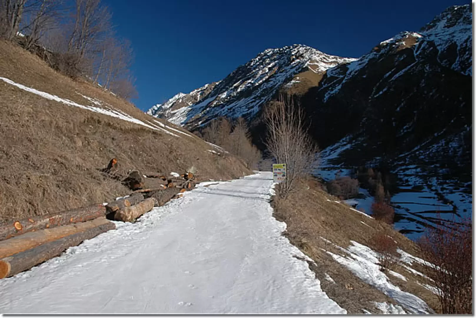
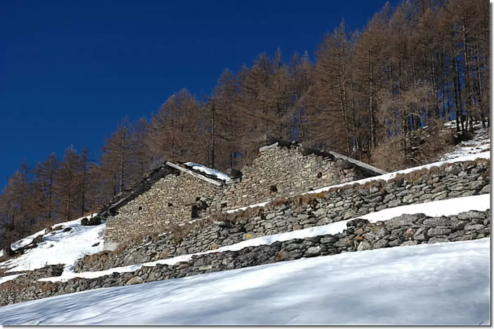
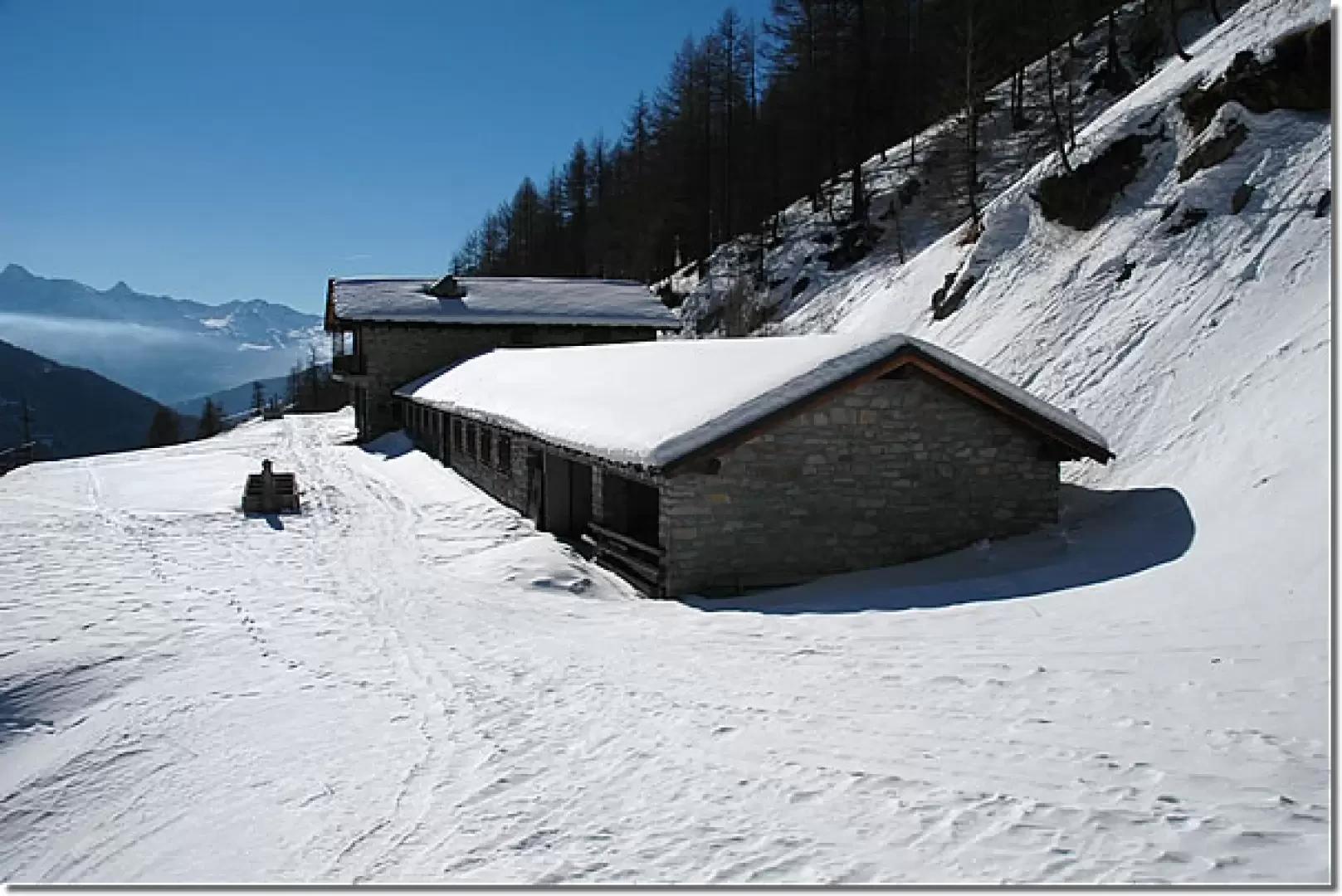
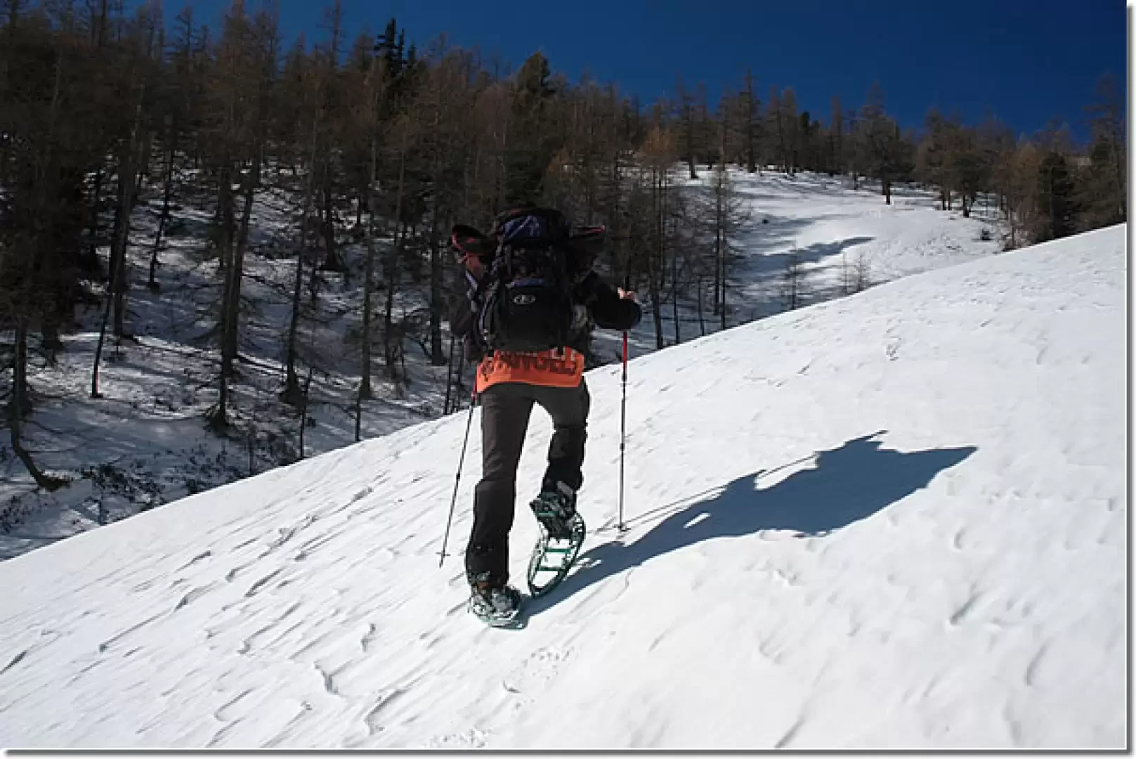
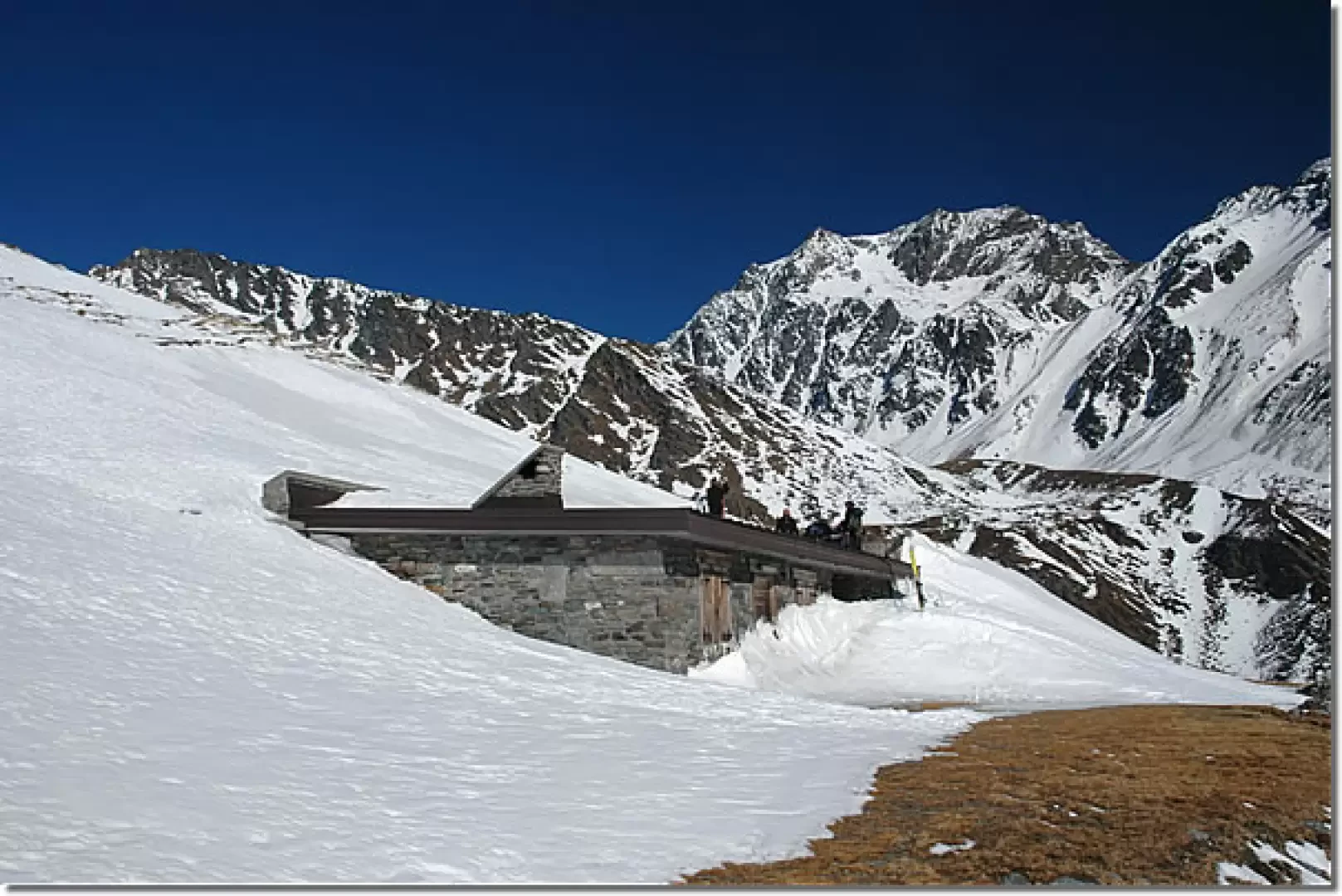
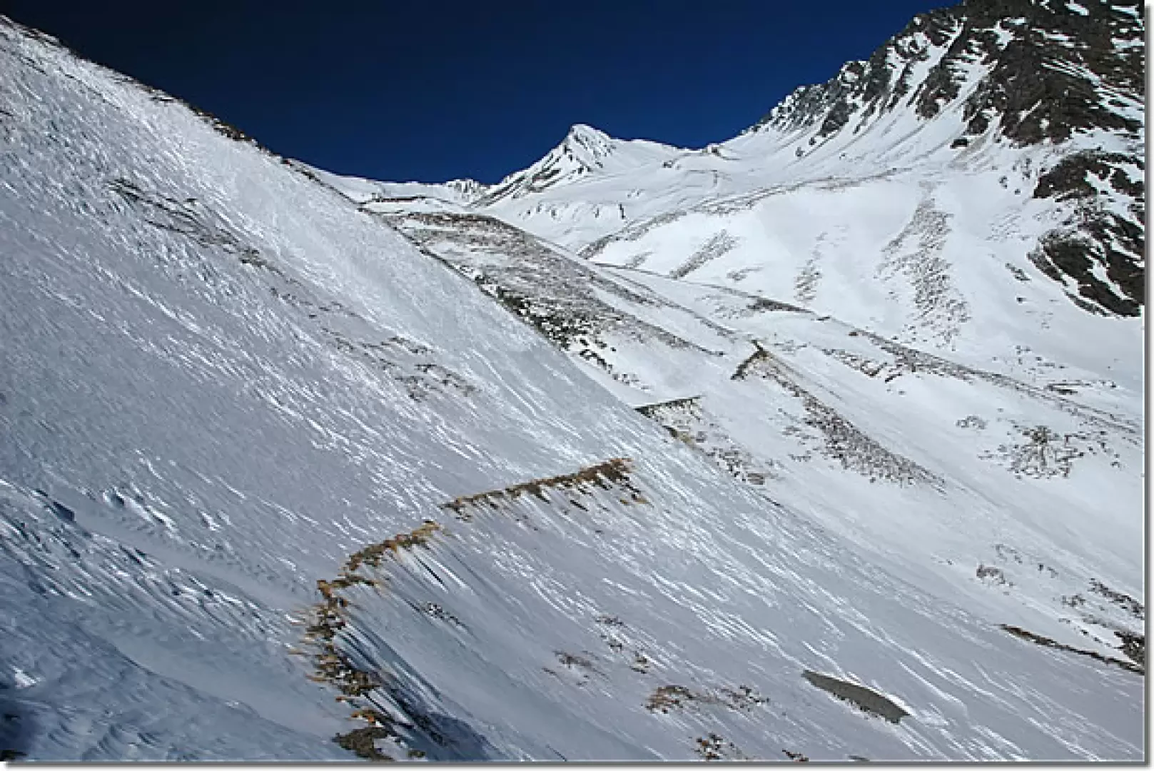
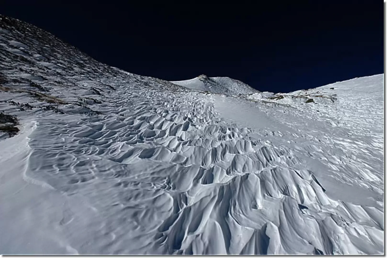
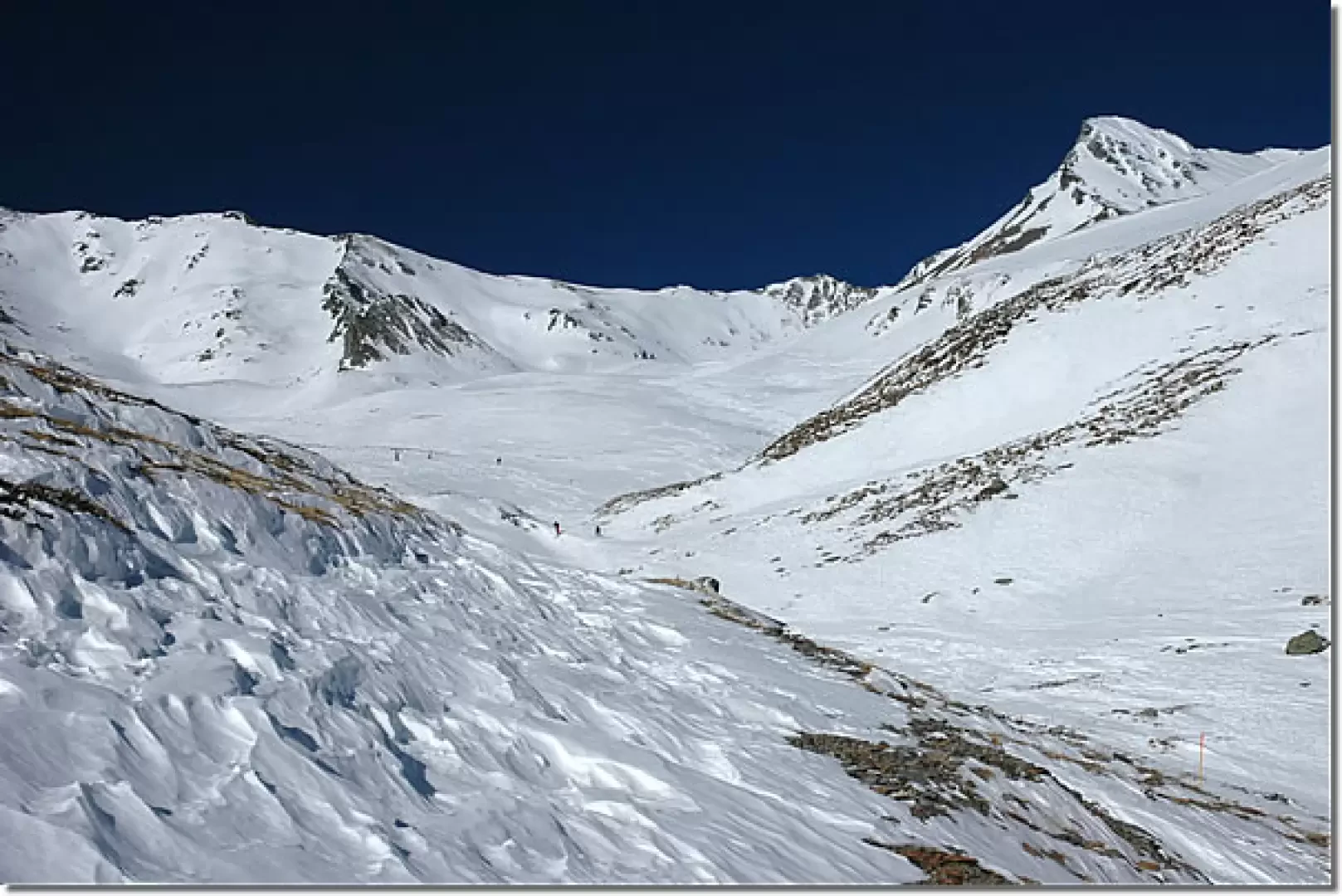
Leaving the car behind, you will immediately come across the snowshoe signs indicating itinerary No. 6 "Vallone di Menuove". We continue along the road turned into the Super Saint-Bernard track, which quickly leads us to the fork for Quaye (1631m, 0h10'). The trail continues up the lower part of the Menovy valley, and enters a sparse larch forest with beautiful views of Mont Velan. Pass two long hairpin bends and you reach the junction for the Col de Champillon (1754m, 0h40'): ignore the diversions to the right and continue along the track; pass a couple more hairpin bends (there are a few traverse stretches that make it a little difficult to pass) and you reach another junction: ignore the track again to the right and continue until you reach the pastures below the Combe German pasture. Now walk along the lower edge of the wood along an almost straight and gently sloping section until you reach another fork (1864m, 1h10'): here, turn left and continue to the Combe German pasture (1876m, 1h20'). Here, the trail climbs a short slope before the alpine pasture and then turns to the right to reach the ruins of Plan Bois (1903m, 1h25'). Cross between the cottages until reaching the larch forest again and the junction with the track coming from Essanaz (Barasson valley). Turn right, leaving the signposts for snowshoes here, and continue almost level to the Menovy mountain pasture (1913m, 2h00'). Leaving the alpine pastureland, we tackle the steepest part of the entire itinerary; we climb a short but steep slope that soon allows us to rejoin the little summer road just in sight of the not far away Tracaoudette alpine pastureland. From here, proceed without an obligatory route, heading towards the alpine pasture, which is finally reached after crossing a not excessively steep slope (2133m, 2h30'). From the alpine pasture, we continue along the track, which is often hardly recognisable due to the snow accumulated by the wind, overcoming the most treacherous section of the itinerary; in fact, we cut across fairly steep slopes that require a good stability of the snowpack, and in addition, the wind accumulations often make the passage somewhat problematic. Once the difficult section has been overcome, we approach the ruins of the Tsa de Menovy and begin the final ascent, initially heading towards the bottom of the valley where the Col Nord de Menovy (2775 m) already appears. We then veer a little to the left, starting to climb the last slopes that separate us from our destination: usually the wind activity in this area is substantial and creates particular ripples in the snowpack. After cutting across the little summer road several times, we first reach some ruins below the alpine pasture and finally the Tsa Nuova (2426m, 3h00')
The return is by the same route as the outward journey (2h00'). It is advisable to follow the little road in its entire length, avoiding the cuts made during the ascent. Alternatively, you can descend by following the Super Saint-Bernard track, which enters a steep gully and is usually quite popular with off-piste enthusiasts.
After the Tracaoudette mountain pasture, the route, although following the comfortable summer route, has some somewhat treacherous traverses: generally made up of windy snow. Extreme caution is advised when traversing these and, above all, careful consideration should be given to the condition of the snowpack as there is a possibility of snow drifting off the slopes.
On the descent, watch out for skiers descending the Super Saint-Bernard slope.
Riferimenti Bibliografici
- Tracce Lievi - Massimo Martini - Martini Multimedia Editore, Saint-Vincent, 2007
Galleria fotografica