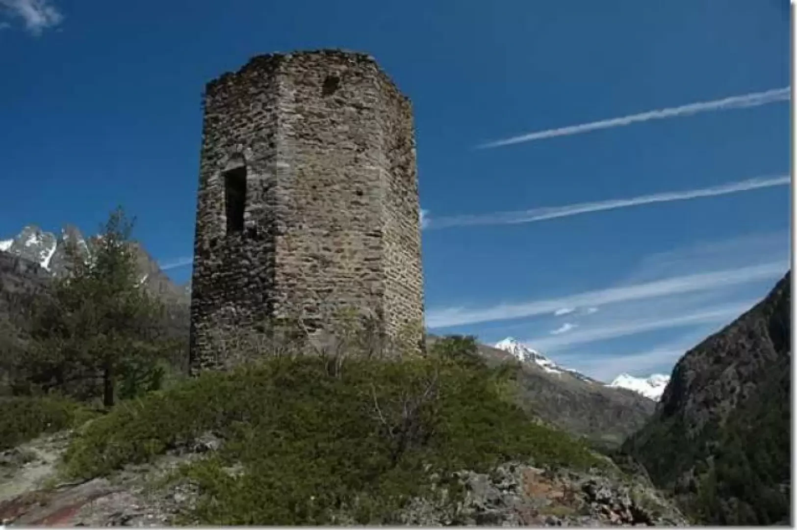
Tour Tornalla, from Oyace

Introduction
Interesting circular route in the middle Valpelline. The route revolves around the Tornalla, a 13th-century tower near Oyace.
Description
0h00' Leaving the car, we climb up a short stretch of the regional road until we reach the town hall of Oyace: after having glanced at the descriptive board for the excursion, we turn right and begin to climb up a small asphalted road that crosses the village. After a few minutes, you cross the regional road again and, after crossing it, you reach the hamlet of Sergnau and turn right, beginning to follow a small agricultural road bordered by a wooden fence. Once you reach the regional road again (1392 m, 0h10'), cross it and continue following the signs for Tour d'Oyace (yellow marker) and La Tour (wooden panel).
You ascend a farm track that passes near a barn: shortly after this, turn right (1422 m, 0h15') and follow a slightly downhill path through green pastures.
Approaching the buttress on which the Tornalla stands, start to climb a short difference in altitude with a series of rapid hairpin bends until, in the midst of a cool fir forest, you reach the ridge and another wooden panel indicating La Tour. Turn right and, shortly afterwards, you will come to a yellow marker: here turn right again and begin to descend a little path which, after a few ups and downs, leads to the 13th-century tower known as Tornalla (1473 m, 0h30'): from here you can enjoy a splendid panoramic view of the mountains of the middle Valpelline while comfortably seated on a bench.
After the suggestive break, walk back along the trail until you come to the yellow marker: here turn right and start to descend the rocky buttress with a long diagonal followed by a couple of wide hairpin bends; finally you reach the Bétendaz alpine pastures (1355 m, 0h50').
You descend below the alpine pastures and cross a little stream on a convenient little wooden bridge. Continue slightly downhill until you cross the Alta Via path (1357 m, 0h55'):
turn right and you will soon reach the little masonry bridge that allows you to cross the Buthier stream at the Orrido di Bétendaz gorge (1360 m, 1h00').
Following the little bridge, you move to the orographic left of the Buthier and, shortly after at the entrance to the forest, you leave the Alta Via 1 route (which turns left) and start walking along a long stretch of path through the cool fir forest. From time to time, suggestive views open up of the Tornalla, which, perched on the rocky buttress, has a very severe air about it. At the end of the forest, we come to a fountain and proceed through green pastures: we descend briefly towards the Ponte di Bagnêraz bridge, meeting up again with a tarmac road (1280 m, 1h 20').
We return to the orographic right of the Buthier and shortly reach the hamlet of Vernosse (another fountain); here we descend towards the regional road but do not take it: shortly before, we turn right, crossing the hamlet of Grenier until finally joining the regional road. Follow it for a short distance and then turn right; go up a wide path bordered by a wooden fence that leads to the parish church in about ten minutes: once you have reached the latter, you will find your car again at the car park next to the religious complex (1363 m, 1h45').
The Tornalla is an octagonal-based tower dating from the beginning of the 13th century. The name derives from the local patois and means small tower: it is probably the reconstruction of an earlier fortification by the lords of Quart, after those of Oyace were deprived of their titles due to their insubordination and their castle was razed to the ground.
The path crosses rugged environments and has some somewhat exposed stretches protected by railings: it is advisable to follow the path faithfully to avoid finding yourself in "unpleasant" situations.