Tour Pramotton, from Pramotton


Edited by:
Massimo Martini
Updated at: 16/06/2026
Access
Exit the motorway junction at Pont-Saint-Martin and turn left to join the state road in the direction of Aosta. At the roundabout, take the second exit and continue along the urban straight stretch of the state road in the direction of Donnas. After about 2 kilometres, turn left onto Via Lungodora 2000, go through the subway and cross the Dora Baltea river. After about 600 metres you will come to another roundabout: take the second exit onto Via Clapey and follow it for about 300 metres. Then turn right, continuing on Via Clapey for another 500 metres, until turning right onto Via Grand-Vert. Follow this road, which crosses the village of the same name, until you reach the free fractional car park (🅿️) of Pramotton, located just before the village.
Distance and travelling time
🕒 Travelling time: 6 minutes
📏 Distance: 3.40 kilometres
GPS navigation
📍 How to get there with Google Maps
📍 How to get there with Apple Maps
ℹ️ Important note
The directions given were verified on the date of the route survey. Before departure, it is advisable to check for any changes to the route. For up-to-date and detailed directions, we recommend the use of Google Maps or Apple Maps.
Introduction
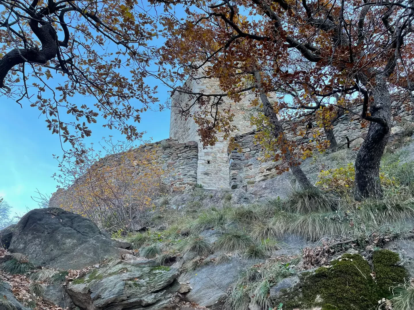
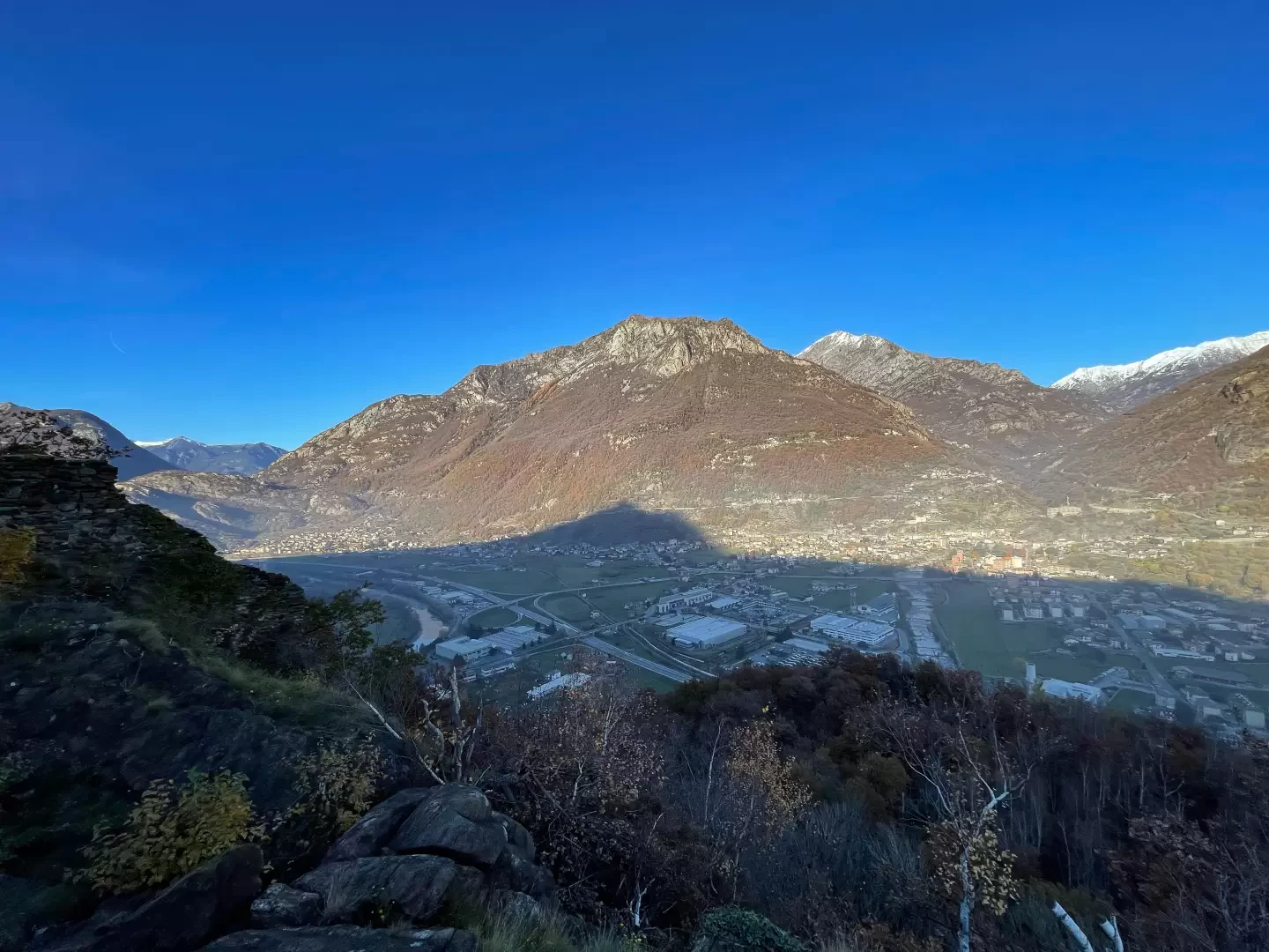
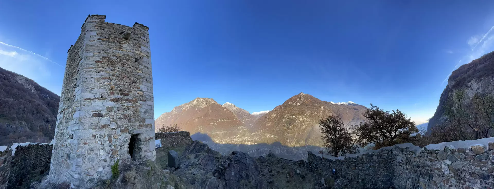
The village of Pramotton, in the municipality of Donnas, is the starting point of a short but evocative itinerary leading to the Tour de Bellegarde - better known as the Tower of Pramotton - one of the earliest examples of fortified architecture in the lower Aosta Valley. The construction, dating back to the second half of the 12th century, is attributed according to tradition to the lords of Bard, local feudal lords who controlled the access territories to the Lys valley. Documents from 1214 record the tower as belonging to Ugo di Bard, who was later forced by Duke Amadeus IV of Savoy to cede the fiefdom in 1242. The appellation 'Bellegarde' appears in later centuries, probably linked to branches of Franco-Sabaudic families that had possessions or rights in this area. Like many mediaeval fortifications in Valle d'Aosta, the tower performed above all functions of sighting and control of the territory. Situated in a dominant position at the entrance to the Gressoney Valley and on the plain of Pont-Saint-Martin, it communicated with Bard Castle and other towers along the Dora Baltea. Its architecture, hexagonal and compact, with a raised gate and protective walls, makes it an interesting example of a Valle d'Aosta tower-dungeon, built more for a visual signal and symbolic garrison than for a real military purpose.
The excursion therefore offers the opportunity of a direct encounter with the feudal history of the valley, as well as with a landscape that for centuries has accompanied the vicissitudes of Alpine communities. A short itinerary, without technical difficulties and practicable in all seasons, it is ideal for those who want a half-day walk in the name of memory and observation of the territory.
Description
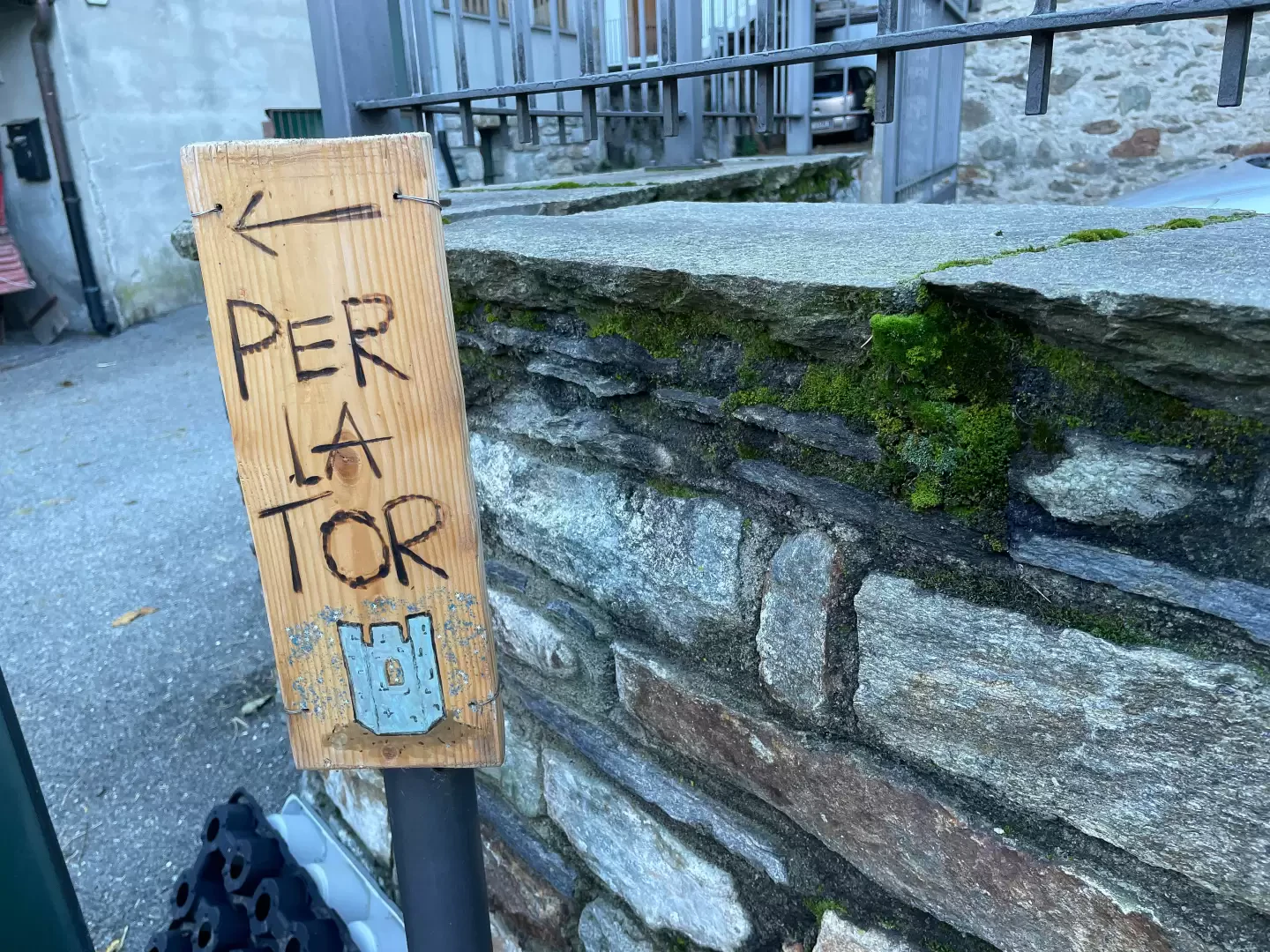
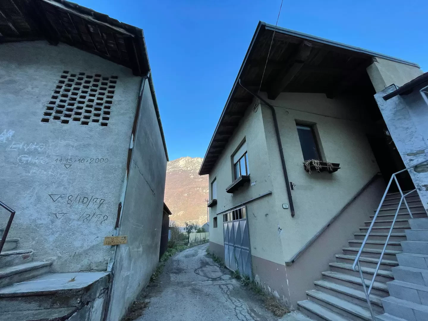
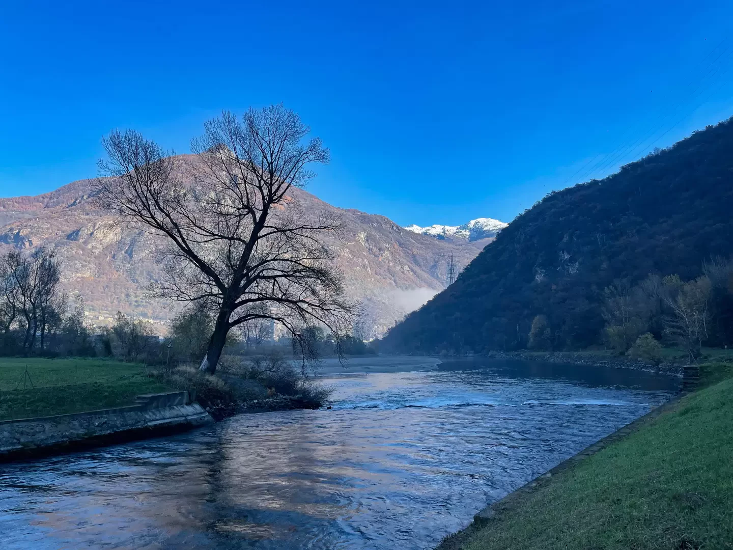
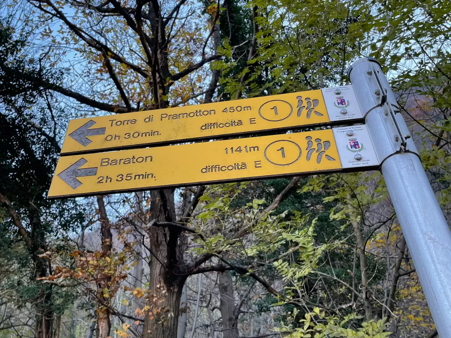
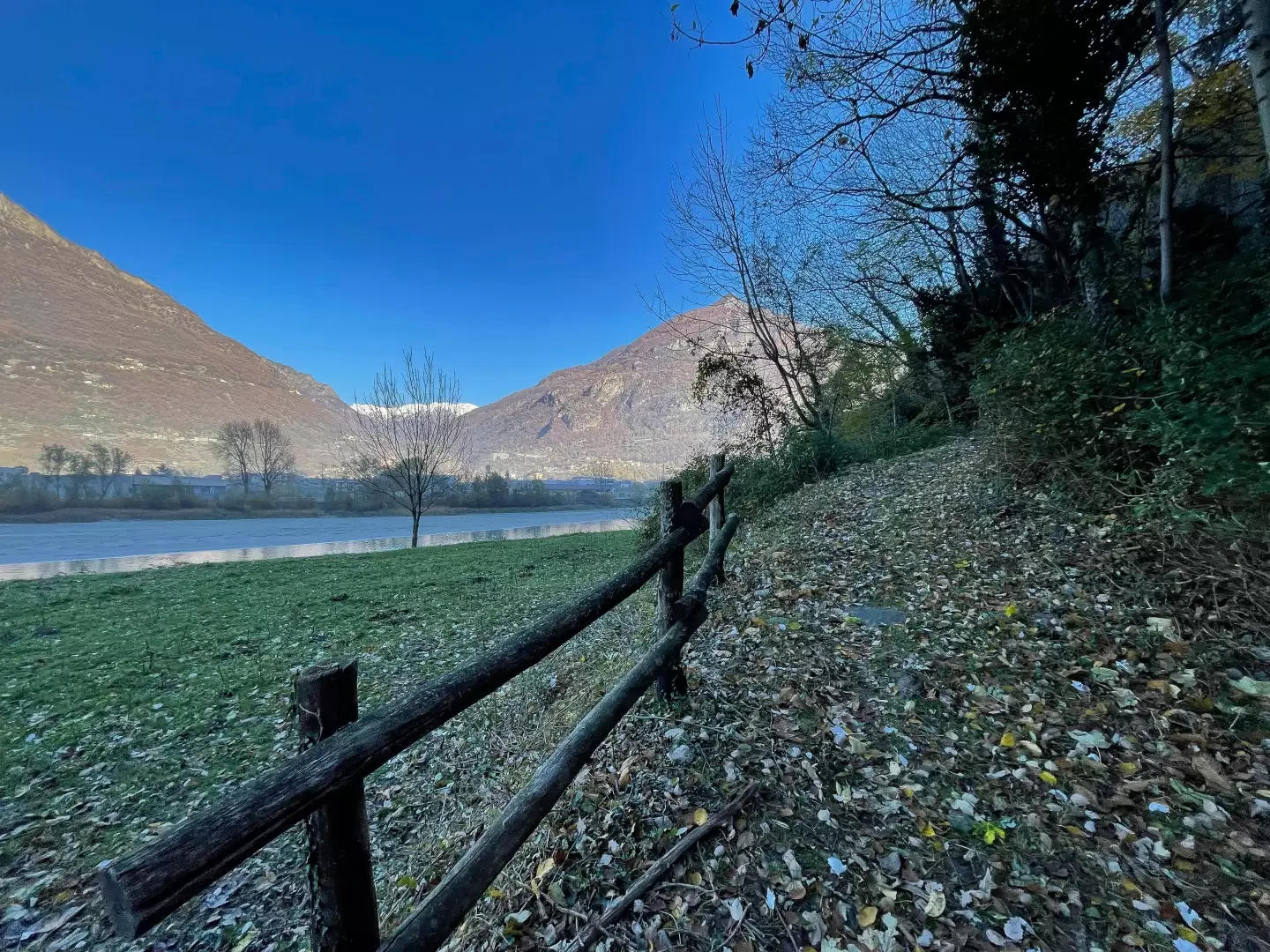
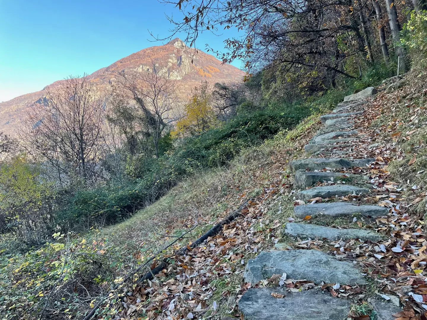
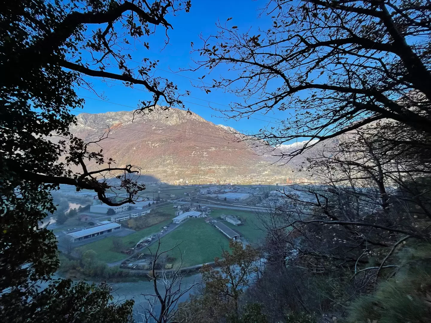
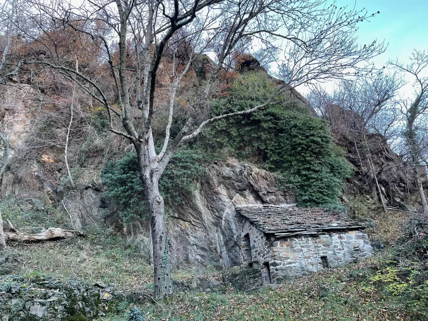
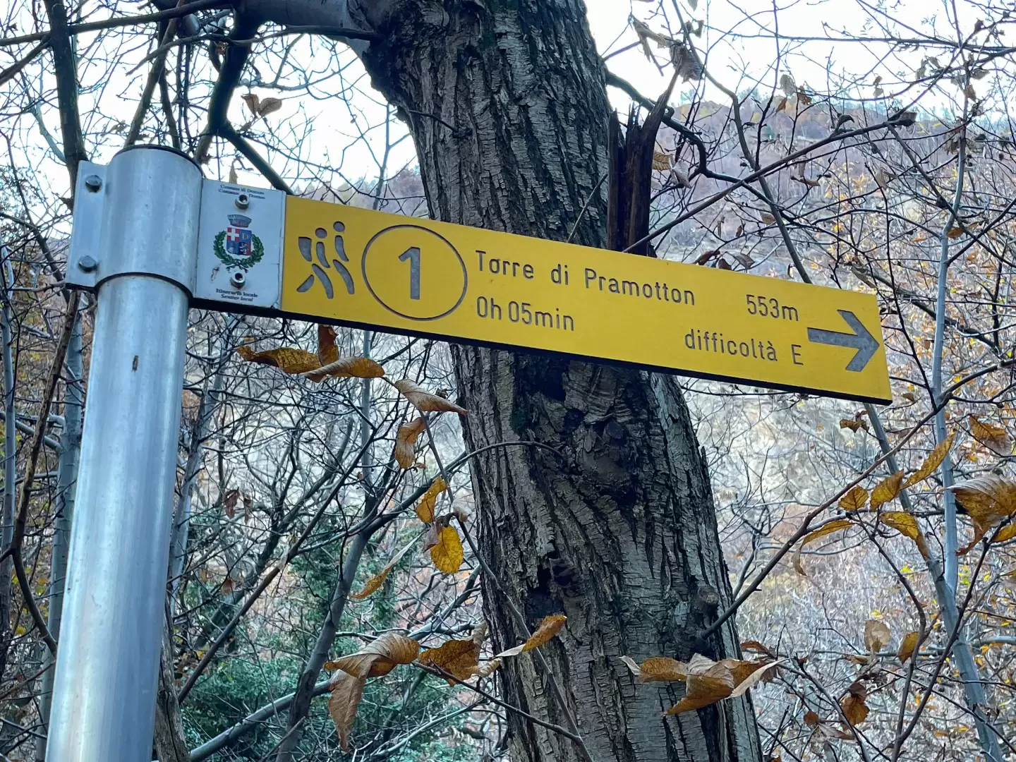
0h00' 0.00km Proceed towards the small village of Pramotton, following the signs for the "Tor", shown on wooden panels. After a few metres, once you have entered the village, turn left and follow the signs for the "Tor de Pramotton", posted on a building that shows the heights reached by the water of the Dora Baltea during the floods of 1977, 1978 and the tragic overflow of 14-15 October 2000. Continue along a short road approaching the Dora Baltea and, ignoring the pedestrian bridge on the left, continue for about 300 metres along a flat agricultural road adjacent to the Grand-Vert power station canal. Cross the meadow heading towards the marker posts on the right indicating the start of the path. Then take the mule track, initially flanked by a wooden railing, and enter the chestnut forest. After crossing a small stream, the gradient increases along the beautiful paved mule track. After a few twists and turns, you pass near a barma and reach an initial viewpoint with a glimpse of the village of Pont-Saint-Martin. The path then softens and leads to a service hut clinging to the rock of the knoll. After a short climb, continue on an almost level stretch until you come to a signpost in the oak and birch forest. Turn right and ascend the path briefly until, having reached the walls, you enter the Tour de Bellegarde complex, commonly known as the Pramotton Tower (altitude 553m) 0h40' 1.35km .
The return is along the same route as the ascent, retracing the main downhill path back to the starting point 0h35' 1.35km .
Points of Interest
Collections
Riferimenti Bibliografici
- La Torre di Pramotton - Prinetti Francesco -
Photo gallery
Comments (0)
Sign in to leave a comment