Tête de Ferret, from Arp Nouva


Edited by:
Ivano Ruffoni
Updated at: 06/04/2026
Access
Navigazione stradale
Lasciare l'autostrada allo svincolo di Aosta Ovest e immettersi a destra sulla strada regionale per la valle di Cogne. Dopo 400m (0,4km) alla rotonda prendere la seconda uscita entrando nella strada statale , da seguire per 32,4km (32,8km), attraversando e costeggiando gli abitati di Saint-Pierre, Villeneuve, Arvier, Avise, Derby, La Salle, Morgex e Courmayeur, sino a raggiungere l'uscita per Larzey – Entrèves sulla . Svoltare a destra e imboccare la percorrendola per 4,0km (36,8km) fino a Entrèves. Proseguire su Strada la Palud per 11,1km (47,9km), superando La Palud, Planpincieux e Lavachey, fino al termine della strada in prossimità di Arp Nouvaz.
Parcheggio
Al termine della strada, dopo aver attraversato la Dora di Ferret su un ponticello in legno, si trova il parcheggio 🅿️ di Arp Nouvaz in fondo alla macchia boschiva. Nel periodo estivo (luglio e agosto) l'accesso è regolamentato: normalmente è consentito prima delle ore 8:00 sino a saturazione dei posti disponibili; dopo tale ora è disponibile un servizio navetta con partenza da La Palud. Per informazioni aggiornate consultare la sezione apposita del sito del comune di Courmayeur.
Accesso con mezzi pubblici
Per raggiungere il punto di partenza dell'itinerario è necessario un mezzo privato. Nel periodo estivo è attivo un servizio navetta 🚌 da La Palud; verificare orari e disponibilità sul sito del comune di Courmayeur.
Distanza e tempo di percorrenza
🕒 Tempo di percorrenza: 57 minuti
📏 Distanza: 47,9km
Navigazione GPS
Nota informativa
Le indicazioni fornite sono state verificate alla data del rilievo dell'itinerario. Prima della partenza si consiglia di verificare possibili variazioni del percorso o delle condizioni stradali. Per informazioni aggiornate si raccomanda di consultare Google Maps o Apple Maps.
Introduction
This route is partly a classic part of the Tour du Mont Blanc (TMB). Great views of the Triolet glacier and Pré de Bar, Les Grandes Jorasses and Mont Dolent. Itinerary practicable by mountain bike to the Refuge Elena Pré de Bar.
.Description
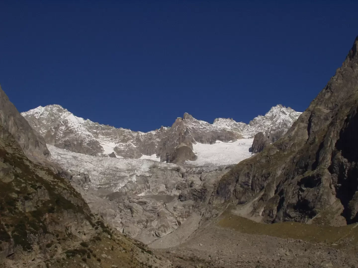
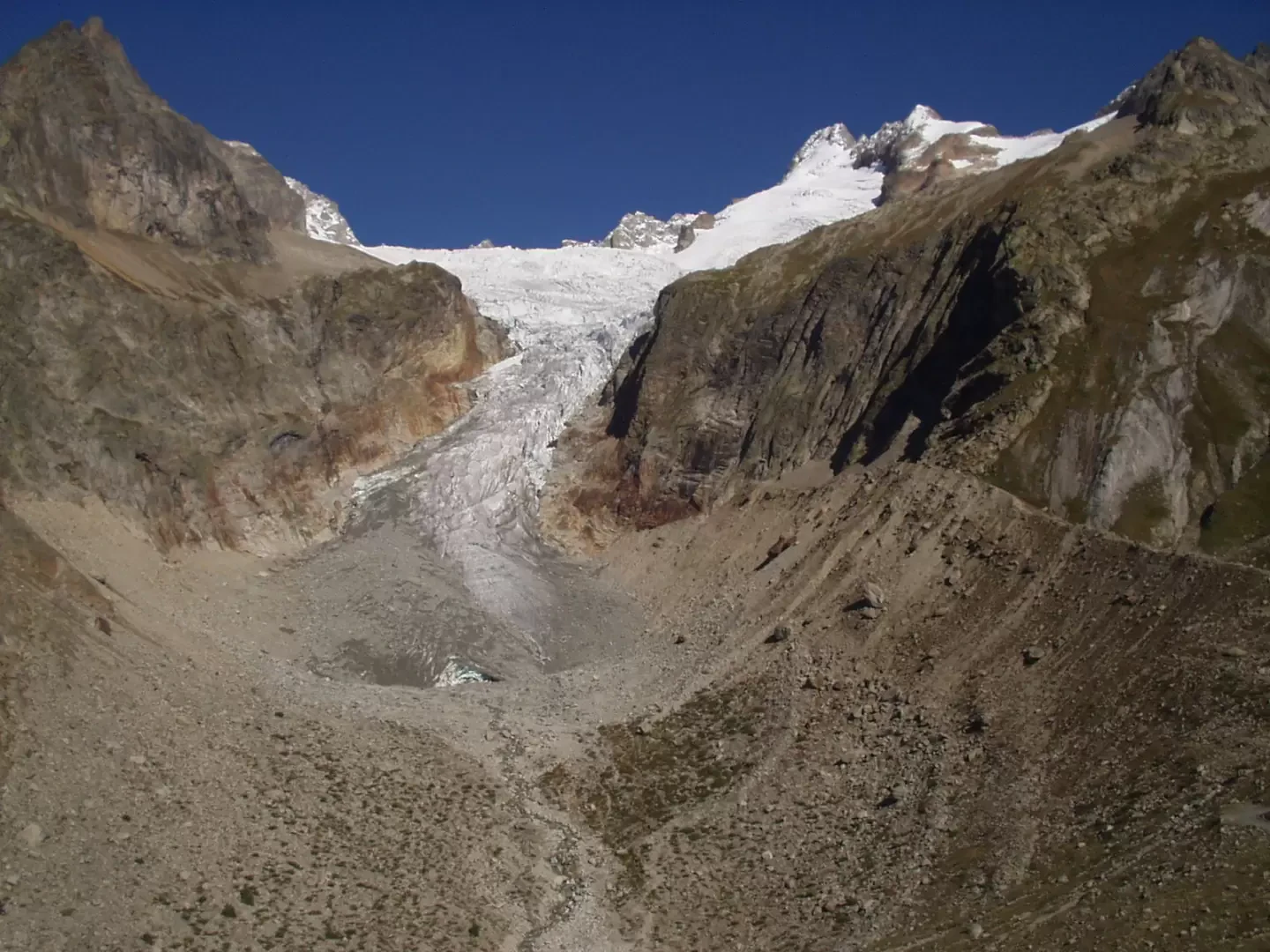
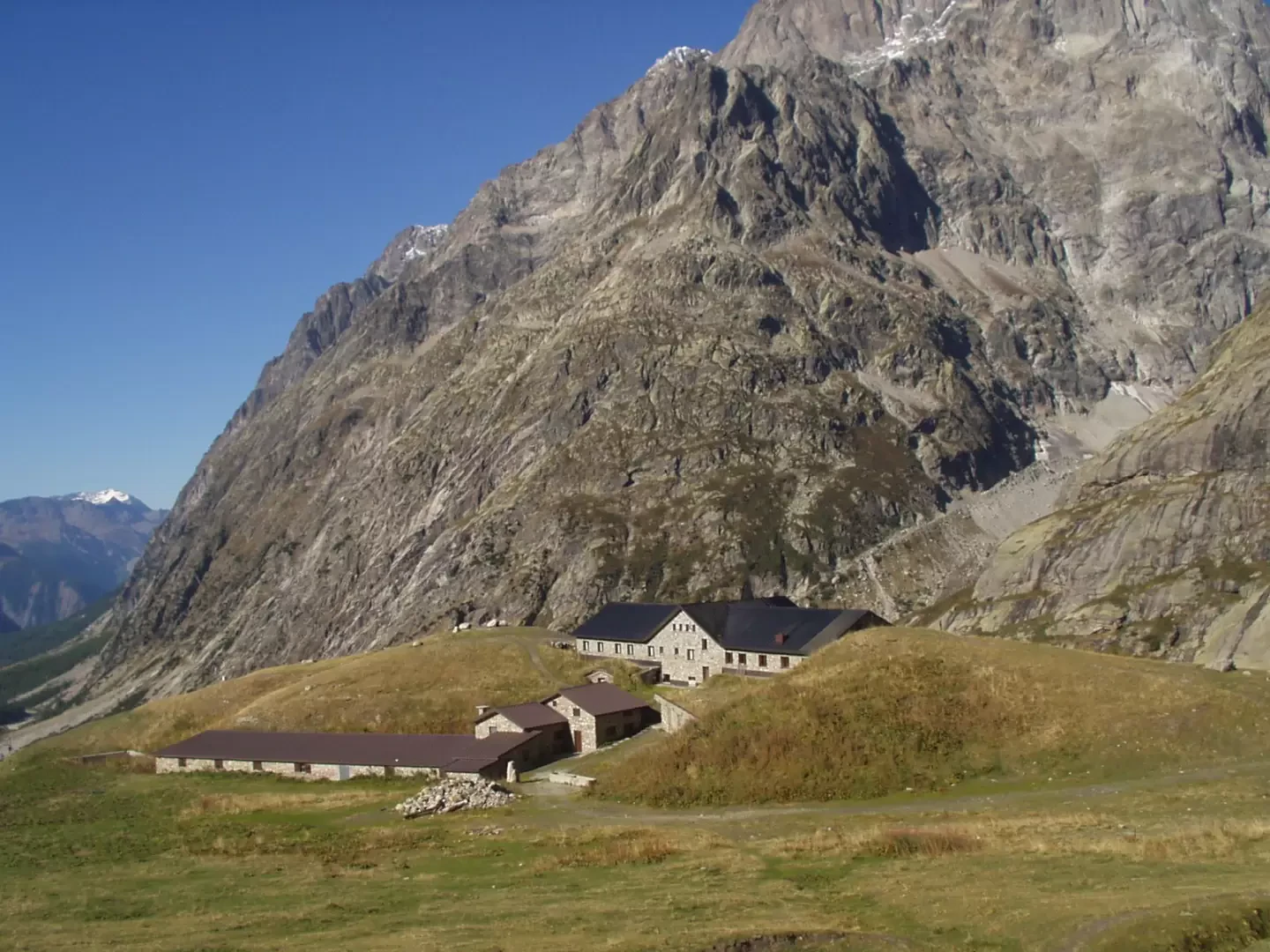
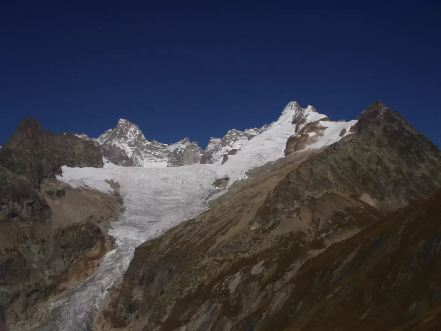
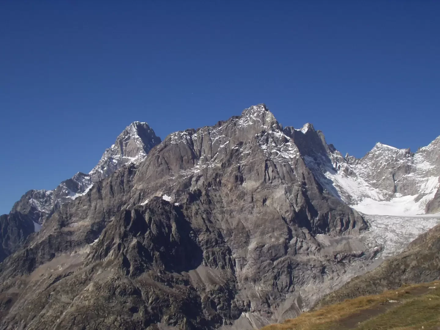
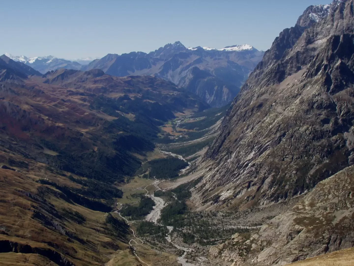
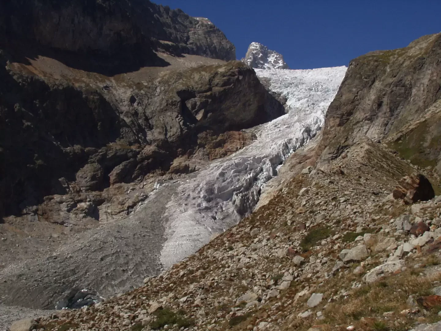
Park at Arnouva (1769 m) just before the Val Ferret shuttle bus terminus (if the Val Ferret road is closed to traffic, take the shuttle bus to Arnouva). Proceed along the dirt road at the bottom of the valley, closed to unauthorised traffic, crossing, first, the trail for the Bivacco Comino bivouac and then the trail for the Dalmazzi al Triolet refuge. Now, on your left, to the north-west, the Triolet glacier and the ridge of the Monts Rouges de Triolet are clearly visible. Near the final nose of the ridge, the road climbs in hairpin bends to the Elena Pré de Bar hut (2060 m). In an east-southeast direction, one can enjoy the beautiful panorama of the east face of Les Grandes Jorasses. The trail now climbs up to Alpe Pré de Bar (2264 m), pushes a little towards the Combette valley, and then bends to the left. In the half-hill stretch that follows, the glacier of Pré de Bar, a beautiful and characteristic tongue nestled between the Monts Rouges de Triolet and the Petit Grapillon, is clearly visible to the northwest. This panorama accompanies the trail to the Col du Grand Ferret (2537 m). From the pass, follow the path northwards along the grassy ridge leading to the Tête de Ferret (2724 m), a privileged vantage point from Mont Dolent, a triple border point between Italy, Switzerland and France, to Les Grandes Jorasses and the entire Val Ferret. The return can be made by going back to the Col du Grand Ferret, then turning right on the mule track to reach the Col du Petit Ferret (2488 m), also known as the Col de Grapillon. Alternatively, you can descend from the summit of the Tête de Ferret via a steep, slippery path that heads north-east and quickly reaches the Col du Petit Ferret. From the pass, the steep trail to the Fiorio Bivouacs is clearly visible. We now descend from the pass on another steep and slippery path, in places on shale rock, which leads to a hairpin bend on the dirt track to the Elena Pré de Bar Refuge. Now follow the valley floor road, taken on the way up, to the Arnouva houses.
.Photo gallery
Comments (0)
Sign in to leave a comment