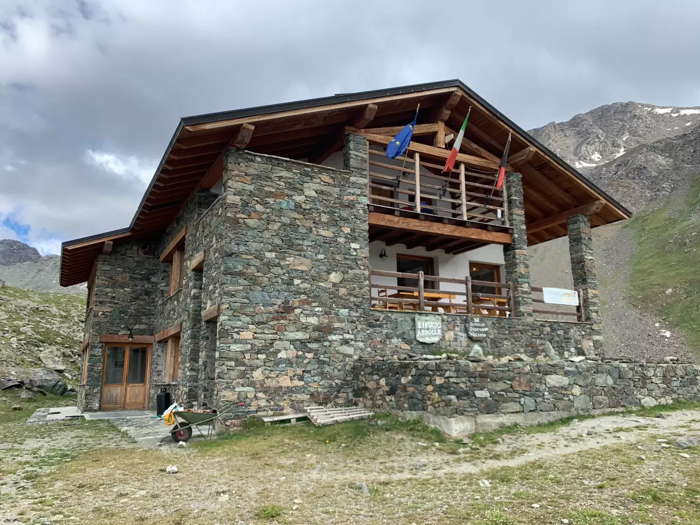
Arbolle Refuge, from Pila

Access
Leaving the motorway at the Aosta Est exit, take the state road and continue in the direction of the capital. Once in Aosta, follow the signs for Pila until you reach the locality of Pont-Suaz: from here, having crossed the Dora Baltea, continue in the direction of Charvensod. Go up the entire regional road until you reach Pila, at the first parking area near the arrival point of the Aosta-Pila cableway.
- How to get there with GMAPS
- How to get there with Apple Maps
Description
Leaving the car park, go up the metal staircase that leads to the gondola lift station and, after crossing the little meadow in front of it, turn right onto a small road. After a few metres, ignore the road to the left that leads to the hermitage of San Grato, and shortly afterwards you come to a temporary signpost indicating to turn left in the direction of the Chamolé mountain pasture. Go up a dirt track that in a few minutes first leads to an alpine pasture and after a few metres ends at a signpost indicating Alpe Chamolé (1851 m, 0h10').
The path ascends a deforested strip among the fir trees, populated by Sorbus (Sorbus aucuparia) and Alder (Alnus cordata) up to an altitude of about 2000 m, where the deforested section becomes wider and gives way to some grassland. You soon reach a wider path (2062 m, 0h30') and turn left up a beautiful trail that quickly crosses the forest and leads to the beautiful pastureland clearing below the Chamolé alpine pasture. The path, with a wide semicircle to the left, first approaches a ruin and finally reaches the Chamolé mountain pasture (2154 m, 0h50'): from here, the panorama is already exemplary, Mont Blanc stands out in the distance and in front of us, the view of the Fallère group and the Grand Combin is unmissable... especially at first dawn. At the back of the alpine pasture, we take a small road, still following the signpost, near a fountain. You first climb up a small road that becomes a path and enters a wooded area. After a few minutes, you come to a fork in the road: both lead to Lake Chamolé, the 102 on the left reaches it directly, while the one on the right takes you up a small valley to the arrival point of the Chamolé chairlift (2310 m, 1h20') with a refreshment point. From the chair lift, we follow a wide, almost level path that leads us to Lake Chamolé (2325 m, 1h30') in less than 10 minutes. From here we begin to climb the ridge that leads to Col Chamolé: the path, which is very popular, comfortably climbs the grassy ridge below the Tête Noire; as we climb it, the panorama becomes more and more captivating and the view of the needle below becomes more and more suggestive. At the end of the innumerable hairpin bends, the pass is finally reached and the Arbolle omba opens up before us with the refuge and the two small lakes located near it. The marker placed on the pass (2655 m, 2h10') indicates that the path for Punta Valletta starts on the right; we ignore it and begin the descent of about 150 m until we reach the plateau that precedes the refuge. We cross the stream with the runoff water from the Arbolle lakes and reach the Arbolle hut (2523 m, 2h30'). The return trip follows the same route as the outward journey.