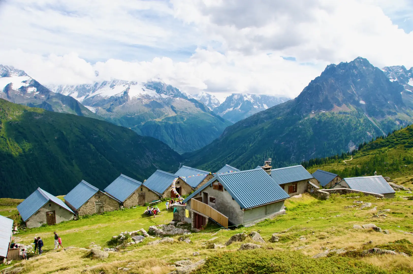
Refuge de Loriaz, ring from Le Couteray

Access
On arrival in Chamonix-Mont-Blanc, at the roundabout leading to the Mont Blanc tunnel, take the direction for Vallorcine - Martigny along the departmental road . Follow the departmental road for 16.5 km up the valley, through the village of Argentière and over the Col des Montets. On the descent, enter the commune of Vallorcine: pass the village of Le Buet and, immediately after the bridge over the Eau Noire stream, turn left onto the road leading to Le Couteray. At the free car park 🅿️ of the village is the start of the hike.
Distance and walking time
🕒Travel time: 24 minutes
📏 Distance: 16.9 km
GPS navigation
📍 How to get there with Google Maps
📍 How to get there with Apple Maps
ℹ️ Important note
The directions given were verified on the date of the survey of the route. Before departure, it is advisable to check for any changes to the route. For up-to-date and detailed directions, we recommend the use of Google Maps or Apple Maps.
Introduction
A classic route in the Vallorcine valley, the ascent to the Chalets de Loriaz (2,020 m) allows you to immerse yourself in an environment of remarkable scenic and natural interest. The route, well marked and signposted, starts from the village of Le Couteray and runs counter-clockwise, alternating between stretches in coniferous forests and wide high-altitude pastures. As the climb progresses, the view gradually opens up, embracing the Mont Blanc massif and the Aiguilles Rouges, until reaching the characteristic alpine pasture of Loriaz. The chalets, arranged in rows and very close together, retain the traditional layout of alpine constructions in the Chamonix and Vallorcine valleys. Surrounding them are vast alpine pastures that are coloured with alpine flowers in summer, offering numerous ideal spots for a rest or a picnic with a view of the surrounding mountains. The presence of the refuge also makes it possible to stop for refreshments or to spend the night at altitude. The hike is part of a culturally evocative context: not far away, the 'chemin des Diligences' retraces the ancient route of the carriages that connected Switzerland to the Chamonix valley, past mills, bridges and traditional architecture. Those arriving from Chamonix can take advantage of a stop at Col des Montets, where the 'Chalet de la Réserve des Aiguilles Rouges', open in the summer months, houses an exhibition centre and an alpine garden that tell of the extraordinary botanical variety of the region.
.Description
0h00' 0.00km From the Le Couteray car park, continue along the road until the first signposts pointing in the direction of the Loriaz. Take the path that enters the forest at a constant gradient until reaching the junction with the Côte du Nant path [1]. Continue the ascent, ignoring the turnoff for Tré-les-Eaux and, a little higher up, reach a mountain pasture track that can be used by off-road vehicles. Follow it for about 200 metres until you reach its hairpin bend, where you leave the road to take the path to the right.
The track continues in a balcony-like traverse, crosses a footbridge over the Nant de Loriaz stream and continues pleasant and steady until it forks with the Loriaz path [4]. Here, turn left and tackle the more direct ascent leading to the alpine pastures, first in view of a large isolated boulder, then of the Croce di Loriaz erected on a rocky outcrop. With a last flat section, you easily reach the Chalets de Loriaz (2,020m).
For the return journey, leave the chalets by following the path that descends towards the vast plateau of the Gouille du Sassey, where the entrance to an EDF tunnel is visible. From here, join the access track to the alpine pastures, which leads back below the Corne de Loriaz. The descent along the cart track leads to the hairpin bend with a metal bar, already encountered on the ascent, then to the path coming from the Côte du Nant. Continue to descend through the forest until you reach Le Couteray and the starting car park.
Points of Interest
- Vallorcine
- Refuge de Loriaz