Punta della Rocchetta


Edited by:
Ivano Ruffoni
Updated at: 22/09/2024
Access
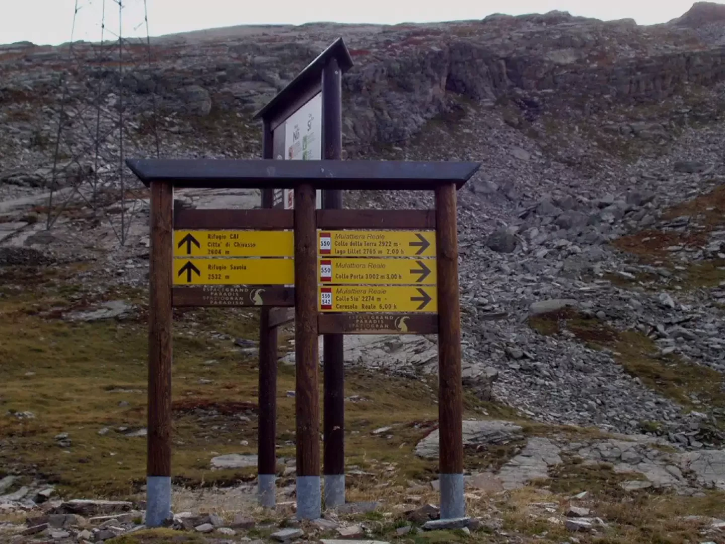
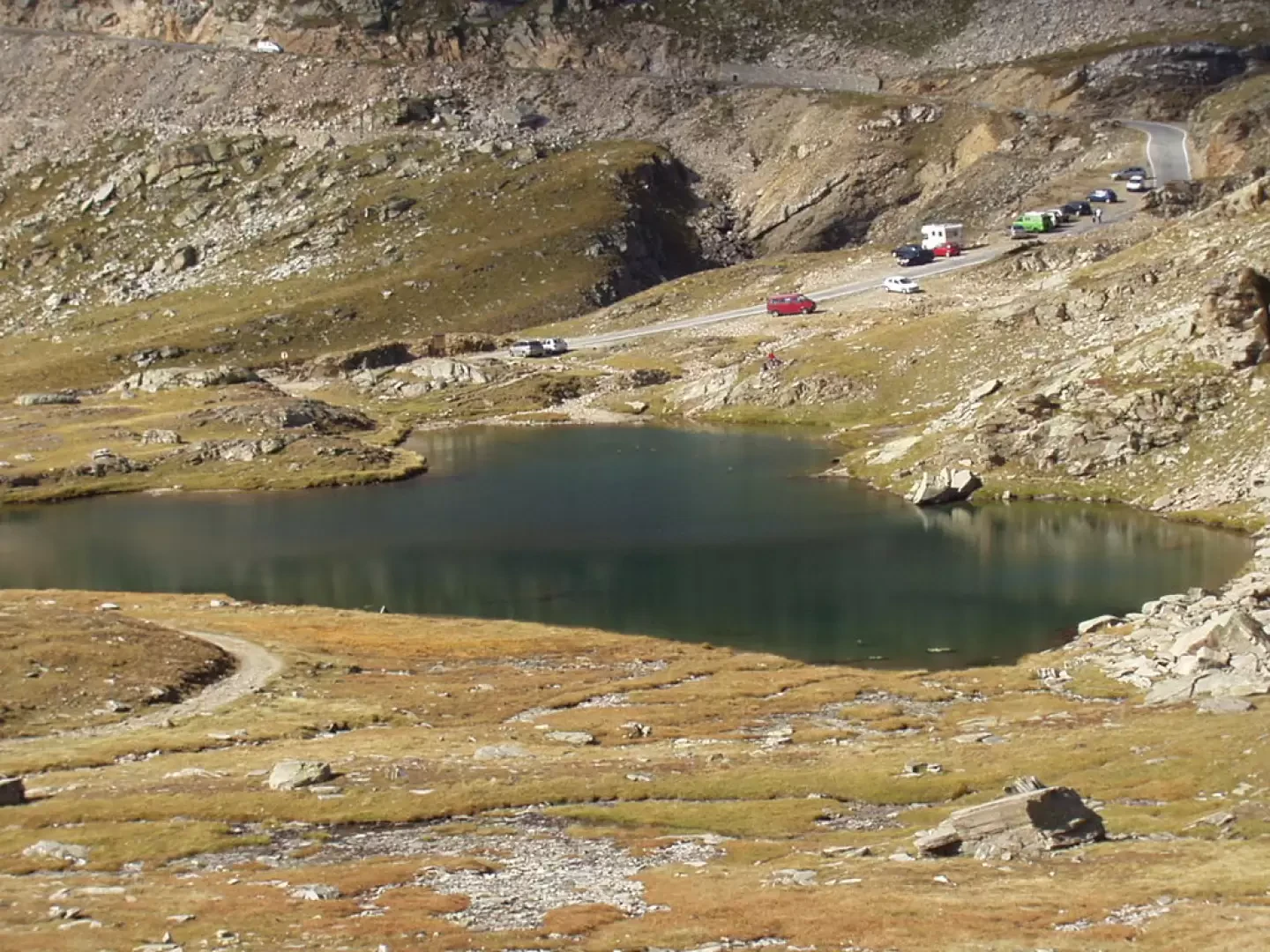
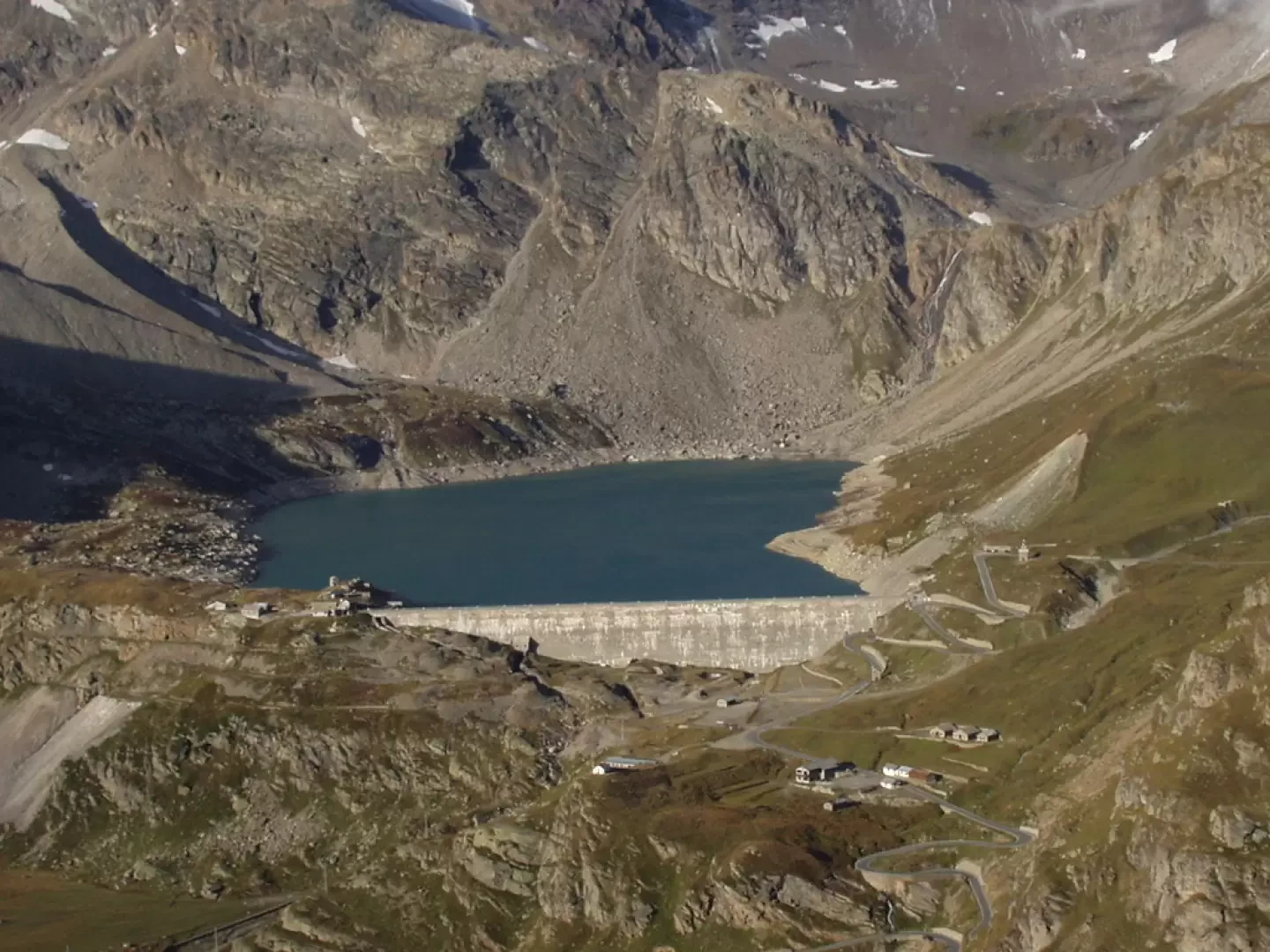
From the [A5] motorway exit at Ivrea, take the Pedemontana road, SS565, and at Castellamonte, the SS460 Ceresole Reale road. Arriving in Ceresole Reale, you skirt the lake of the same name and continue along Provincial Road 50 of the Colle del Nivolet, where access, in the summer months, is regulated or permitted only by the convenient shuttle bus. Pass Lake Serrù and Lake Agnel and park a few hairpin bends before Colle del Nivolet, near the signs indicating the signpost and the small lake at an altitude of 2461 m, a few dozen metres before the signpost for km 16.
.Introduction
Classic hike in the Gran Paradiso Park. The itinerary follows the Royal Hunting Route through lakes, streams, scree and pastures. There is a good chance of encountering the park's typical fauna.
.Description
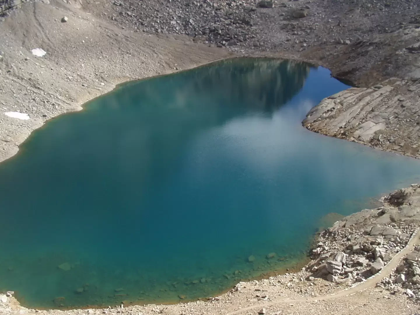
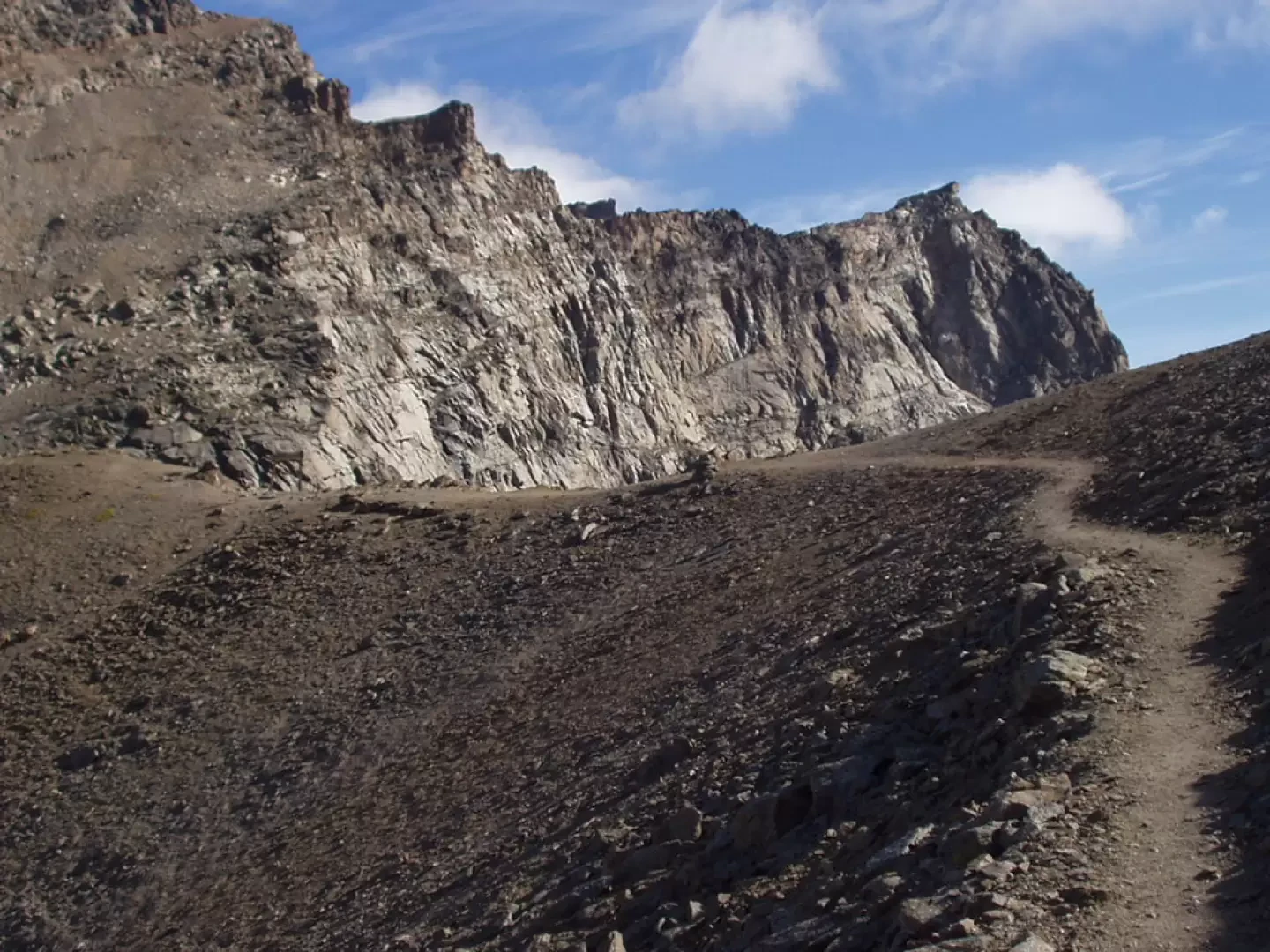
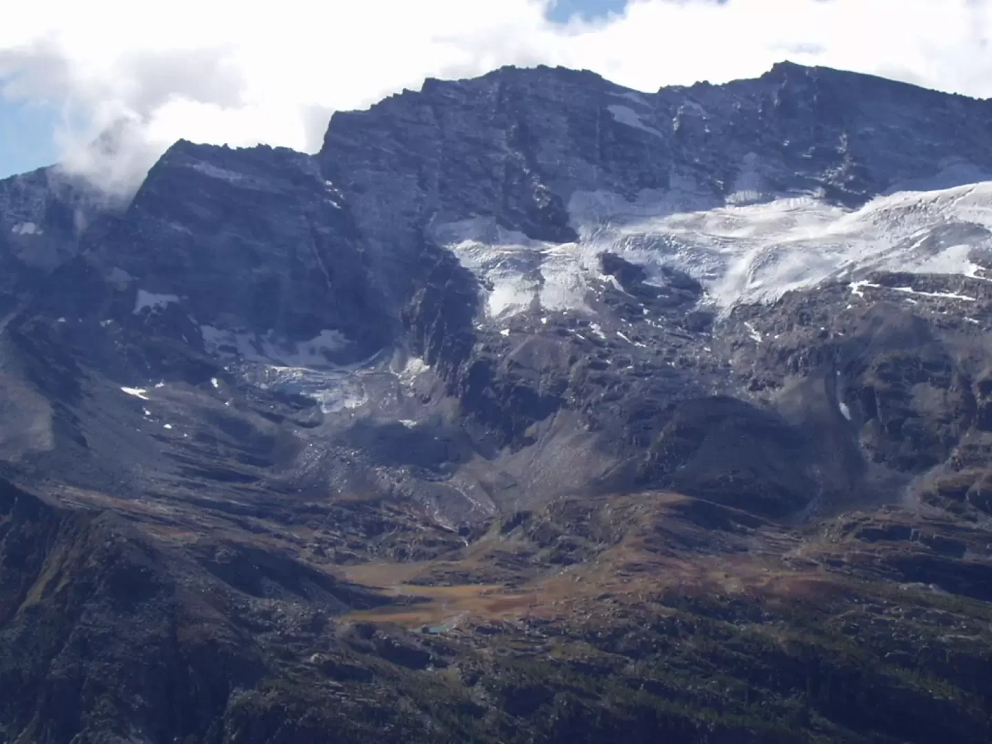
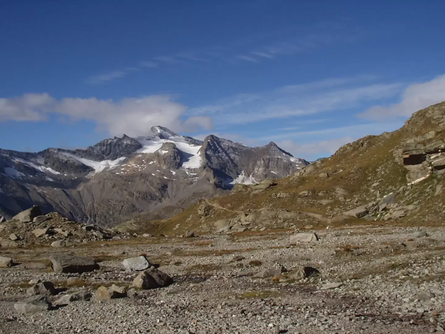
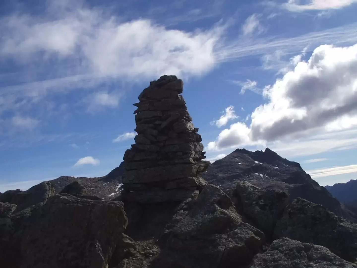
You take the royal hunting mule-track, marker , which immediately leads to a beautiful little lake and immediately afterwards to another set among the stones and rocks of the Costa della Civetta above. A few minutes' walk and the Serrù and Agnel lakes are immediately visible to the right. To the south, the Rio del Carro valley begins to appear, overlooked by the glacier of the same name and the Aiguille Rousse. The mule track now winds like a panoramic balcony over the upper Orco valley, passes above the Bastalon hut, which can be reached by a short path to the right of the mule track, and then, with slightly descending and then ascending stretches, crosses the streams that descend from the small lakes below the Punta della Violetta and the Comba lakes. Near Alpe di Comba (2549m), the Videsott path for Chiapili di Sopra crosses to the right. To the south, on the other orographic side of the valley, the Levanne, the Nel glacier and the Jervis refuge are clearly visible. The mule track enters the plane of the Rio della Percia stream and, now a path, climbs diagonally between scree and gullies. It is very easy in this area to witness discharges of stones, sometimes triggered by the local fauna, which, perhaps frightened by human presence, moves about in a disorderly manner: so watch out for ibexes or chamois wandering above the path. The last stretch, over small stones and reddish detritus, leads directly to Colle della Terra (2911m), where a clear track to the south quickly leads to the modest Punta della Rocchetta (2922m), marked by a conspicuous cairn: a splendid view of the Ceresole Reale lake below, the Levanne and the Nel glacier. From the pass, proceed for a couple of minutes in search of the view of the underlying [[Lago Lillet]] (2765m), an incredible body of water embedded at the foot of the steep south face of Mare Percia. The descent follows the same route.
.Photo gallery
Comments (0)
Sign in to leave a comment