Punta d'Arbella, from Frachiamo

Edited by:
Ivano Ruffoni
Access
From the motorway exit of Ivrea, take the Pedemontana road, SS565, and at the height of Castellamonte take the SS 460 of Ceresole Reale: continue into the Orco Valley, passing Pont+Canavese and arriving at Sparone. We then turn right towards the Ribordone Valley road. You then climb up the valley to the orographic left bank of the Ribordone stream and turn, after a few hairpin bends, to the right turnoff to Frachiamo. Park in the square in Frachiamo (980m), right next to the church.
Introduction
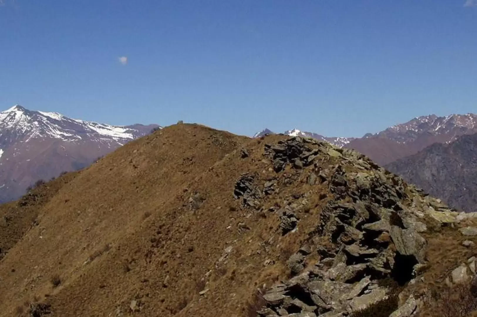
The Punta d'Arbella is a mainly grassy peak, with some rock outcrops, separating the southern parts of the Ribordone and Soana Valleys. The summit is a magnificent vantage point over a vast arc of the Alps, ranging from Monviso, the Tre Levanne, Tresenta to the Tour du Grand Saint-Pierre and beyond. On the summit, an observation post helps to spot all the surrounding mountains. The itinerary is very popular and follows a well-marked and always steep path. There is a good chance of encountering the typical fauna of the Gran Paradiso Natural Park.
Description
From the Frachiamo car park (980m) a signpost indicates the direction to follow. After a few metres, take the small road on the right (signposted Punta Arbella), ignoring the one on the left for Vasario. One crosses the village, zigzagging through the built-up area, and climbs up a mule track that runs alongside the Rio Pissa, passing by an old and crumbling wooden bridge. Immediately afterwards, leave the mule track to take the path marked on the right by a yellow arrow. One crosses the Rio Pissa, climbs a grassy area and then, steeply, a chestnut wood. Further on, one crosses a new brook, climbing up the opposite side on a stepped section. After passing a few buildings, the path leads onto a beautiful ridge of pastureland, which we follow to reach the huts of Paramea (1203m). The trail climbs steeply again, passes more buildings, then enters beautiful birch woods and reaches the ridge. Walk along the ridge, bypassing a group of boulders on the left, then, amidst shrubs, grass and outcrops of rock, take the ridge line again and, already seeing the cross located on the peak of the Punta d'Arbella, reach Alpe Colmetto (1744m). Steep turns over grassy terrain finally lead to the cross. The view is magnificent over the plain below and a wide arc of the Alps. Following the simple ridge, in 5 minutes, you reach the Punta d'Arbella (1879 m), where an observation post is positioned indicating the main surrounding mountains. The descent is along the same route as the outward journey.
.Riferimenti Bibliografici
- Val Soana - Blatto Marco e Zavatta Luca -