Pizzo Meriggio, from Campelli


Edited by:
Marco Bonati
Updated at: 22/09/2024
Access
From Milan to Sondrio along state roads 36 and 38. At the entrance to the city, take the ring road in the direction of Bormio - Confine di Stato, but soon leave it at the exit for Albosaggia. With a few bends, you reach the Orobic village and, looking for the signs, continue on to Campelli. The route is quite long, climbing up the wooded slopes between the maggenghi, but eventually you reach the car parks at the Porte del Parco delle Orobie Valtellinesi.
Introduction
Trip far more famous as a ski-mountaineering trip (few Lombards have not learnt here the techniques of ascending with skins and descending untracked terrain), but also valid on foot, both for the environment and for the truly unique panorama. The ring described leads to visit two Orobic valleys little known to tourists and, although it has to take advantage of recently opened forest tracks, it is also very significant from a botanical point of view.
Description
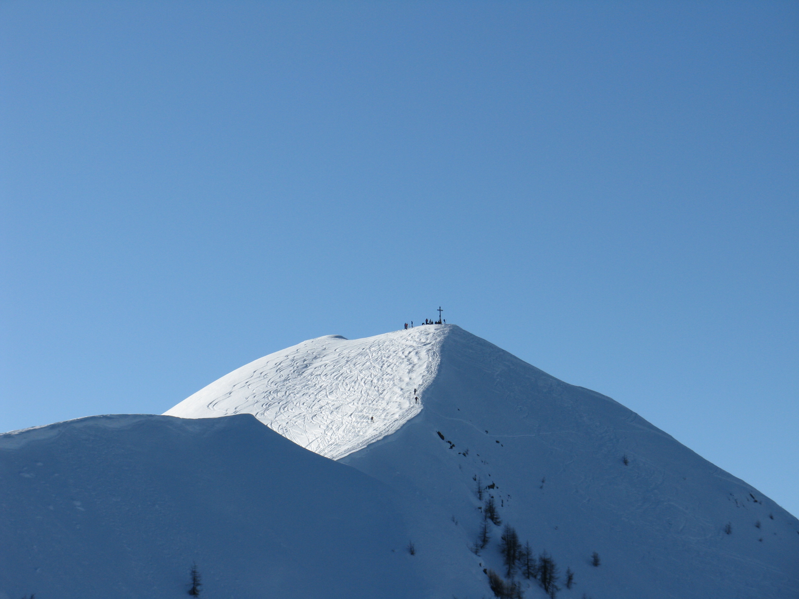
Leaving the car at the Campelli, now a residential hamlet with renovated huts, we begin to climb up the wide meadows in the direction of the visible peak: in this way we are retracing the traces of an old ski slope, which is gradually being encompassed by alders. When the ascent tends to increase abruptly, you find on the left the trace of the mule track that led to the alpine pastures: following it for a long time, crossed by the hairpin bends of the recent forest track, you climb up the wooded shoulder between larch and rhododendron trees until you look out over the Val Venina. The panorama sweeps over the Scais and Venina lakes to the culminating Orobic peaks: Pizzo di Coca, Pizzo Redorta and Cima di Scais. Soon you arrive among the pastures at Baitone della Piada 2107m (Baita Meriggio on the maps); from here, follow the barren ridge to the summit cross of Pizzo Meriggio 2358m.
In a westerly direction, the furrow of the Livrio Valley is also visible, but the view is almost exclusively attracted by the panorama to the north and north-east: from the Disgrazia group, to Bernina, Ortles and the Adamello. For the descent, it is convenient to avoid the repetition of the ascent route and head - with very few traces of passage - along the north-east crest, with a view towards the Laghi delle Zocche: having reached Passo della Portorella 2123m, descend to the left into a rather impassable and landslide gully, which soon leads to the first lake. Nearby, there are some signs pointing towards the Lago della Casera hut along a forest track: the lake is very picturesque and worth a diversion, but our track - at the first fork - is to the right, still on the track. We follow it for a very long time, with some marked ups and downs; we avoid the unnecessary ascent to Alpe Meriggio 2003m, and continue in an easterly direction, crossing the pyramid of Pizzo Meriggio at its base. At the end of the track, you join the uphill track, which you should ignore in favour of the historic cobbled path, and soon find yourself back at the car park. It is useful to visually memorise landmarks (huts, fences, etc.) to orient yourself on the descent to the Campelli.
We have been there

Edited by:
Ermanno Panara
Pizzo Meriggio
salita faticosa, pochi tratti relativamente piani. Tratti molto ripidi, evitabili percorrendo la lunga strada poderale. Grande soddisfazione all'uscita del bosco, sulla dorsale. La strada di accesso al parcheggio era in condizioni terribili, ghiaccio vivo. Nessun tipo di manutenzione. Grossi problemi con le gomme termiche. Diversi chilometri di brivido. Consiglio il montaggio delle catene o una 4x4, adeguatamente gommata.