Monte Stino, from Zumiè


Edited by:
Ivano Ruffoni
Updated at: 04/05/2025
Access
Brescia Ovest exit of the motorway. Continue east along the Tangenziale Sud/SS11 and then on the SS45 bis/Gardesana Occidentale. Arriving at Villanuova sul Clisi/Tormini you have two alternatives: go left up the Val Sabbia on the SS237 or coast the western shores of Lake Garda to Gargnano continuing on the SS45 bis. - Via Lago d'Idro (or Eridio) If you choose the first road, the SS237, you reach Lake Idro, then on the SP58 you cross the Chiese river, the lake's emissary, pass Lamprato, ignore the diversions to the left for Crone and climb up the Valle dei Fondi to the S. Rocco pass (946m), the border between Val Sabbia and Valvestino. You are soon at the three villages (Vico, Viè and Zumiè) of Capovalle. - Via Lago di Garda (or Benaco) Continuing towards Lake Garda, leaving the turnoff for Salò on the right, you pass through Gardone Riviera, Fasano, Maderno, Toscolano, Bogliaco and Villa. Shortly after the entrance to Gargnano, the road rises slightly to cross, on the left, Provincial Road SP9 for Capovalle-Lake Idro-Magasa-Valvestino. Taking the left with numerous bends, you climb up Montegargnano, first crossing the turning for Musaga on the right and then the turning for Sasso, Liano, Formaga, Costa to the right and Navazzo, Valvestino, Magasa and Capovalle to the left. Keeping to the left along the SP9, pass Navazzo and proceed towards Valvestino, skirting the lake of the same name. At Molino di Bollone keep to the right and immediately afterwards turn left to climb up the Valle dei Molini to the three villages (Vico, Viè and Zumiè) of Capovalle. - Follow the local signs for Monte Stino to reach Zumiè and the asphalt road that climbs the Coste di Stino. After a little more than 2 km, on the right, near a hairpin bend, you can park in an open space.
.Introduction
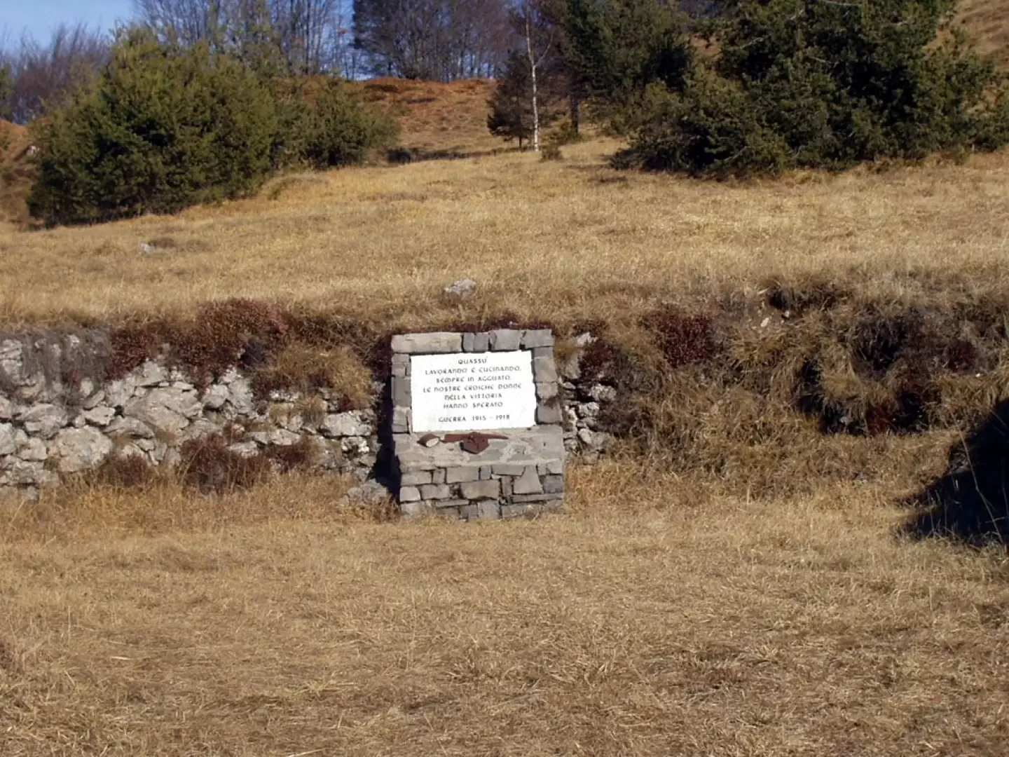
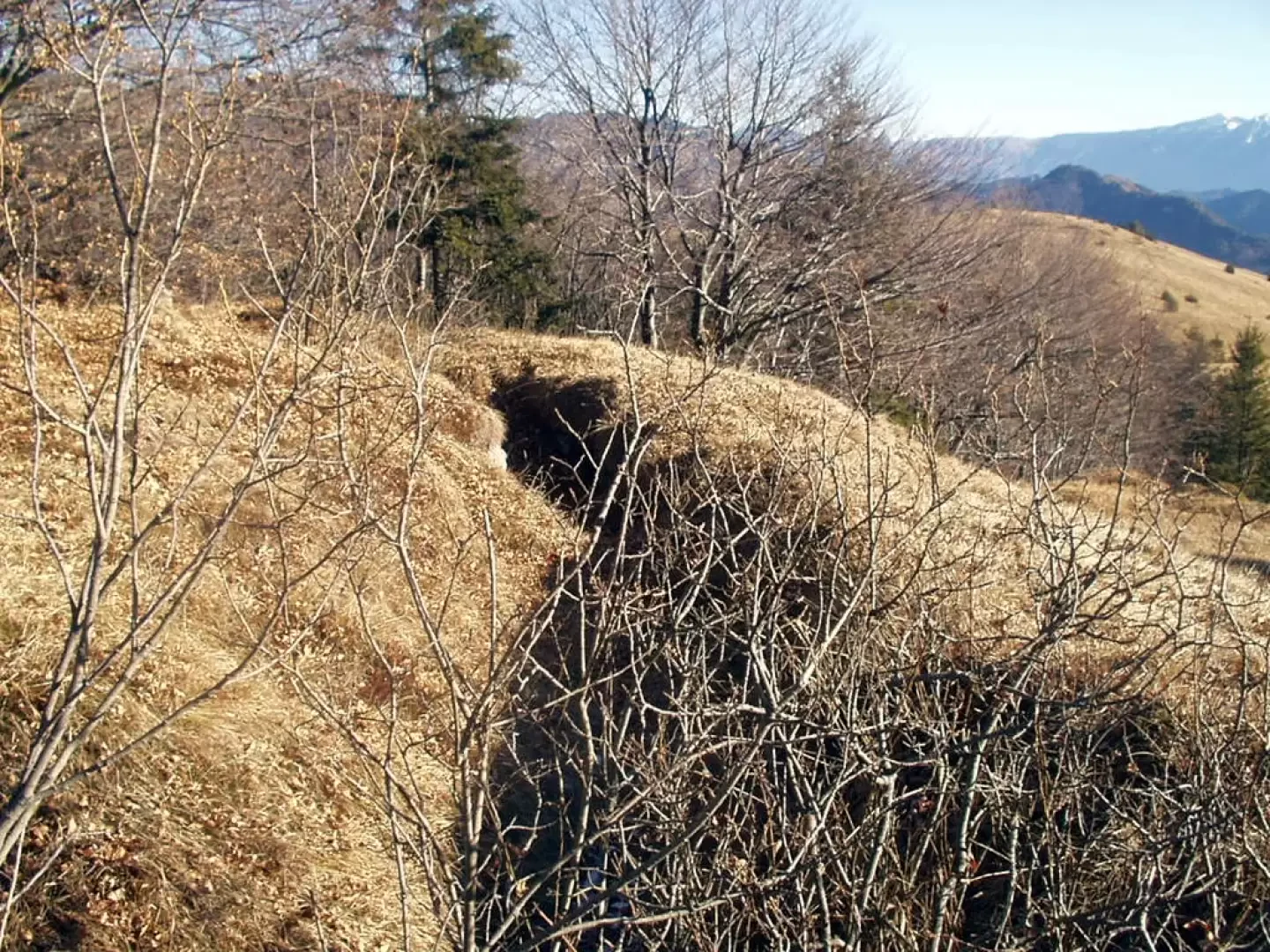
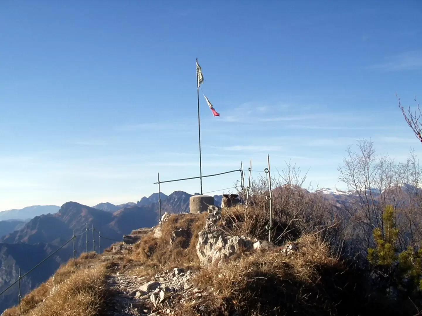
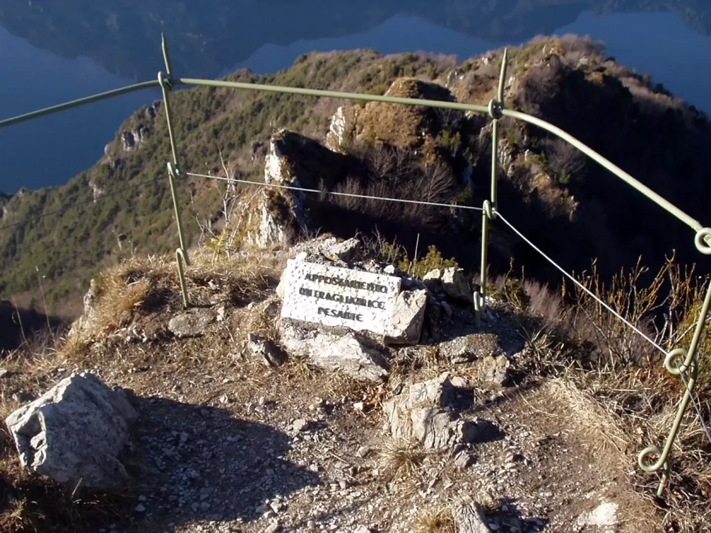
Monte Stino, north of the Capovalle plateau, the most remote settlement at the time of the Serenissima Republic and, until 1918, the former border with the Austro-Hungarian Empire, is a humpbacked plateau located east of Lake Idro, between Idro and Ponte Caffaro. Its slopes, as witnessed by the trenches built nearby, were the scene of acts of war during the 1915-1918 war. To the west, towards the end of the Val di Neve, a war museum has been equipped, by refurbishing the tunnels already present, with the war remains found in the area. From the summit, the panorama reaches the Adamello group, the Tombea peak and Monte Caplone, Denervo and the Monte Baldo chain.
Description
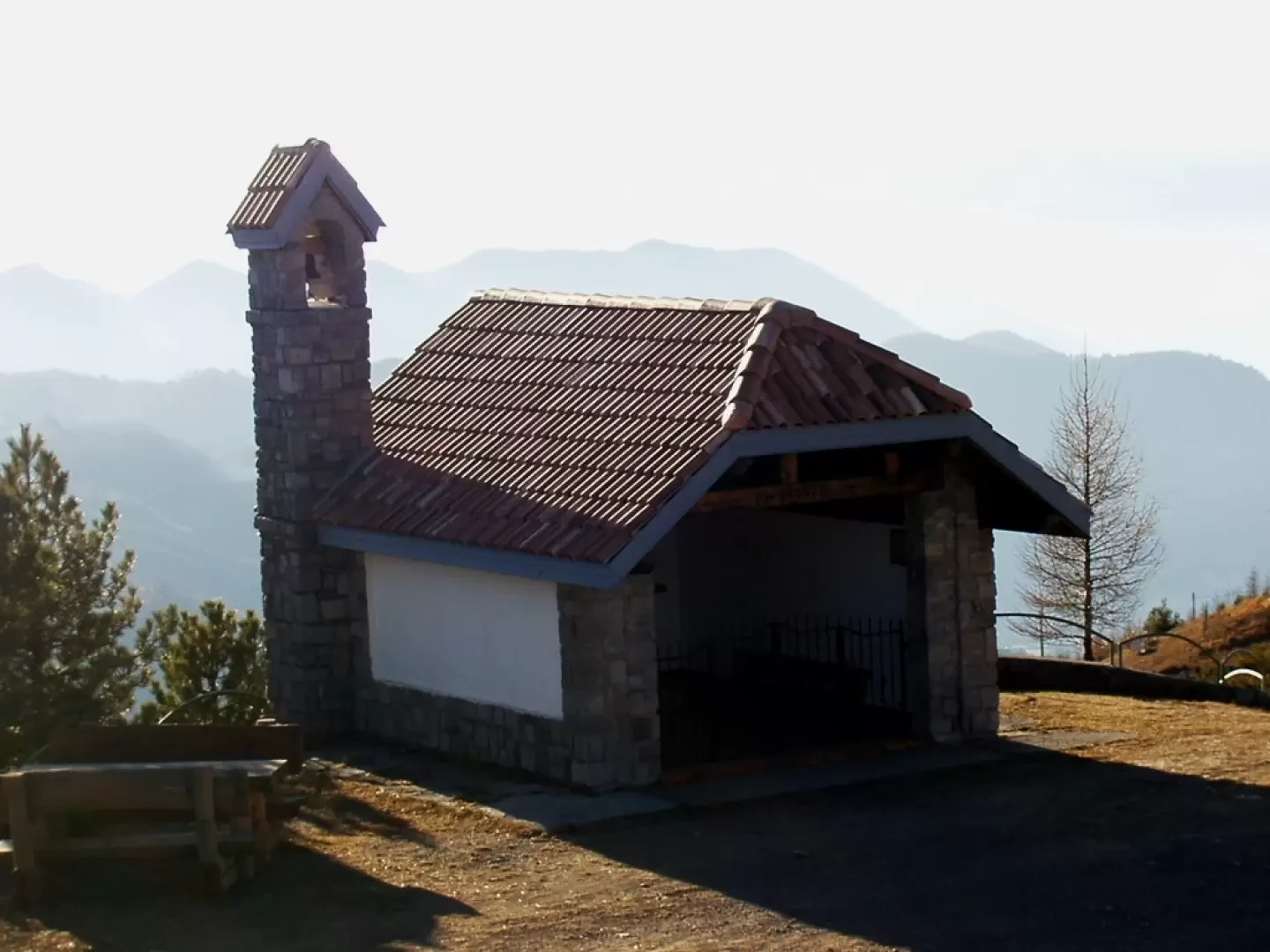
From the widening (approx. 1300m), continue along the tarmac road north-westwards, along meadows dotted with a few rare fir trees, with a view of the Capovalle villages below, as far as the little "Redemptor Hominis" church. At the next crossroads, follow the off-road track to the left for a short distance until the sign indicating the ruins of a field kitchen on the right. Having visited the large circular clearing of the kitchen, follow a few traces of the path, before a small lake and a house, ascend along a semi-clear path to the summit of Monte Stino (1467m, 0h35'), partially surrounded by trenches. It is advisable to descend, again following a few traces of the path, westwards, to reach the dirt road and a hump of grass and outcropping rocks. It is therefore recommended to visit the tunnels that have been converted into a museum and to circumvent the hump by taking the "Sentiero delle Vedette" (protection with metal handrails, please be careful) to admire the splendid panorama of Lake Idro, the Anfo promontory and to observe the heavy cannon and machine gun emplacements and sentry posts. Back on the dirt track, you return to the little alpine church and retrace your steps back to the asphalt road at the starting point (about 1300m, 0h30').
General Information
Path:
Signposts: -
Type of route: a/r
Recommended period:April, May, June, July, August, September, October, November
Objective Danger: none
Sun exposure: south
Exposed sections:none
Water: n.r.
Bibliographic references
- Kompass Carta Turistica 1:50000 103 - Le tre valli Bresciane - Val Sabbia - Val Trompia - Val Camonica
- Kompass Carta Turistica 1:50000 102 - Lago di Garda - Monte Baldo
Photo gallery


Comments (0)
Sign in to leave a comment