Monte Muggio, from Mornico

Edited by:
Rita Tarussello
Access
SS 36 Bellano exit. Follow the signs for Taceno on the SP66 road. After Vendrogno you arrive at the village of Mornico where you leave your car in a large car park at the entrance to the village.
Introduction
An easy hike in Valsassina in a panoramic setting over the Lombardy Pre-Alps and Lake Como, particularly impressive in the autumn period.Description
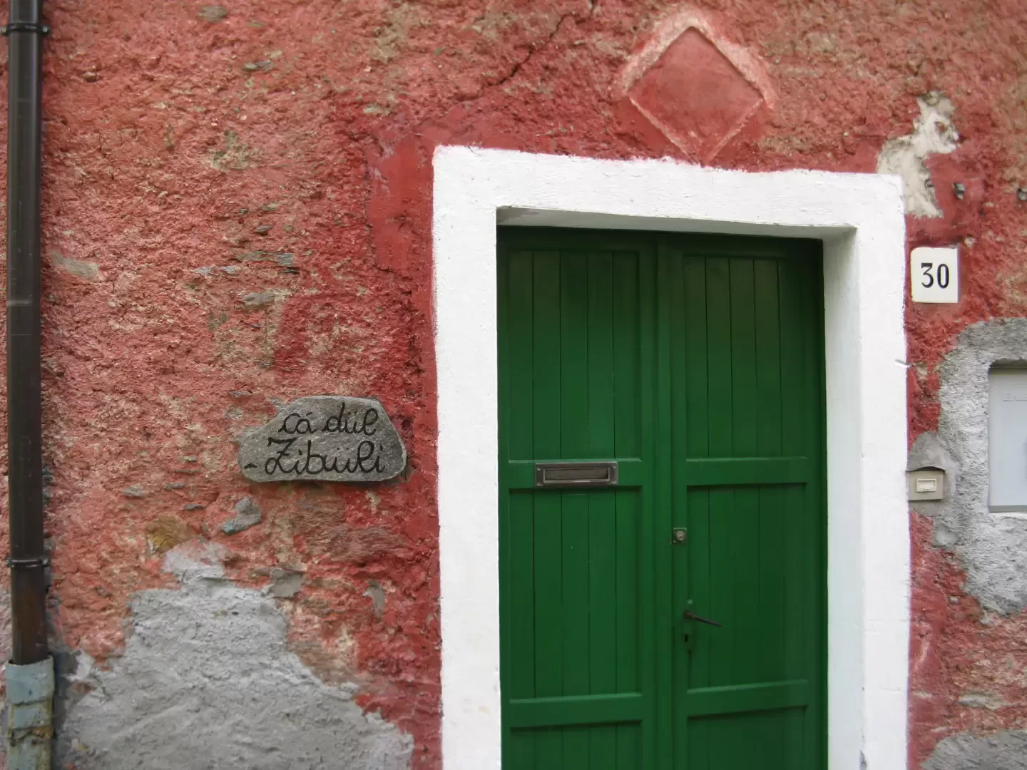
Mornico (975m), a hamlet of the Vendrogno municipality in Valsassina, is a very characteristic village. The alleys and houses have remained as they were in the past, and curious stone slabs are placed beside the entrance doors bearing the name, or more often the nickname, of the landlord, all strictly in the local dialect. The transit of cars inside the village is forbidden, and in any case the width of the alleys would not allow it. Arriving from Vendrogno, park at the entrance to the village, where the road ends.
Just after the car park, after a few dozen metres, there are signs for the
path leading to Tedoldo. The signposts are often very 'handmade' (wooden signs or red marks in a yellow frame). Go up a small path to the right, near the Cà della Maestra, and turn immediately left onto a stepped track that leads to the path proper, which climbs fairly steeply over the meadows above the village until you come to a small chapel.
Turn right, still on an obvious track, and enter a birch grove. Continue uphill on cobbled ground that is sometimes a little slippery due to wet leaves and you will come to a cart track that you follow by turning left (signposted Tedoldo). After a few hundred metres, a round metal marker on a post leads up the meadow to the right. We enter a birch forest, pass a stone building and continue uphill until we come out into the open near the lovely village of Tedoldo (1239m).
Now the signs lead us into the village; we pass between the houses and then climb to the left in the direction of a lovely chapel located further up.
As you pass the village, you enter a sparse forest of small rocks mixed with heather and juniper bushes, and a little further on, a short downhill walk takes you to a fenced-in waterhole in a flat area with a few wooden benches. A little further on, to the right, a wide path climbs up through the forest.
A little further on, a yellow and red sign on a stone can be seen on the left; one then climbs up a steep track between small rocks and ferns; one then continues uphill through an area of cut shrubs, arriving at a small terrace with a tall, narrow cross (Croce del Botul). Continue in a northerly direction and then take another slightly downhill stretch, where there is another small altar with a madonnina, a bench and a spring (1379m).
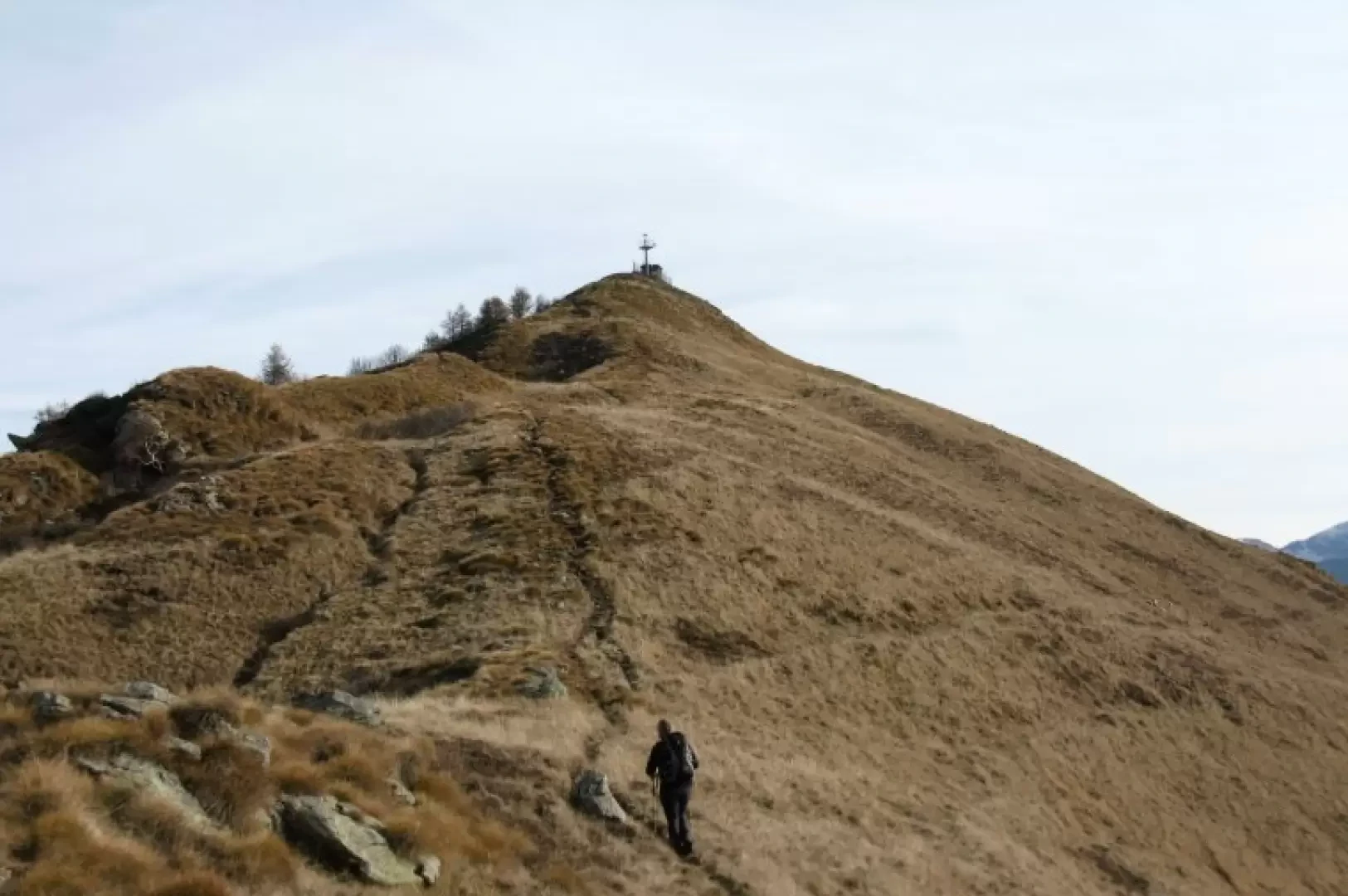
We are now out of the forest. The trail climbs the summit of Mount Muggio and, after a couple of zig zags, turns eastwards until it reaches the Alpe Chiaro (1533m). At the entrance to the small hamlet, a signpost indicates the various directions, including the Muggio ring, but no indication of how to get to the summit, which is, however, clearly visible.
It is therefore necessary to go back up the meadows until the path that leads to the south-west ridge is intercepted and from there, without any possibility of error, the summit cross is reached.
Continuing in the same direction, descend over meadows next to a small ski lift to Alpe Giumello (1538m), a small settlement in a scenic area, much sought after by paragliders.
From Alpe Giumello a level track leads back to Alpe Chiaro, and then to the path already taken.
After climbing the hump at the small altar with bench, however, it is best to continue straight on. The track descends between grass, rocks and sparse woodland to an area where there is a stone spring with a drinking trough. Turning left, it is easy to reach the hump above the hamlet of Tedoldo and from here continue back along the outward path.
Galleria fotografica
We have been there

Edited by:
Ermanno Panara