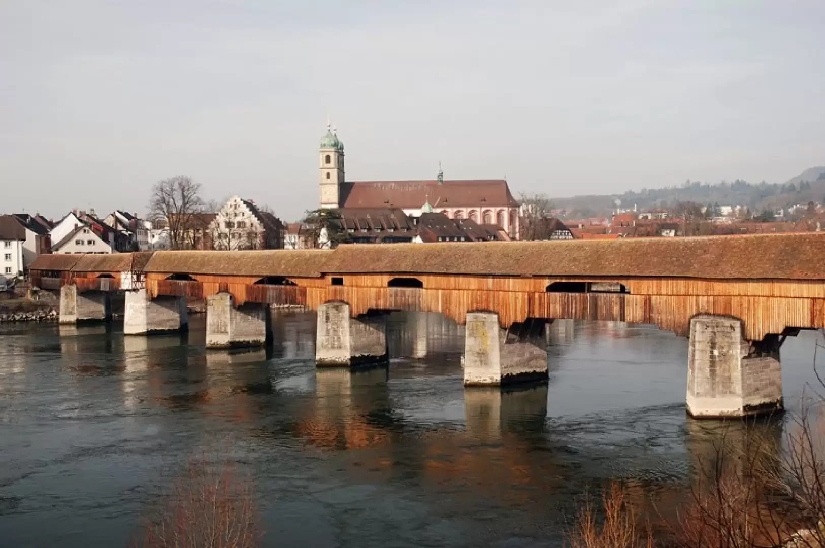
Holzbrücke

Introduction
A very short walk to discover an interesting feature of Bad Säckingen: the Holzbrücke is the longest wooden bridge in Europe and crosses the Rhine to Stein, Switzerland.
Description
Leaving the car in the large car park at the station, proceed towards the town centre along BergstraStraße and, after crossing Hebelweg Straße, take the pedestrian street (SheffelStraße) and continue until you reach the church dedicated to Sankt Fridolin, an Irish monk who came down to the Rhine to preach Christianity in the 6th century. After the necessary visit of the Munster, you turn right onto Rhein-Brücke Straße until you reach Holzbrücke. You then walk along the distinctive wooden bridge enjoying the interesting construction features. Along the way, you can appreciate views of the Rhine and, about halfway across the bridge, the border between Germany and Switzerland marked by a clear white line. On reaching the Swiss side, in Stein, you can possibly walk along stretches of the Rhine embankment in search of a nice shot of the Holzbrücke. The return trip follows the same route as the outward journey (0h15').
[gmap line=47.55508463119107,7.948587745559053 + 47.55492895615986,7.948421448600129 + 47.55480224358372,7.948110312354402 + 47.55464656771358,7.947756260764436 + 47.554530715603065,7.947600692641572 + 47.55441486323645,7.947520226371125 + 47.55417229651426,7.947681158912019 + 47.5536075099447,7.948201507460908 + 47.55339752364219,7.948421448600129 + 47.55332511437726,7.948448270690278 + 47.55312960886216,7.948630660903291 + 47.55287979519811,7.94890424622281 + 47.55270601107729,7.949102729689912 + 47.55254308794063,7.949290484320954 + 47.55243809276193,7.949177831542329 + 47.55223534285604,7.949059814345674 + 47.55213034706077,7.949016899001435 + 47.552068797703704,7.949043721091584 + 47.551905872585984,7.949290484320954 + 47.5517863938444,7.949505061042146 + 47.551670535410636,7.949767917525605 + 47.551565538483786,7.9500629605172435 + 47.55152571200823,7.950116604697541 + 47.551435197178456,7.951355785262422 + 47.55141709419375,7.9520102442620555 + 47.551402611801485,7.952337473761872 + 47.551359164600676,7.952680796515779 + 47.55129399373191,7.953018754851655 |markers=small red::47.55511359393656,7.948566287886933 + 47.55126140826714,7.952991932761506 |zoom=15 |center=47.55340331640116,7.950389385223389 |width=752px |height=400px |control=Small |type=Satellite]