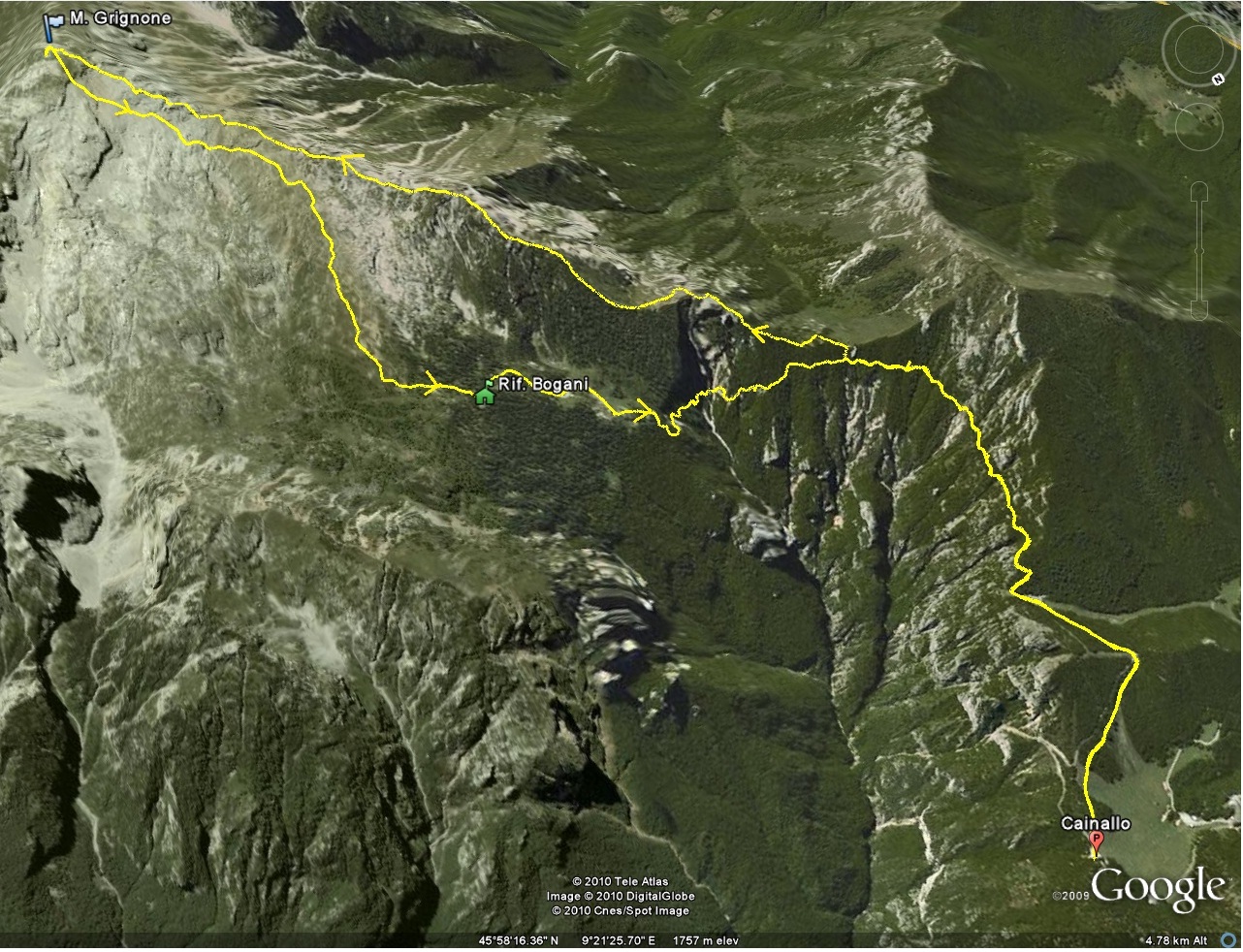
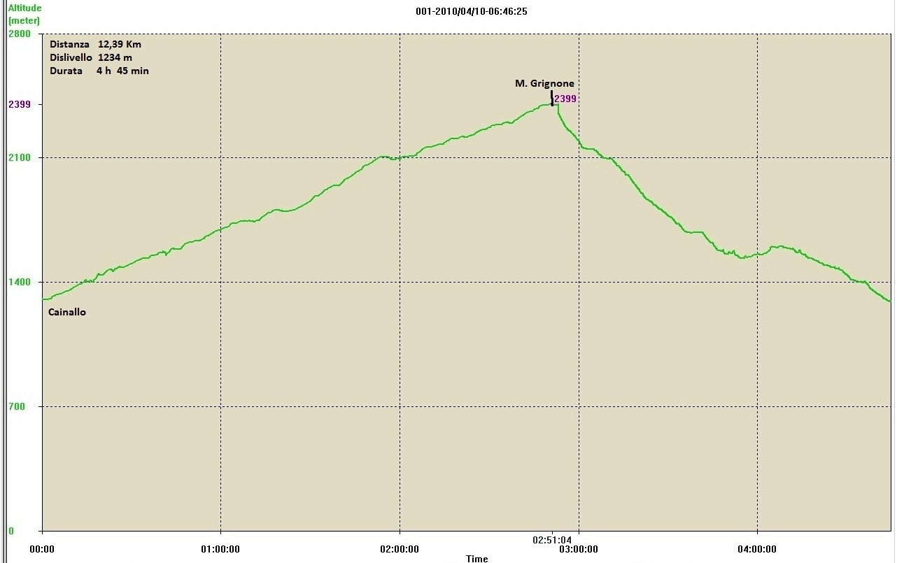
Direct access to the Grigna Settentrionale from the Lario side is from Rongio, a hamlet of Mandello del Lario. The hike, which is very long and demanding, runs from west to east through a large part of the Val Meria, reaches the Elisa refuge, then turns west to enter the Val Cassina gully. It climbs it until it intercepts the via ferrata Cai Mandello, which runs along the Sasso Carbonari ridge and comes out at Bocchetta del Releccio, 200 m below the summit of the Grigna Settentrionale. The return trip takes place by descending the first section of the Traversata Alta to the Bocchetta della Bassa, then taking the Chignoli path, which steeply leads to the Elisa hut, and from there to the valley. The itinerary covers an altitude difference of over 2000 m, plus about 200 m of counter slopes. It is feasible, though inadvisable, in a day, but one must take into account that, in addition to the 11 tabulated hours, one must take the time to make at least three stops. Lastly, although there is no shortage of water on the path to the Elisa refuge, it is a good idea to set off well supplied with liquids. Physical exertion aside, however, this excursion is exciting to say the least, because in addition to the variety of the route, it offers stupendous scenery in the contrasts between rocky amphitheatres, long vertical walls, eerie gullies and spectacles of green between grass and mugo trees.
Description
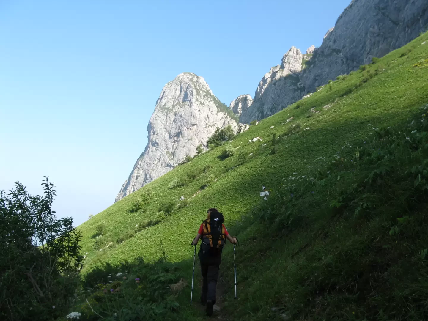
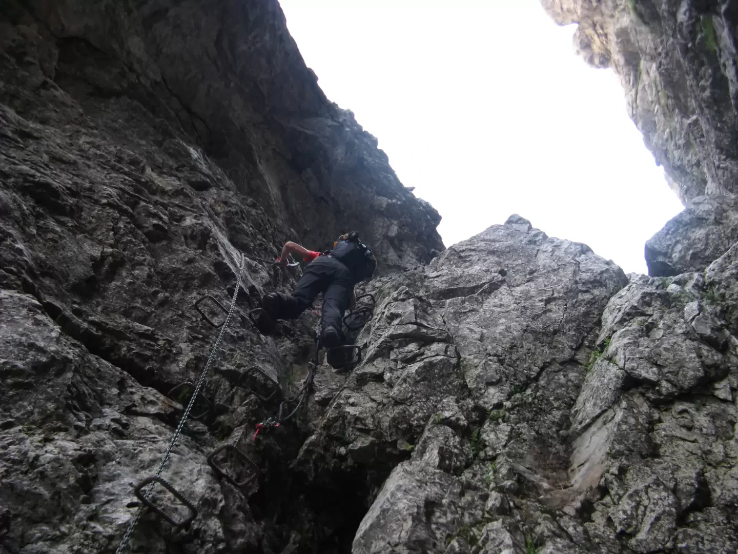
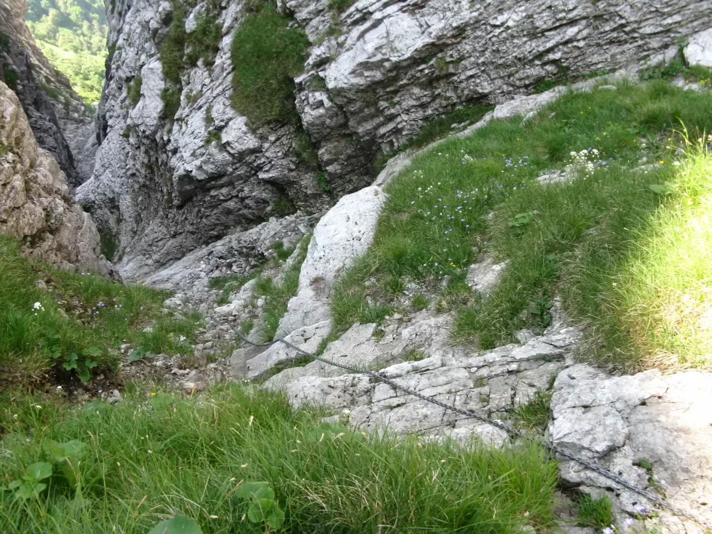
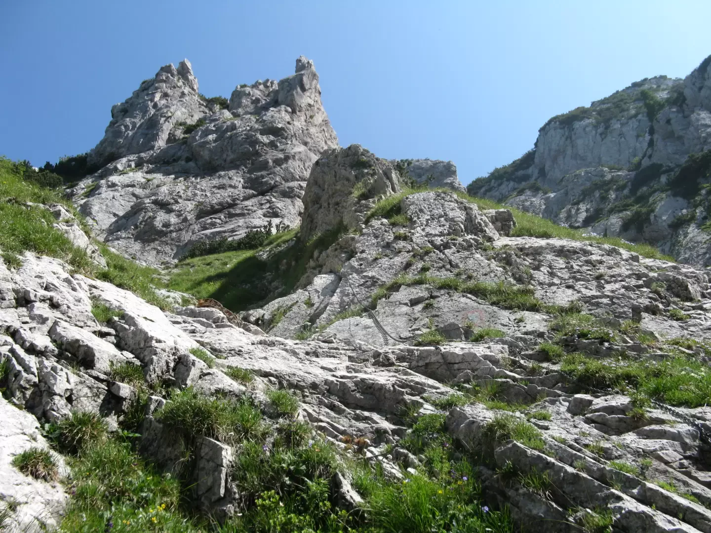
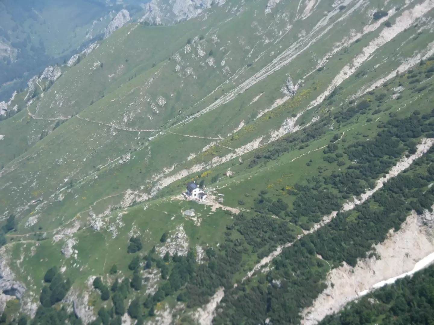
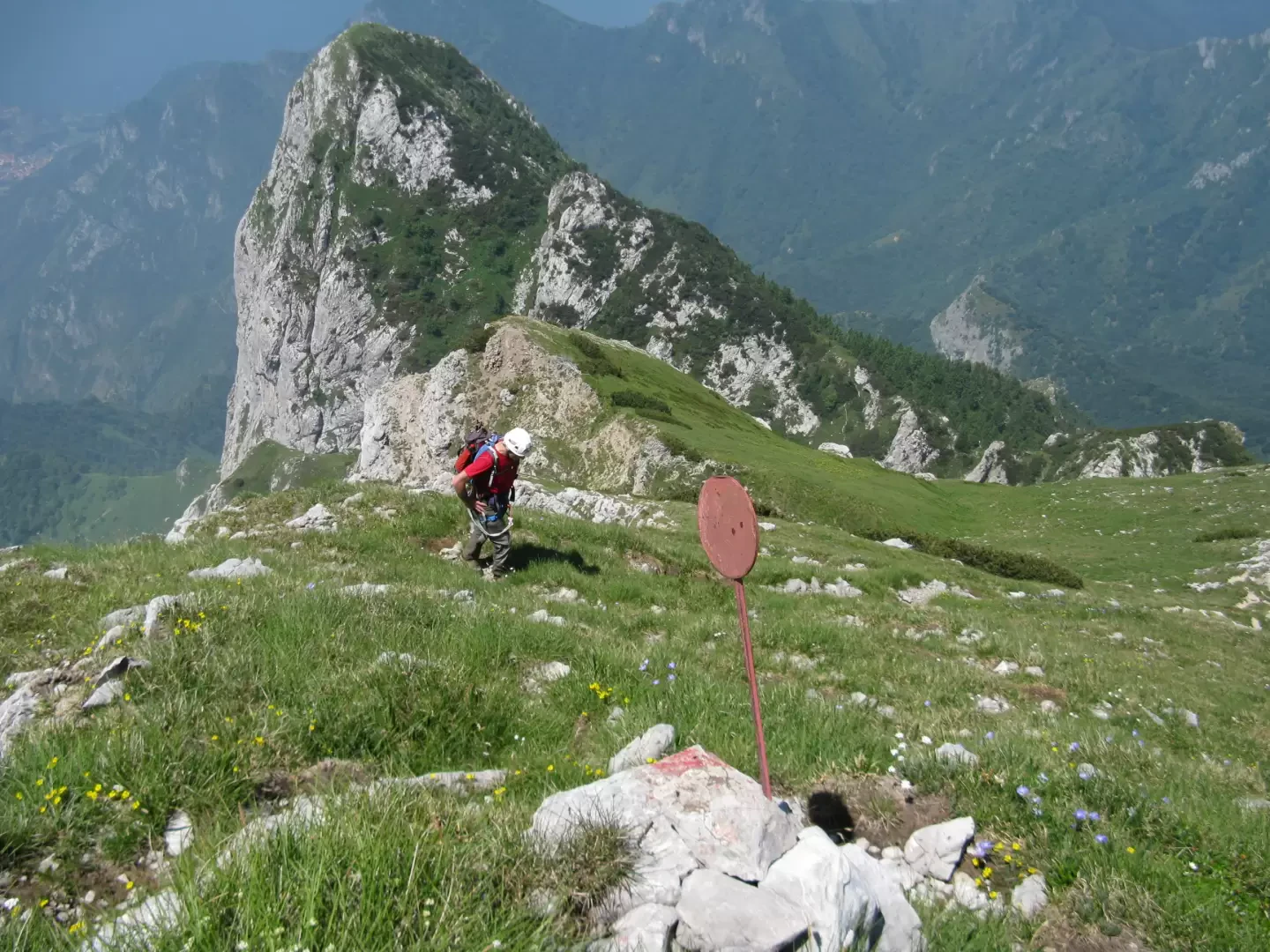
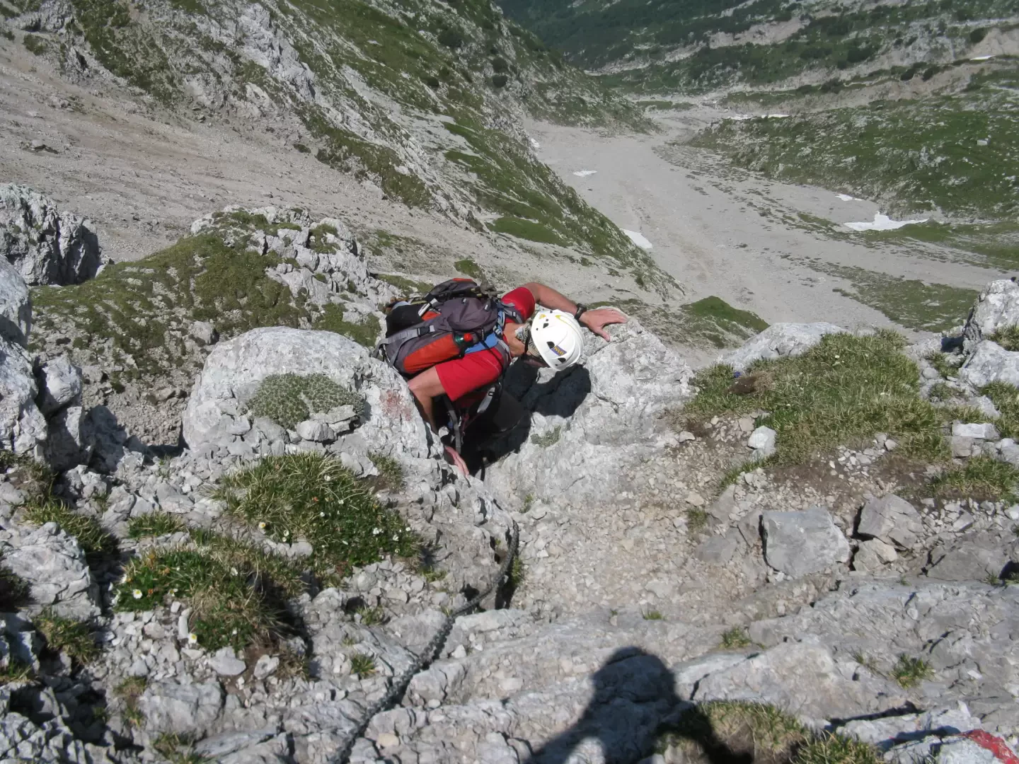
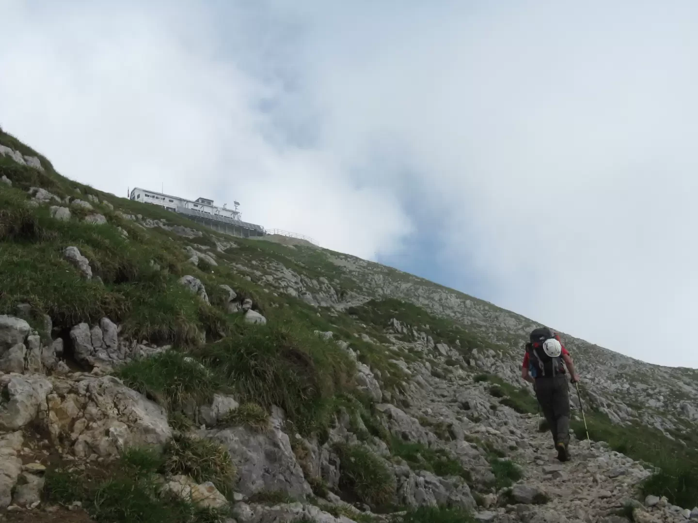
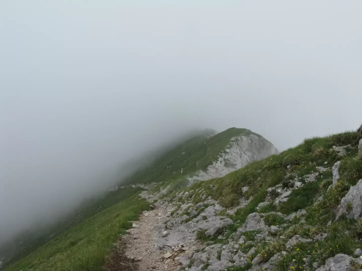
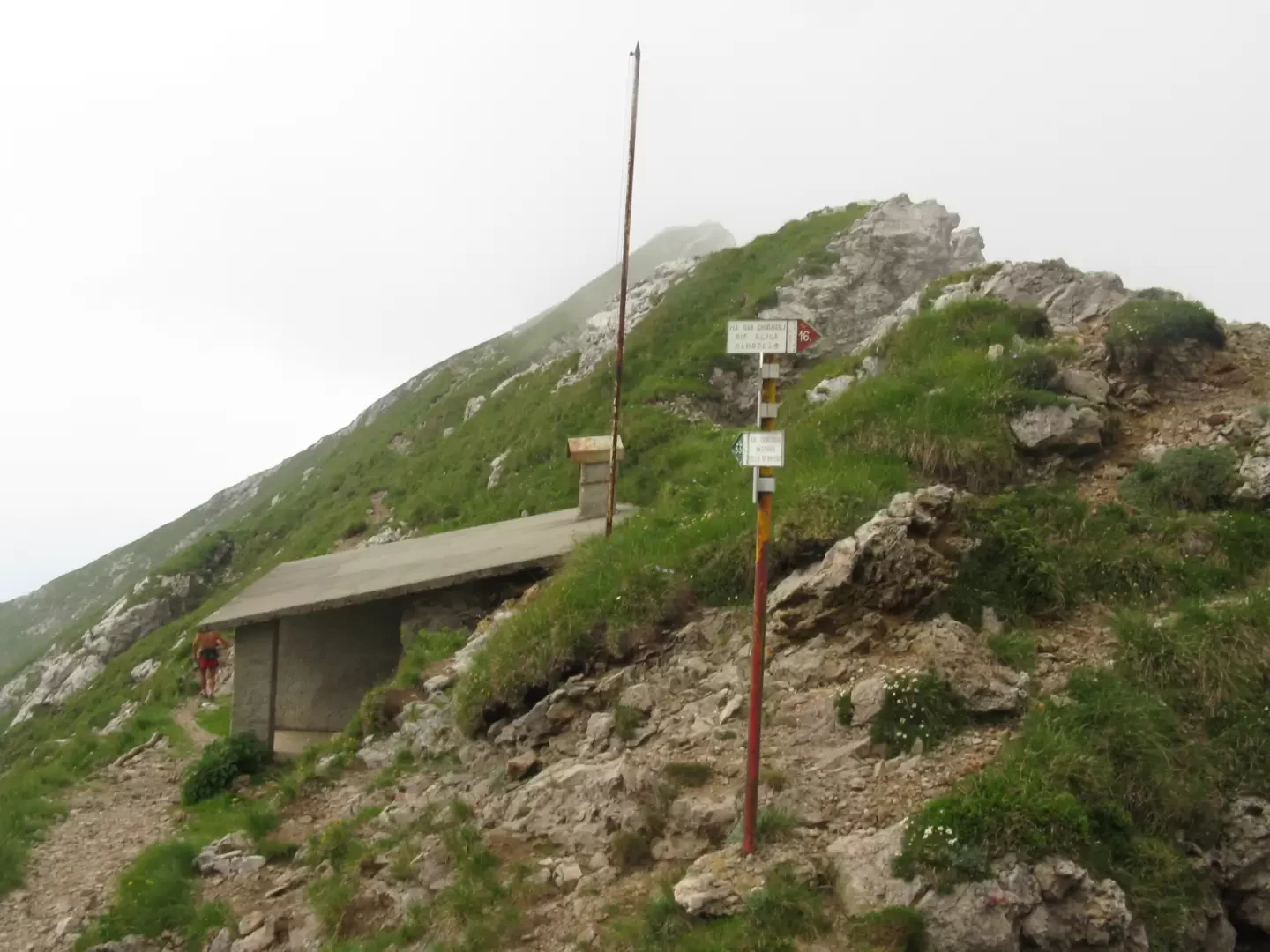
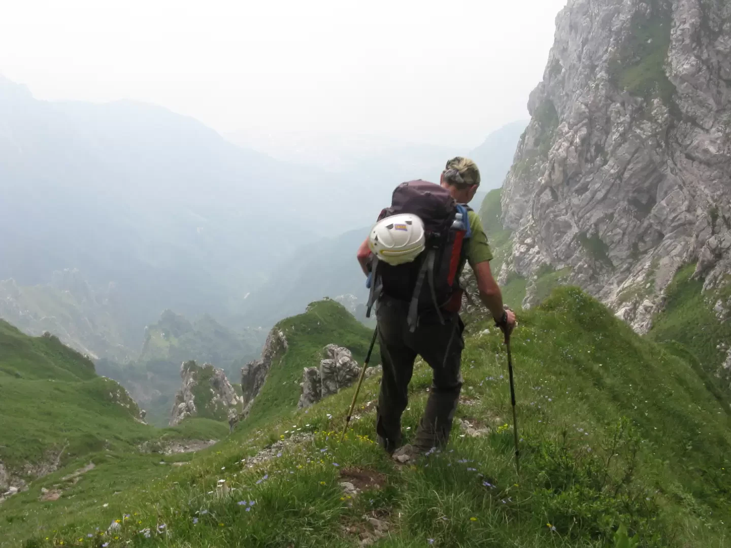
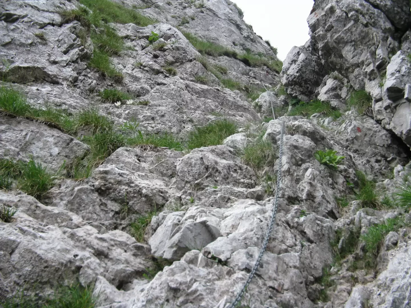
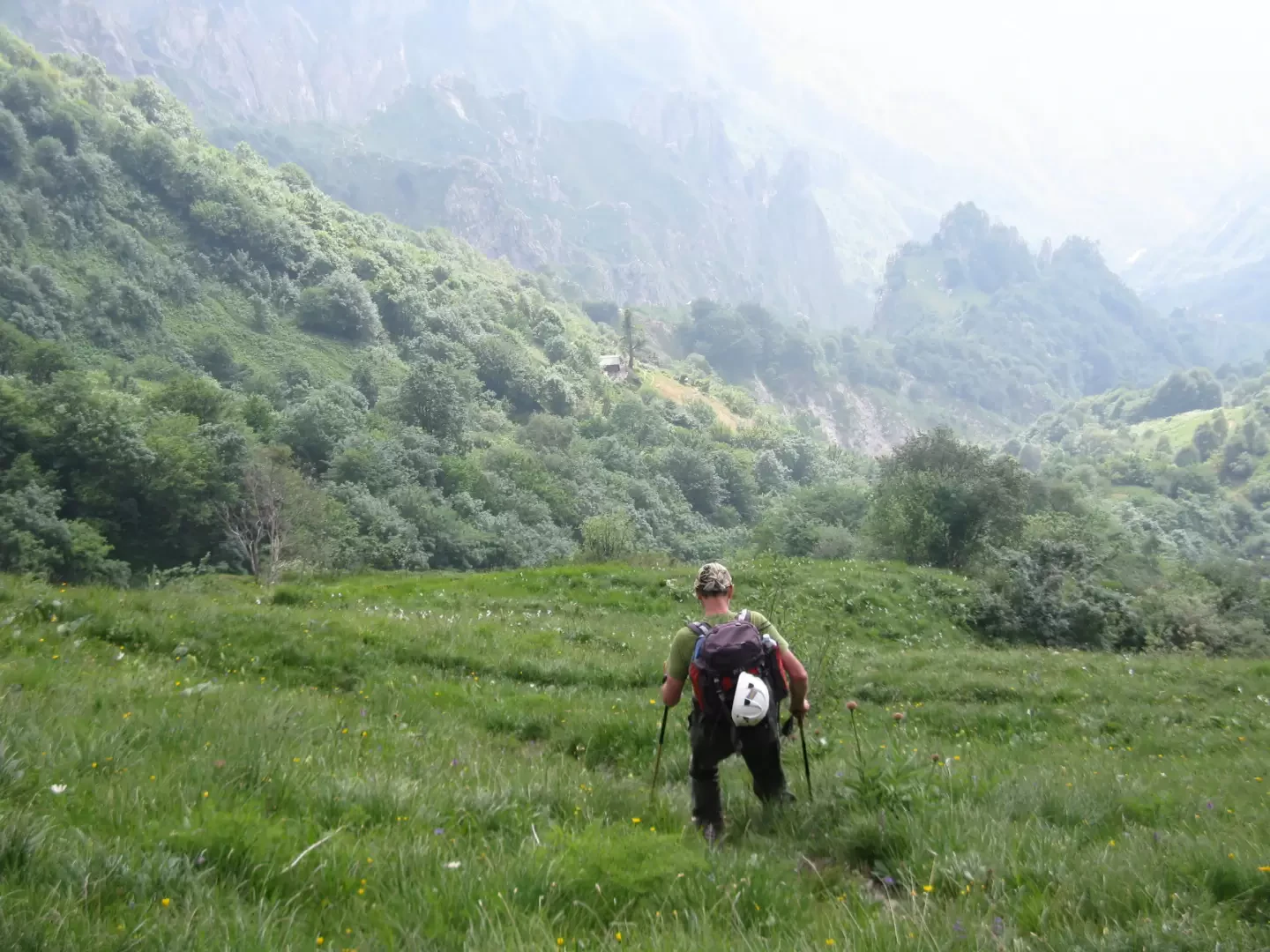
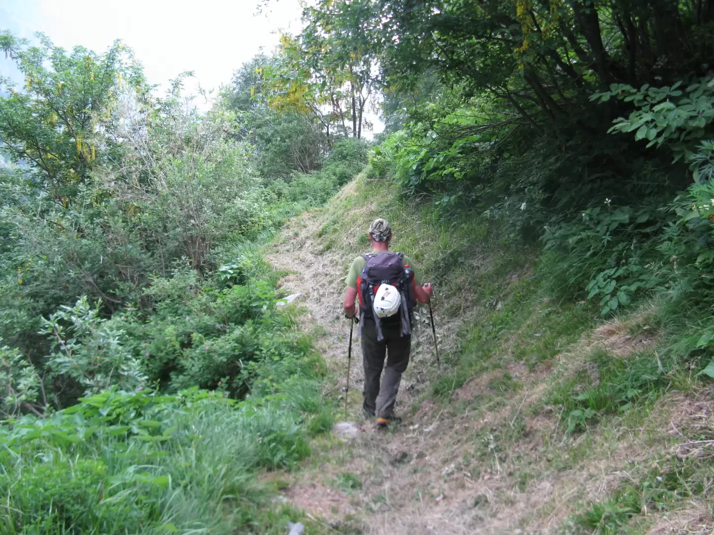
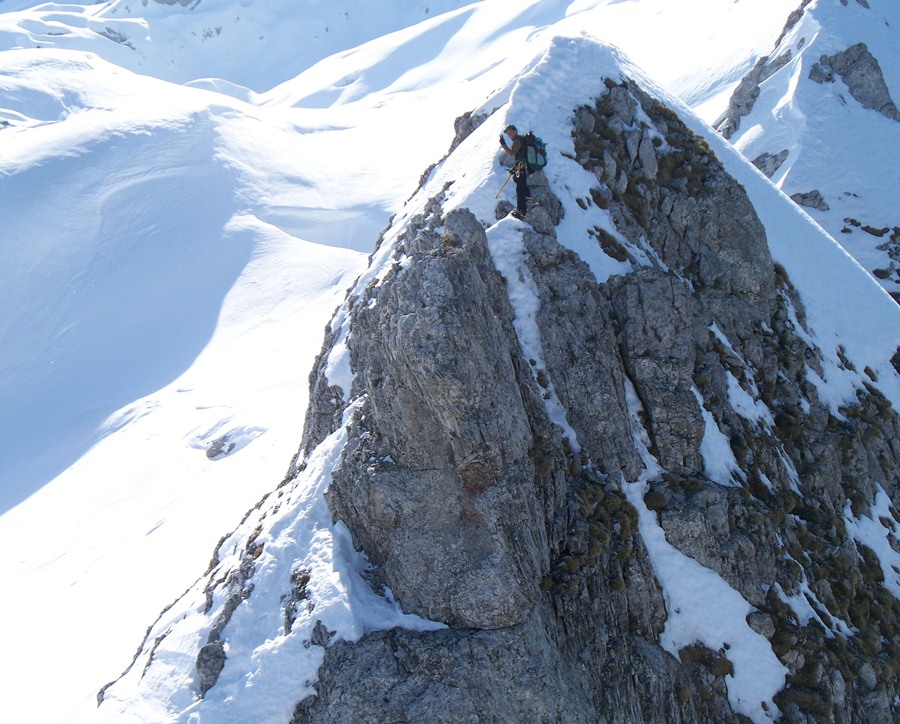
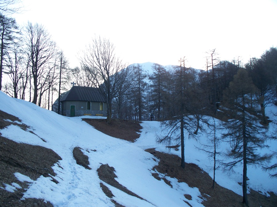
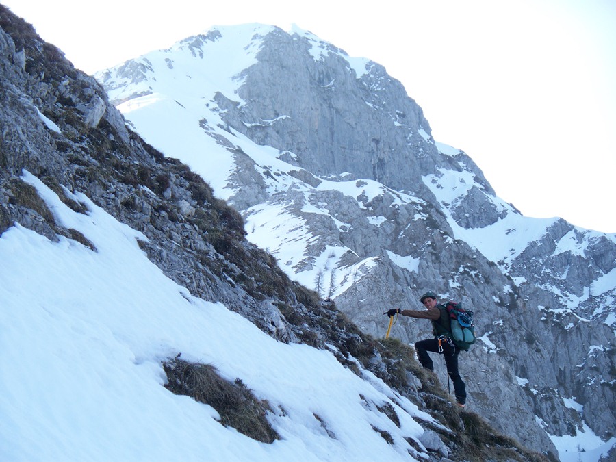
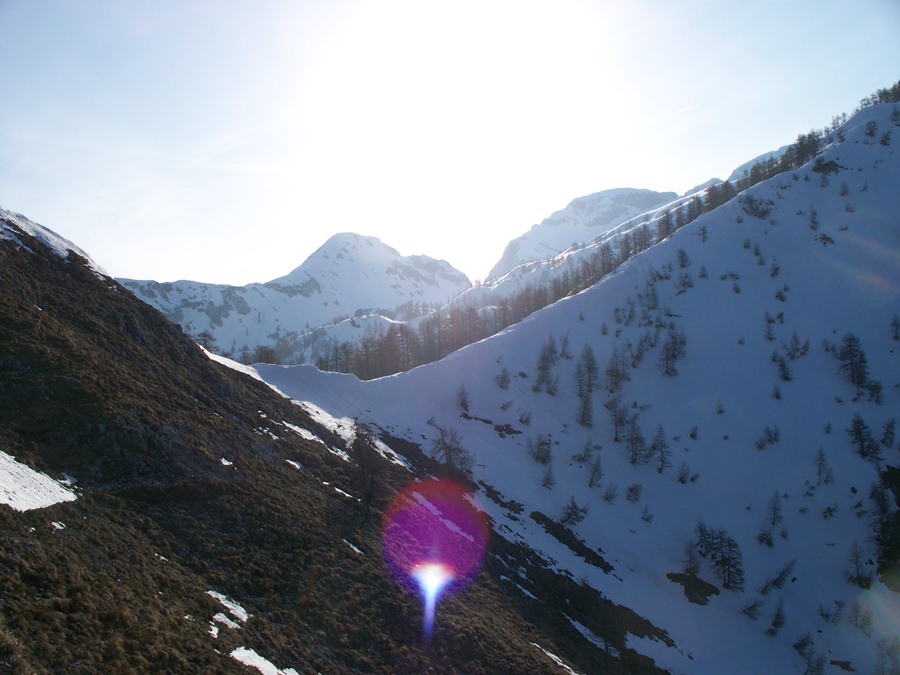
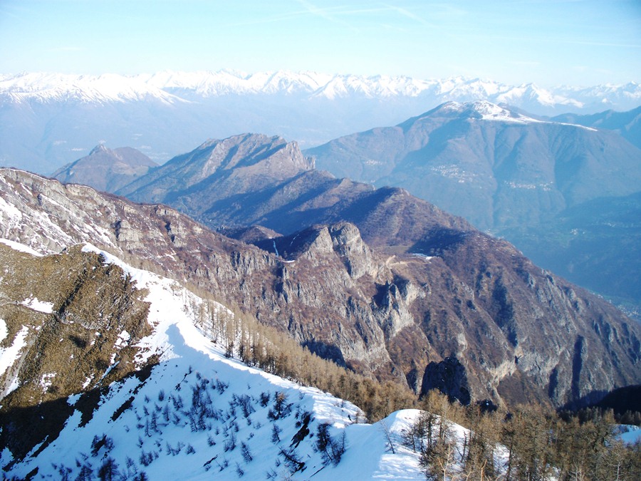
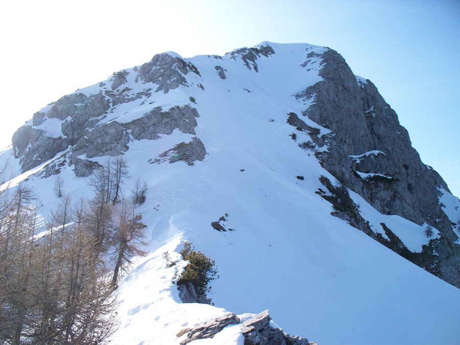
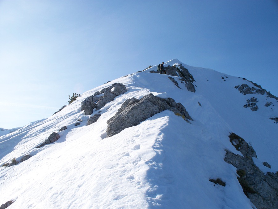
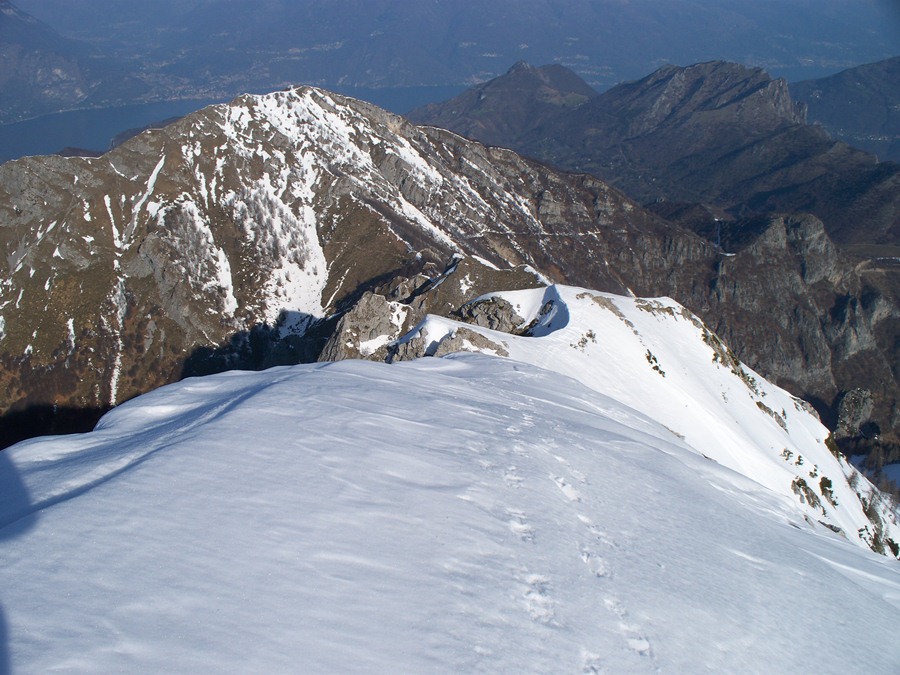
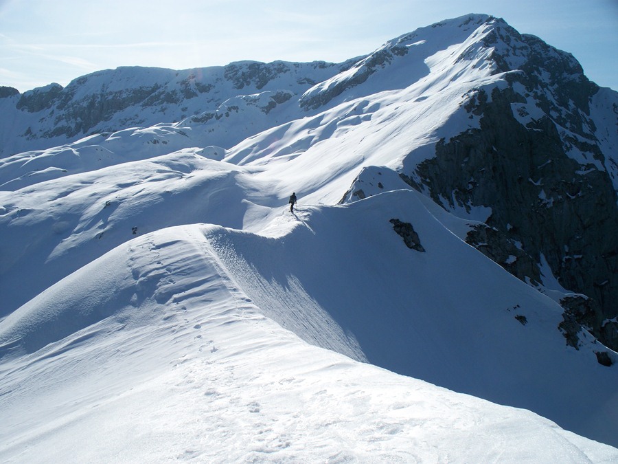
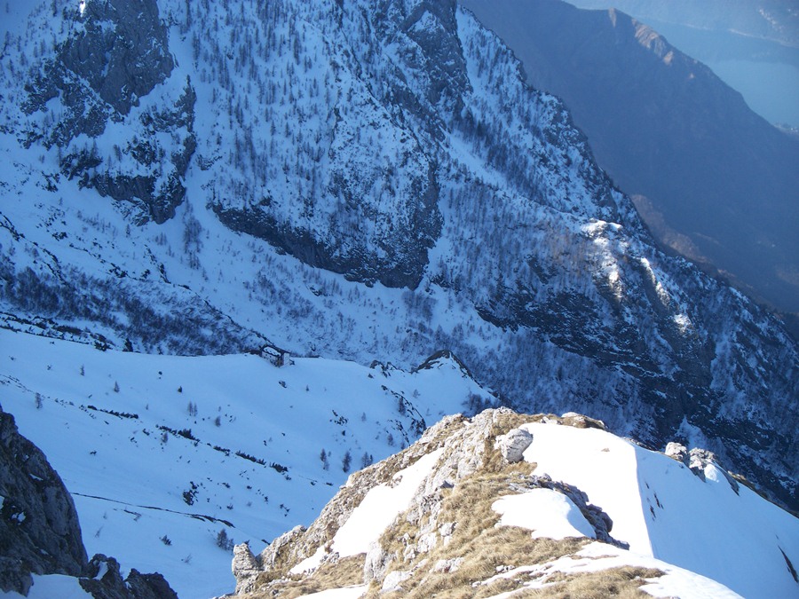
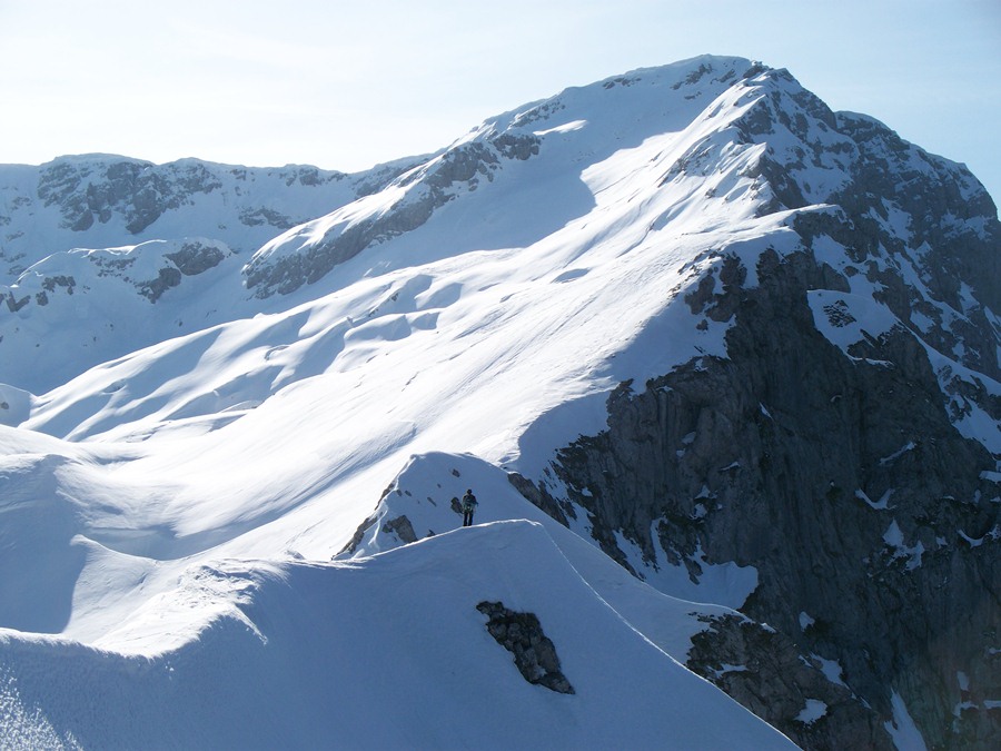
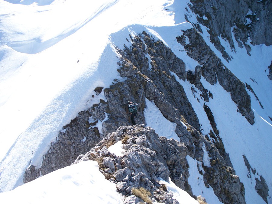
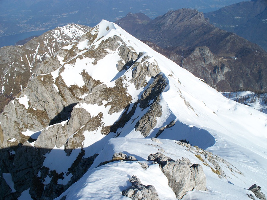
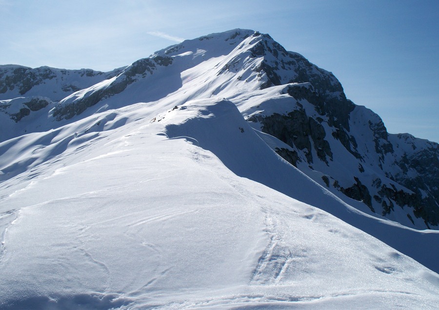
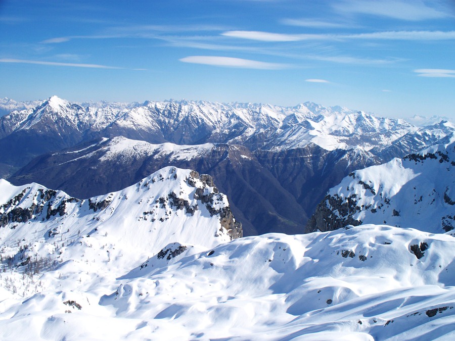
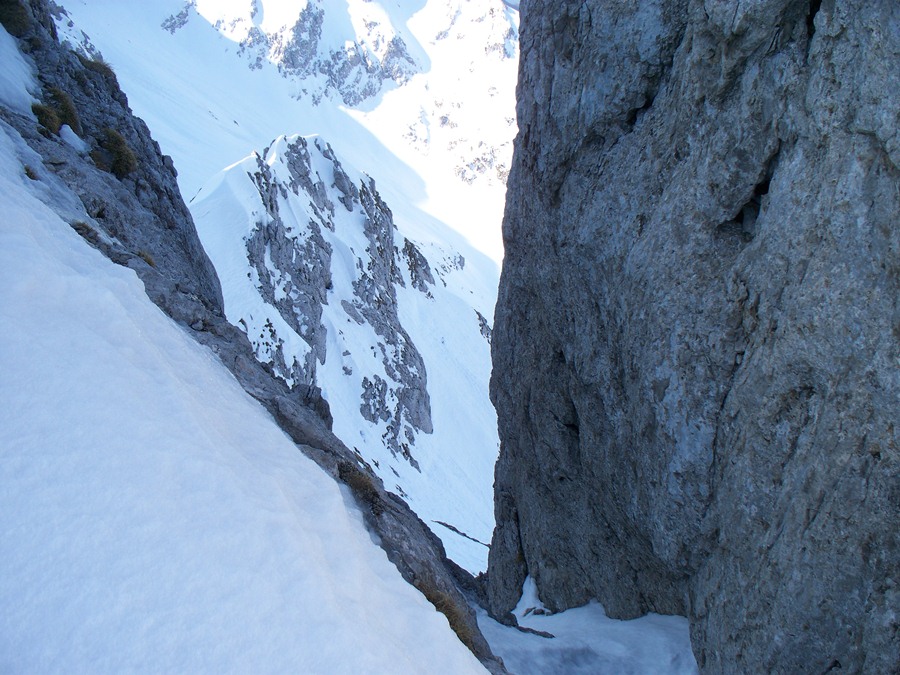
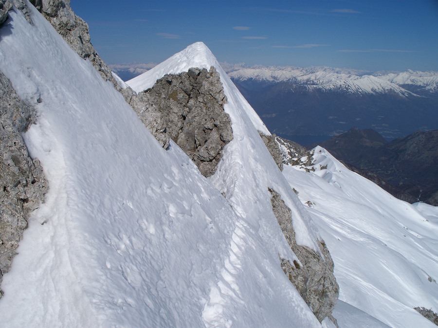
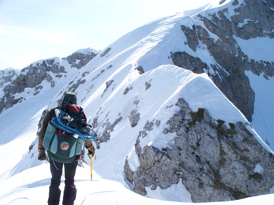
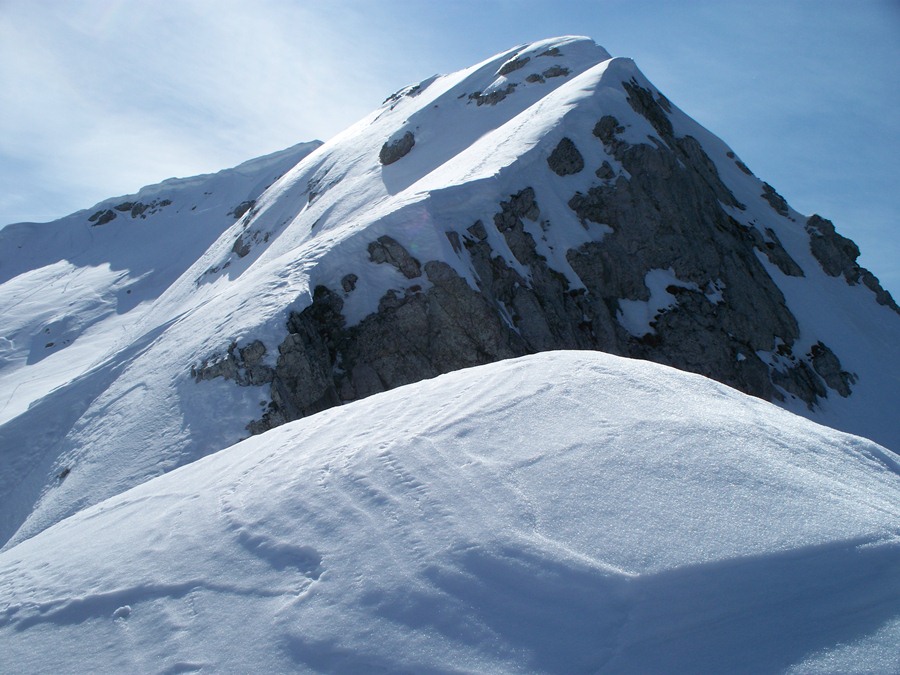
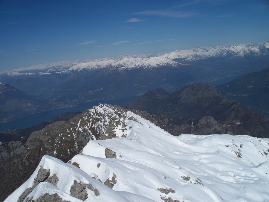
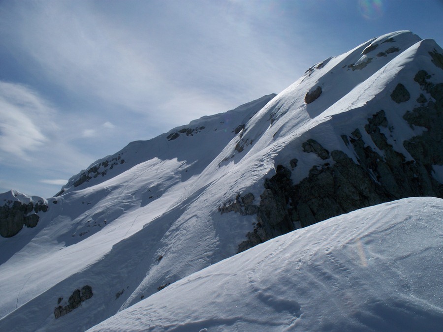
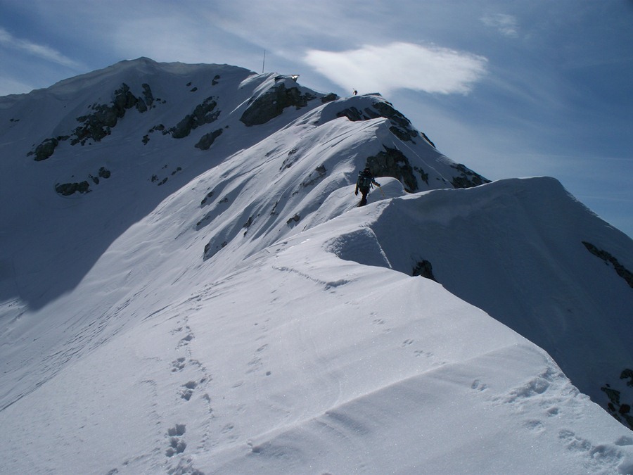
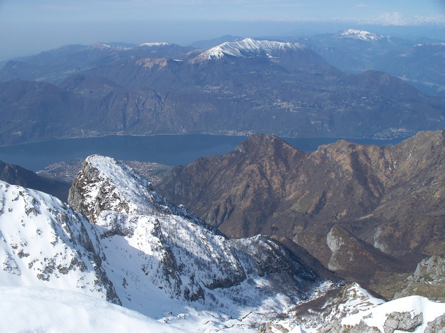
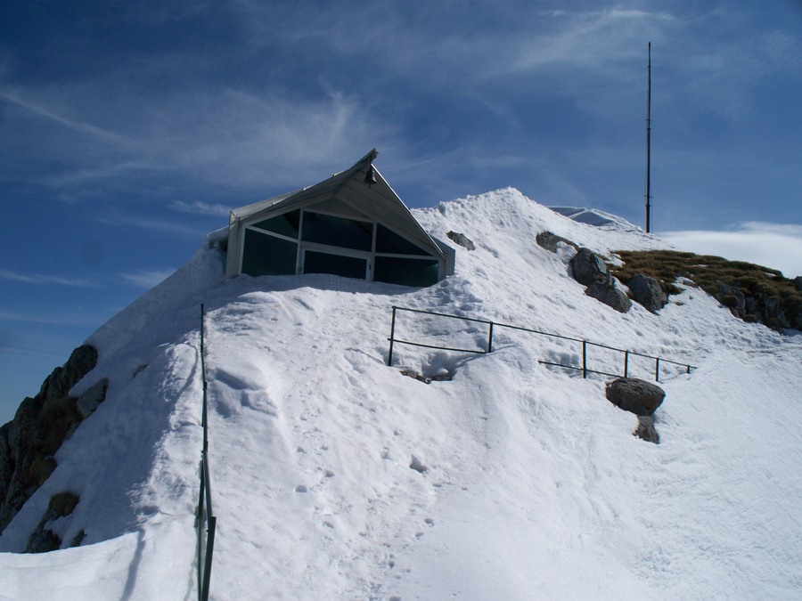
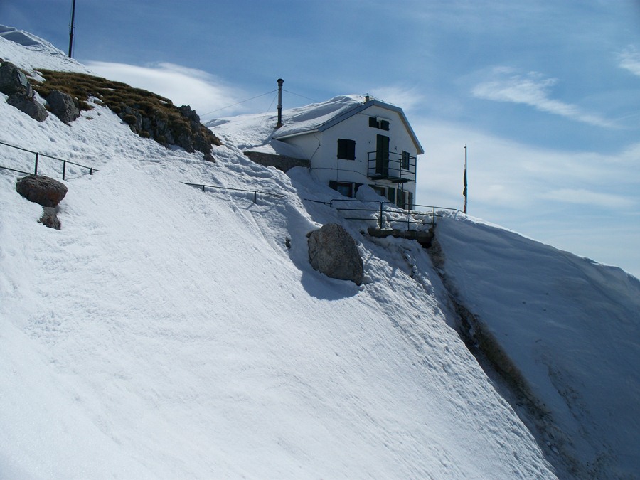
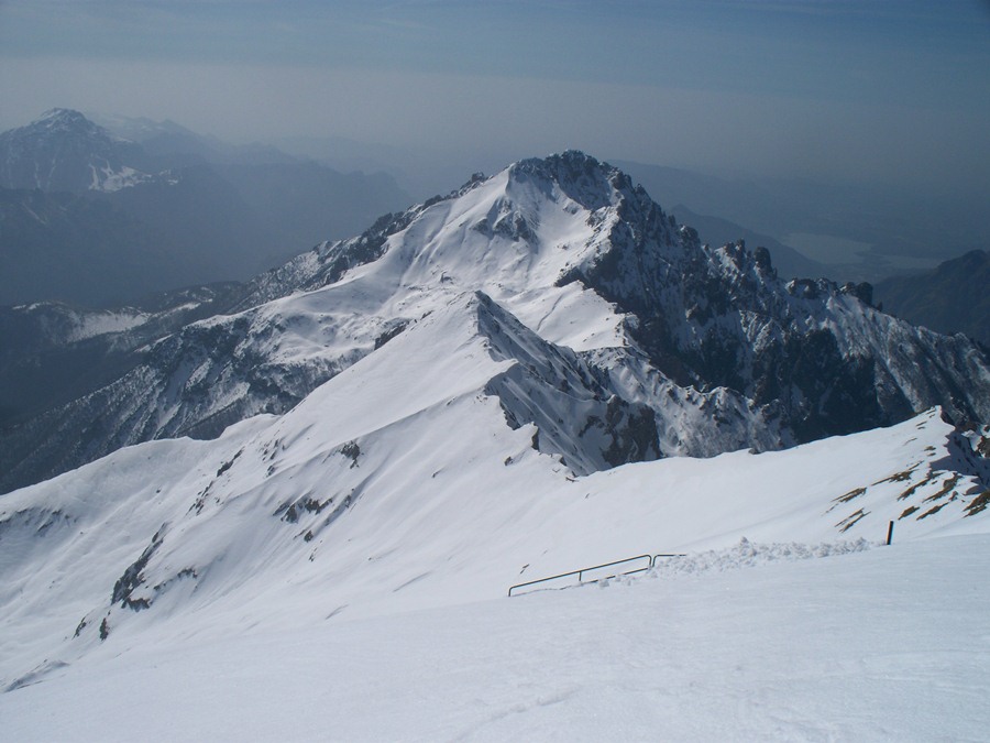
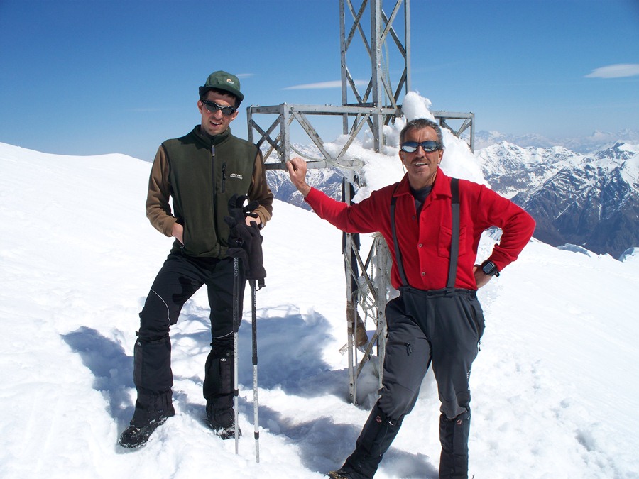
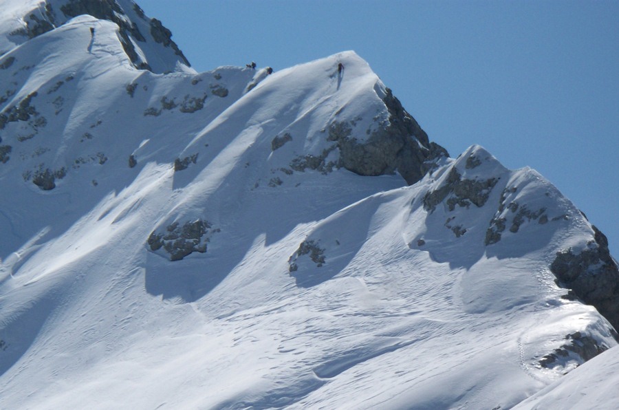
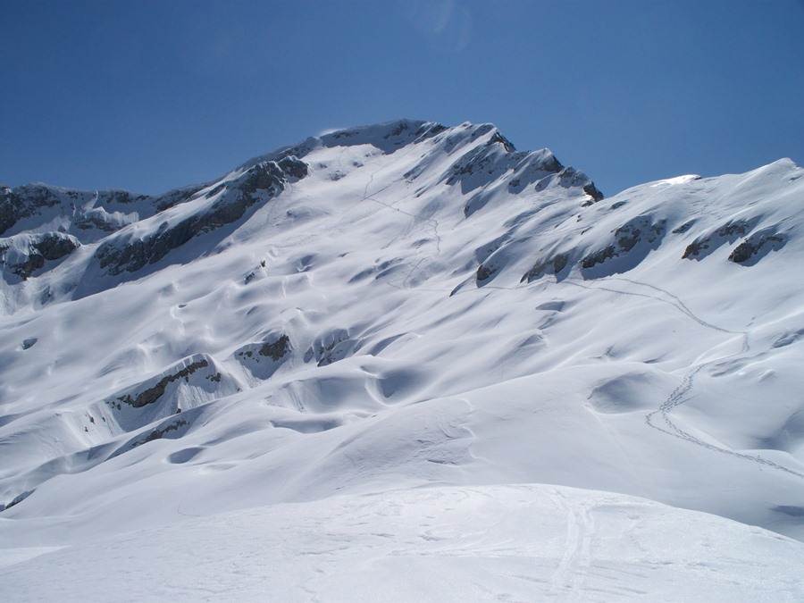
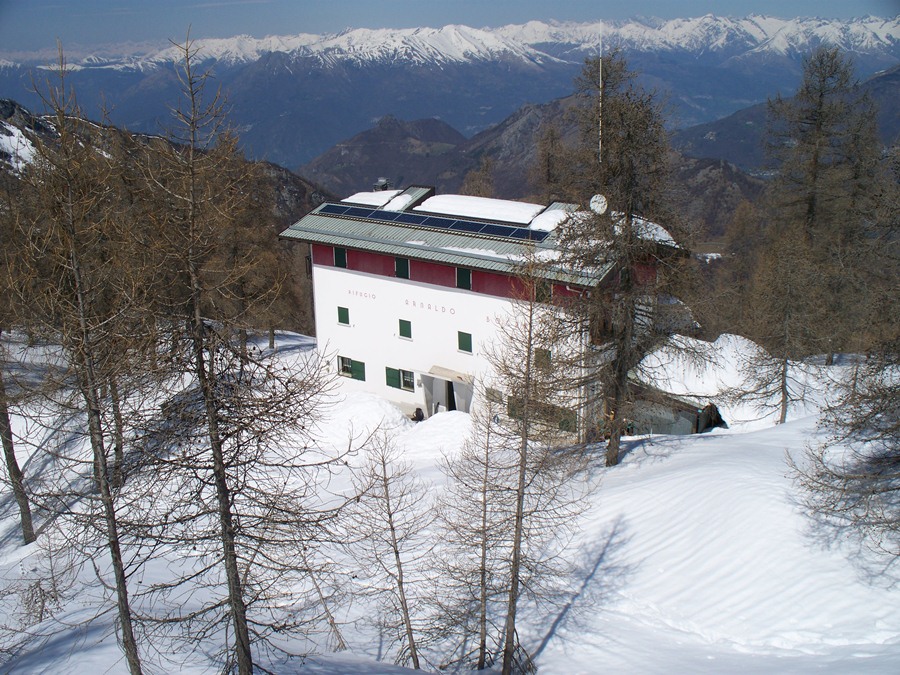
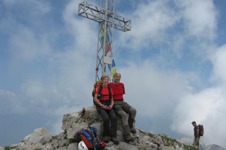
Leave the car at the car park and continue on foot along the tarmac road, which soon leads to a lay-by on the left with signposts for all the paths from Rongio. Turn left in the direction of Rifugio Elisa, path no. 14. For a description of the route, see the report "Rifugio Elisa" by Ermanno Panara, 2009. When you reach the hut in just under three hours, a signpost on the left-hand side bears the signpost for path no. 16 (Rifugio Bietti -Canalone della Val Cassina). Take it, climbing the meadow above and entering a wooded area. Climb up a rock step (chain) and, continuing westwards, reach the "Baitel de la Spaùla", a beautiful stone construction, restored and well maintained. We cross the Valle dei Chignoli and, after a stretch where the path is wedged between two boulders, we come to a signpost, the meeting point with itinerary no. 16a (i Chignoli), which we will follow on our return journey. We continue on the track with a flat course that cuts across the meadows of Val Meria . To the right, the overhanging walls of Sasso Carbonari loom up, while the mass of Sasso Cavallo looms overhead. Finally, we reach a crossroads, from where a track climbs up that, having detached itself from the main path at an altitude of 1250 m, leads directly towards the entrance to Val Cassina. (We saw the signpost on the left, but the path was hardly visible in the grass and we preferred to stay on the 'official' route). We then turn right to get to the entrance of the Val Cassina gully, a deep gully that separates Sasso Cavallo from Sasso Carbonari, opening up an access gap between Val Meria and Releccio, where the Bietti refuge is located. We reach the entrance at an altitude of 1580 m. The sight of huge walls, separated by a narrow gully that seems to want to end against a high wall of boulders, is disturbing. Entering the gorge, however, one discovers that the route is well signposted by red marks, the signs for path no. 16 and the distinctive paint squares of the Alta Via delle Grigne. In this section, it is easy to find snow until late in the season. We then follow the marks, going round large boulders and over easy rocks, sometimes aided by stretches of chain and a few stirrups. One thus follows the gully to its bottom. A red ladder, placed on a large boulder, helps to ascend it. Then follows a vertical section facilitated by numerous stirrups, chain and cable. Next comes a small gully with the aid of a chain, and finally a last long chain on the ground helps to climb up a sloping slab that leads to the exit of the gully. Here it is important to be very careful not to dump stones. We emerge into the sun, into a completely different landscape in which meadows, mugo trees and rock faces alternate. Behind us, the head of the Sasso Cavallo looks less austere seen from this angle. We climb steeply up meadows and grassy rises until we notice at the top, at an altitude of 1624 m, the signpost indicating on the left the continuation of path no. 16 to the Bietti hut and on the right itinerary no. 26 leading to the Brioschi hut via the via ferrata Cai Mandello. So far 4:30 hours. You turn right on a downhill track close to a rocky ledge, then go back uphill passing a rocky slab and steeply, on very mobile boulders and grassy rocks, you laboriously climb up the gully that leads to the start of the via ferrata situated on a saddle between two rock walls (Bocchetta di Val Cassina). Wearing the harness and helmet, we tackle the right-hand wall on a ladder and some stirrups, then continue the easy ferrata, which, with a very varied and enjoyable route, runs along the Sasso Carbonari ridge in a truly fascinating environment. On the left (to the north), you can see the Sasso Cavallo valley and the Releccio basin overlooked by an amphitheatre of rock faces, scree, snow drifts and steep gullies that make up the northern slope of the Grigna Settentrionale. Already from the start, the summit and the Brioschi hut can be seen at the top left. Finally, after endless ups and downs, the chain dies on a stone in the grass with the word 'End' in paint. Here we are at Bocchetta del Releccio (2259 m). A few more tens of metres on grass and you cross trail no. 7 of the Traversata Alta. Take the mule track on the left that climbs the panoramic ridge and reaches the Brioschi hut and the summit cross (2410 m, 7 o'clock). After a suitable rest, descend by the same route on the Traversata Alta path, pass the Bocchetta del Releccio and continue up to the Bocchetta della Bassa (2117 m, 7:30 o'clock) where the Ugo Merlini bivouac is located. Here a signpost indicates the arrival of path no. 16A or Sentiero dei Chignoli. We descend the steep slope on detrital and unstable terrain and after several bends we turn left towards a landslide gully beyond which we can glimpse the track of the path on the meadow. You reach it and descend steeply down the grassy slope in narrow serpentines. Now it is necessary to cross the rocky crag, descending cautiously first over easy rocks, then into a steep gully. With the help of the chain and the numerous handholds, we descend until we reach the base of the Zucco dei Chignoli. From here we find the meadows we traversed in the morning halfway up. Follow the track over the grass to the junction with trail no. 16, which leads to Val Cassina. 9:30 a.m.
At this point you can continue on towards the Elisa hut or you can shorten the route by turning right onto path no. 16. After a few hundred metres you will see a wooden sign on the left with the words "Mandello". Go down a nice path that enters the vegetation and reaches the Baitello dell'Aser (1340 m) without further effort on route 14 taken on the outward journey, which leads to Rongio in another two hours.
Tracciato via con matù87 poi seguiti a distanza da altre 8 persone neve non portante nella parte iniziale della cresta poi migliore ma con alternanza di neve meno consolidata.
Per il ritono indispensabili ciaspole nel vallone neve marcia
Partiti 6.45 arrivati alle 11.30 Tracciato via con matù87 poi seguiti a distanza da altre 8 persone neve non portante nella parte iniziale della cresta poi migliore ma con alternanza di neve meno consolidata.
Per il ritono indispensabili ciaspole nel vallone neve marcia
Partiti 6.45 arrivati alle 11.30
Percorso che merita di essere fatto con condizioni climatiche più favorevoli; il caldo torrido e l'afa obbligano ad una costante e continua idratazione, e l'acqua pesa. Il percorso è spettacolare, comodo (e lungo) sino al Rifugio Elisa, diventa impegnativo per ogni metro successivo. Il canalone della Val Cassina impegna maggiormente della ferrata Cai Mandello, pur non essendo considerato una ferrata in senso stretto. La discesa dai Chignoli è un altro punto particolarmente impegnativo perchè giunge dopo molte ore di cammino e la stanchezza si è già fatta sentire. Il terreno franoso e scivoloso, nonchè ripidissimo, obbliga alla massima concentrazione. Una caduta sarebbe rovinosa. Ma lo spettacolo che si gode per tutto il percorso ripaga della fatica; confesso però che gli ultimi chilometri sono stati un'autentica sofferenza, attenuata da un magnifico temporale che, forse per pietà, si è scatenato raffreddando la mia temperatura che era a livelli di allarme. Credo che le Grigne, per un pezzo, non vedranno comunque la mia presenza...
Percorso che merita di essere fatto con condizioni climatiche più favorevoli; il caldo torrido e l'afa obbligano ad una costante e continua idratazione, e l'acqua pesa. Il percorso è spettacolare, comodo (e lungo) sino al Rifugio Elisa, diventa impegnativo per ogni metro successivo. Il canalone della Val Cassina impegna maggiormente della ferrata Cai Mandello, pur non essendo considerato una ferrata in senso stretto. La discesa dai Chignoli è un altro punto particolarmente impegnativo perchè giunge dopo molte ore di cammino e la stanchezza si è già fatta sentire. Il terreno franoso e scivoloso, nonchè ripidissimo, obbliga alla massima concentrazione. Una caduta sarebbe rovinosa. Ma lo spettacolo che si gode per tutto il percorso ripaga della fatica; confesso però che gli ultimi chilometri sono stati un'autentica sofferenza, attenuata da un magnifico temporale che, forse per pietà, si è scatenato raffreddando la mia temperatura che era a livelli di allarme. Credo che le Grigne, per un pezzo, non vedranno comunque la mia presenza...
Avvistamenti faunistici: Capreolus capreolus


Comments (0)
Sign in to leave a comment