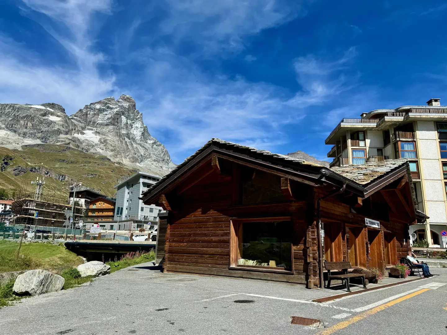
Leave the motorway at the Châtillon-Saint-Vincent tollbooth. Turn left and continue for 300 metres to the roundabout. Take the third exit onto via Émile Chanoux and follow it for 600 metres through the centre of Châtillon. Turn slightly right onto via Menabreaz and continue for 450 metres to the roundabout with the Matterhorn monument. Take the second exit onto Regional Road in the direction of Valtournenche. Continue along for about 27 kilometres, passing through the municipalities of Antey-Saint-André and Valtournenche, until you reach Breuil-Cervinia, where, just after the avalanche tunnel, on the left is the entrance to the large free car park 🅿️ located near the bus terminal.
The starting point of the itinerary is served by public transport. To consult the timetable, visit the aosta.arriva.it
The information provided has been checked on the date of the survey of the route. Before departure, it is advisable to check for any changes to the route. For up-to-date and detailed directions, we recommend the use of Google Maps or Apple Maps.
Introduction
The excursion to the Carrel Cross is a high altitude itinerary that from the centre of Breuil-Cervinia climbs the flanks of the Gran Becca to reach a place that is highly symbolic for the history of mountaineering in Valle d'Aosta. The cross, placed just above the Duca degli Abruzzi Refuge at Oriondé, commemorates Jean-Antoine Carrel, the famous guide from Valtournenche who in 1865 was the first to climb the Matterhorn along the Italian route. A charismatic figure and protagonist of an era of memorable mountaineering challenges, Carrel remained attached throughout his life to his mountain, which he climbed dozens of times leading clients and climbing companions. The cross stands on the spot where, at the age of 62, Carrel suddenly died of illness while returning from yet another ascent, after having rescued his clients. The itinerary therefore not only allows you to get close to the majestic Matterhorn, but also to retrace a stretch of history that has profoundly marked the imagination of international mountaineering.
The route preserves the charm of the ascent to the Oriondé, the place where the Italian normal route to the Matterhorn begins. The ascent alternates between pastures and scree until reaching the austere silence of the highest altitudes, where the cross stands as a sign of remembrance and testimony to the profound relationship between men and this legendary mountain.
Description
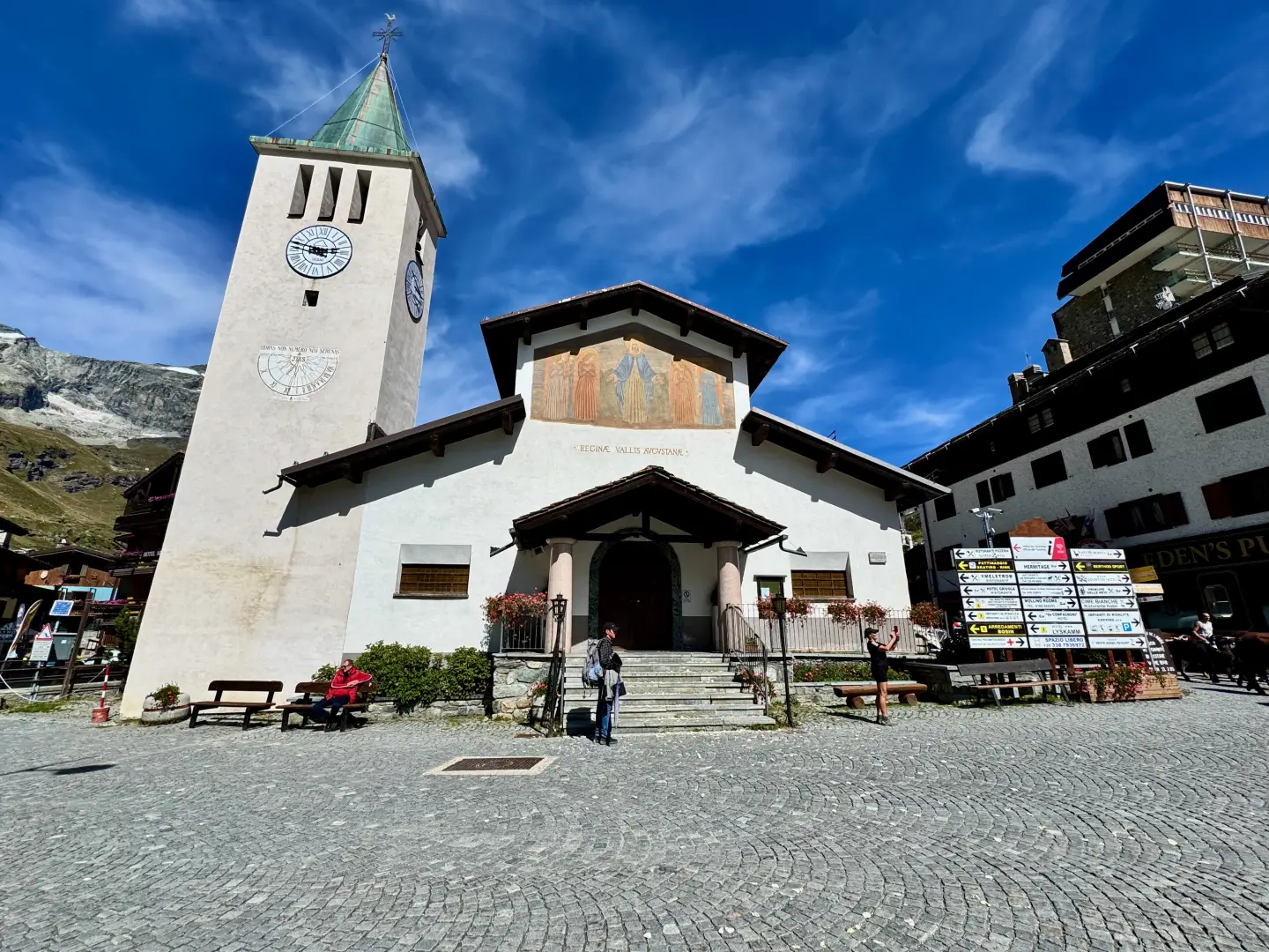
0h00'0.00km From the central car park, walk towards the bus terminal and pass the roundabout. Then continue along the left pavement of Via Guido Rey, skirting the first buildings in Cervinia, until you reach the roundabout in front of the chapel dedicated to Maria Regina Vallis Augustanae (2,002m). In the small adjoining park, on the left, you will also notice a half-bust dedicated to Mike Bongiorno.
0h05'0.32km Turn left into via Carrel and then via Battaglione Monte Cervino, until you reach a crossroads in front of the Hotel Europa. Here turn left, skirting the tennis courts and spotting the signposts indicating the start of paths
and
.
0h15'0.85km
and
Take the small tarmac road, following the first two hairpin bends. Shortly afterwards, signposts direct you onto some cut-off paths that make the ascent more direct. After crossing the small road again, now unpaved, you reach a small shelf. Follow the road for a short distance, then cut a hairpin bend to the right, taking you in front of a metal barrier. From here, make a short turn to the left and gain the plateau on which stands the Chiesetta degli Alpini (2.14 m), dedicated to the Monte Cervino Ski Battalion, flanked by a high cross commemorating the mass celebrated by John Paul II.
0h40'1.63km
and
Beyond the chapel, the road veers to the right, passing the "Royaume du Cervin" restaurant and reaching a small bridge over the Fossu stream. Here, numerous path cuts begin, alternating with the cart track and reducing the length of the route. With a long diagonal cut across the pastures, you return to the dirt track, reaching the fork to the Cherillon glacier (2,285m).
1h15'2.42km
Neglect the path to the left and continue to the right on the dirt track along a section with a slight incline until reaching the waterfall created by the Porteiller stream (2,355m). Turn left and take the path that continues to cut across the road until reaching the pastures of Mont de l'Eura. After a short stretch on the dirt track, turn right onto the narrow path leading to the pastureland of Mont de l'Eura (2,546m), located at a hairpin bend. From here, continue on the path, which climbs steadily, as interesting views open up over the Cervinia ski area and the Breithorn. After crossing the road, turn left: an ascending diagonal takes you to the junction with the Carrel path, signposted
.
2h40'4.65km
Turn right and cross the dirt track. The path then climbs the barren slope in a long diagonal; at the end, turn left and, having reached the road for the last time, you are in front of the Duca degli Abruzzi hut at Oriondé (2.810m).
2h50'4.97km Go around the hut on the northern side, passing under the imposing south face of the Matterhorn, and continue eastwards along an almost flat initial section. After passing a small lake, the path rises sharply and quickly gains altitude, tackling a rocky crag where some passages can be a little uncomfortable. A little further on, a scree shelf opens up, from which the track begins to climb again among the scree; the yellow marks, always clearly visible, guide the hiker among the rocks, facilitating orientation. A right turn leads onto a series of small ledges that, with a short ascent, lead to the iconic point where the Carrel Cross (2,958m) 3h20'5.76km stands. From here, the Matterhorn shows itself in all its grandeur, while the eye can follow the Italian normal route, which, passing by the Carrel Hut, goes all the way up to the summit.
The return follows the same route as the outward journey: from the Carrel Cross, the route descends again to the Duca degli Abruzzi Hut, then to the pastures of Mont de l'Eura and the Cherillon glacier crossroads. Continuing along paths and cart tracks, you return to the Chiesetta degli Alpini and from here to the Hotel Europa crossroads. Finally, we return along via Battaglione Monte Cervino, via Carrel and via Guido Rey to the central car park in Breuil-Cervinia 3h20'5.76km .


Comments (0)
Sign in to leave a comment