Col Ranzola - Arescoll, from Fenillettaz


Edited by:
Massimo Martini
Updated at: 02/06/2026
Access
Leaving the motorway at the Verrès exit, enter the roundabout and take the second exit. Proceed in the direction of the town centre and, after 300m, turn left onto the regional road for Val d'Ayas. Follow the regional road for 16.5 kilometres, passing the villages of Challand-Saint-Victor and Challand-Saint-Anselme before reaching Brusson. Pass the village and, just before the junction for Col de Joux, turn right to take the communal road to Estoul. Continue on the communal road for about 7 kilometres, passing the village of Estoul before meeting a large car park 🅿️ where you can leave your car.
[0h38'] - [23km]
How to get there with GMaps
How to get there with Apple Maps
The information provided here has been verified as of the date of the survey of the route. Before setting off, it is advisable to ensure that no substantial changes have occurred on the route to the starting point. We therefore recommend the use of the satellite navigation apps provided by Google or Apple for up-to-date and detailed directions.
Introduction
Short hike on one of the easiest passes between the Ayas and Lys valleys. The route does not present any difficulty and is therefore one of the easiest and least demanding in terms of physical energy. The little road, then path, leads the hiker between the Estoul and Frudière valleys in the presence of the rugged walls that descend from Mont Ciosé - Stallerhòre. The pass, already frequented in antiquity, was used for the seasonal emigration of Valsesian men heading across the Alps to work as stone pickers or masons. During the 18th century, a long drystone wall was built by the Russian-Austrian truppers for fortification purposes, which is still evident. In 1857, the Russian writer Lev Tolstoy passed through the pass: a plaque under a white madonnina commemorates his passage.
"The great poet Tolstoy passed over this pass on 20 June 1857. He left Gressoney at six o'clock and climbed up to a chapel pure and rarefied air, clear sounds on the mountains a boy sings, descent, aromas, smells of rye and melissa, cuckoo song on the mountains. Peace, Brusson".
In the crest of the hill there is a small building used as a shelter in case of strong winds.
Description
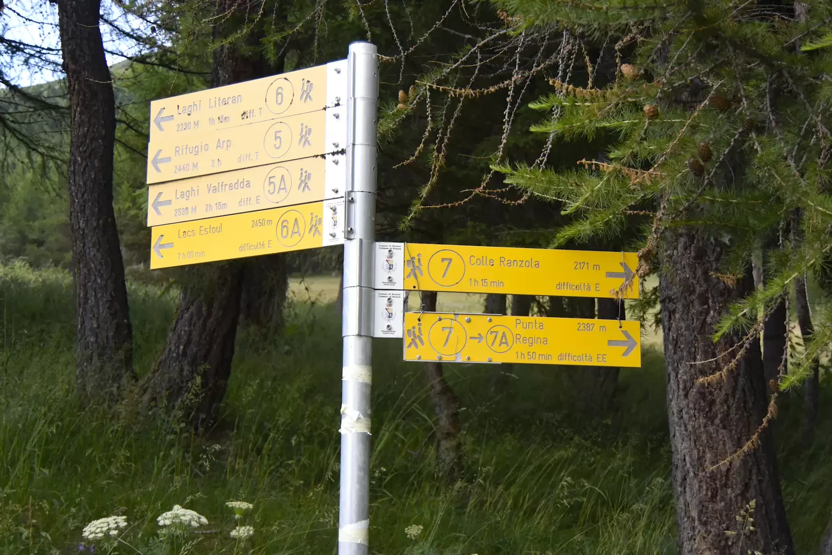
0h00' At the end of the car park, you will find signposts indicating the main routes in the area. Proceed along the tarmac road following the signs for path . The first part of the itinerary is almost level, in the presence of Mont Ciosé (2664m). Continue along the little road until you skirt the Murassaz pastures (1890m) below the roadway.
0h10' Turn slightly to the left until you come to the Chamen stream, which descends from the Estoul lakes: here the road becomes a dirt track and proceeds making a slight arch to the left until you reach the Praz dessous (1927m) alpine pastures: splendid panoramic views of the lower valley and the Avic mountains. Begin to climb, curving slightly to the left, entering the rounded valley that leads to Col Ranzola: evidence of the ancient route of the Balteo glacier.
0h25' Go up the larch wood following the farm track that enters the valley; gain a little altitude with a couple of hairpin bends and, at an altitude of 2014m, you will come to the crossroads for Praz dessus: go straight on, ignoring the track that climbs to the left.
0h45' After an almost flat section, climb again until you reach the signpost indicating a detour to the left for Col Ranzola: a little further on you will see the alpine pastureland of Fenêtre (2087m).
0h55' Climb up the path, which branches off in places, and climbs the steep ridge halfway up. The path comes out of the forest and, after a final climb, reaches Col Ranzola - Arescoll (2171m) - 1h15' .
The descent follows the same route as the ascent 1h00' .
Riferimenti Bibliografici
- Nel 1857 Leone Tolstoj insidiò le virtù di una gressonara - Navillod Gian Mario -
Photo gallery
Comments (0)
Sign in to leave a comment