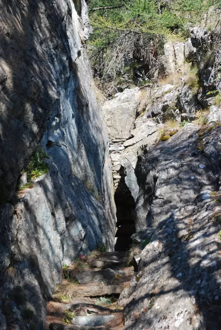
Borna da Ghiasa, from Erésaz

Access
At the Châtillon Saint-Vincent motorway exit, turn right towards Saint-Vincent, at the traffic lights go straight on passing under the state road and after 1.5 km turn left following the signs for Colle di Joux and Emarèse. At 11 km from the toll, shortly after the Salirod antennae, turn right for Erèsaz and after 3.8 km inside the village you will see a sign on the left indicating Borna da Ghiasa. Leave your car immediately afterwards, in the car park on the right.
Introduction
The Borna da Ghiasa, the Ice Hole in Italian, is a 30-metre deep cavity from which a flow of cold air escapes in the summer months. It was used by the locals for storing foodstuffs. The small room was closed by the door that now lies inside and the village priest kept the key. The origin of the cold air current seems to be related to the deep fractures in the subsoil, caused by the DGPV (Deep Gravitational Depression of the Slope): a very slow landslide triggered by the retreat of the Baltese glacier that causes the entire sector of the Emarèse municipality to slide towards the valley floor with an imperceptible movement.
The Borna da Ghiasa is one of the numerous geosites in Valle d'Aosta. Anyone wishing to learn more about the origin and particularities of this geological curiosity can consult the relative file on the region's website, which is full of scientific and cartographic information.
The sign warning of the possible presence of asbestos fibres is due to the presence of an asbestos mine located to the north of the itinerary, upstream of the village of Cheissan. The lode is rich in long-fibre ore, prized because it is easy to work. It was discovered in 1872 and exploited with mixed fortunes until 1968 when mining was definitively abandoned due to the hazardous nature of the material.
.Description
Follow the signs for the Borna da Ghiasa by taking the paved path that climbs between the houses and the walled plots of Erésaz until you reach a small bridge above the village. Shortly afterwards, the path narrows, continues by cutting across an escarpment halfway up, then crosses flat pastures until, at the beginning of the coniferous forest, you come across a disturbing sign warning of the possible presence of asbestos. One enters the scrubland and just before arriving at the Borna da Ghiasa one crosses a steep rocky slope that the conifers have colonised with difficulty.
One enters the cavity through a crack in the rock that at its narrowest point measures about forty centimetres, the doorway is about one metre high and is closed by a small stone wall. Inside is the entrance door, and on the left, separated by a 2.5-metre-long wooden balustrade, one can see the mouth of the vertical fracture about one metre wide by 80 cm, which descends inside the slope for about thirty metres.
Objective Danger: do not go inside the Borna da Ghiasa without appropriate caving equipment; caution: danger of collapse and falling rocks
Borna da Ghiasa (1310 m) - © 2006 Gian Mario Navillod Borna da Ghiasa (1310 m) - © 2006 Gian Mario Navillod Borna da Ghiasa (1310 m) - © 2006 Gian Mario Navillod Borna da Ghiasa (1310 m) - © 2006 Gian Mario Navillod Borna da Ghiasa (1310 m) - © 2006 Gian Mario Navillod
The start Beginning of the coniferous forest Disturbing signpost Steep rocky slope The mouth of the vertical fracture