At the motorway junction of Aosta West, turn right and take the regional road for the Cogne valley. Drive through the village of Aymavilles and, after 1.3 kilometres, take the second exit at the roundabout. Go up the regional road for 19 kilometres, passing the villages of Vieyes, Epinel and Crétaz, until you reach a roundabout: take the second exit, following the signs for Lillaz. Continue on the communal road for about one kilometre until you reach another roundabout; continue straight on for another 1.8 kilometres until you reach the large free car park 🅿️ in Lillaz.
[0h32'] - [24.0km] How to get there with GMAPS How to get there with Apple Maps
The directions provided have been carefully checked at the time of the route survey. However, it is highly recommended to check for any changes that may have occurred since then, especially regarding the route to the starting point. Before embarking on your journey, it is advisable to consult up-to-date navigation tools for accurate and up-to-date directions. We recommend the use of satellite navigation apps, such as Google Maps or Apple Maps, to ensure the most accurate and safe route.
Introduction
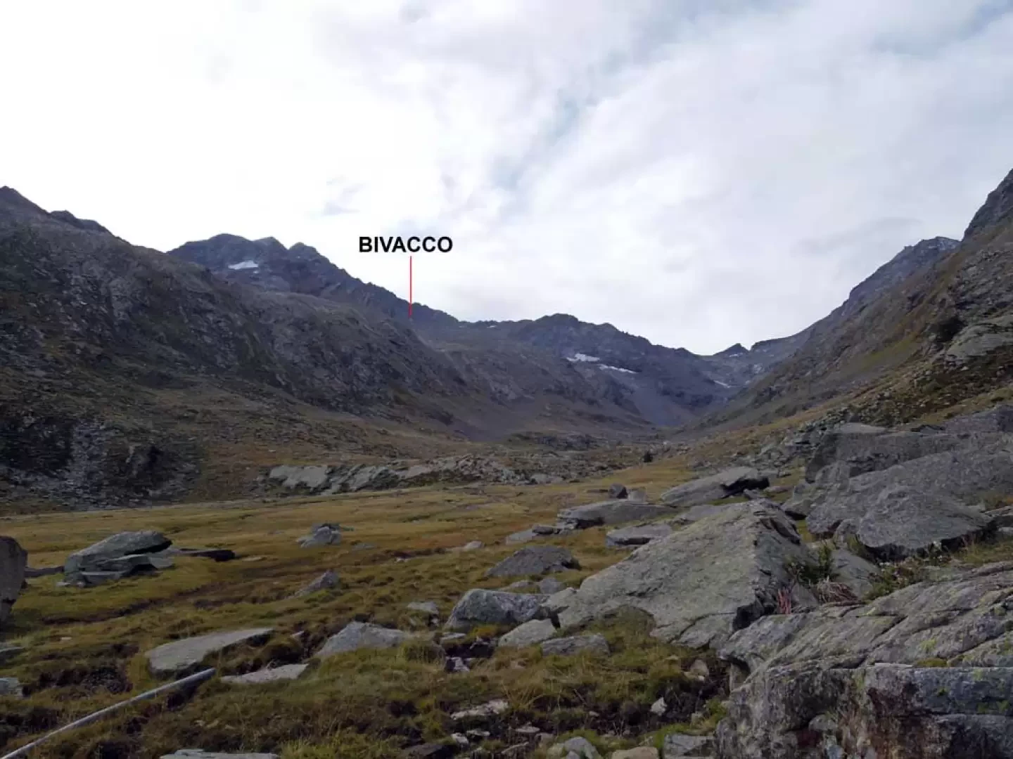
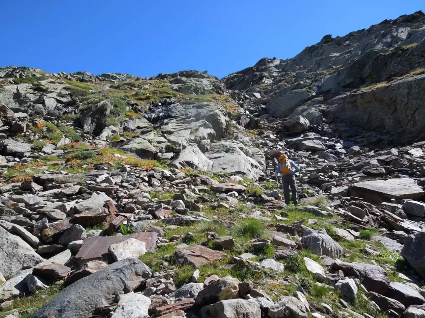
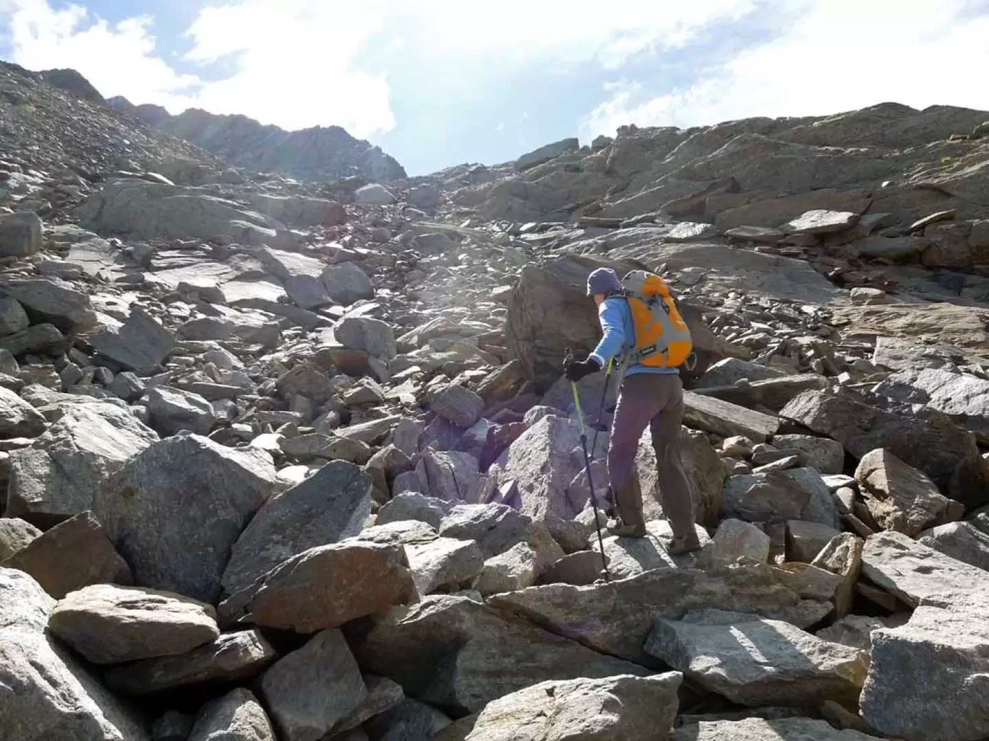
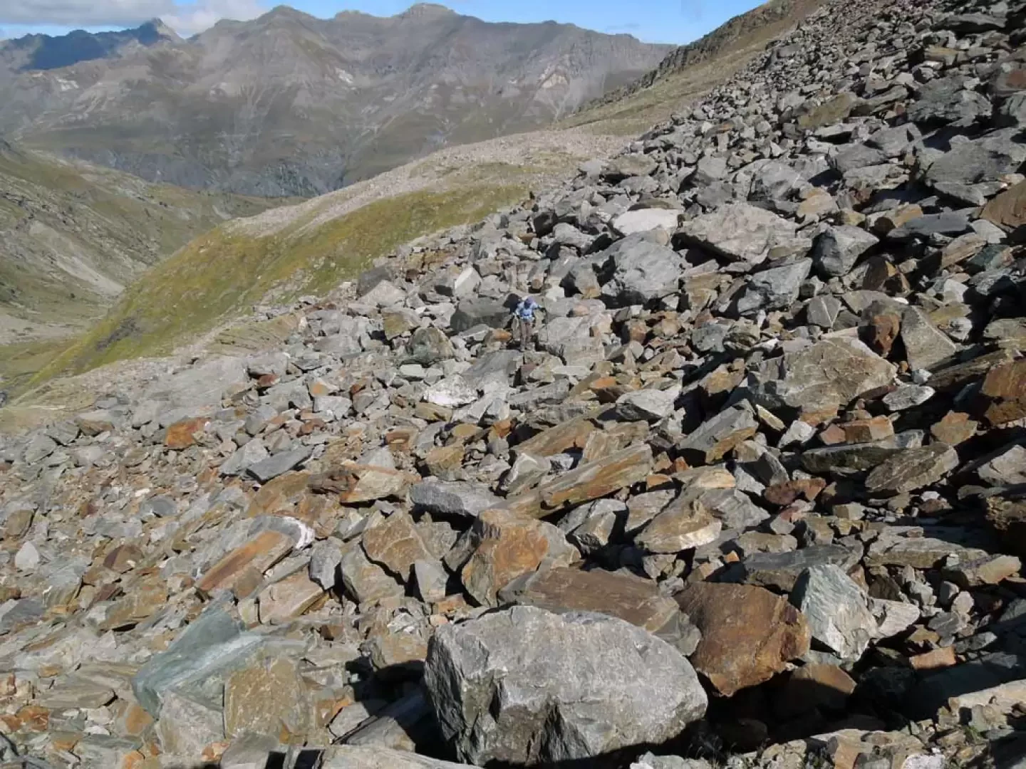
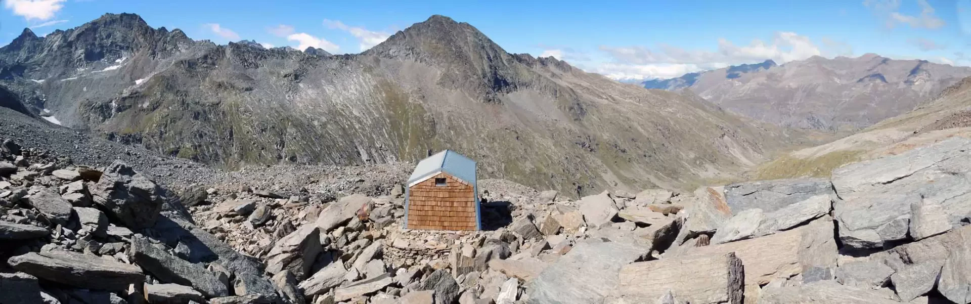
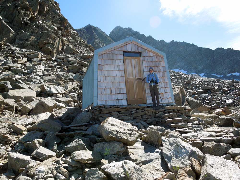
This long hike (just under 20 km) takes place in the Gran Paradiso National Park and more precisely in the wild Bardoney valley above Lillaz. It leads to a panoramic bivouac made of wood and sheet metal located on the orographic right of the valley at the base of the rocky crest of Punta Lavina. The new construction, which has not yet been inaugurated and has not yet been completed as far as the water supply is concerned, is always open and has eight beds on planks and is equipped with blankets and mattresses. The ascent is along an easy path until the deviation just before the junction for the Colle dell'Arolla, while thereafter its route takes it over rough terrain and large scree slopes where there are very few reference points and markers: for these very reasons, it is best to only make the excursion with good visibility. Since it is mainly north-facing, attention must also be paid to the possible presence of verglass on the steep slopes leading above the ramparts and on the scree. Its length, difference in altitude and the lay of the land on the upper part combined with a good amount of orientation recommend it to experienced and well-trained hikers.
Description
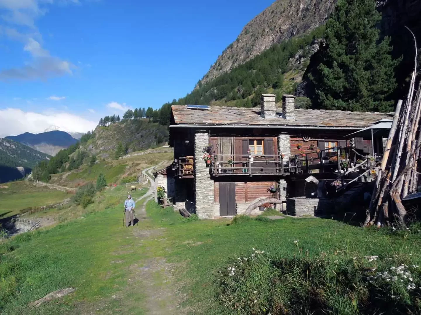
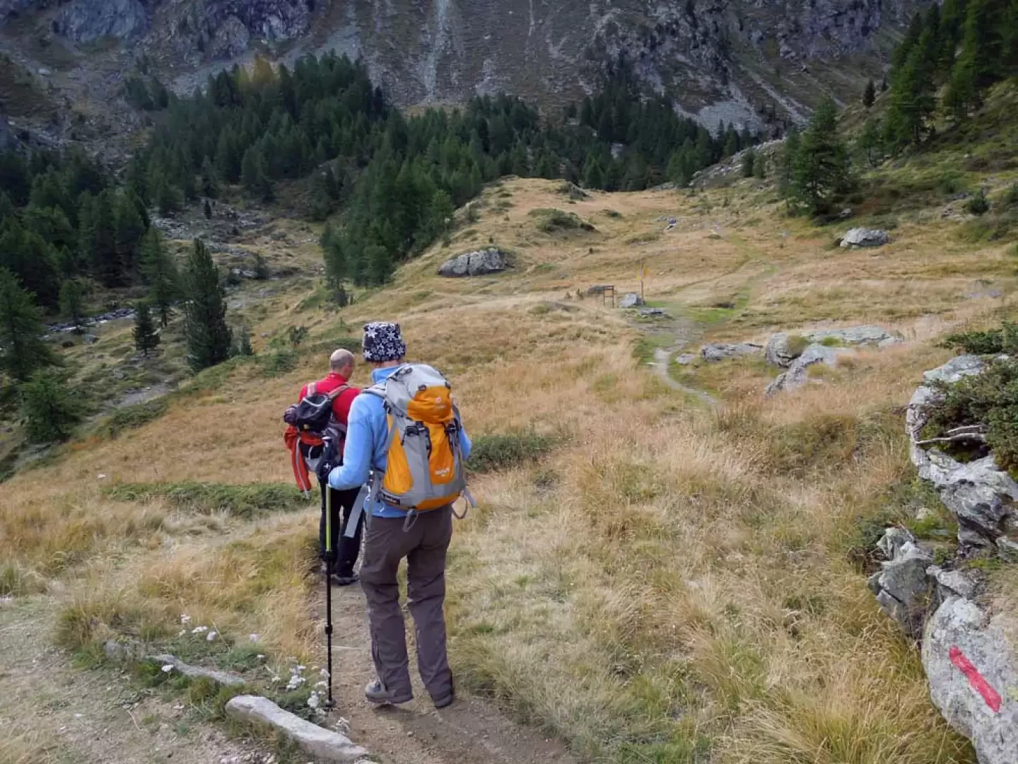
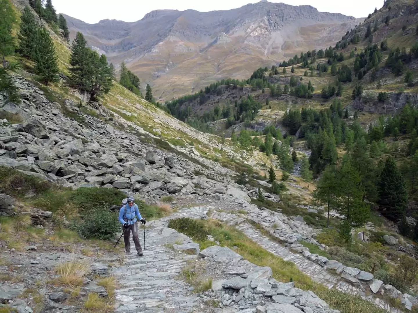
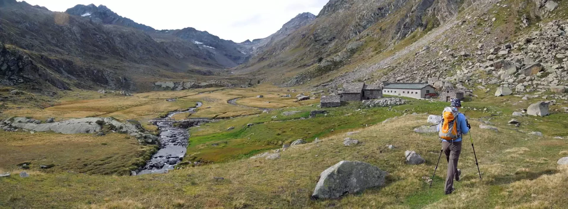
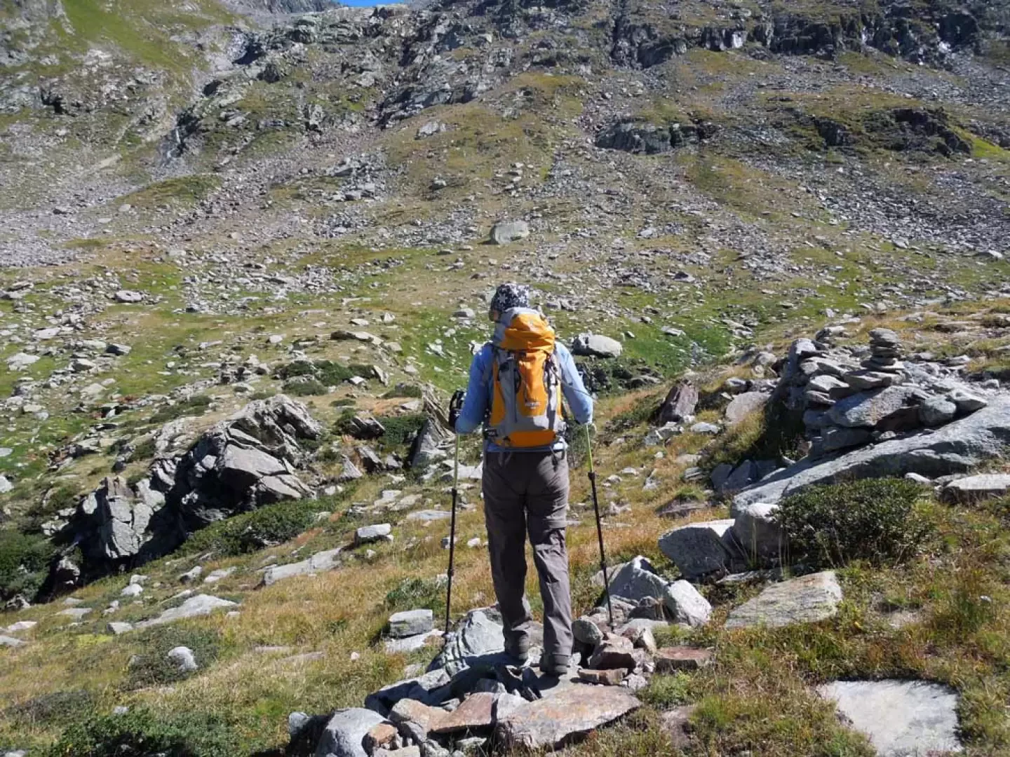
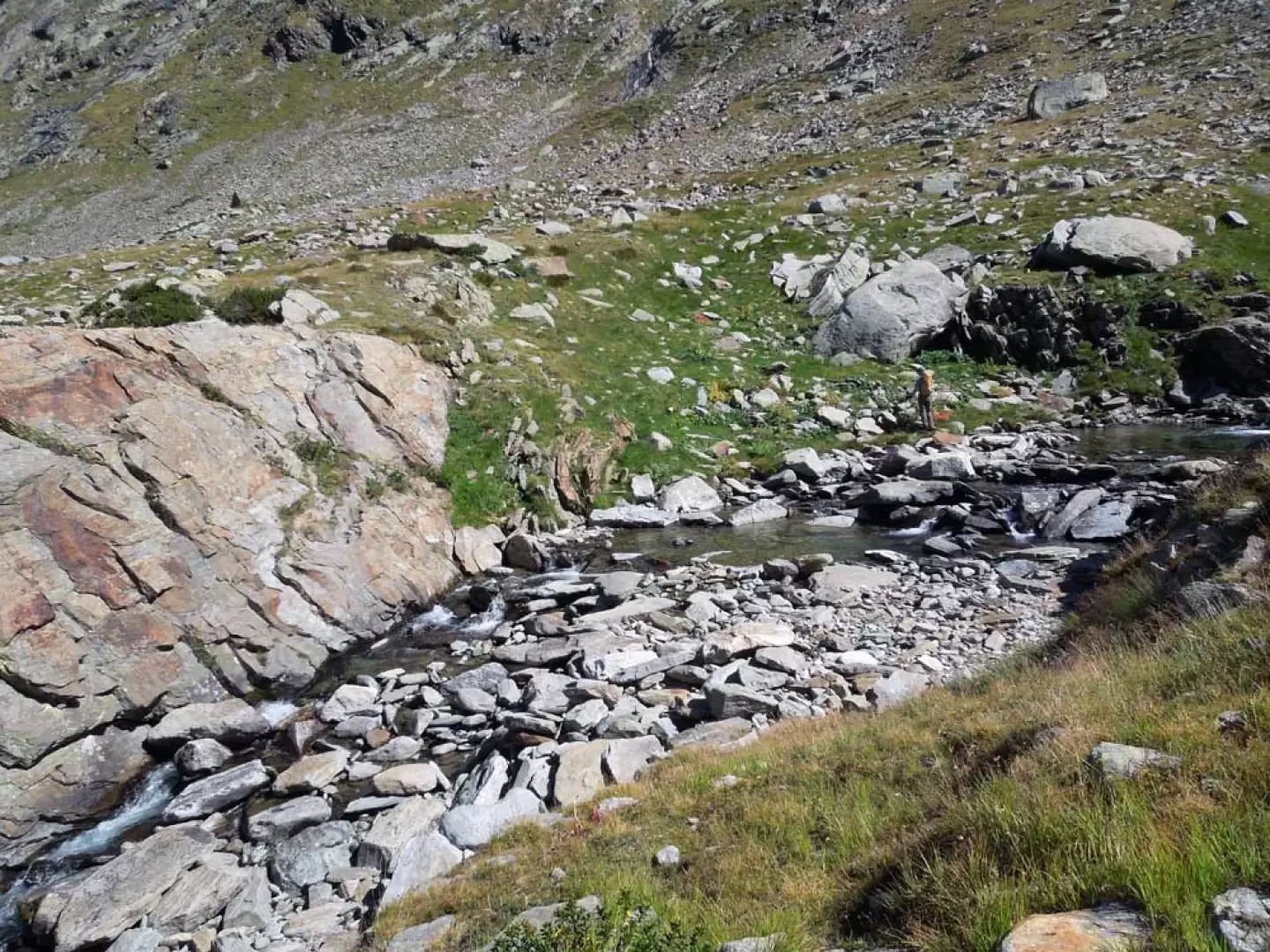
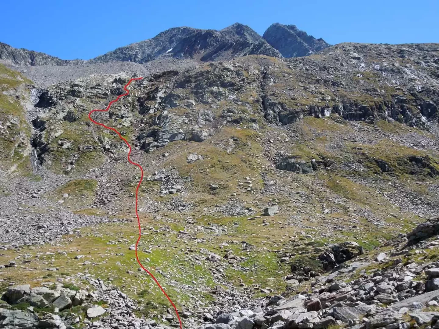
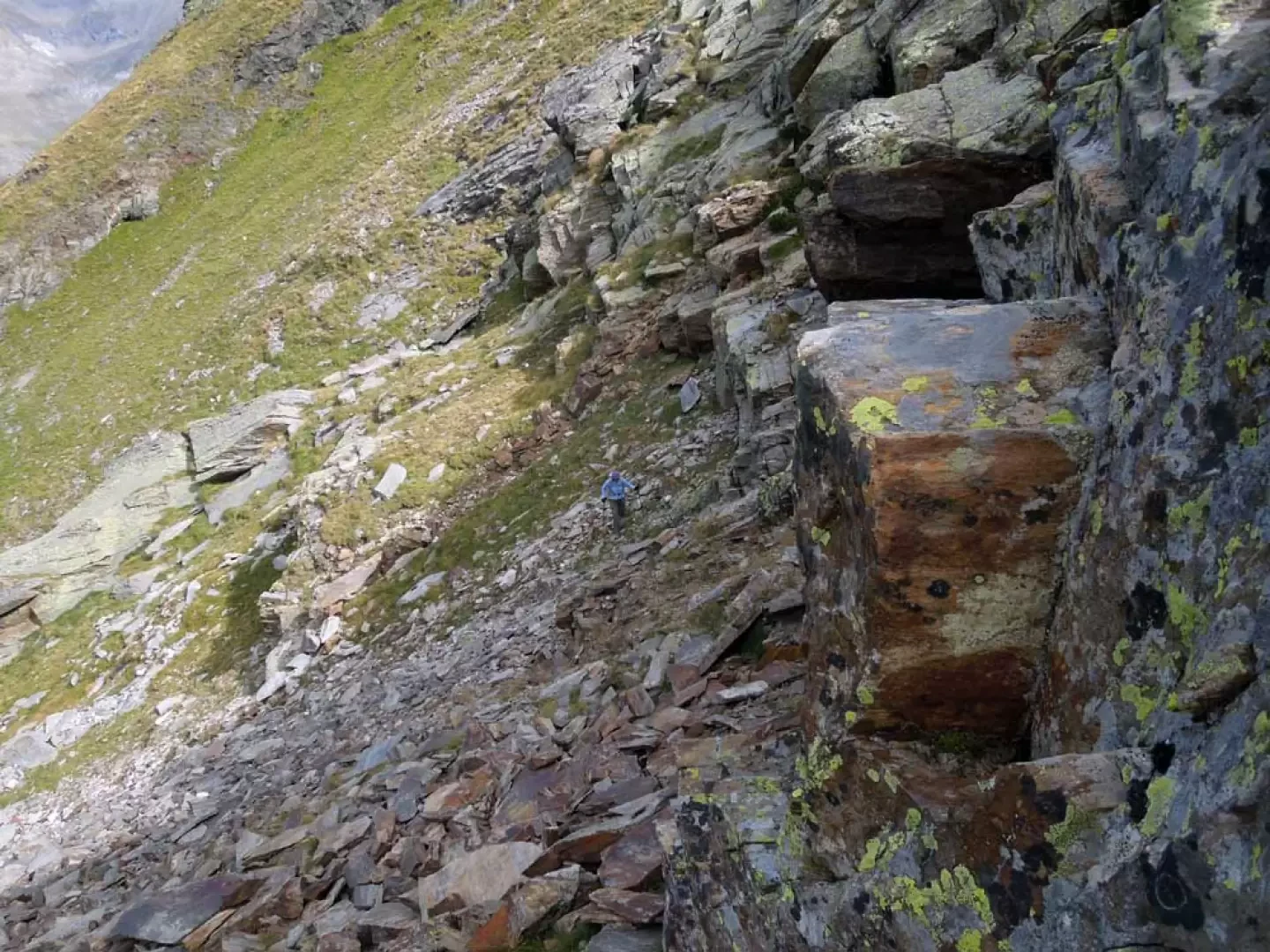
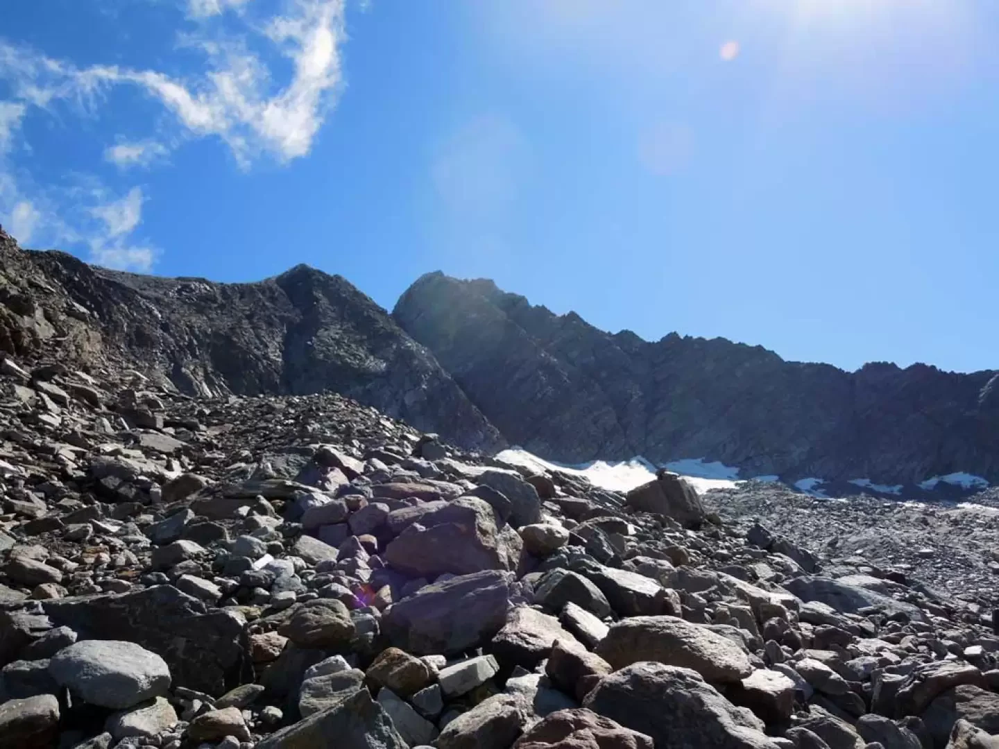
From the parking area, take the road that starts at the bottom of the car park on the left and continue for a few dozen metres until you come to some posts on the left that are at the beginning of a path that climbs in steps; once you take the path, rise decisively past some forks that are well indicated by the posts, after which, having passed the road, head towards a rocky rampart that you climb up passing by a water conduit. Once around the rampart, you pass a small chapel (1838 m) from which you lose a few metres in height and reach a pastureland where, at its beginning, there is a fork in the road, at which you keep to the right to cross it; you then pass the Goilles dessus huts and, turning slightly to the left, go down a short stretch of false level to reach the nearby Goilles desot hut (1847 m). You pass it and approach the stream, which you cross over a bridge after which you ascend slightly, skirting a grassy slope at the end of which you cross a mule track and take the path into the forest (1871 m). Now the slope increases a little as you climb back up into the wood, with hairpin bends alternating with short traverses with which you move upwards and, after a series of tight bends, you pass a short stretch protected by a handrail; having climbed a grassy gully again, you turn right again, arriving at a short descent at the end of which you find a fork signposted by signs (2154 m) from which you take the path that continues to the right. The track rises slightly in the valley and then, with a few nice bends on a paved surface, climbs more decisively, approaching the gorge of the torrent where it then flattens out slightly, reaching another fork (2227 m). Continuing on the left, there are a few small ups and downs between low grassy rises and, beyond a slightly higher hill, we arrive at the Bardoney pasture (2240 m) from which, in front of us, the large valley of the same name opens out. We now enter the valley with the path that continues almost flat between stones and pastures and, after a few slight ascents and a couple of hairpin bends, we arrive at an altitude of 2347 m (cairn) where it is convenient to deviate to the left, leaving the track; we approach the stream by pointing to a large, slightly reddish sloping rock where, in front of it, there is a convenient ford on large stones. One ascends the slope, moving to the left, and heads towards the grassy crags between a small waterfall, on the left, and a mostly dry stream, on the right; having reached the base of the latter, one ascends the comfortable ledge to the left and then almost immediately rises laboriously between clods and shifting stones, crossing to the right and thus gaining the summit of the rampart. From this point, walk a little further on a low rib of rocks and grass, trying to spot the bivouac now visible on the right at the base of the rocky ridge, and when you reach an altitude of about 2610 m, it is worth turning towards it, starting to walk along a wide scree slope. Crossing it uphill, but remaining under the moraines on the left, one crosses a first part of it and arrives at its shoulder from which one continues to traverse it again with a long diagonal ascent aiming at an evident gully of scree and small stones; having also climbed this short stretch laboriously, one arrives at the panoramic bivouac.
Trovati solo un paio di piccoli ometti sopra la dorsale. Non so se il nostro itinerario sia il migliore ma senz'altro sembra, visto sulla cartina, il più diretto, logico e, se si può dire, meno faticoso per risalire la dorsale sotto le pietraie e per il proseguimento a vista vedendo sulla destra il lontano bivacco; in funzione di questo abbiamo sistemato una dozzina di ometti, di cui uno grande al punto di deviazione per il guado, dall'inizio della dorsale da risalire sino al punto di deviazione verso le pietraie perchè da lì in poi il percorso lo si sceglie al momento a seconda delle condizioni.
Escursione da evitare in caso di nuvole basse o scarsa visibilità per difficoltà di orientamento nella parte superiore


Comments (0)
Sign in to leave a comment