Salvan

Edited by:
Massimo Martini
Access
In terms of access, Salvan is connected via the Martigny-Châtelard railway, with stations both in the main town and in Les Marécottes; there is also the possibility of reaching the area by car via the cantonal road, with good road connections to Martigny and the valley floor. The nearest airport is Geneva (about 70 km), from where one continues by train or car.
Introduction
Salvan is a Swiss mountain municipality located in the Canton of Valais, in the district of Saint-Maurice, in an elevated position in the Trient Valley in the heart of the Alps. Its toponymic origin derives from the Latin "Sylvanum", meaning forest, and reflects the strong presence of forests and natural spaces that characterise the territory. The landscape boasts a great geological and environmental richness: Salvan includes part of Lake Émosson, with its turquoise waters at the foot of the dam, and numerous alpine itineraries to the surrounding peaks such as Tour Salière and Luisin, as well as direct access to the Dailley Gorges and the famous Lake Salanfe, popular excursion destinations. Also of interest is the Les Marécottes ski resort on its territory, offering various winter sports activities.
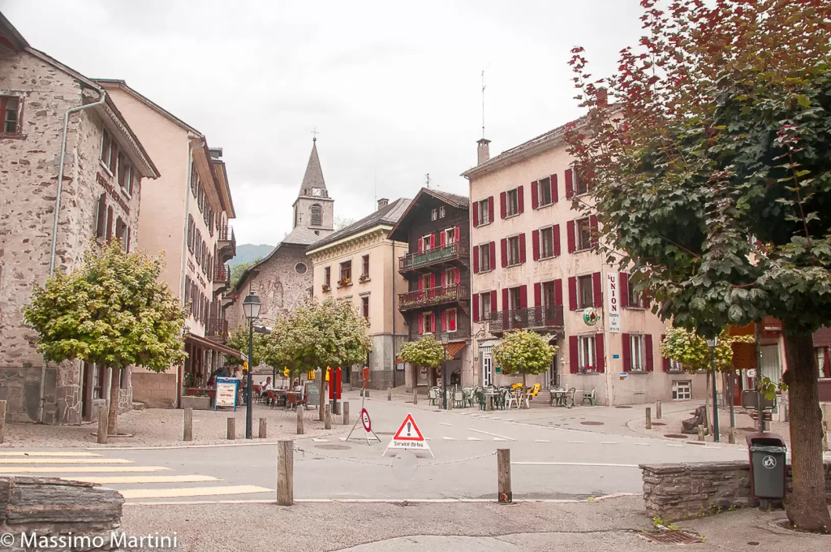
Description
The main centre stands at an altitude of 912 metres and features traditional alpine architecture, flanked by historic buildings and rural houses, bearing witness to the municipality's agricultural and forestry past. The Catholic parish church of St Maurice, documented since 1265, recalls the strong historical presence of the Abbey of Saint-Maurice, of which Salvan was for a long time a lordship in the ancient Valais territorial structure. The municipal coat of arms, officially adopted in 1933, shows a fir tree against a backdrop of mountains, an environmental and linguistic symbol.
In the course of history, the municipality has undergone some territorial changes: in 1912, the hamlet of Vernayaz was separated from Salvan, becoming an autonomous municipality. Today, Salvan is also known for the responsibility entrusted to the original families, who are part of the patrician municipality and take care of the conservation of local assets.
The community maintains a lively associative and cultural tradition, with local events, a municipal band and sports activities mainly related to the mountains. Typical dishes reflect the simple and hearty cuisine of the alpine pastures, complemented by small-scale dairy and agricultural production. There are numerous legends linked to the forest, some of which tell stories of mythical figures wandering among the forests and rocks, a sign of the deep connection between man and nature in these valleys.
Tourism is developed both in summer and winter, thanks to the variety of walking routes (e.g. to Van or Lake Salanfe) and the Marécottes ski offer, plus the evocative Dailley Gorge route, characterised by footbridges and stairs between rock walls, a destination for many hikers. The village is also popular as a base for discovering the Trient Valley and its natural features.
Information
Area: 53.5 km²
Centre altitude: 912 m above sea level.
Main elevation: Tour Salière (3220 m)
Number of inhabitants: 1483 (end of 2023)
Name in dialect: Salvanais (French)
Patron Saint: St Maurice
Neighbouring communes: Vernayaz, Finhaut, Martigny-Combe, Trient, Châtelard, Les Marécottes
Official website: www.salvan.chArea: