Gignod

Introduction
The town of Gignod is located in the valley of the Great St. Bernard, a few kilometres above Aosta at an altitude of approximately 1,000 metres, although its territory extends to the 2,707 metres of the Pointe de Chaligne (the destination of an annual pilgrimage on 16 August, the day of St. Roch, a saint invoked as a deliverer from contagious diseases, in particular the plague: in fact, this tradition dates back to 1630).
Description
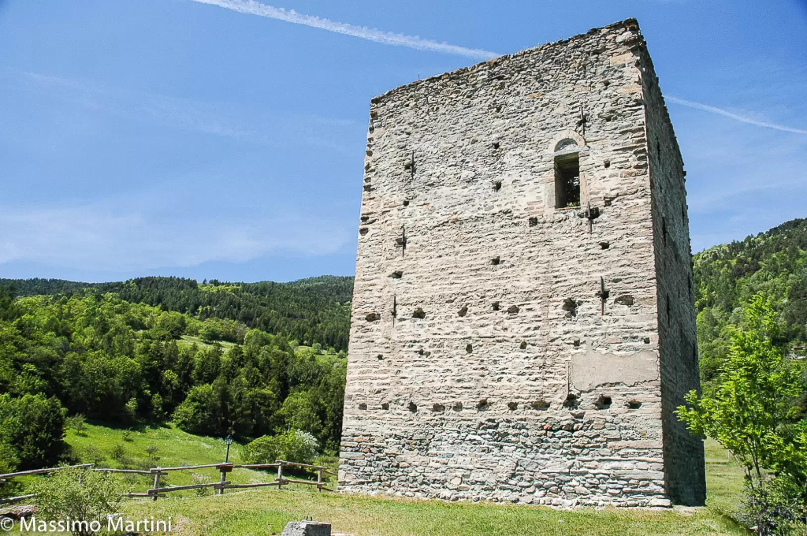
It is a very old settlement, as archaeologists have found evidence there dating back to pre-Roman times. In the Middle Ages, there was a castle there owned by the De Gignod family (or in the Latin version De Gignio), which was enfeoffed by the lords of Avise. The seigniory then passed from family to family, even passing through that of the Savoys, while the castle was dismantled in the 15th century to recycle the materials in the construction of today's parish church. Today, only the square tower of the old castle can be seen, but the church has some splendid 15th-century frescoes, brought to light during restoration work in 1895.
A purely agricultural centre, Gignod experienced an industrial interlude in the 18th and 19th centuries, when, due to the depletion of the woodland resources of Ollomont and Cogne, a blast furnace was built there to process the ore extracted from the respective mines.
As in all the villages of the so-called Comba Freida (those of the Gran San Bernardo valley), the carnival tradition is also very much alive here, during which the typical masks inspired by the uniforms of the Napoleonic army, which passed through these parts in May 1800, are displayed.
Information
Area: 26.00 square kilometres
Altitude: 988
Maximum elevation: Punta Chaligne (2607m)
Number of inhabitants: 999
Name in dialect:
Inhabitants name: gignoleins
Patron Saint:St. Hilary (13 January)
Website: www.comune.gignod.ao.en
Webcam:
Bordering communes: Allein, Aosta, Doues, Etroubles, Roisan, Saint-Oyen, Saint-Pierre, Saint-Rhémy-en-Bosses, Sarre
Villages and hamlets: Arliod, Arsanières, Buthier-Gorrey, Buthier-Verney, Caravex, Chambavaz, Champex, Champlong, Champlorençal, Champorcher, Chatellair, Chef-lieu, Chez Courtil, Chez Henry, Chez Percher, Chez Roncoz, Chez Roux, Chez Sentin, Clémencey, Colière, Cré, Crou, Faverge, Fiou, Gorrey, La Bédégaz, La Cau, La Chériéty, La Clusaz, La Condéminaz, La Forge, La Minchettaz, La Ressaz, Le Château, Les Côtes, Lexert, Maisonnettes, Meylan, Montjoux, Moré, Moulin, Petit-Quart, Perre-Besse, Plan-Château, Plan-Meylan, Planet-Côte, Planet-Plan, Rovin, Roysod, Savin, Seycinod, Tercinod, Valcartey, Variney, Véclos, Véfan
Alpeggi: