Alpe Ciof, from Pedesina


Edited by:
Marco Bonati
Updated at: 03/03/2026
Access
From Milan to Morbegno along state roads 36 and 38; at the roundabout at the entrance to the town turn right towards Valgerola. Go up the valley to the village of Pedesina: between the few houses turn right uphill and, after a few bends, park in a small square near the church of S.Rocco.
.Introduction
Short excursion of panoramic interest that leads to one of the mountain pastures that are still loaded, where the famous Bitto cheese is produced. The lower part of the route takes place on a mule track - at times very steep - immersed in a very suggestive mixed forest; at about 1500 m the terrain opens out onto pastures with sweeping views of the entire Valtellina section of the Rhaetian Alps and the nearest Orobic valleys.
Description
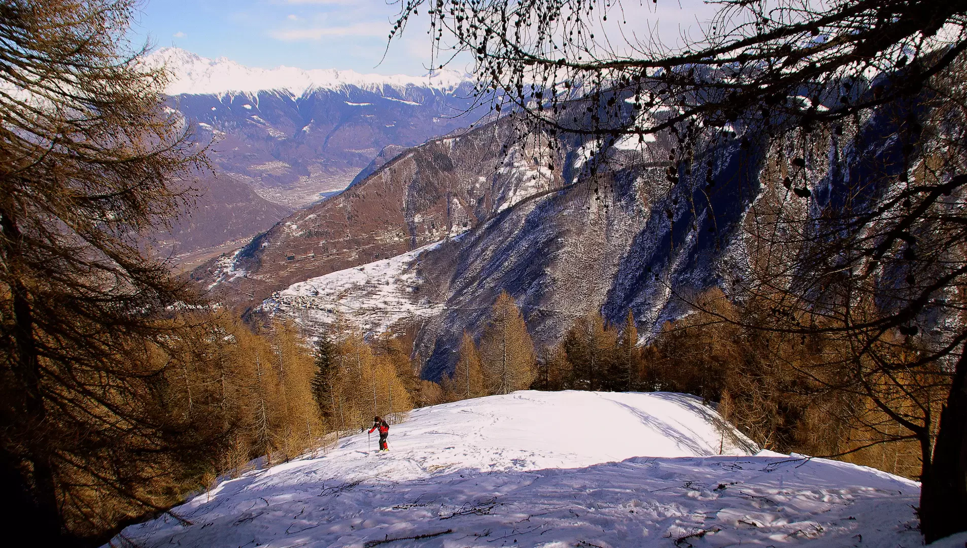
On the left-hand side of the little church, take the forest road, initially asphalted, which leads - according to the signs - to "Combana" and "Combanina". Continue along it for a long time and, after a large waterworks tollgate, near the current end of the track, climb steeply to the left on a stepped path. The path climbs in hairpin bends up the wooded slopes of the spur between Val Mala and Val di Pai; one often encounters ancient constructions dating back to periods when forestry and pastoral farming activities were scattered over the mountain in altitudinal bands of use according to the course of the seasons. Following the clearly visible signs in paint, one notices that one must always keep to the right at the main forks. After a very steep section, the path flattens out near a small waterworks hut (hut with signpost arrows) and, turning left, plunges into a very dense forest to be climbed in narrow hairpin bends. The vegetation soon ends and suddenly you come out onto the wide pastures of the huts at an altitude of 1509m: a beautiful view of the valley's best-known and busiest ski mountaineering destination, the Cima della Rosetta. Ignoring an arrow pointing to the left, one leans into the small valley on the right and - on powdery snow - begins the ascent of the final ridge: the slope is steep and the track, often not very solid, tends to give way downhill. The clearing narrows and, already in sight of the destination, you will cross a wide shoulder with windy and crusty snow
Beware of a steep hollow with dangerous accumulations on the left: the two huts of Alpe Ciof (1732m), recently renovated, are the panoramic arrival point.
Descent by the outward route. It is possible to avoid the last monotonous stretch on the forest track by paying attention - looking eastwards - to the appearance of the bell tower of the parish church of Pedesina: at that precise point steep meadows open up in the valley, leading just above the little church of San Rocco.
In the pictures illustrating the excursion, the use of skis instead of snowshoes can be seen: for alpine skiers, however, this itinerary is only a stopgap and requires large quantities of snow to be able to proceed comfortably through the woods.
Trail:
Signposts: red/white/red. 115 then 5. Often on logs, well visible.
Type of route: a/r
Recommended period: December, January, February, March
Objective hazard: none
Exposure to sunlight: east
Exposed sections:none
Water: -
Photo gallery
Comments (0)
Sign in to leave a comment