Col de Champillon, from Chatelair


Edited by:
Sergio Enrico
Last survey: 19/01/2005
Updated at: 11/02/2025
Updated at: 11/02/2025
Difficulty
MS
Length
0.00 Km
Departure altitude
1479 m
Arrival height
2709 m
Positive difference in height
1230 m
Round trip time
03h30'
Recommended period
Introduction
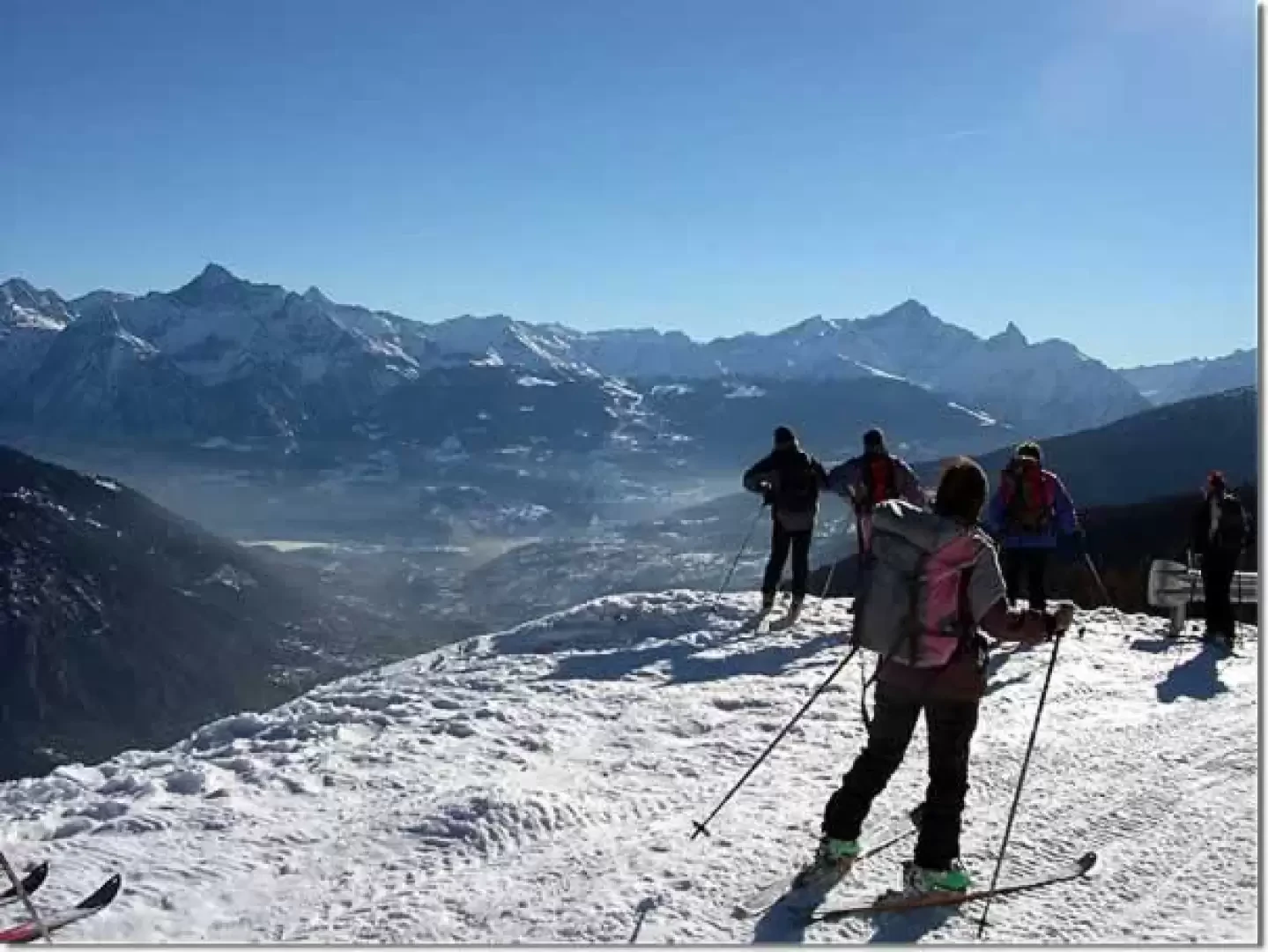
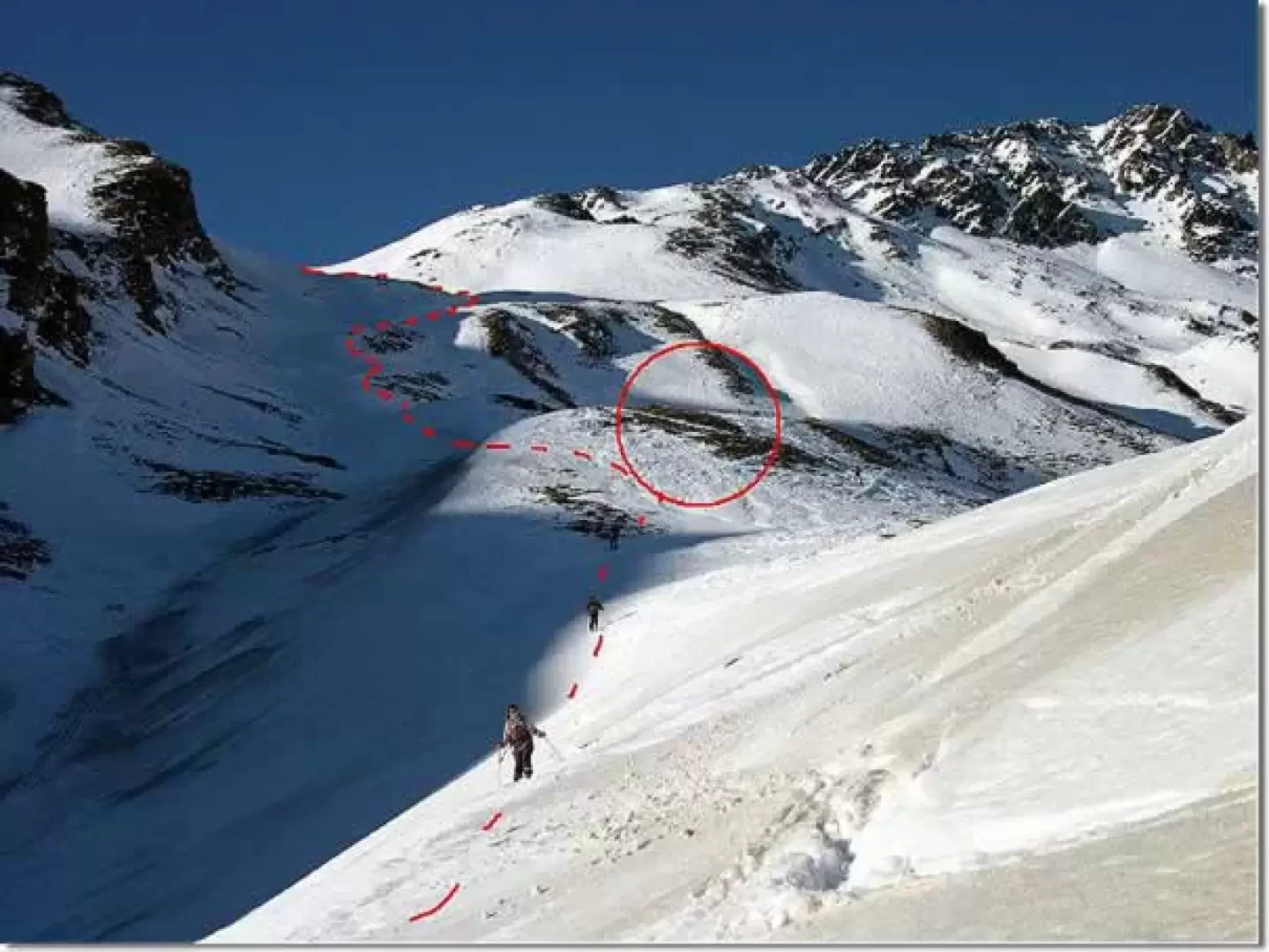
Beautiful hike on wide, very sunny slopes. The final part can be dangerous due to avalanches.
Description
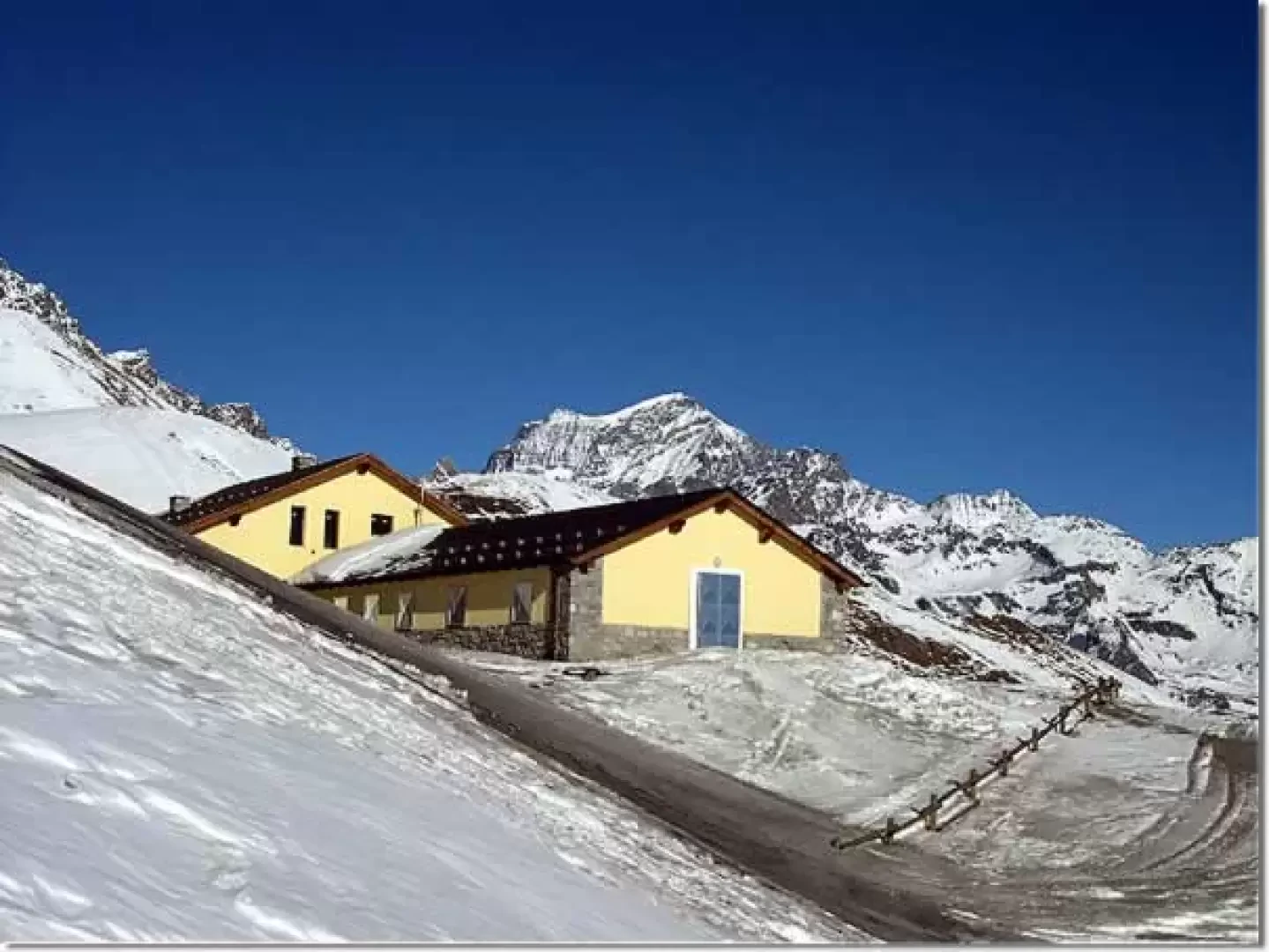
From above Chatelair, follow the slopes exposed to the east (with more snow) and then, without an obligatory path through meadows or along the road) to the beautiful Champillon basin. Climb up on the left towards the new Champillon hut. For the final stretch there are two alternatives:
- just before the hut go up to the left and then cross to the right (watch out for the steep slopes above) and with a steeper section reach the final little valley that leads to the pass.
Bibliography
- Alessandro Mezzavilla and David Pellissier, [[White Horizons Vol.1]], Martini Multimedia Editore, Saint-Vincent, 2004
- Sergio Enrico, [[Valle d'Aosta Ski-mountaineering itineraries]], Editions Pramotton, Pont-Saint-Martin, 2005
Cartography
- [[Gran San Bernardo, Ollomont]], Trail map sheet 5, 1:25000, L'Escursionista Editore, Rimini, 2005
Riferimenti Bibliografici
- Orizzonti Bianchi Vol.1 - Alessandro Mezzavilla e David Pellissier - Martini Multimedia Editore, Saint-Vincent, 2004
- Valle d'Aosta Itinerari sci-alpinistici - Sergio Enrico - Editions Pramotton, Pont-Saint-Martin, 2005
Photo gallery
© 2021 - Sergio Enrico
© 2021 - Sergio Enrico
© 2021 - Sergio Enrico
© 2021 - Sergio Enrico
© 2021 - Sergio Enrico
Comments (0)
Sign in to leave a comment