Mont Maudit, Kuffner Ridge


Edited by:
Giancarlo Beretta
Updated at: 18/02/2025
Access
Exit the motorway at the Courmayeur exit, follow the signs for the Mont Blanc tunnel and then for Val Ferret. As soon as you leave the road that leads to the tunnel, at a hairpin bend, you will immediately find a large car park, or, if you continue with your car, you will find two more car parks at the cable car departure station and, with this, you will drive up to the Rifugio Torino.
Introduction
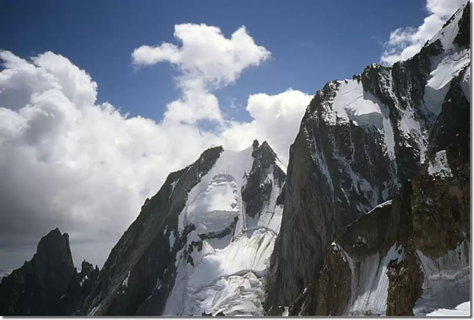
The itinerary follows the south-east watershed ridge, which climbs with rock and snow from Col de la Fourche to the north-east shoulder, and then reaches the summit. It is one of the most beautiful and classic ridge routes of Mont Blanc in a magnificent high mountain environment: varied, on mixed terrain and with very sharp and airy snowy sections. It is preferable to make the ascent at the beginning of the season, as with a shortage of snow it can become a dangerous point due to falling stones. It should also be borne in mind that the Alberico and Borgna bivouac, being also the starting point for the routes on the Brenva, Aiguille Blanche and Pilier d'Angle slopes, is usually crowded and has 12-15 places on planks to which the inevitable places on the floor must be added!
.Description
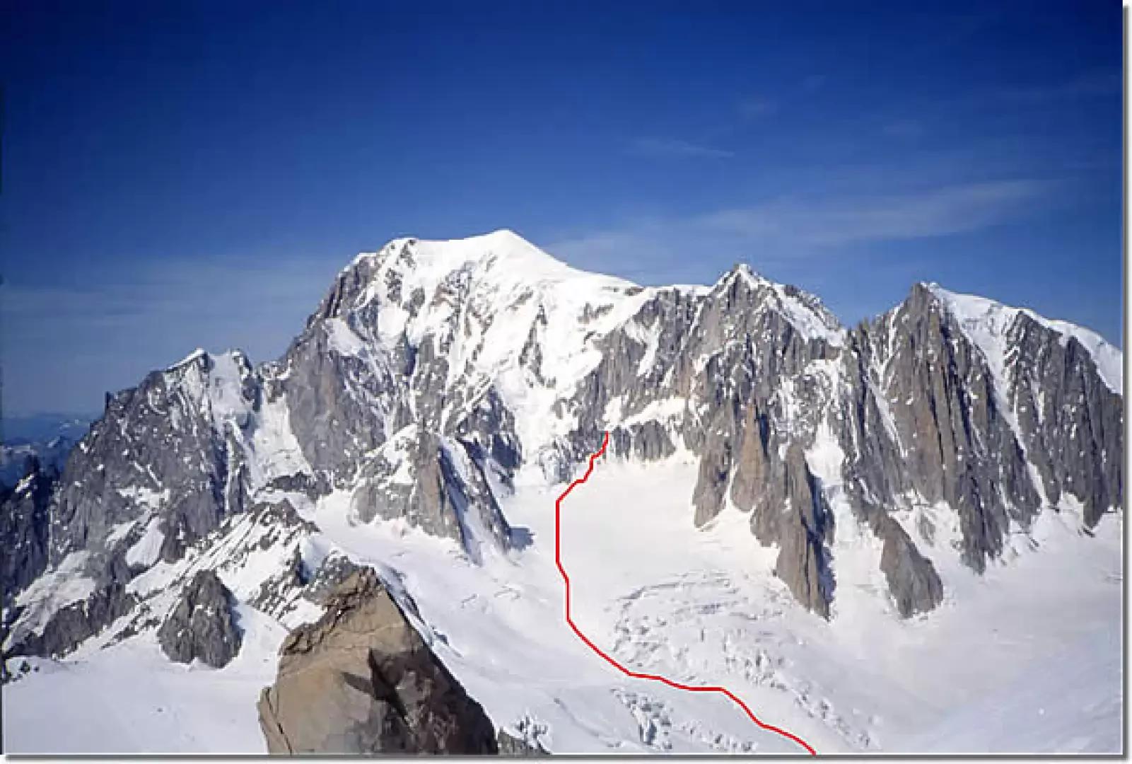
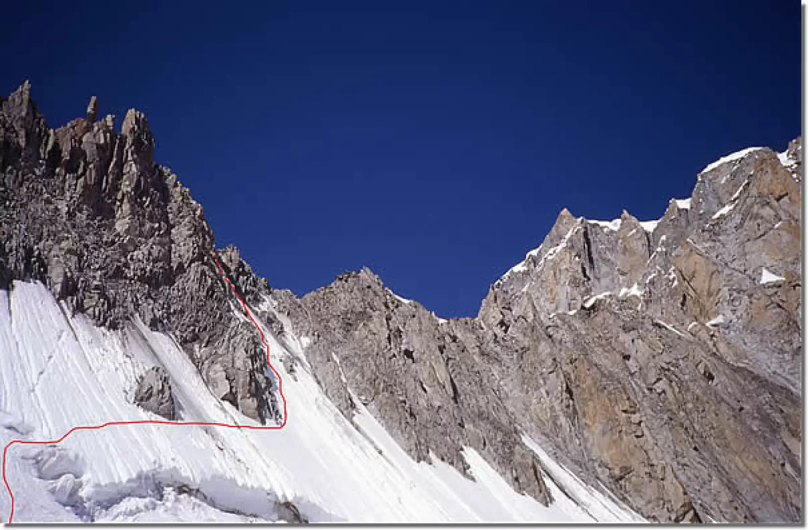
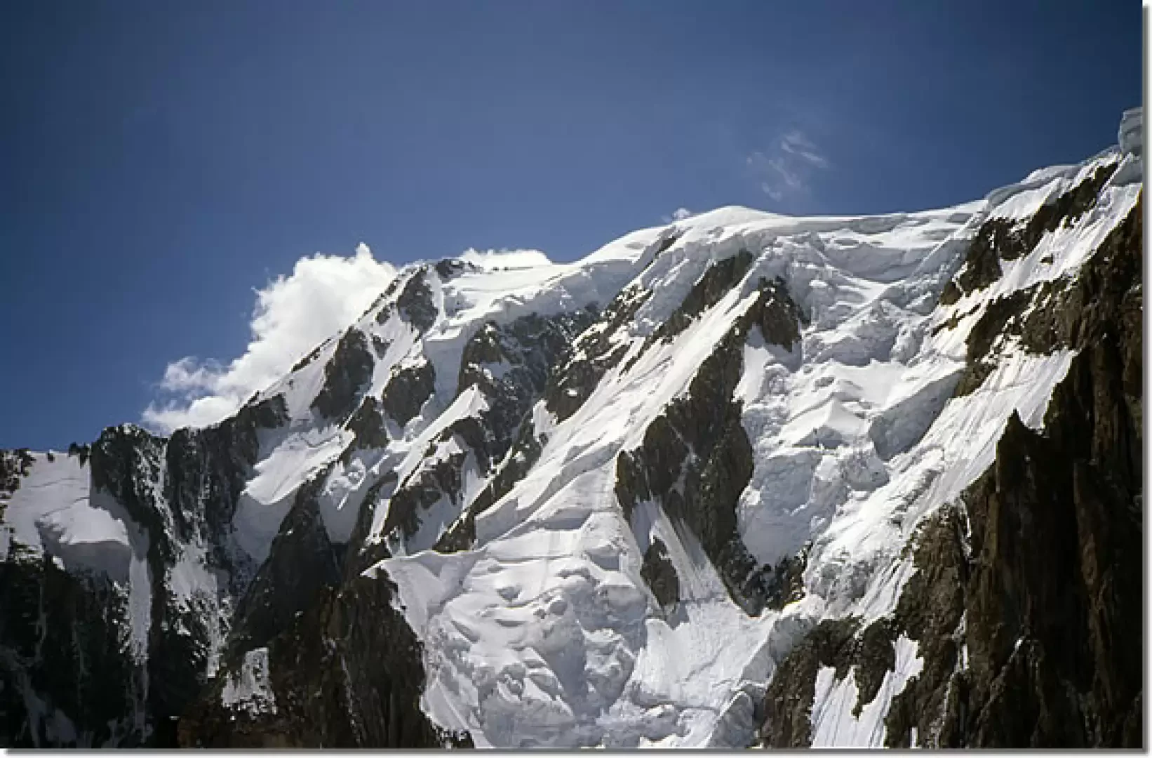
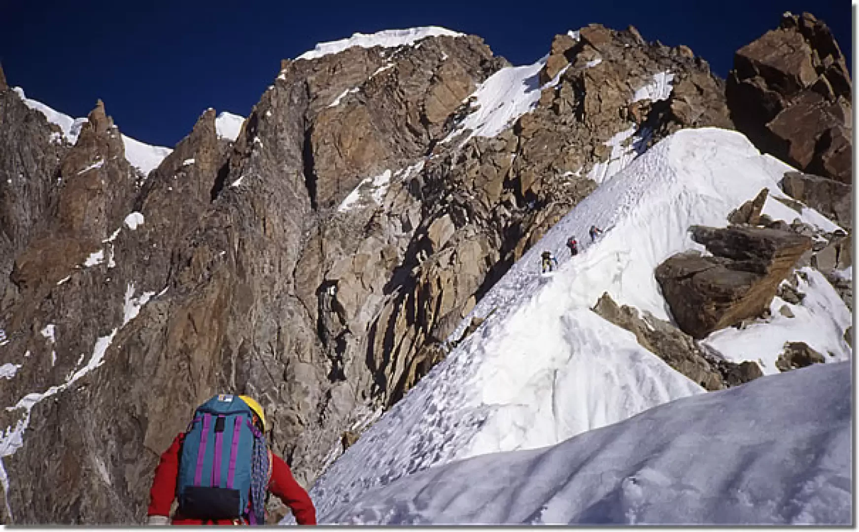
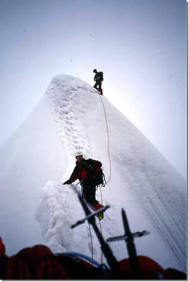
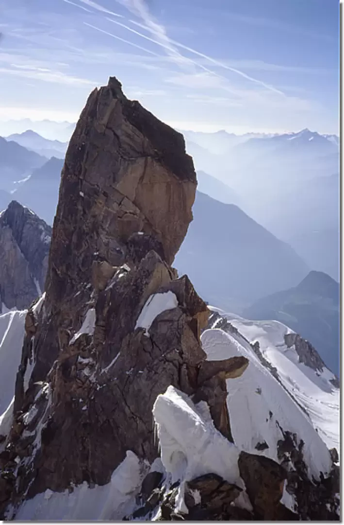
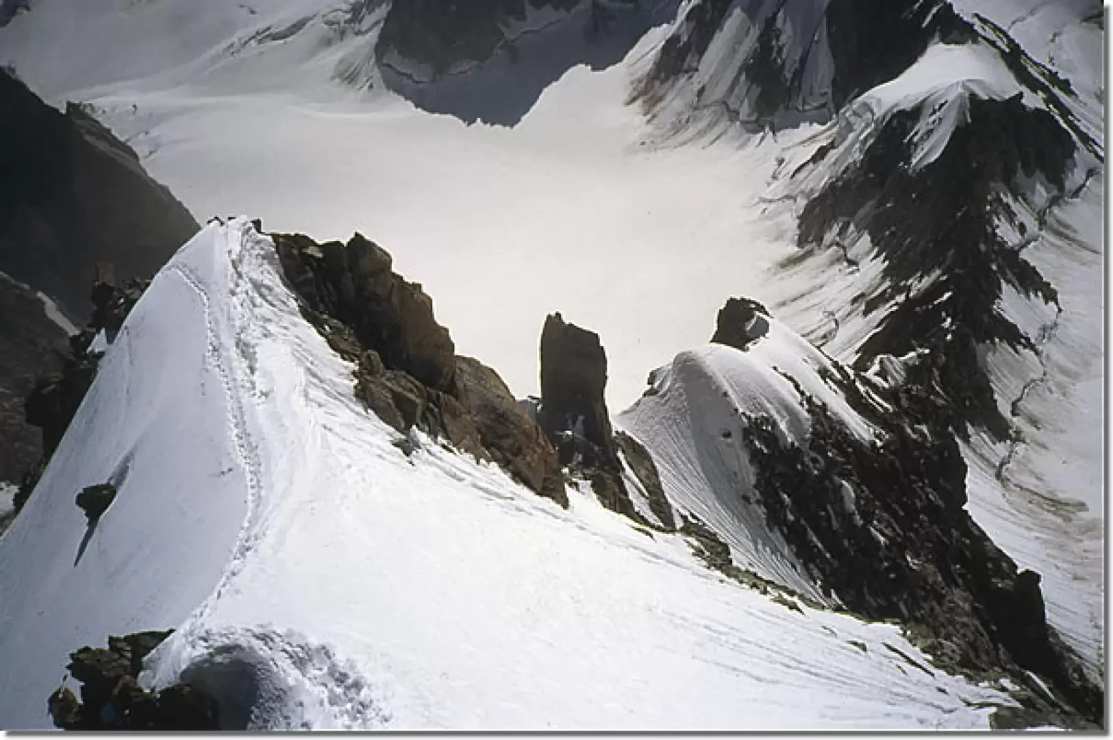
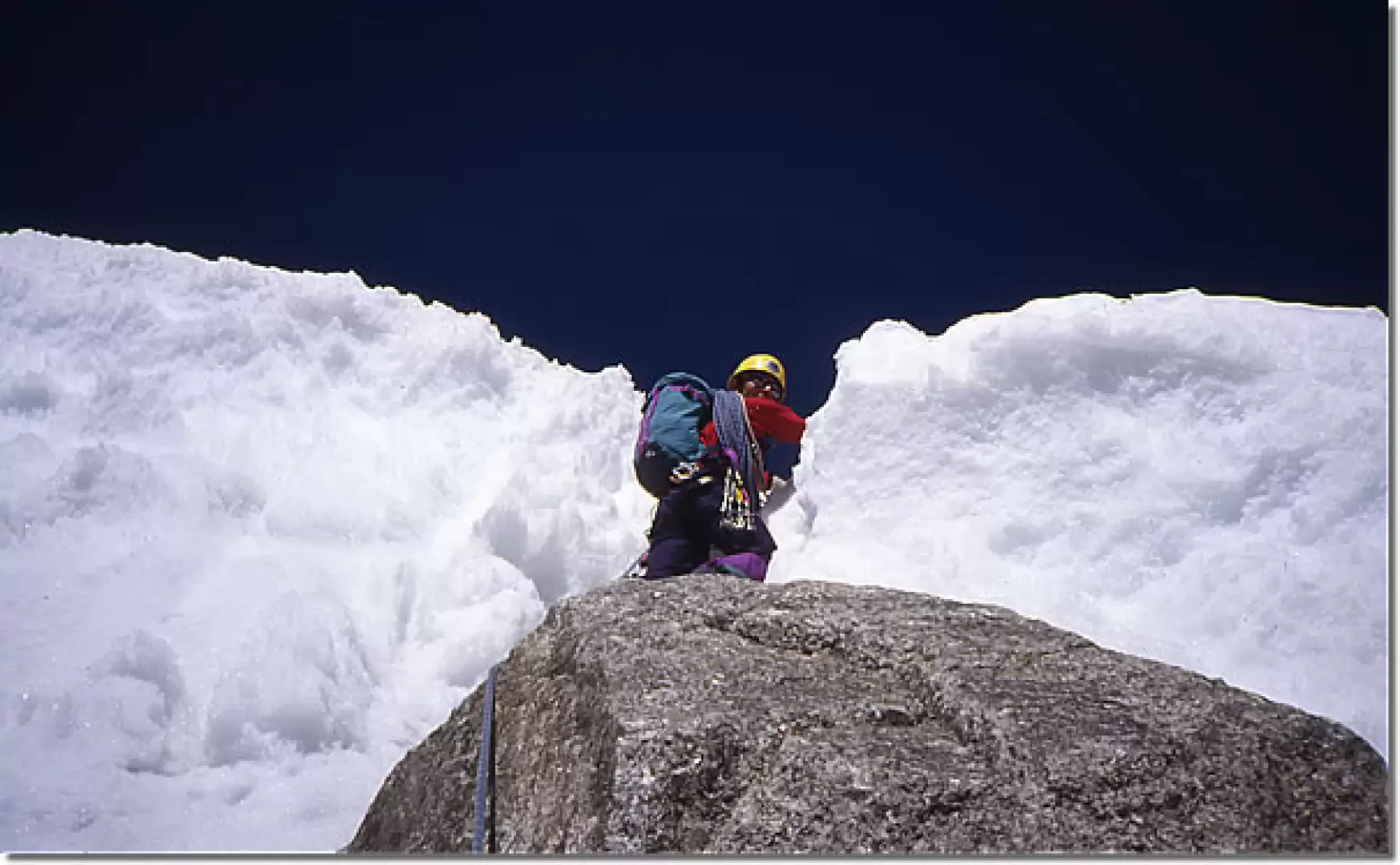
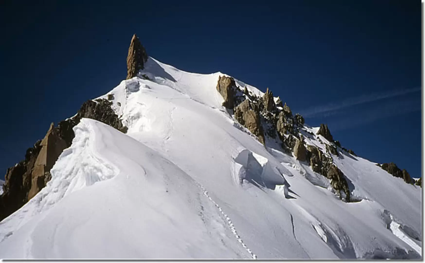
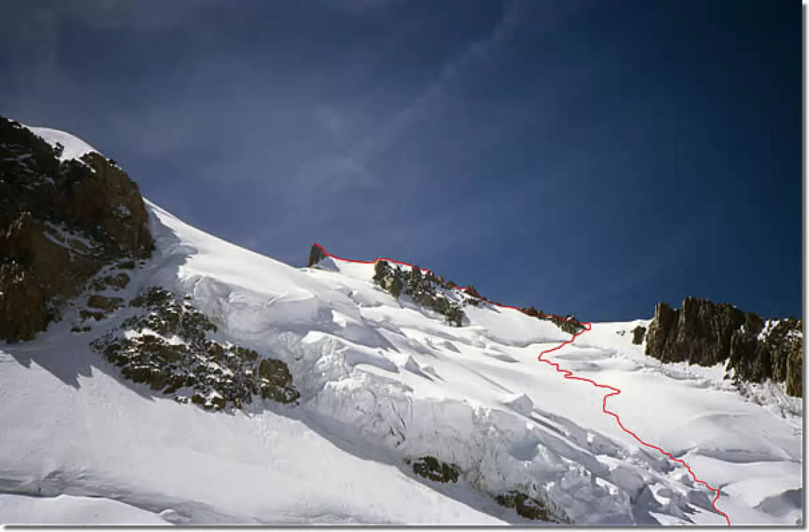
1st day The route to the Alberico and Borgna Bivouac from the Rifugio Torino is usually marked by numerous tracks: go over the Col des Flambeaux (under the aerial support pylon of the gondola) and turn left, descending until you pass the base of the steep north face of the Aig. des Toules (approx. 3300 m). From here, head westwards, passing to the north of the Tour Ronde, and over the gently sloping slopes of the high glacier of the Giant to reach below the icy chute to the right of the Trident. Once past the crevasse, which is high and difficult, climb the very steep slope (45°-50°) to reach the Col de la Fourche and, with a traverse to the left, the bivouac (3684 m), a splendid balcony overlooking the Brenva and the south face of the Maudit. If the snow is not in good condition, the rocky rib to the right can be crossed. Day 2 From the bivouac, follow the horizontal ridge first over mixed terrain and then over a sharp ridge of snow (delicate) to reach a snowy slope to the right, where the ridge begins to climb (given the length of the route, this section is best tackled in the dark). From here, follow the ridge up to a first large rise, where you continue to the left on the snowy bottom of a wide rocky gully. Take the ridge again where it becomes snowy and leads above the first prominence. After a thin, airy shoulder, you reach the foot of the rocky Pointe de l'Androsace (4107 m), which can be bypassed or climbed over. To go round it, descend a little to the left (Brenva side) and cross the snowy chute to then climb up via a little gully to the snowy ridge above the point (dangerous due to unstable blocks in the absence of snow). Climb up rock and mixed terrain a little to the left (IV passage), where a ramp-channel takes you back to the ridge after 'piercing the cornice' . Along the ridge, you first reach the snowy shoulder where the ridge that climbs from Col Maudit joins, then on mixed terrain the airy north-east shoulder (4346m). From here, a beautiful snowy ridge with cornices leads below the rocky summit tower. This is circumvented to the right and from the west you reach the summit. Descent From the summit rocks, head, following the tracks of the normal route and climbing over or around some rocky gendarmes, to Col Maudit, slightly up the west shoulder of Mont Blanc du Tacul and then descend to Col du Midi. From here there are two possibilities:
- Get to the Aiguille du Midi and take the gondola to the Rifugio Torino, or descend to Chamonix and take the bus to Courmayeur.
- Follow the numerous tracks up the Giant's glacier, passing alongside the bold granite walls of Mont Blanc du Tacul, to reach the Rifugio Torino (2 hours or so from the Col du Midi).
Photo gallery
Comments (0)
Sign in to leave a comment