Uja of Calcante

Edited by:
Marco Andreis
Updated at: 03/09/2024
Introduction
Interesting itinerary at the entrance to the Valli di Lanzo. The ascent to the Uja di Calcante also allows you to cross the Lunelle, one of the first rock gyms for Turin climbers.
Description
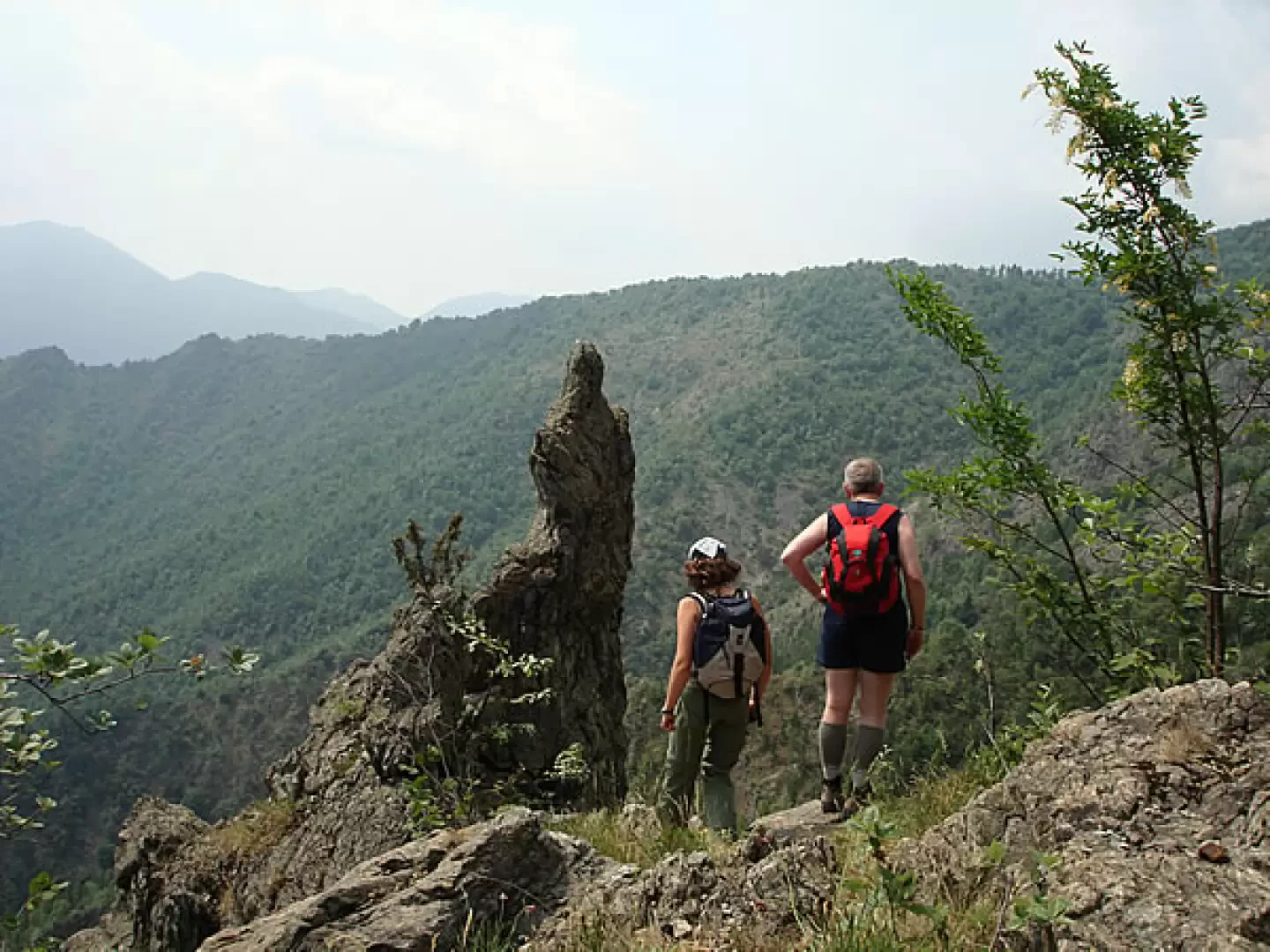
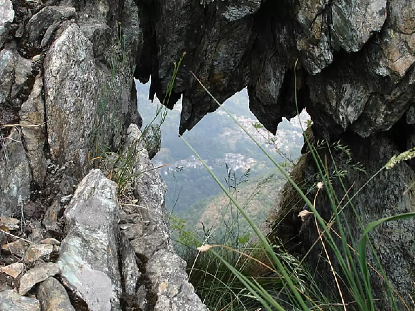
Before setting off, at the square, it is advisable to stock up on a good supply of water, as there will be practically none to be found for the duration of the hike. From the square, continue along the main road, which enters the village, for about 200 metres, then a series of wooden signs on the right indicate the start of the route and the approximate time required (the path leading to Lunelle was named a few years ago after Piergiorgio Frassati). Leaving the road, we pass by a characteristic covered wash-house and then, turning left, we enter the middle of a group of houses that has preserved, without too many inappropriate alterations, the appearance it had in the first half of the last century. Having passed the houses, and still following the wooden signposts, one ascends gently along a pleasant path through the woods and, in about 30 minutes, comes out on a characteristic plateau (where a picnic area has been set up) known as "Pian Bracun" (whose etymology may be found in the Celtic "brac" - uncultivated). The plain (approx. 800 m), once completely cleared of vegetation, is today colonised by a beautiful birch forest and popular belief has it that it was here that the witches' sabbath took place. They used to dance to the sound of the violin from which the notes were drawn by none other than the devil himself, who sat on a characteristic (the only) rock protruding from the ground and which has a hollow just shaped like a comfortable seat. With a short digression to the left (with respect to those ascending from the path), one can arrive, about 50 metres further up, on a hilltop called "Crus d-l'Ënvérs" (Cross of the Inverse - meaning the north-facing slope) where there is a characteristic little stone oratory with a large wooden cross in front of it, relocated years ago to replace a pre-existing one; From this point, it is possible to enjoy a good panorama that sweeps from the Lunelle and Calcante ridges, to the entire valley of the 'Rio Ordagno' (which springs from the Calcante slopes), to the village below and as far as the entrance to the Lanzo Valleys. From Pian Bracun, start climbing again on the right (ignoring the path that leads to a nearby mountain hut on the level) along a well-marked path that, with a constant but never excessive gradient, and with a few wide bends, rapidly gains height along the slopes of the 'Cima del Toro' in an arid and sunny environment (decidedly hot in the heart of the summer season) with rocky outcrops and vegetation characterised by shrubs and conifers, planted for reforestation purposes in the period between the two world wars. After about an hour from Pian Bracun, the path becomes almost flat and crosses a stretch of thicker, cooler woodland to lead, after turning over a ridge ("Cre d-la Vërnëta" - Cresta della Vernetta, named after a group of huts below), into the sunny hollow of "Funs ët-Calcant" (Fondo di Calcante). From this point, it is possible to complete a ring-route that takes you to both the Lunelle ridge and the Uja di Calcante (ascending first on one or the other at your discretion), and then return here, or simply go round one of the two. Either way, the area is definitely interesting. Following the path that leads into the aforementioned 'Funs ët-Calcant', in a few minutes you reach a fountain (the regularity of the flow is not guaranteed) and, immediately afterwards, you cross a mining site that was of great importance to the economy of the Valleys in the 19th century. From the slopes of Calcante, where the entrances of several mines are clearly visible, iron, copper and nickel ores were extracted, which contributed to the strong development of the forges for the manufacture of nails in Traves and which made our ancestors say that 'Calcante and Pietra Cagna (mines above Groscavallo - high Valleys of Lanzo) are worth more than France and Spain'; the mines were exploited at the end of the 1800s by an English company, but already in 1289 a company of smiths obtained a concession from William VII of Monferrato to exploit the mines in the area. Curiously enough (but only due to an error), in the I.G.M. cartography, the Calcante mines are indicated as 'abandoned gold mines'; for those interested in delving deeper into the subject, there is a short publication edited by Ezio Sesia di Mezzenile entitled 'Il Calcante e Pietra Cagna valgon più di Francia e Spagna'. Returning to the original path, one ascends again on the right, in an area of rocks, scree and shrubs, for about 30 minutes, to the crest of a grassy hill from where the marked path descends, on the northern slope, opposite that of Traves, towards the hamlets of the municipality of Mezzenile. From here on, you are on the rocky and sharp Lunelle ridge; keeping to the south-eastern slope, which faces towards the 'Funs ët-Calcant', some red marks allow you to continue for a short distance, then it is necessary to slow down a little in order to look for the best passages on the rock and in the grassy gullies (without any difficulty if one avoids both stooping too low and exposing oneself too close to the top of the ridge, which precipitates dangerously on the northern slope) until reaching an evident collar that cuts deeply into the ridge (where a memorial stone is clearly visible, recalling a fatal accident that befell two mountaineers at the beginning of the last century) then always moving through a series of small gullies and grassy ledges, you easily reach the highest point of the crest (about 30 minutes from the grassy col) where, on a small, very airy clearing, there is an iron cross and where the climbing route that climbs from the Mezzenile side also arrives. Lunelle (1434 m) constitutes, with Rocca Sella, one of Turin's oldest climbing gyms, whose first 'academic' ascent dates back to 1905 by the Academic Alpine Club of Turin; the most famous passage is Placca Santi, probably from the surname of its first climber, and well-known mountaineers of the early 1900s found their deaths on its routes: in 1921 Rovere and in 1927 Augusto Domasi and Alfredo Morello. The most famous frequenter of the Lunelle was undoubtedly the young Pier Giorgio Frassati (today beatified by the Church) who walked the Traves path, with two friends, on his last excursion: 7 June 1925, less than a month before his premature death in Turin on 4 July from fulminating poliomyelitis. From this point, it is possible, following the airy rocky ridge in a south-westerly direction with all due caution, to reach the Uja di Calcante (1614 m) in less than an hour, from where, particularly on clear days, you can enjoy a panorama that sweeps from the head of the Lanzo Valleys to the plains of Turin and the lower Canavese. From the summit, heading south along trail tracks, you descend to the 1,400 m of the Pra Lorenzo pass (on the watershed with the Viù Valley) and then quickly dividing towards the 'Funs ët-Calcant', along a path that is not always easy, you return to the area of the mines and then to the closing point of the above-mentioned ring-route. Here again, it is worth dwelling on the name of the Uja: Chalcedes; in mythology, Chalcedes was a priest of Apollo and a soothsayer in the Greek army, and his answers were considered to be an interpretation of the will of the gods; it was Chalcedon who suggested to Agamemnon that he appease Diana (outraged against him, who had killed a doe consecrated to her) by sacrificing his daughter Iphigenia to her, and when Troy was taken by the deception of the wooden horse that concealed the flower of the Greek heroes, Chalcedon, who had been surpassed in the art of divination by his emulus Mópso, died from the pain of the defeat suffered. It is certainly singular to find, in an area where the names of peaks are linked either to purely local toponyms or to their climbers, a peak whose name is even imported from Greek mythology and which constitutes the first significant peak to be seen as one enters the Lanzo Valleys. If you do not wish to follow the circular route, return from the Lunelle ridge to the col with the memorial stone and walk back along the rocky ridge (the path from the memorial stone down the northern slope is not recommended, as it is extremely uncomfortable and slippery in the first section and overgrown with bushes and brambles further down, and would also involve a tiring ascent, to the right, and then the outward path to Pian Bracun, where, on the opposite side of the path to the one you came up from the Villa, an evident path descends until it intercepts another, wider and flatter path, called "Vi d-la rooia" (path of the rivulet), bordered by a characteristic small open-air canal that carries the water captured in the Ordagno stream to the wash-houses of the hamlets of Bertolè and Andrè di Traves; an interesting and ancient hydraulic work that has also recently been the subject of specific studies, especially for degree theses. Descending from Pian Bracun, when you reach the "Vi d-la rooia", you must obviously turn left (otherwise you will return towards Calcante) and follow the path, ignoring the various detours that branch off, until the path first becomes a dirt track and then an asphalt road in the hamlet of Fontana, from which in a few minutes you reach the main road and then the church square.
.Photo gallery
Comments (0)
Sign in to leave a comment