The Dosso di Sant'Antonio


Edited by:
Marco Bonati
Updated at: 30/11/2025
Access
From Milan to Morbegno along state roads 36 and 38; at the first traffic light in town, turn right towards Valgerola. Follow the provincial road until just beyond Rasura, where you should look to the right for the road signposted "Bar Bianco". Continue steeply uphill until you enter a forest: note carefully a small yellow sign with the words "Dosso di S.Antonio - 20 min.". Look for parking nearby, at the side of the road.
Introduction
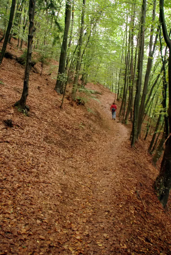
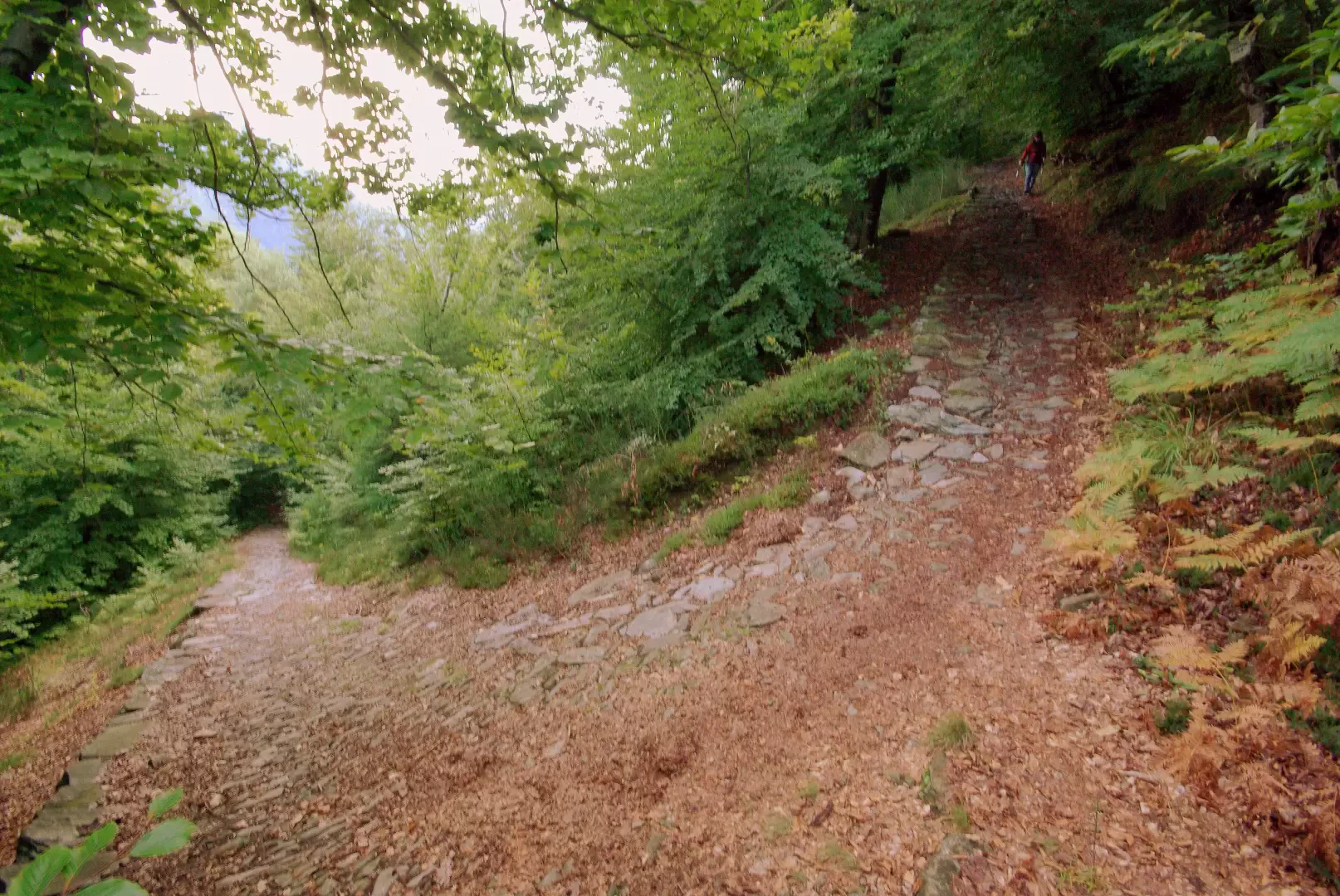
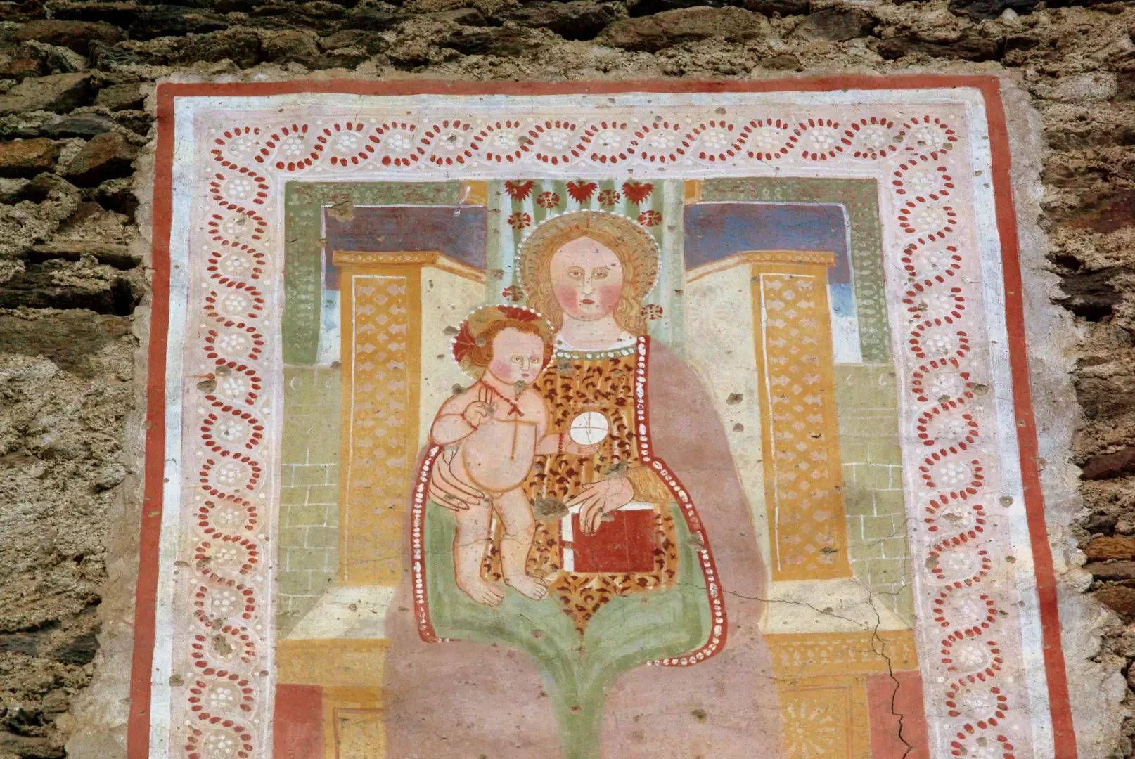
A very pleasant excursion, completely looped, which takes you across several maggenghi at the entrance to the Valgerola. You pass along quiet, shady paths and on an ancient cobbled mule track that is still in excellent condition. The huts that one encounters are often well restored to holiday homes, sometimes with remarkable frescoes.
Description
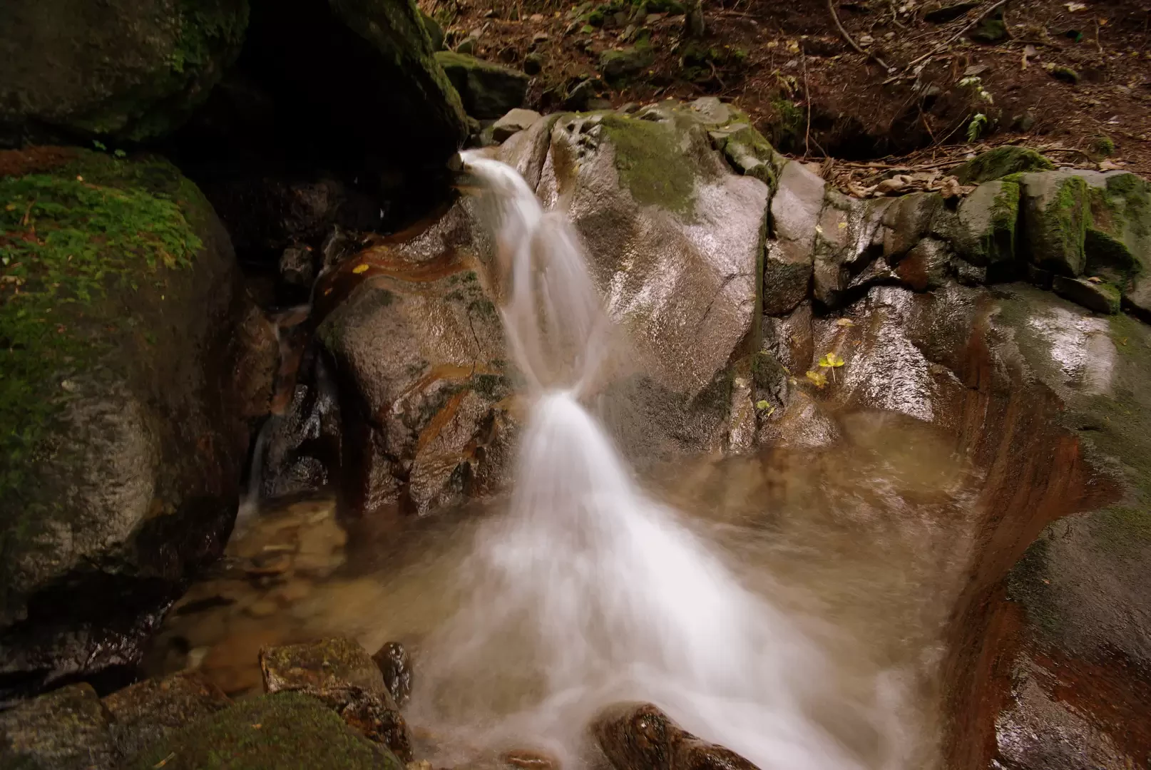
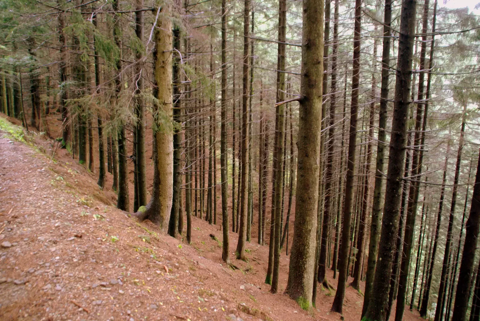
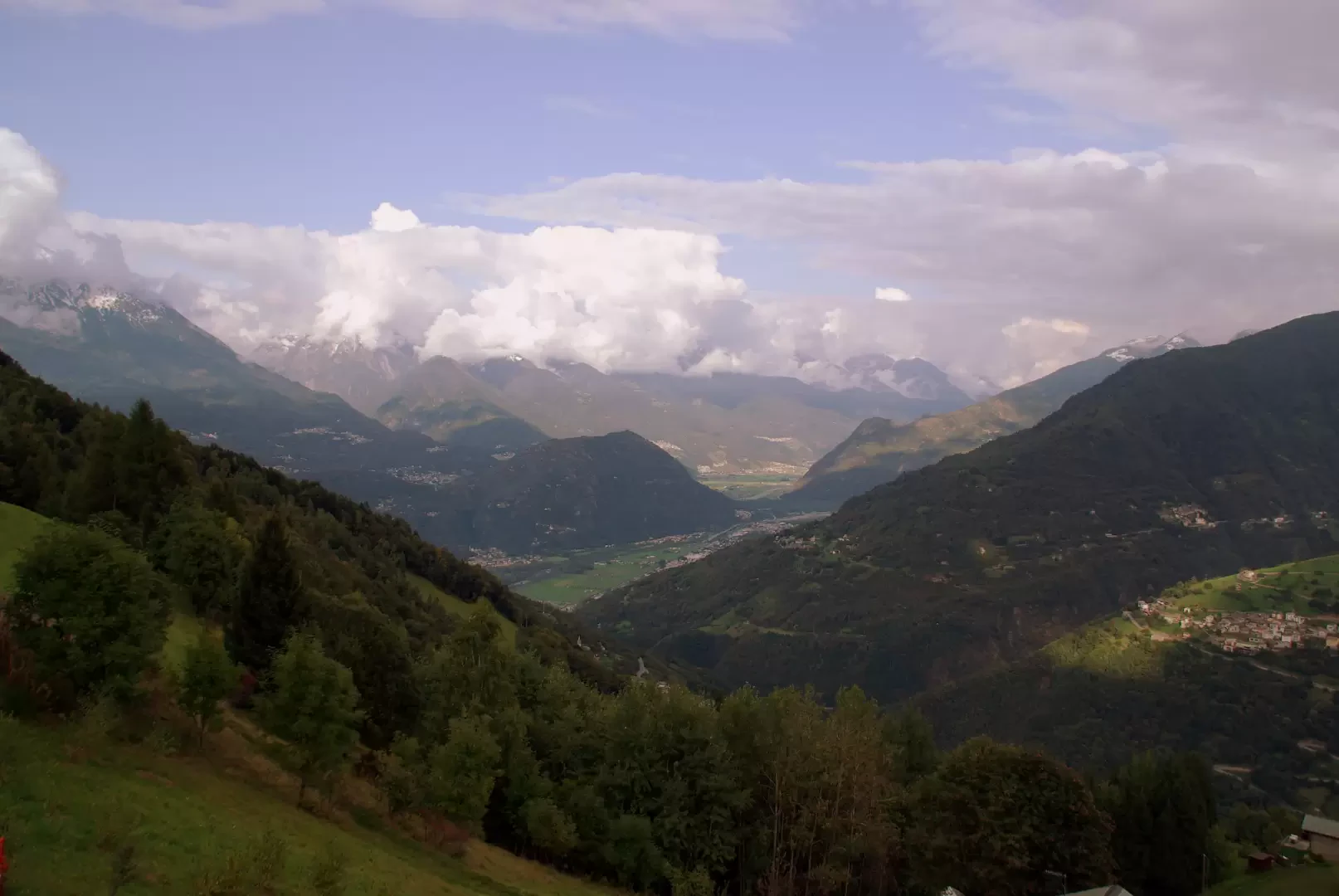
From the yellow 940m signpost at the hairpin bend, follow an easy path to the left which, after passing two mountain huts, enters a forest of tall fir and beech trees; with a gradual ascent, you come alongside a small valley crossed by the Fium stream - note some potholes - and then cross it over a concrete bridge. Neglect the cart-track that descends to the right in favour of a fine uphill track through steep meadows with scattered refurbished huts; finally come out onto the tarmac road that joins Rasura with the alpine pastureland of Corte and follow it to the right for a few hundred metres. At a sharp bend to the left, inside a forest of silver firs, at a barely visible gravelly clearing 1250 m, take a level path to the right. At the next two forks, with no possibility of error, choose to descend to the right; at this point you are on the spectacular cobbled mule track that joins Alpe Corte to Sacco (the first village in Valgerola and a hamlet of the municipality of Cosio Valtellino). The descent is long and increasingly steep - very slippery in wet weather - and at the end there is a series of hairpin bends suspended on dry stone walls that provide the necessary inclination (in winter, with the track covered in icy snow, the 'parabolic' bends helped to keep sledges laden with hay or timber on track). The cobbled track ends abruptly on a cemented road to be followed to the left; passing a couple of adjacent meadow hollows, you arrive at the high houses of Sacco 700 m. Before continuing on, it is worth visiting the small centre: its parish church, the Omo Selvadego museum and in search of houses with ancient frescoes. On the way back, take Via Mellarolo, which, with a moderate but steady climb through recent coppice woods and isolated huts, leads to the hamlet of the same name, preceded by the steep meadows of the Sponda district. Between the houses of Mellarolo 816m, continue as far as a hairpin bend: go up to the right and, near a poorly visible wash-house, descend on a grassy path; cross the Fium stream again and, with a steep ascent in places, you reach the high houses of Rasura 762m. On an asphalted road, to be followed uphill, you reach the final route taken by car: in a few hundred metres you arrive at the car park.
.Galleria fotografica