Tete des Cretes, from Plan Débat


Edited by:
Benedetto Lorusso
Updated at: 04/10/2025
Access
From the Aosta exit of the A5 motorway, follow the signs for Gran San Bernardo. After the second tunnel, take the road to Valpelline and then the diversions on the left to Doues. From this village, follow the signs for Champillon to the large car park at Plan Débat.
.Introduction
Description
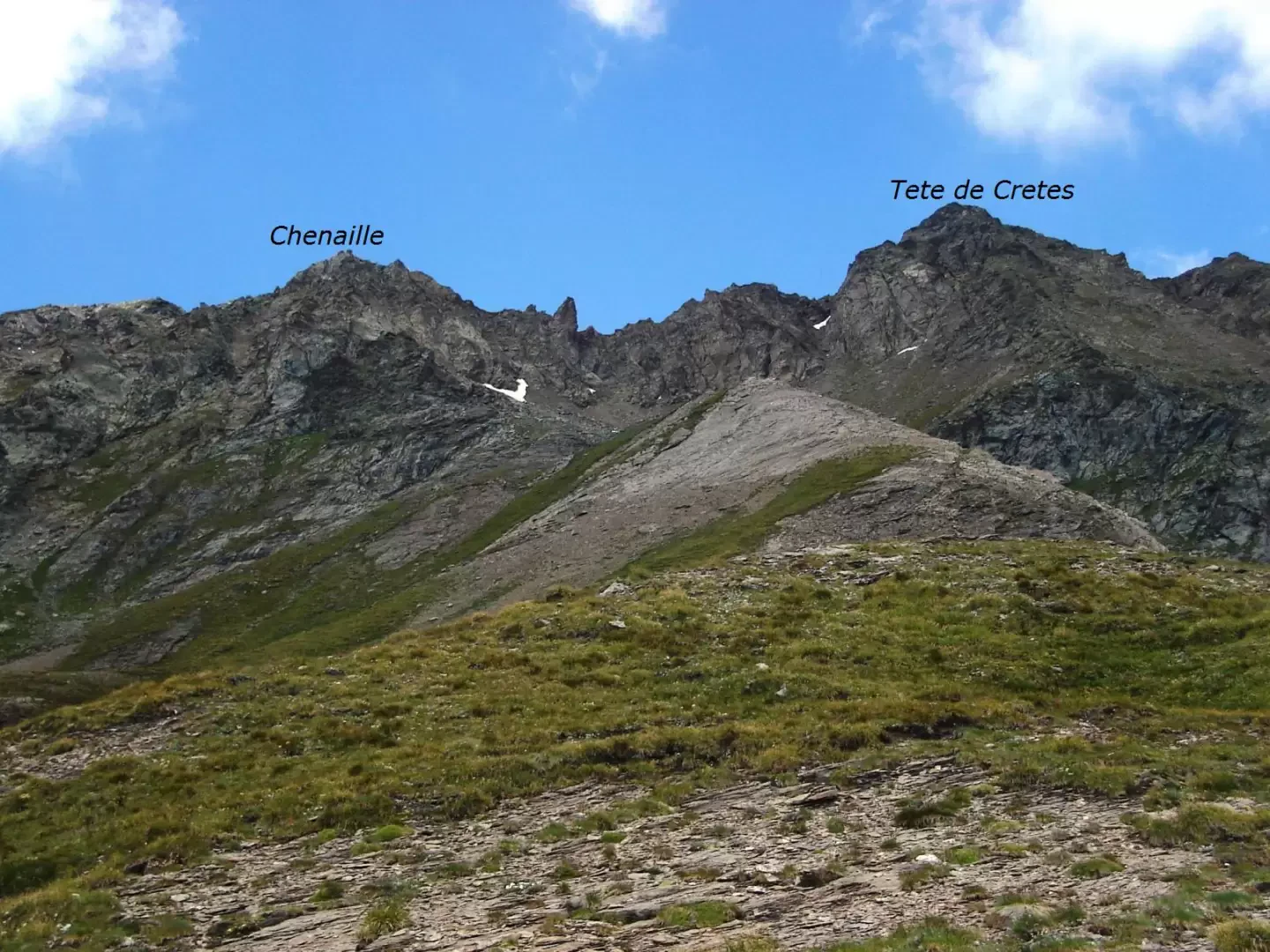
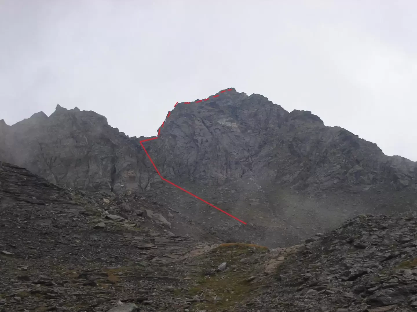
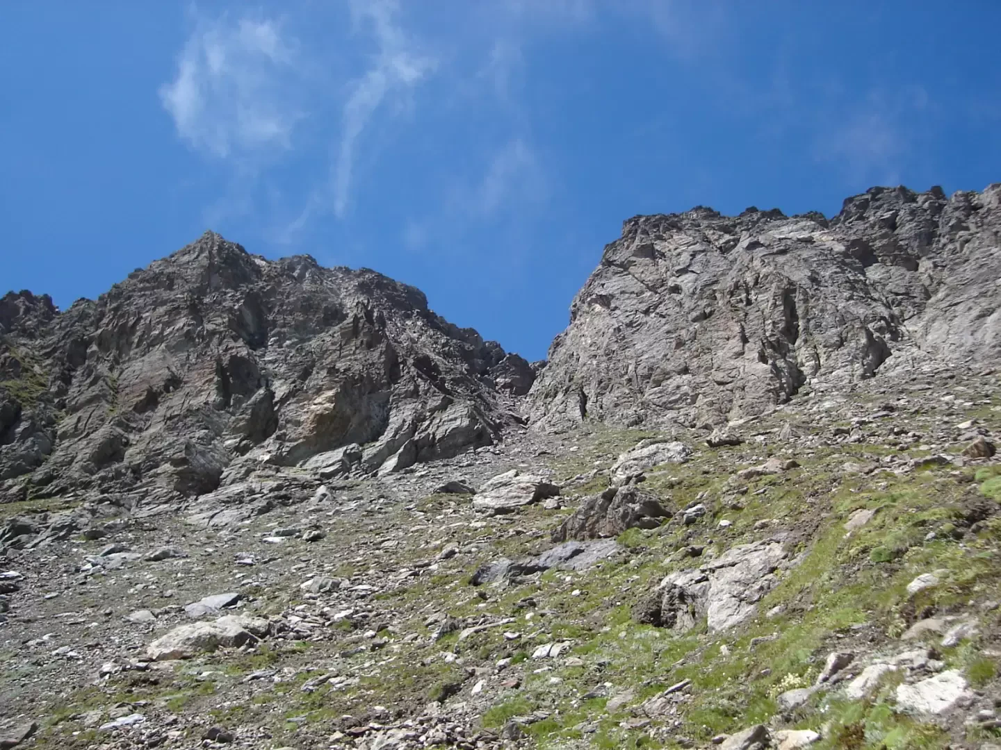
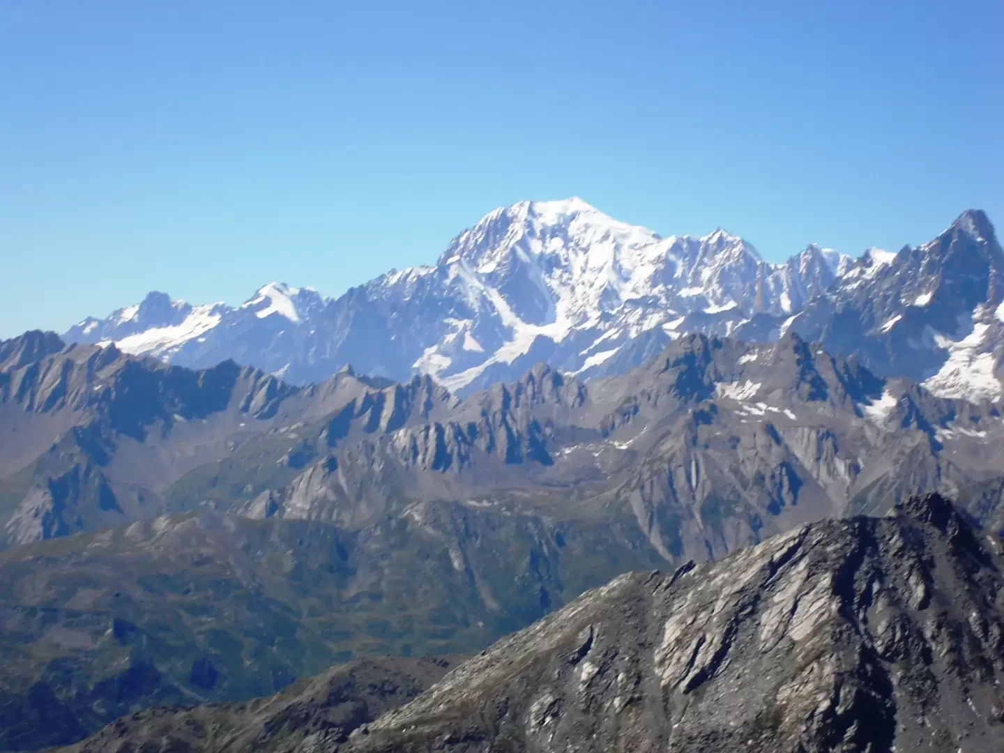
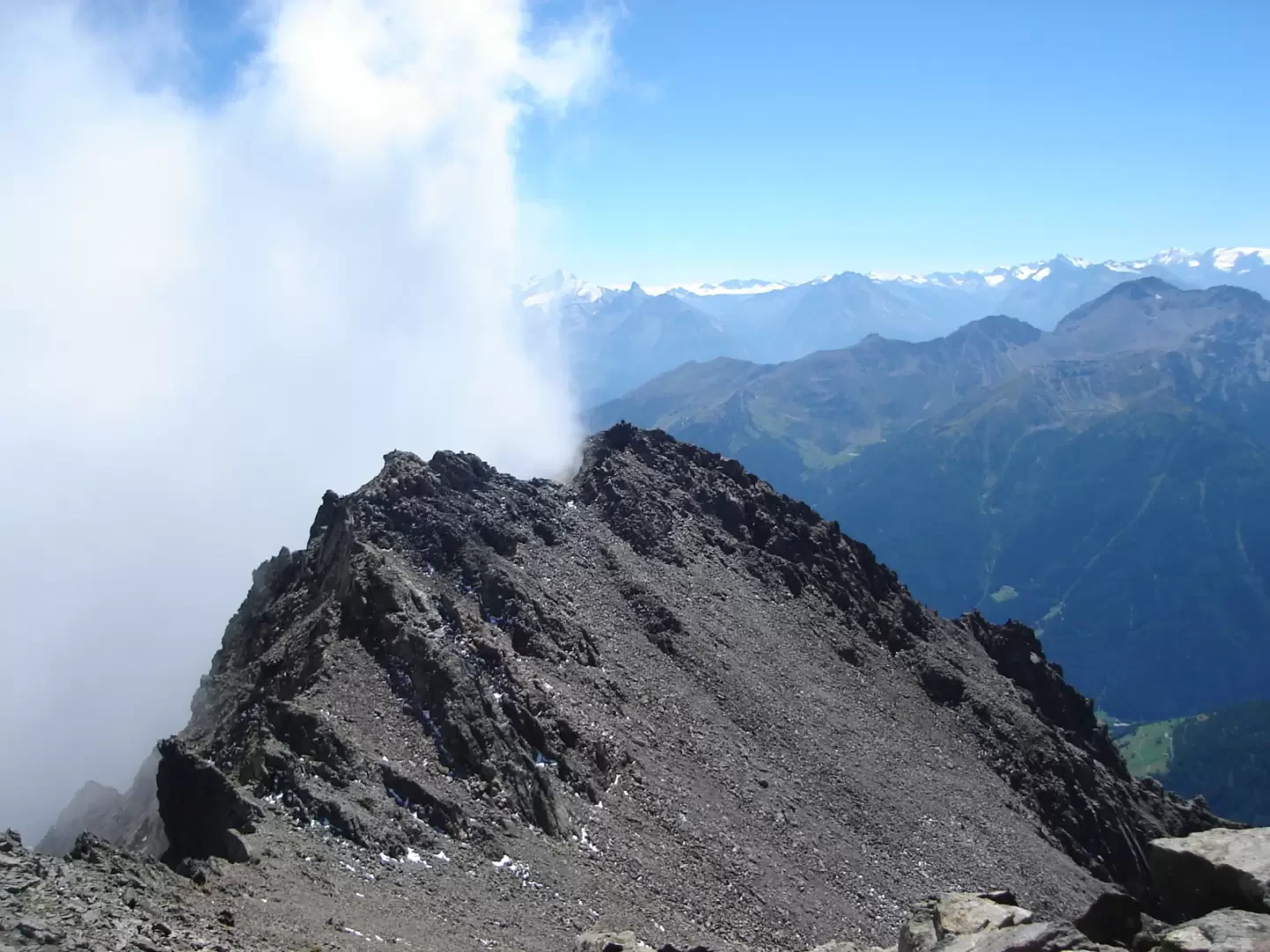
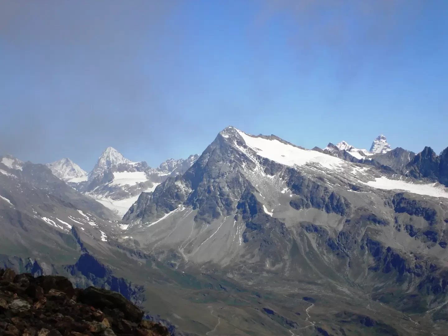
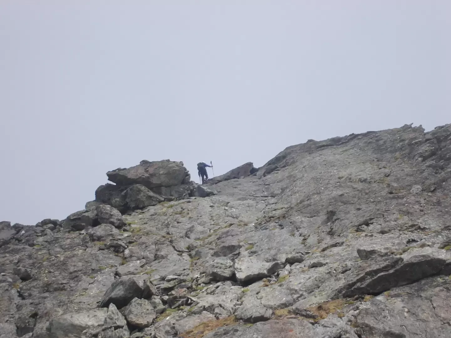
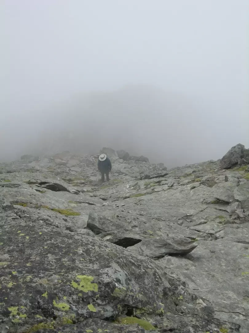
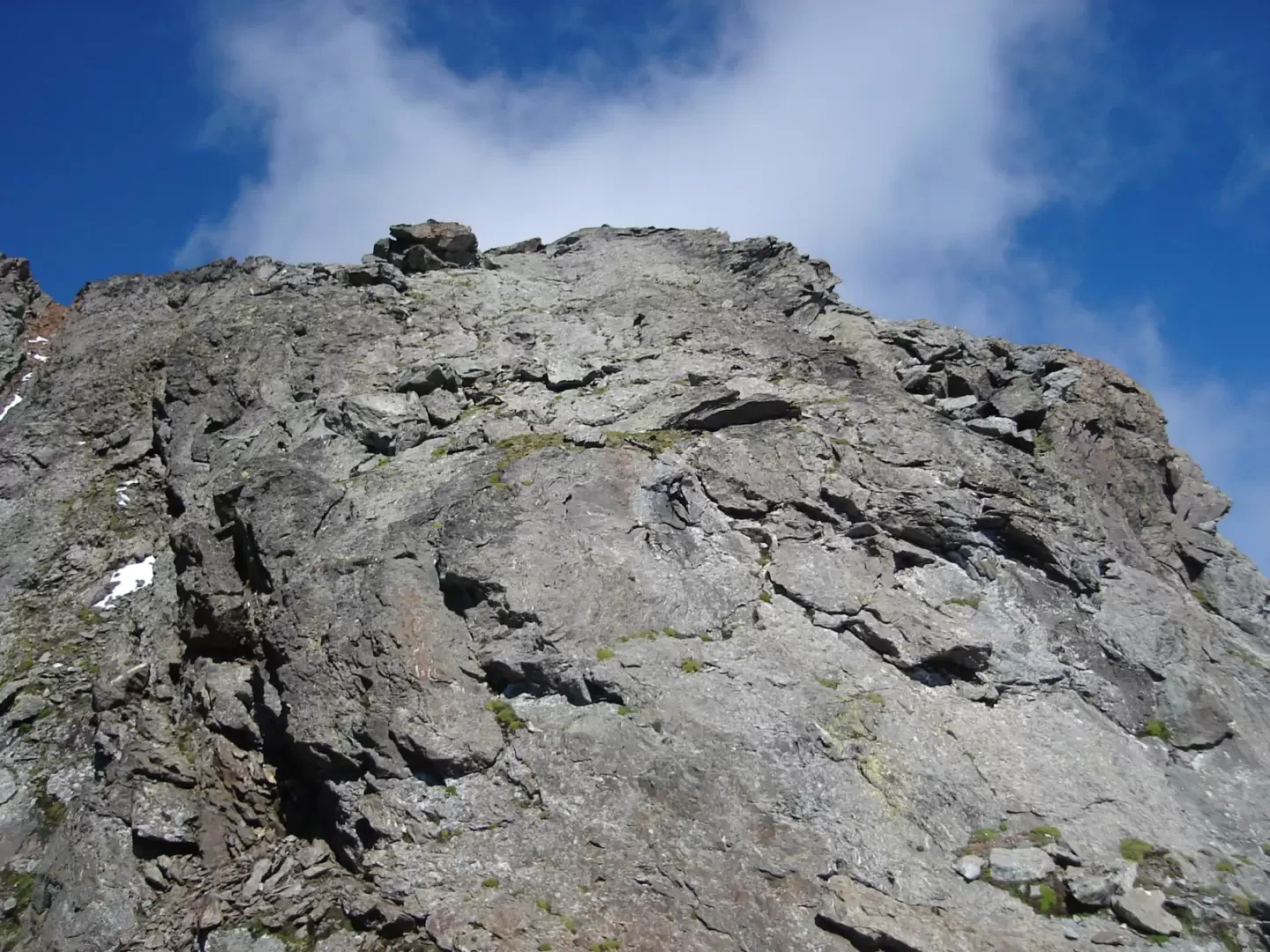
From Plan Debat (2076m), follow the trail to Rifugio Letey al Champillon, as far as the Tsa di Champillon (2297m), to leave it and follow a service road to the right until it turns left to head towards some hydraulic installations. It is then abandoned to reach, on cattle tracks, the crest that descends from Mount Chenaille and divides the Comba de Champillon from the Comba de Crêtes. This ridge can also be reached from the Comba de Crêtes, leaving the farm road that leads to the Tsa d'Ansermin to reach the barn on the left at an altitude of 2234m, from where a path reaches the ridge. Follow the crest, first grassy, then scree, until reaching the wide terrace between the Chenaille and the Tête des Crêtes. Cross to the right and then climb the scree slope laboriously in the direction of the gully that can be seen from below. Climb this gully, which is about 90 metres high, with due caution (especially on the descent) due to the unstable terrain and the consequent possible fall of stones onto the people below. We thus arrive at the crest between Chenaille and Tete des Cretes, facing Mont Blanc. It is now necessary to climb a jump of about fifty metres, which is quite steep. Two passages require the use of the hands, then the slope decreases and it is easier to reach the airy summit.
Notes
The altitude of 3212 indicated on some maps, according to Buscaini (Alpi Pennine I, Guida dei Monti d'Italia) is wrong. Osvaldo Cardellina, when describing the Crou de Bleintse - Salliousa traverse, also gives an altitude of 3258.
Photo gallery
Comments (0)
Sign in to leave a comment