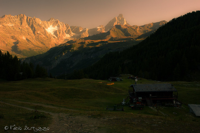
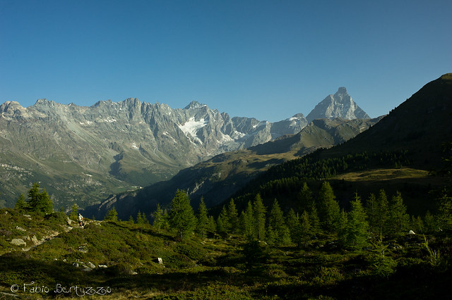
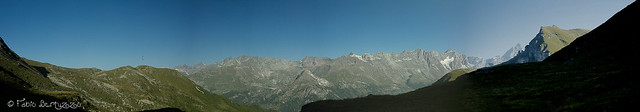
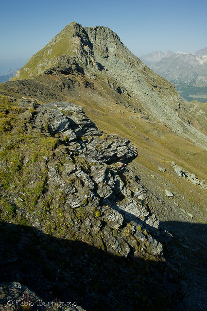
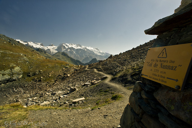
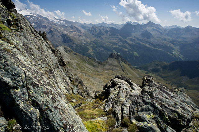
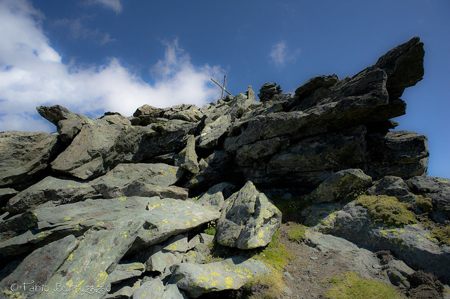
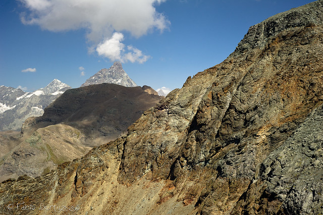
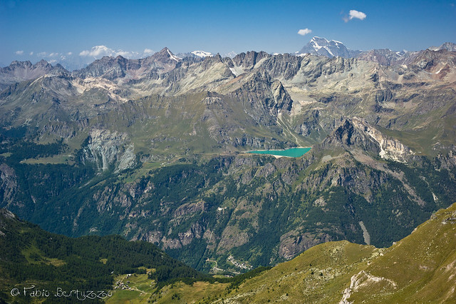
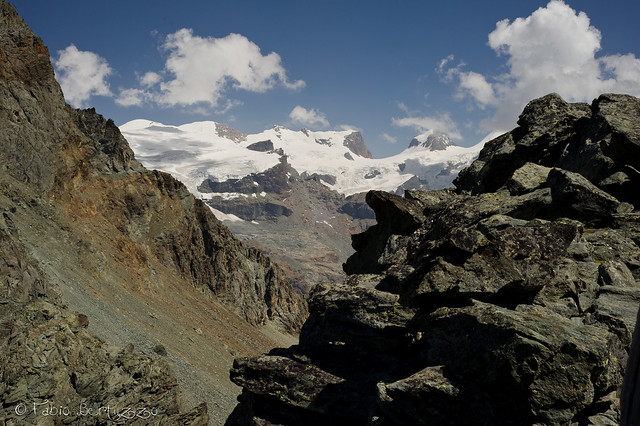
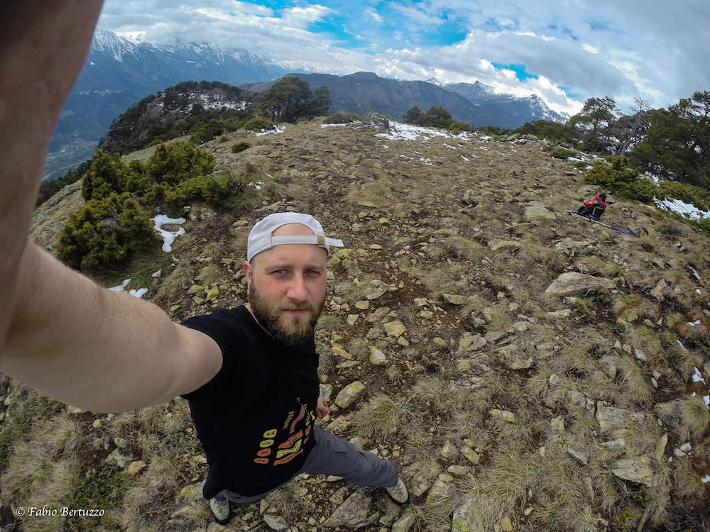
ISO 640 - 35mm - f/14 - 1/30s From the forecourt, take the path that starts after a small bridge and steeply leads into the Cheneil basin (2105m), here, in the natural amphitheatre of bend to the right until you reach a rich post and the track to the SOUTH of the village. From this point your steps will follow the Alta Via No. 1, to be followed in a SOUTH-WEST direction; the route initially coincides with paths No. 29, 30 and 31. ISO 640 - 35mm - f/10 - 1/200s You immediately enter a little wood (whose rhododendrons and junipers are sung about in hiking literature) at the end of which you must ignore the turnoff to the right for the Santuario di Clavalité (sent. no. 31) and cross a little stream. You now begin to gain a little altitude and after easily crossing a second stream, a beautiful plateau gives you the best view of the Becca d'Aran. ISO 640 - 35mm - f/16 - 1/125s (photomerge with 5 photos) From the terrace, head in an easterly direction, towards the four small houses of Champsec (2335m above sea level), ignoring the trail to the Grand Tournalin. The Alta Via now becomes a little crumbly, a victim of the trampling of grazing cows, and there are a few short, but significant, steep sections ending in a second wide plateau. The path now forms a long loop below the Punta Trécare (which remains to the north) and then turns to the right to accompany you to the Fontanette or Croux Pass (2695 m). ISO 640 - 35mm - f/16 - 1/60s Try to take your eyes off the charm of the panorama and push on into the upper Comba di Chamois where the path appears clearly just a few metres from the southern slope of the Becca Trécare. You will encounter a small lake on the left and marmots near the... ah no, you have already passed them. Climb up to the left until the Monte Rosa massif emerges hanging above the Col de Nannaz (2775 m). ISO 640 - 20mm - f/22 - 1/40s At the pass, don't take the No. 3C to the Trécare, but stay on the Alta Via by descending for about 100 metres until you meet yellow paint on your left from which the path leads NORTH (the "3D" designation for the Petit Tournalin does not appear on the brushstrokes). You can now clearly identify your destination and the scree that will soon become the object of your expletives. The path begins on a little meadow and pushes you up to the first cairn of a vast scree slope, now: - keeping to the right, you identify other cairns that allow you to cross the section on boulders that are almost all well stabilised and almost all easy to approach. Or - further up on the left is a second cairn which advises you of an intuitive alternative, namely to skirt the upper edge of the scree slope by walking halfway up the ridge and then to continue following the edge of the stones down the valley until you find new (so far absent) signs to the left. For a bonus of 150 points, go back once at the bottom and try the previously discarded alternative. Once past the scree you will have to circumvent a few larger boulders and then start sliding down the scree on the south slope of the Petit Tournalin. However daunting and detestable the terrain may become, you will find comfort in the signposts: at every cairn you will spot another cairn, rather than a yellow arrow or a trail marker. ISO 400 - 20mm - f/16 - 1/320s Bear in mind that the ascent route climbs close to the corner between the south and east slopes and that after about 3000m it veers dizzily to the right and then back towards the NORTH-WEST on large boulders. ISO 400 - 20mm - f/8 - 1/1000s From these boulders you can see the summit cross under which you will find political asylum from the Vatican State and a sort of stone basin, excellent shelter from the wind. From the cross, you will conquer the 3207 metres of the actual summit in about 15 seconds. From the summit, the view almost embraces 360°, 'almost' because to the north the Grand Tournalin, big brother of your mountain, hides part of the Breithorn from you. ISO 400 - 50mm - f/16 - 1/80sISO 400 - 50mm - f/16 - 1/80s The return is on the same path, going down rather than up, going right rather than left (and vice versa) and reversing the cardinal points. ISO 400 - 50mm - f/20 - 1/80s


Comments (0)
Sign in to leave a comment