Le Chantonnet, from Arp Nouva


Edited by:
Giancarlo Beretta
Updated at: 06/04/2026
Access
Navigazione stradale
Lasciare l'autostrada allo svincolo di Aosta Ovest e immettersi a destra sulla strada regionale per la valle di Cogne. Dopo 400m (0,4km) alla rotonda prendere la seconda uscita entrando nella strada statale , da seguire per 32,4km (32,8km), attraversando e costeggiando gli abitati di Saint-Pierre, Villeneuve, Arvier, Avise, Derby, La Salle, Morgex e Courmayeur, sino a raggiungere l'uscita per Larzey – Entrèves sulla . Svoltare a destra e imboccare la percorrendola per 4,0km (36,8km) fino a Entrèves. Proseguire su Strada la Palud per 11,1km (47,9km), superando La Palud, Planpincieux e Lavachey, fino al termine della strada in prossimità di Arp Nouvaz.
Parcheggio
Al termine della strada, dopo aver attraversato la Dora di Ferret su un ponticello in legno, si trova il parcheggio 🅿️ di Arp Nouvaz in fondo alla macchia boschiva. Nel periodo estivo (luglio e agosto) l'accesso è regolamentato: normalmente è consentito prima delle ore 8:00 sino a saturazione dei posti disponibili; dopo tale ora è disponibile un servizio navetta con partenza da La Palud. Per informazioni aggiornate consultare la sezione apposita del sito del comune di Courmayeur.
Accesso con mezzi pubblici
Per raggiungere il punto di partenza dell'itinerario è necessario un mezzo privato. Nel periodo estivo è attivo un servizio navetta 🚌 da La Palud; verificare orari e disponibilità sul sito del comune di Courmayeur.
Distanza e tempo di percorrenza
🕒 Tempo di percorrenza: 57 minuti
📏 Distanza: 47,9km
Navigazione GPS
Nota informativa
Le indicazioni fornite sono state verificate alla data del rilievo dell'itinerario. Prima della partenza si consiglia di verificare possibili variazioni del percorso o delle condizioni stradali. Per informazioni aggiornate si raccomanda di consultare Google Maps o Apple Maps.
Introduction
Description
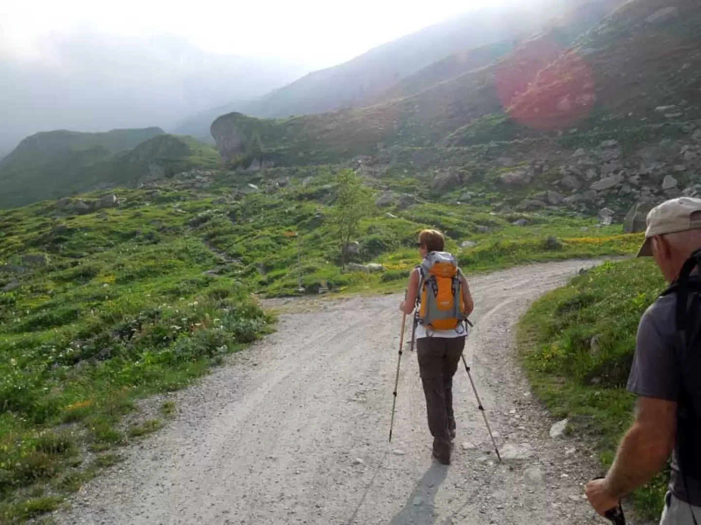
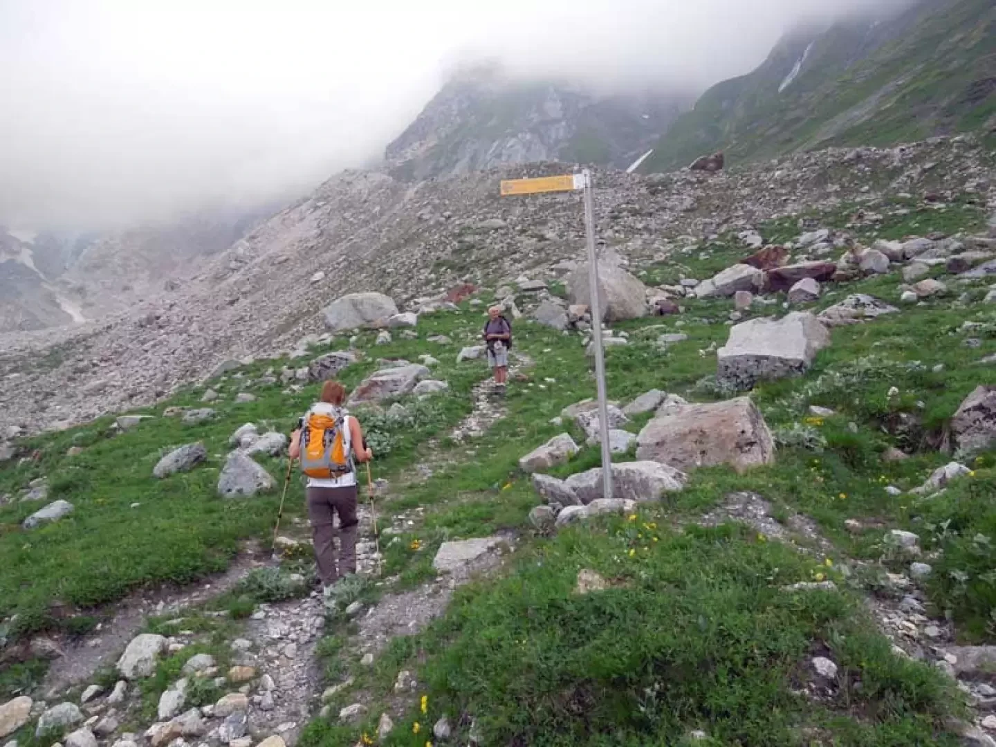
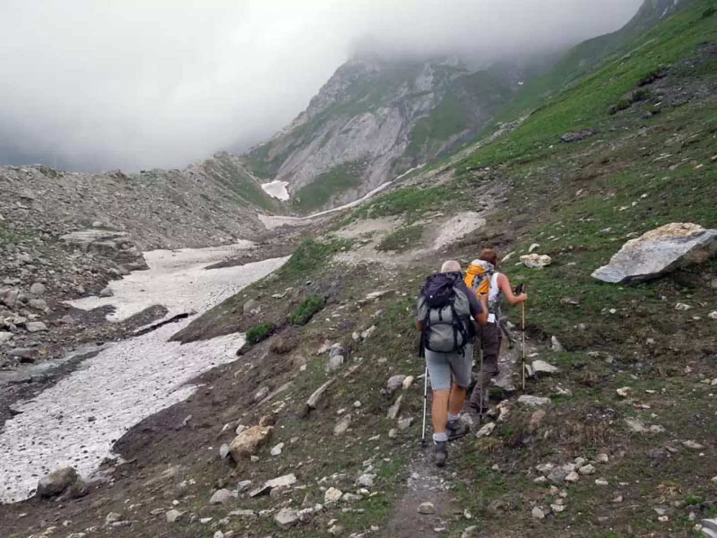
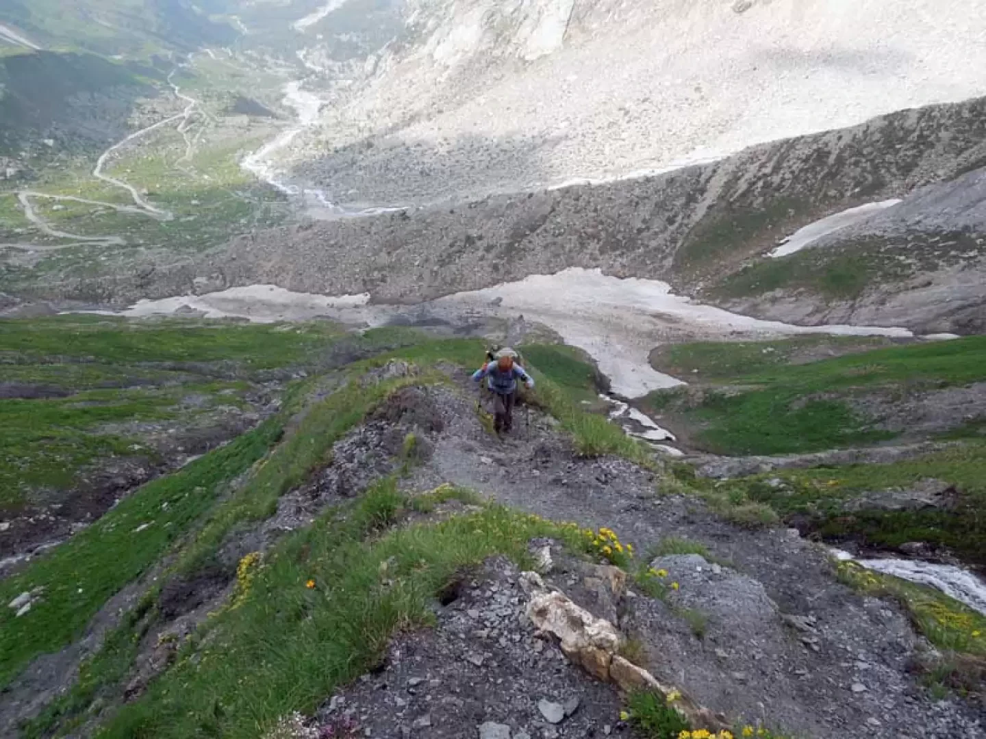
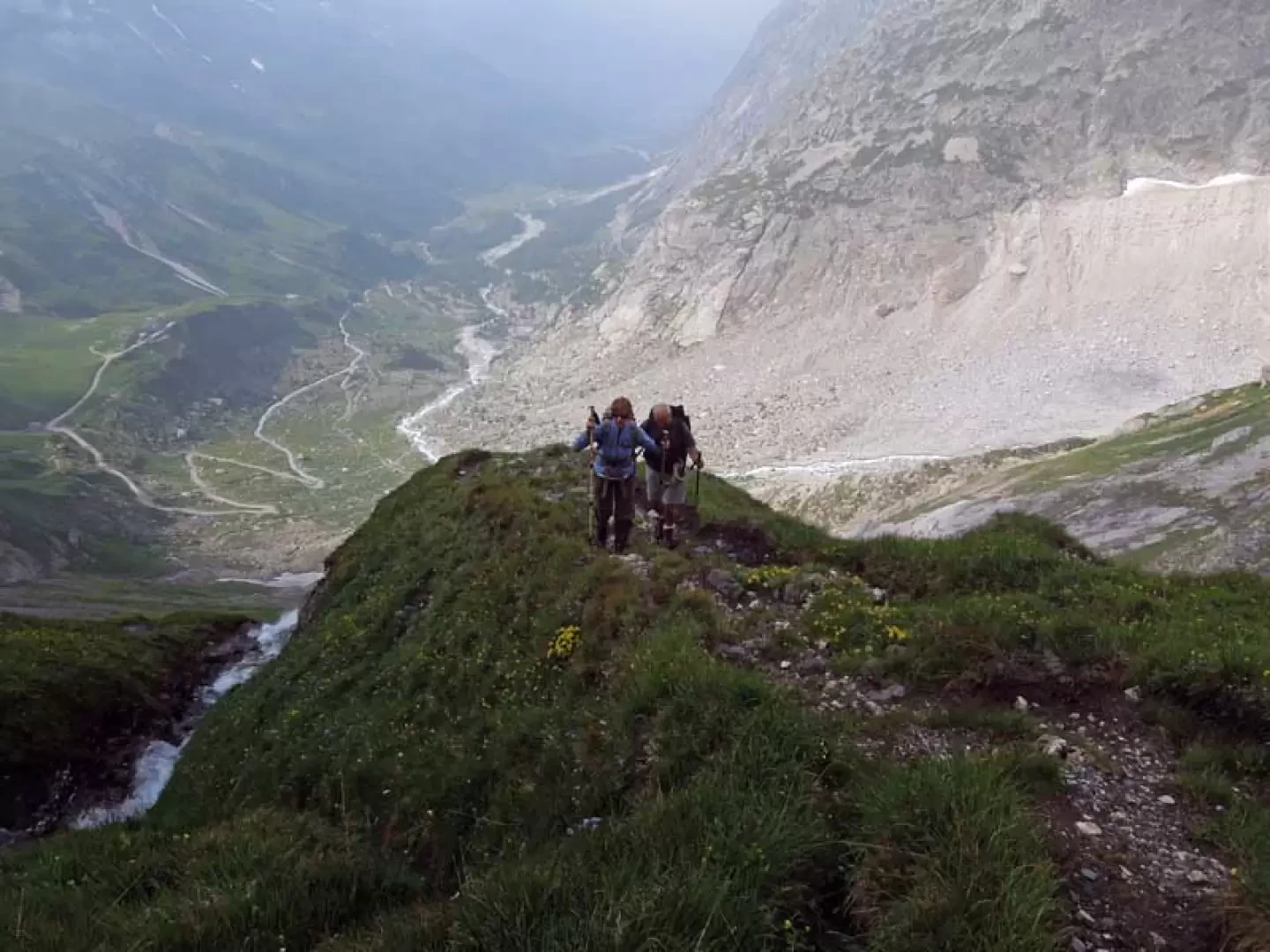
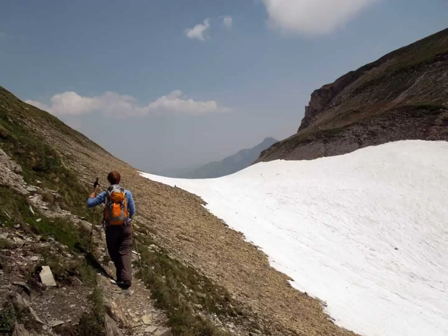
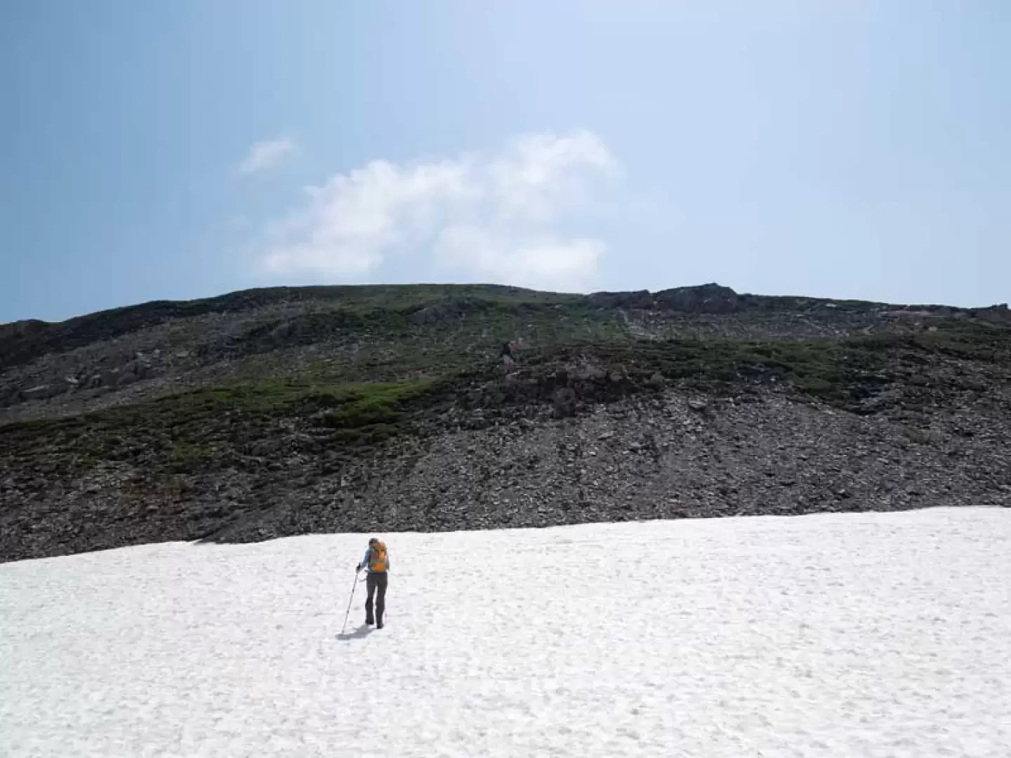
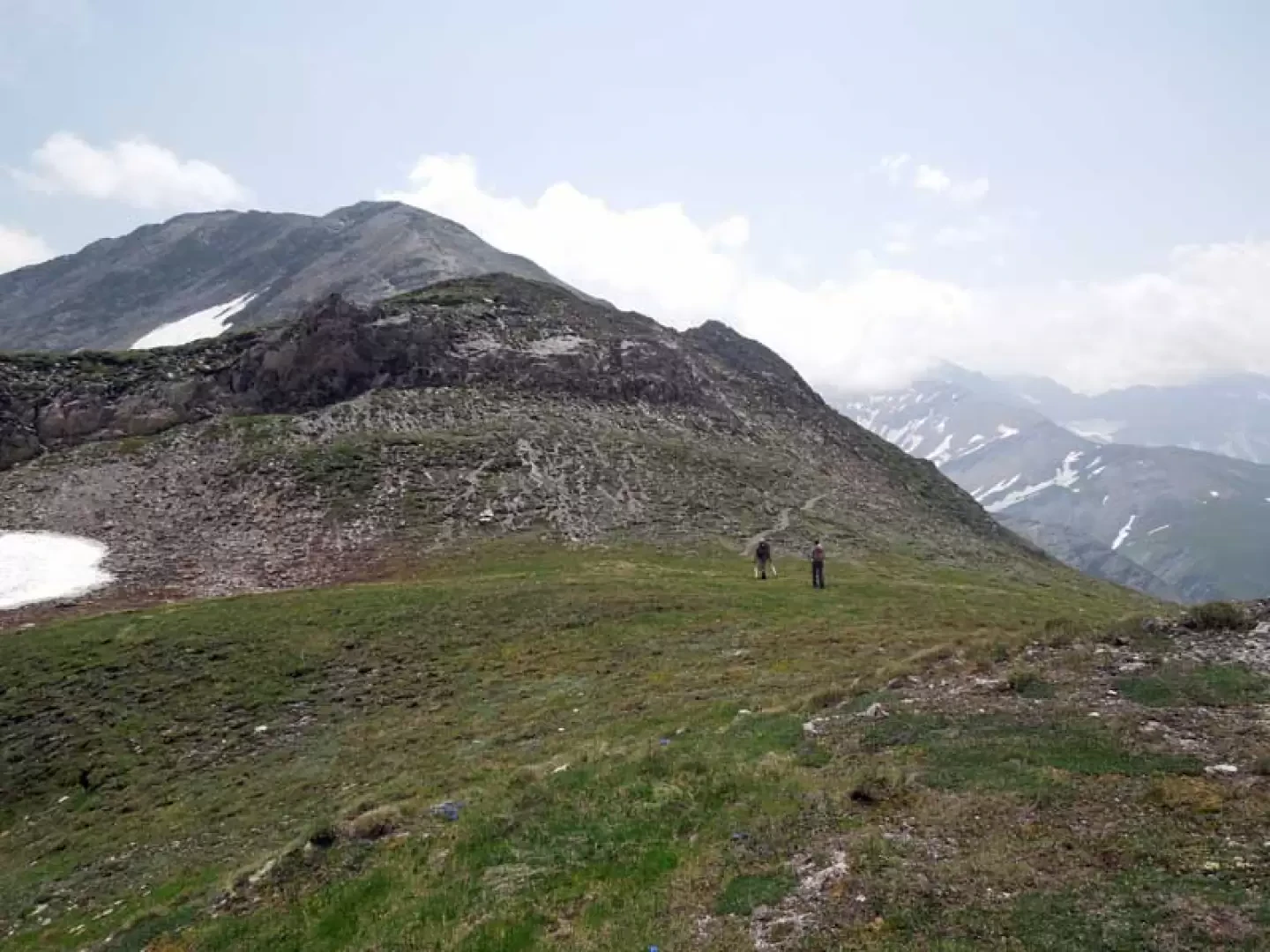
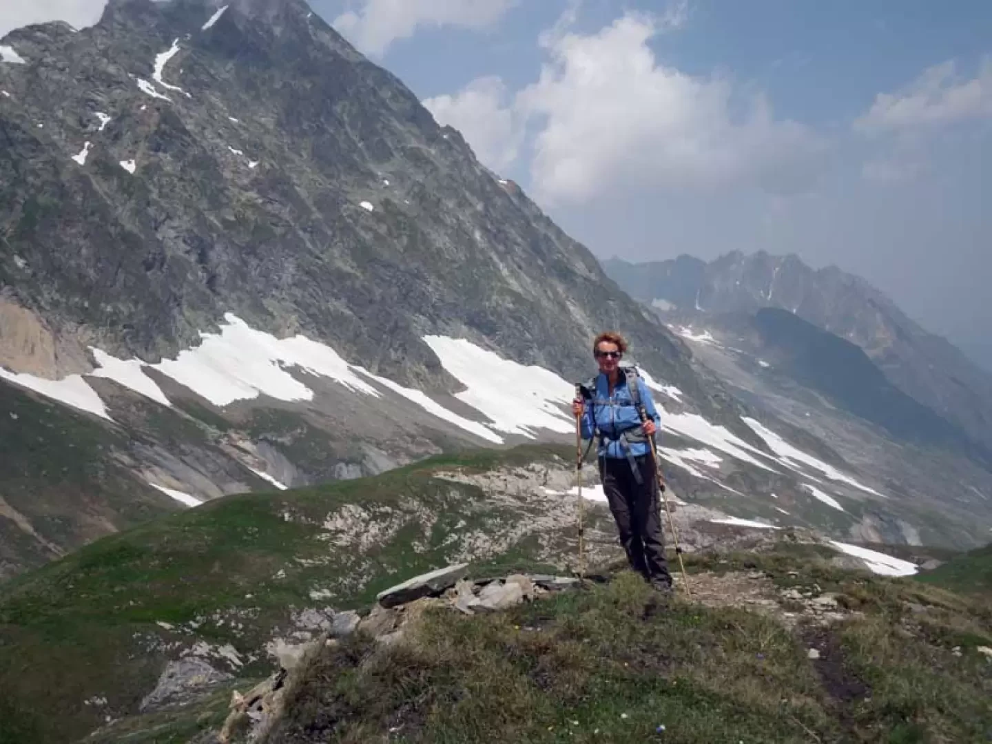
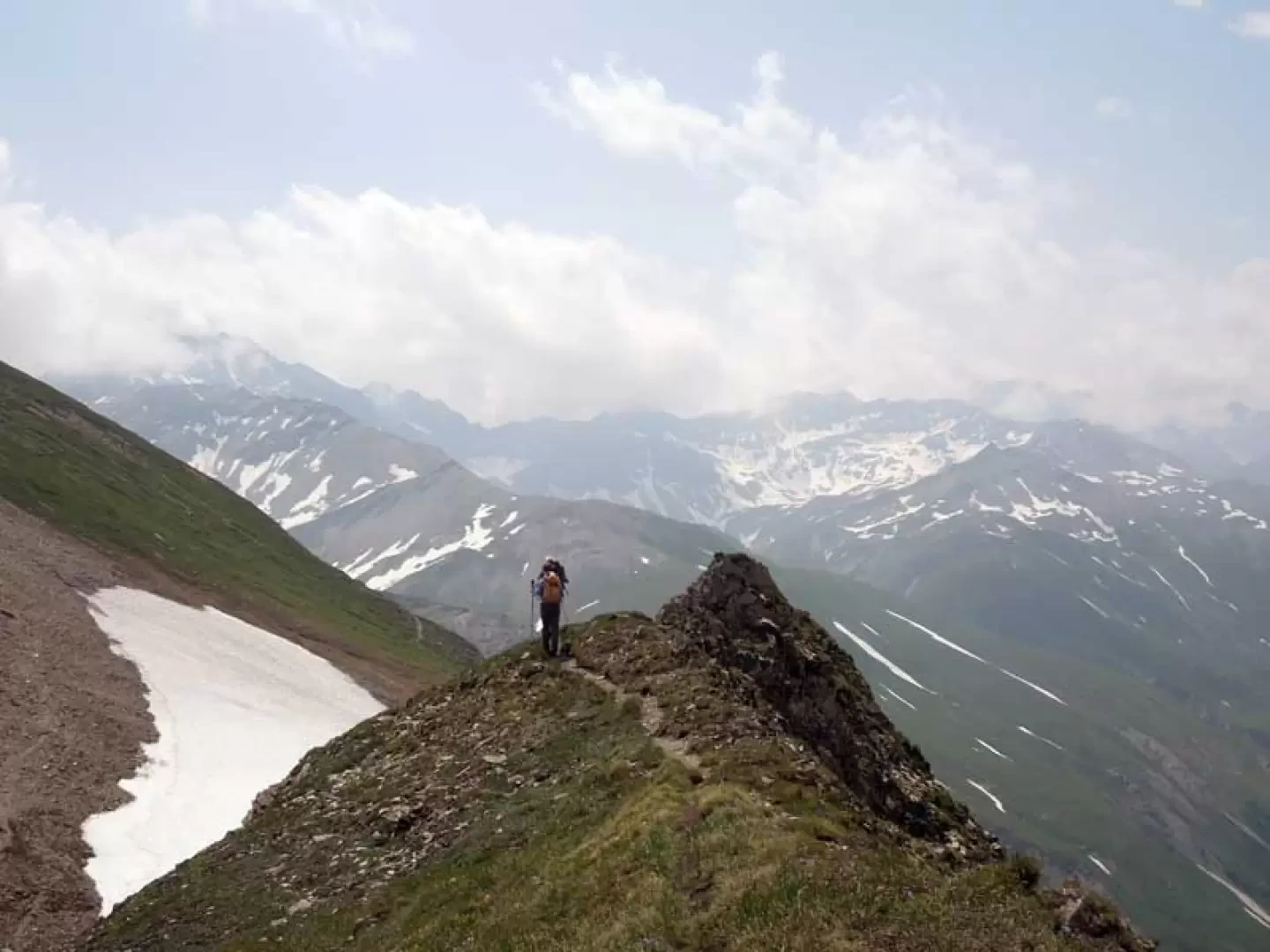
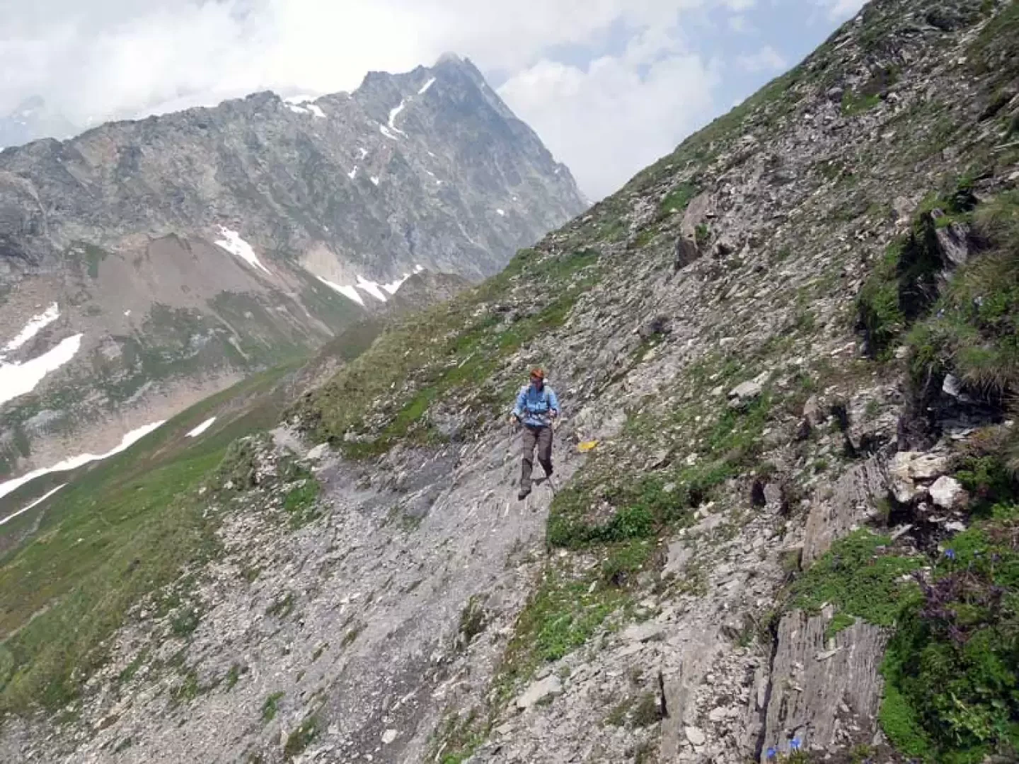
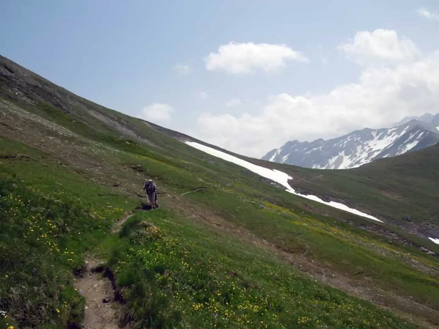
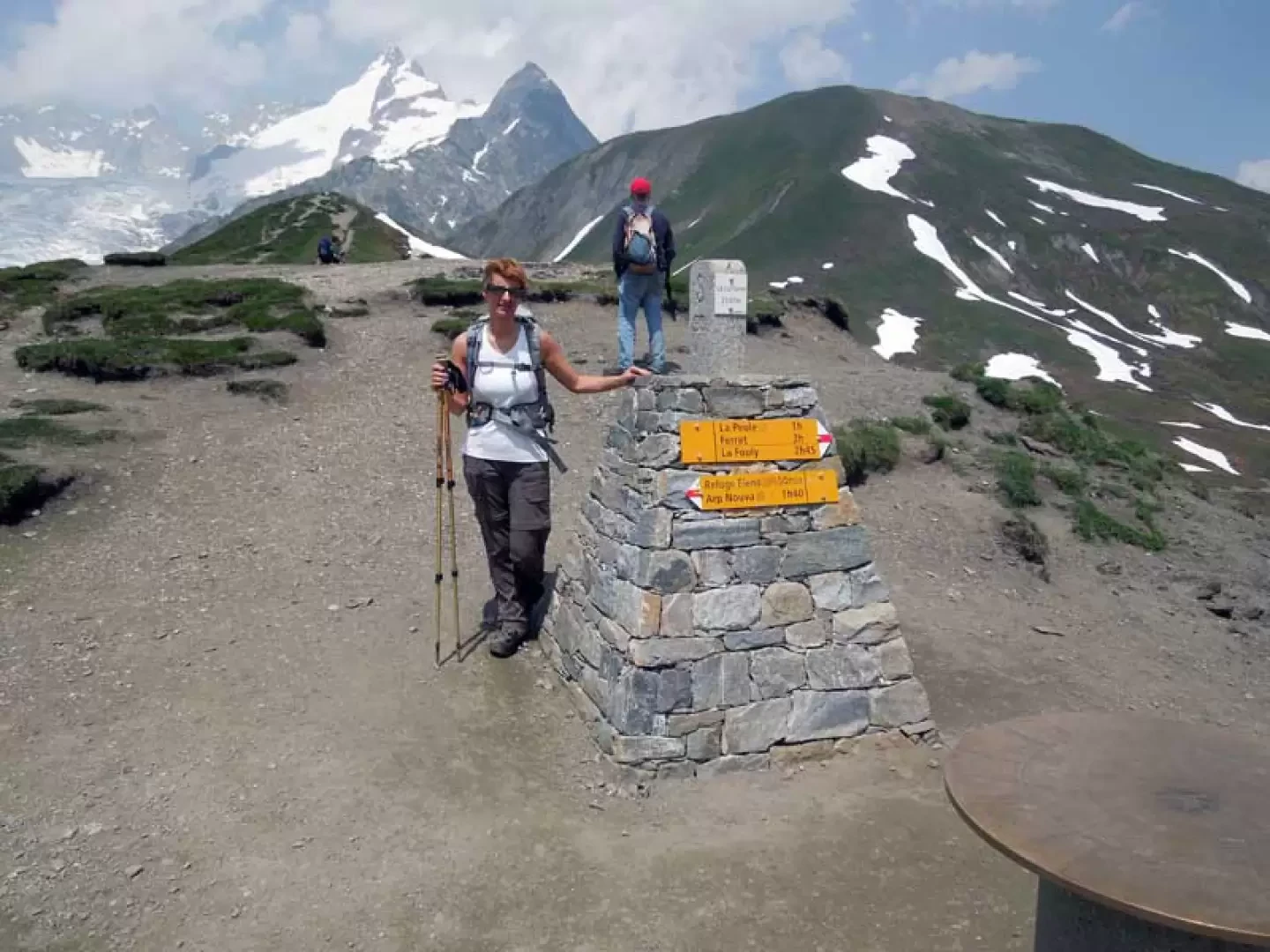
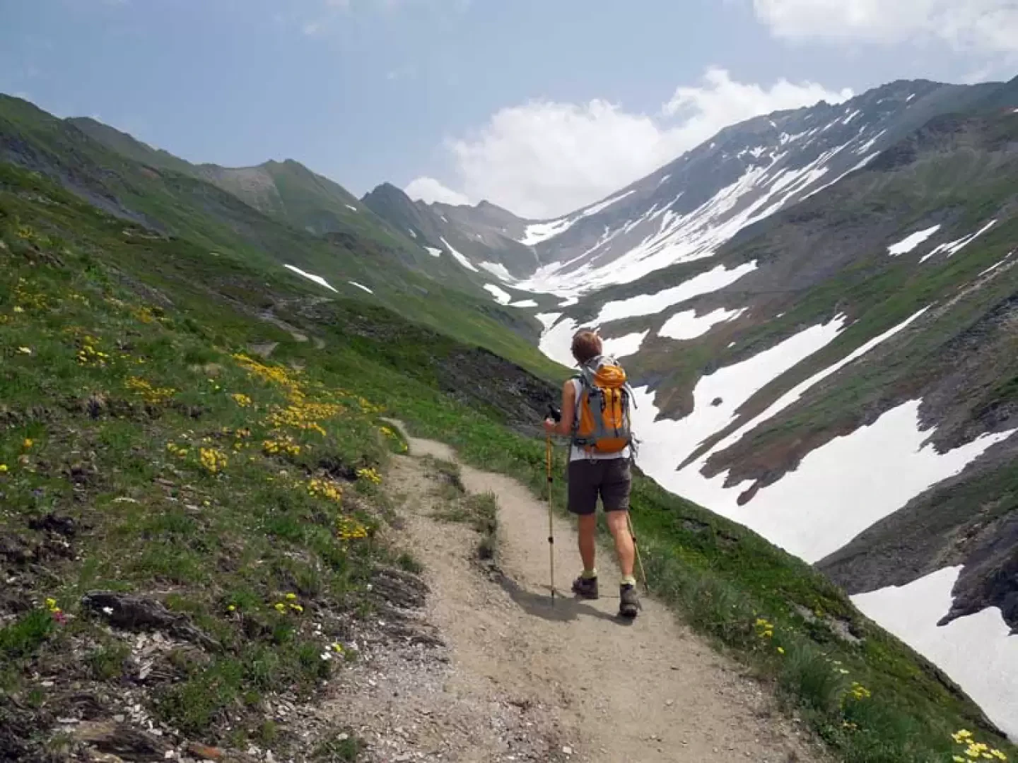
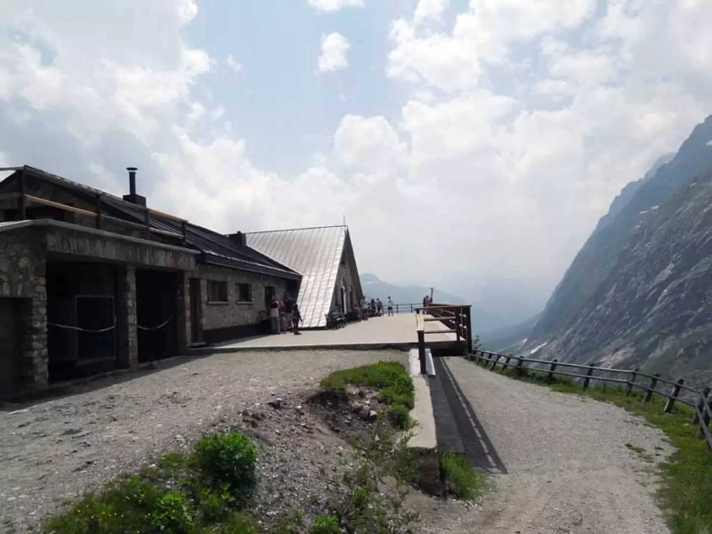
The Chantonnet peak is located on the Italian-Swiss border and more precisely between the Petit and Grand Ferret hills at the eastern head of the Italian Val Ferret; it is the highest elevation encountered on the path that traverses between the two hills and the first section is in common with the ascent to the Fiorio bivouac while the last part of the descent is with the Tour du Mont Blanc itinerary. The circular route follows marked trails or, in the stretch between the two passes, well marked and without any difficulty; the only attention to be paid is the crossing of a few snowfields, which must be taken into account if you are travelling at the beginning of the season. The excursion, precisely because of the altitudes and environments in which it takes place, offers beautiful views on both sides with an exceptional view of the Pré de Bard glacier surrounded by beautiful peaks including the soaring silhouette of Mont Dolent. Description From the dirt track, continue on a slight incline towards the head of the valley, almost immediately coming across a path indicated by a marker (1786 m) that branches off to the left and which you ignore going straight on. After a couple of hairpin bends, you come to another fork in the road, also indicated by a marker (1858 m), at which point you continue along the easy road. Continuing along an almost straight route, you pass under the balcony where the Elena refuge is located and, after a couple of hairpin bends that can be cut, you will find a post indicating the Fiorio bivouac (2041 m) where the path begins. Take it and stay to the right of a moraine, following it until almost its end where, having reached almost the bottom of it, the track begins to climb gently in a traverse, arriving at a steep grassy ridge which you begin to climb, deviating decisively to the right. Continuing very laboriously on steep and friable terrain, you quickly gain height until you reach a panoramic point where the path flattens out a little, deviating slightly to the left. At an altitude of around 2560 m, leave the path that goes up to the Fiorio bivouac and take the track on the right that goes up to the Col du Petit Ferret (there is always a snowfield at the beginning of the season). After walking up the steep slope, you come to a small creek (2515m) and here you take a track that rises up the grassy scree slope on the right, where, after the first short climb, you will find a small concrete marker; after passing it, the slope increases again and, having climbed the slope again, you come to a grassy knoll in front of which is the destination point of the hike. After ascending a last slope on somewhat friable ground, you set foot on the point where there is a low stone cairn; from here, continuing on the track that heads towards a ridge, you begin the descent, which immediately loses altitude to arrive at a col (2559 m) where you take the path that descends in the direction of Val Ferret, then moves to the left towards the grassy side of the mountain. Crossing then halfway up the slope, and past a few short, somewhat exposed sections, walk on a good track on the beautiful slopes that lead to the comfortable ridge that descends gently towards the Col du Grand Ferret. From this wide inlet, take the wide path that descends to the right towards the Le Combette valley, the side of which you descend for a stretch, then bending decisively to the right; after passing a ruin (2274 m), take a few wide hairpin bends to reach the Elena hut below (2080 m). In order not to walk on the dirt track, which can be monotonous, pass in front of the refuge and take the obvious path to the left that cuts across the grassy flank and, arriving just before crossing the stream, without descending towards it, continue on the grassy crest taking a track that is not very evident at first, but then becomes well marked; with this you descend the gentle undulations of the pastures that take you to the dirt track just before the crossroads at an altitude of 1858 m and from here you return to the car in a short time.Photo gallery

Comments (0)
Sign in to leave a comment