Lake Cingino, from Lake Antrona

Edited by:
Giancarlo Beretta
Updated at: 03/09/2024
Access
Follow the A-26 Genoa-Gravellona Toce motorway to its end at Gravellona and continue on the dual carriageway in the direction of Domodossola, exiting at the Villadossola junction; at the roundabout follow the signs for Antrona and drive up the valley of the same name, passing the village of Antrona Piana and continuing as far as Lake Antrona, where you can leave your car in an adjacent square.
.Introduction
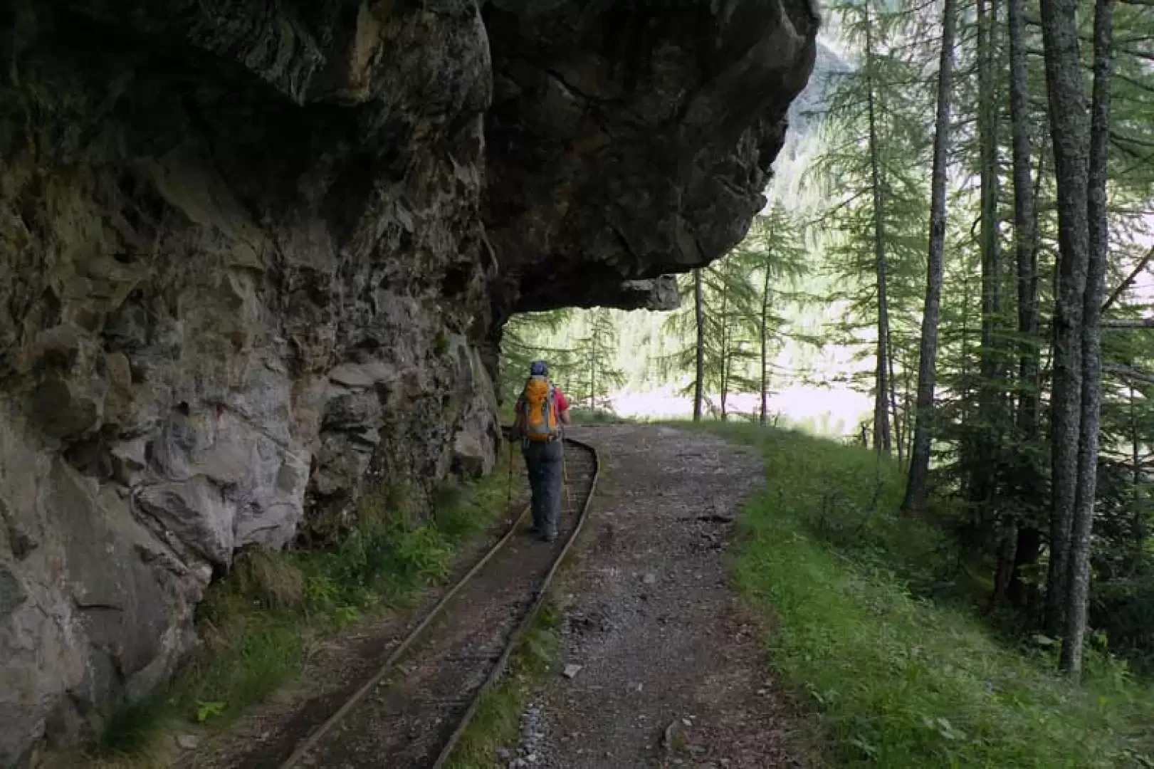
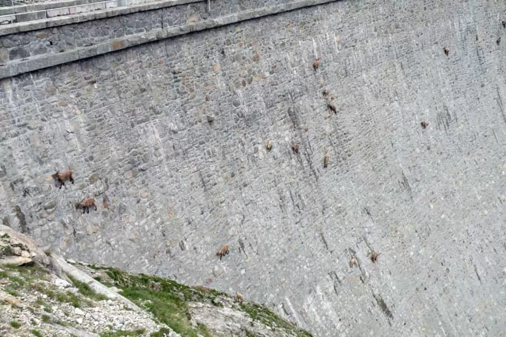
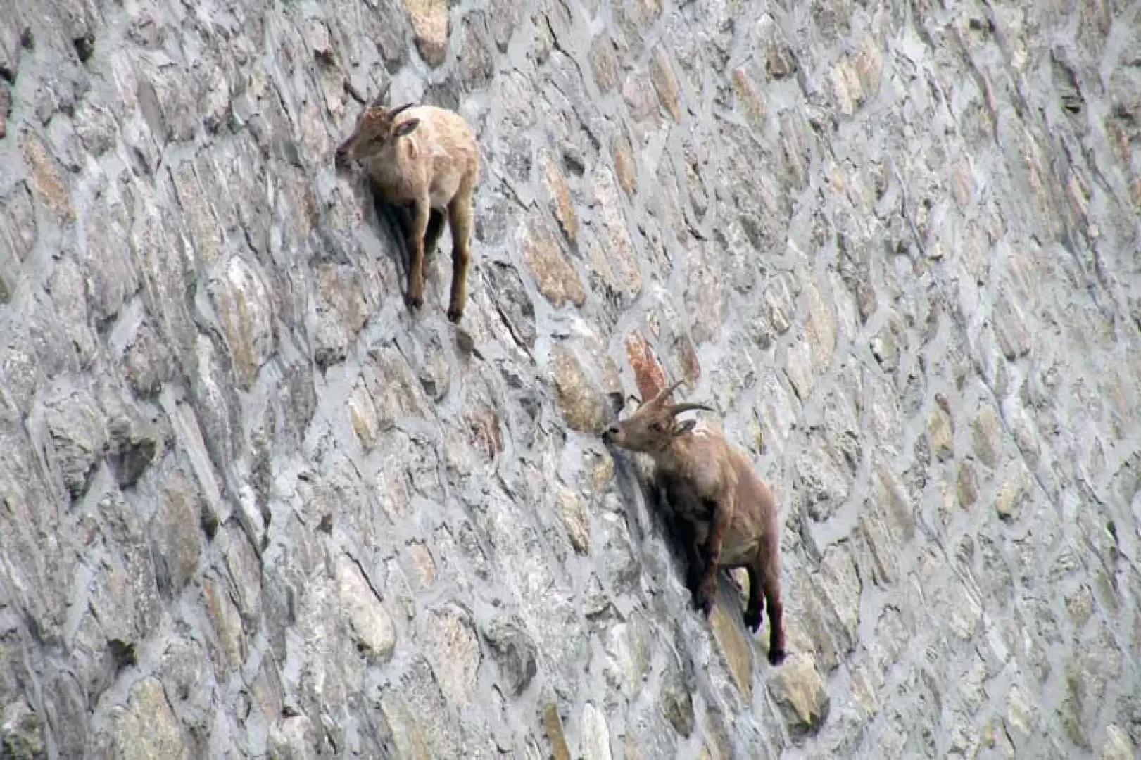
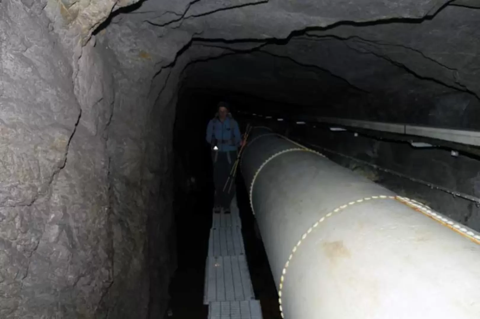
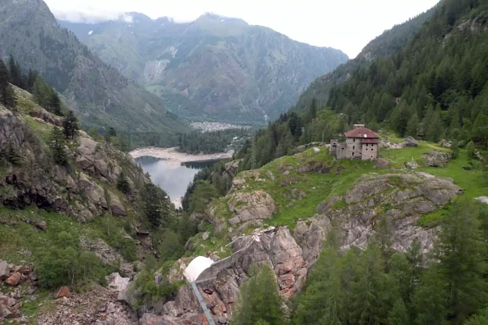
A very long loop hike (about 24 km in length) without technical difficulties but to be tackled if well trained and used to walking on all types of terrain; The route winds its way through the beautiful valleys of the upper Antrona Valley, passing the three large artificial lakes of Campliccioli, Cinghino and Camposecco, with an evocative and unusual stretch (about 30 minutes) to be done in a tunnel, not very high, of the penstocks, so although there is some lighting, it is better to be equipped with a torch and above all not to suffer from claustrophobia. On the barrage wall of the Cingino dam, you can see a spectacle that is perhaps unique, namely the ibexes that climb up it, defying the laws of gravity to lick the saltpetre from the stones that cover it (according to the keeper, they are found every day).
Description
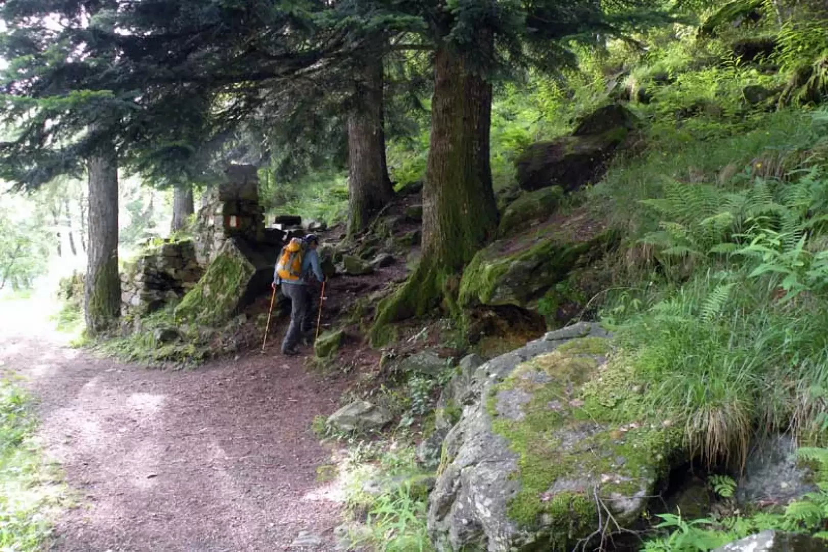
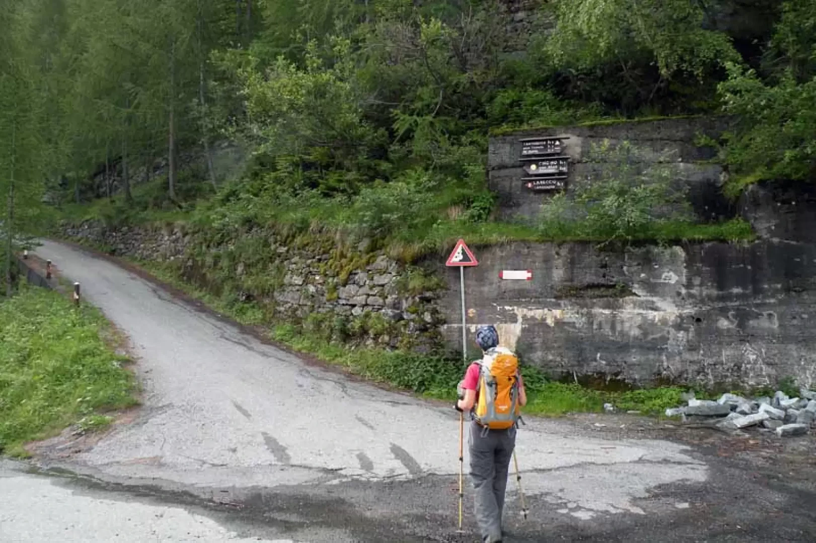
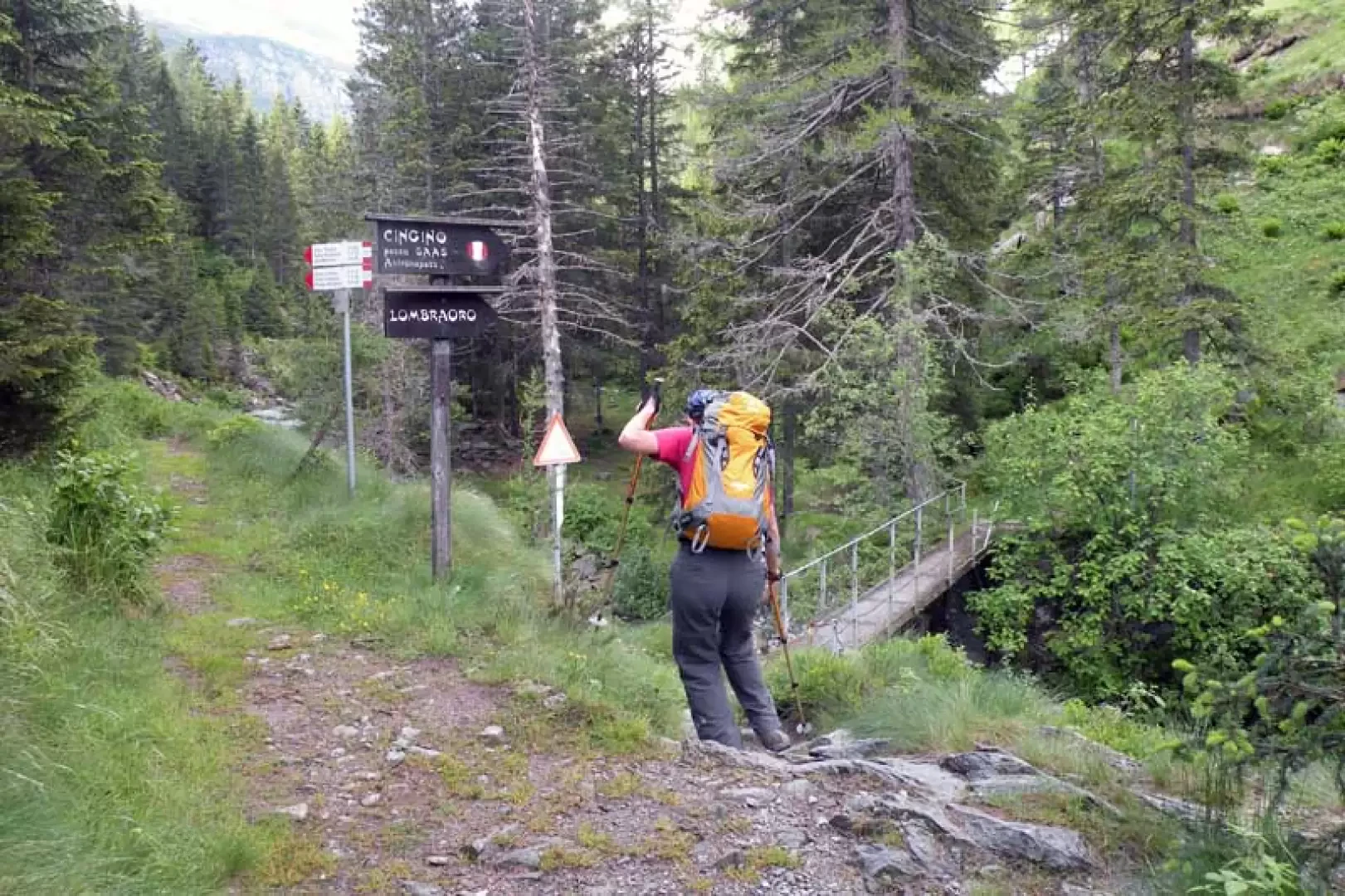
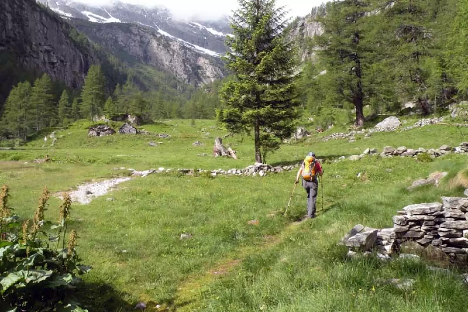
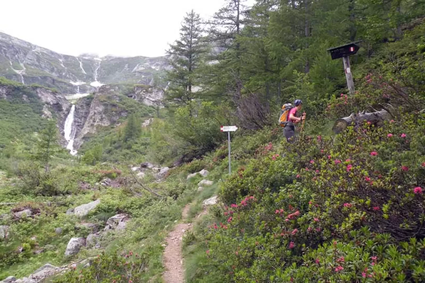
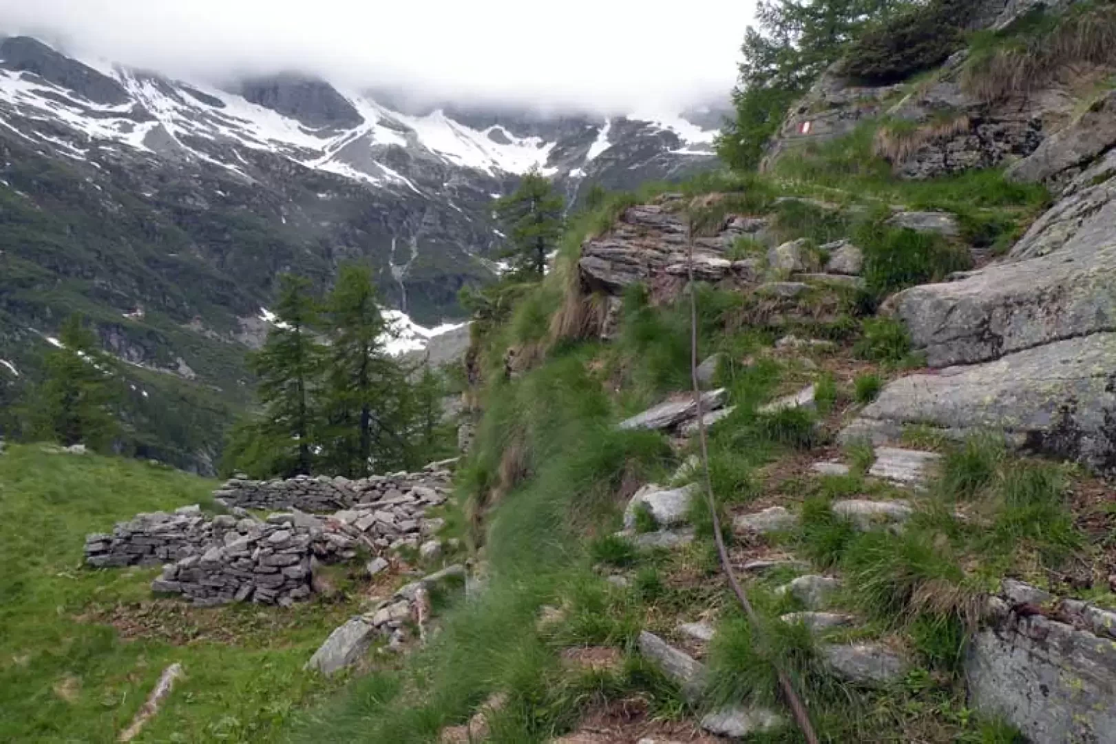
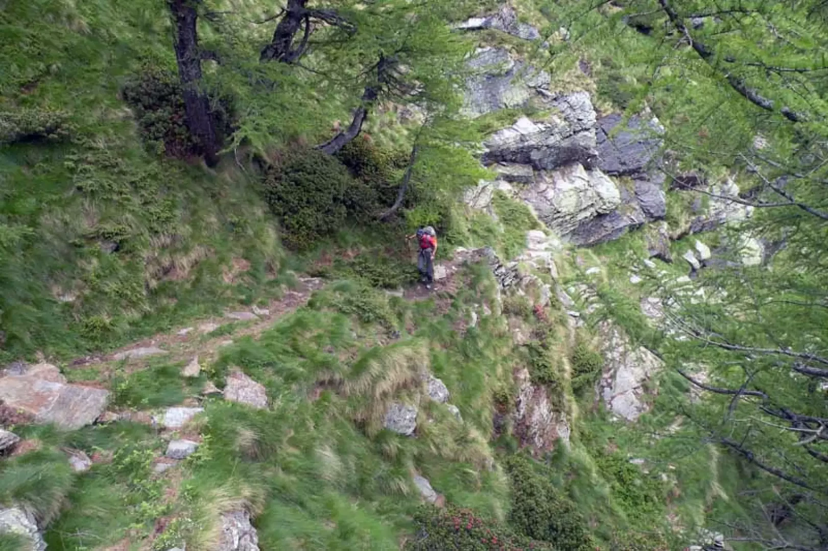
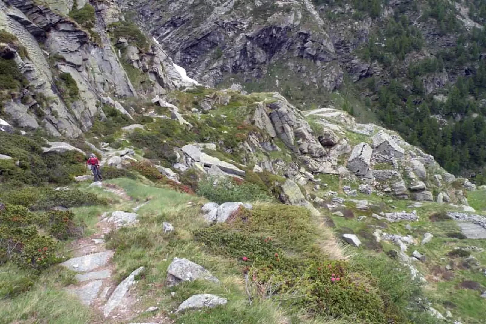
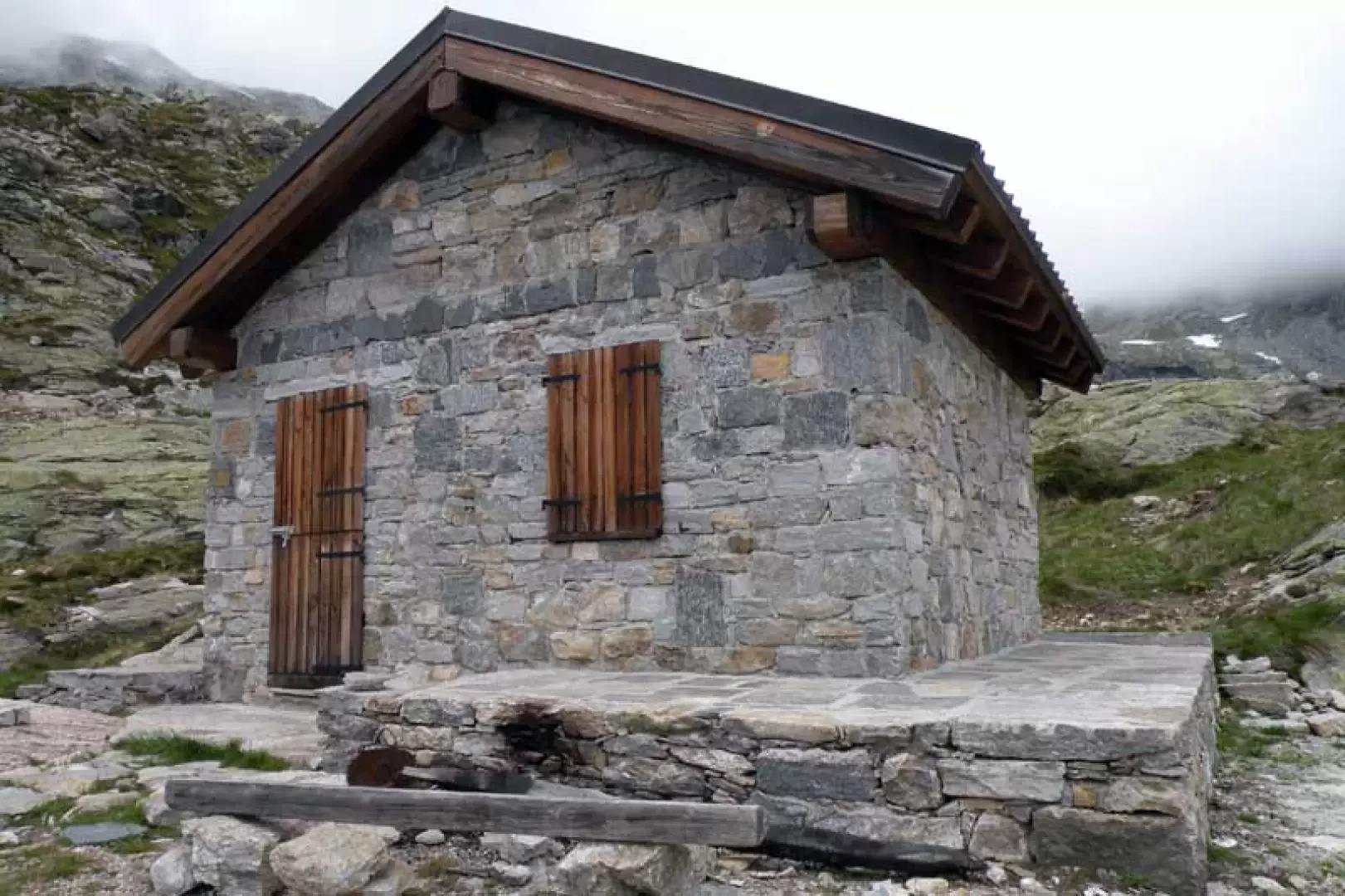
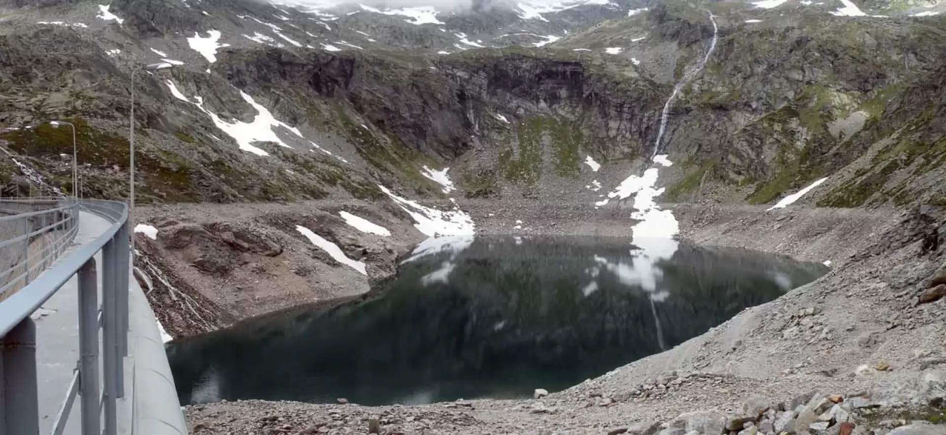
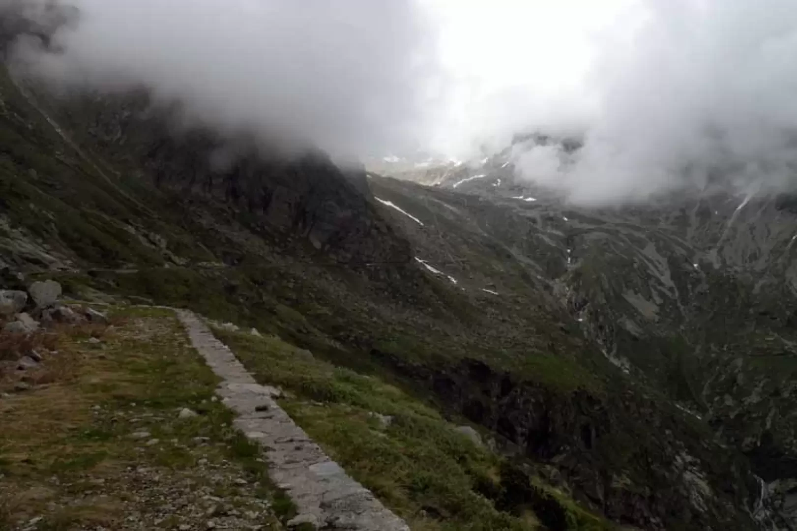
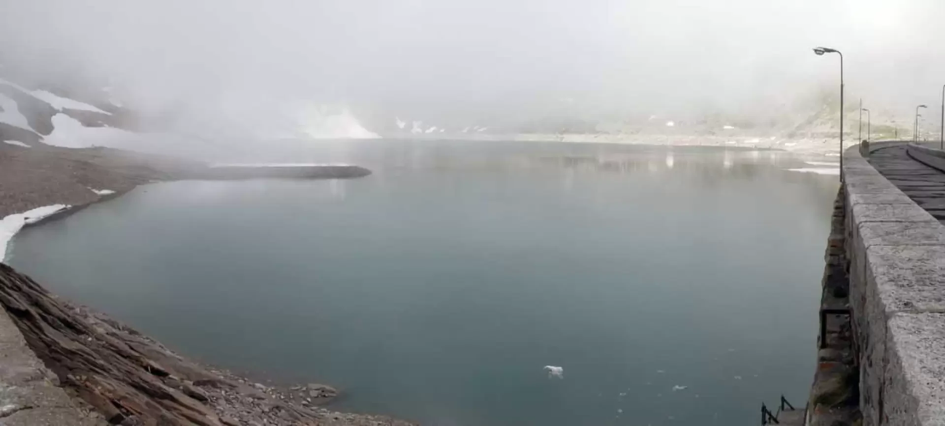
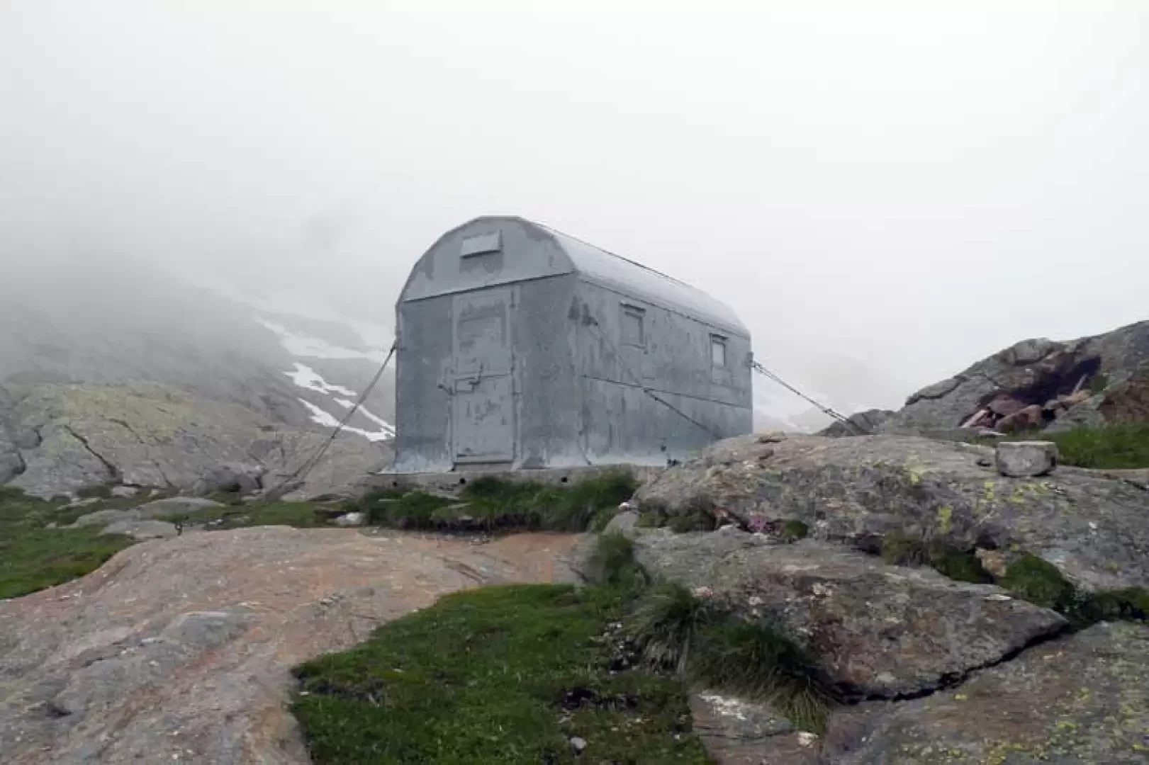
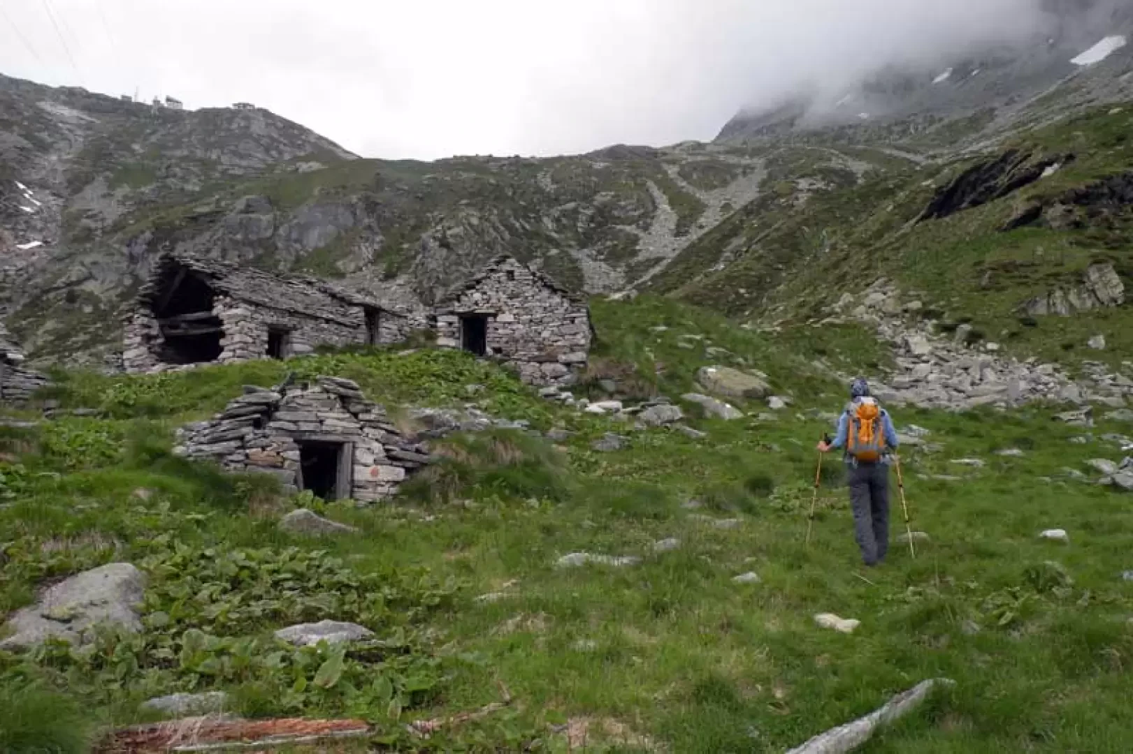
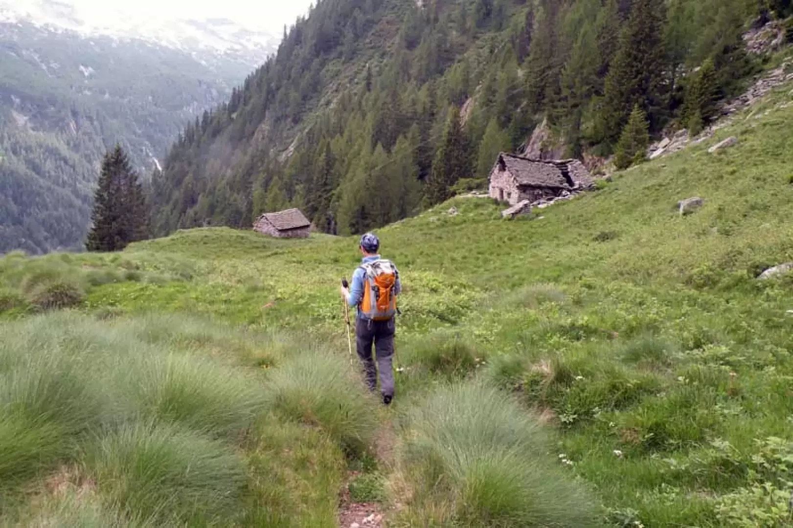
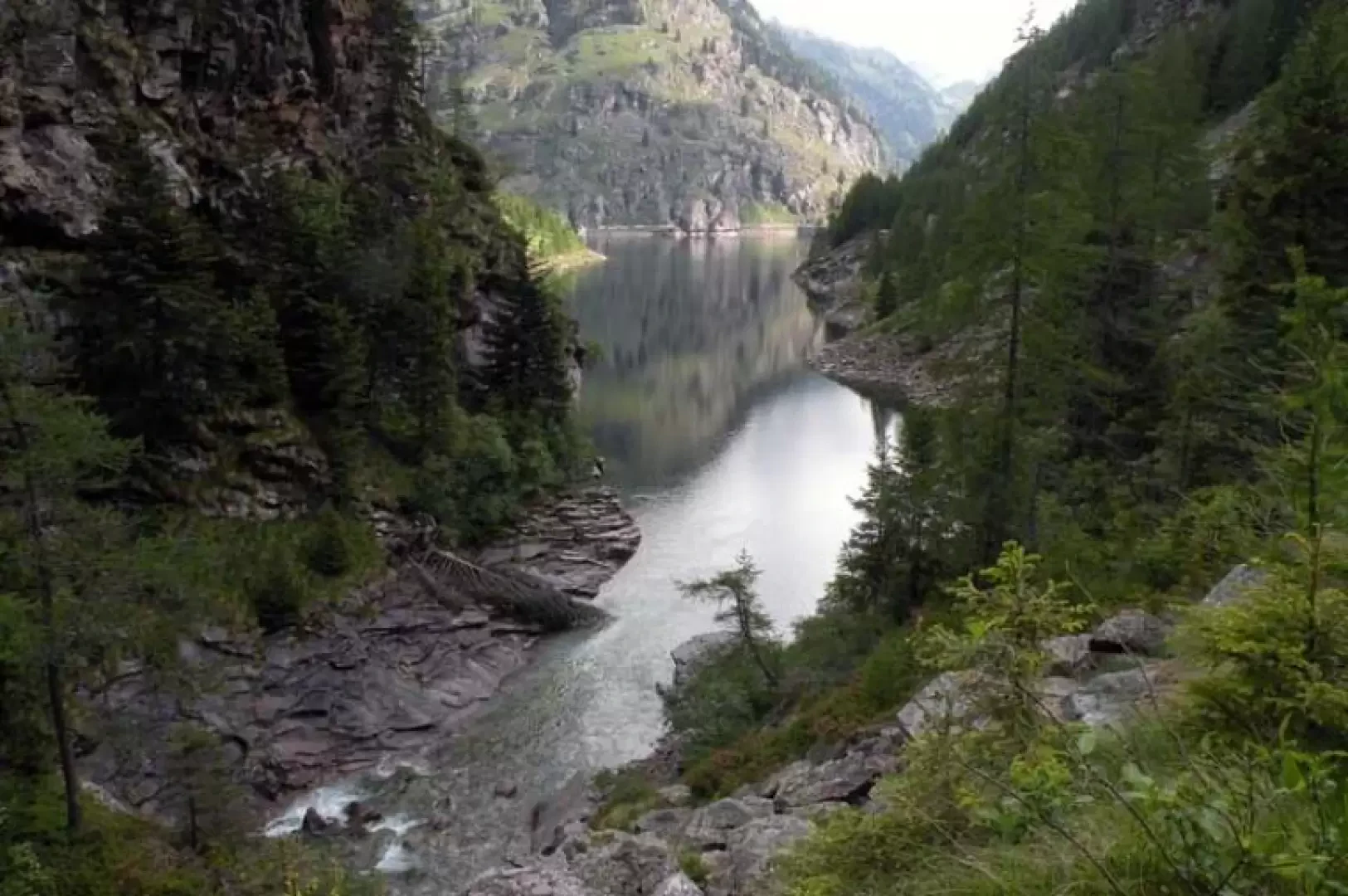
From the car park, walk towards the no-transit sign to take the mule-track on the right, indicated by the posts, near a wooden panel of Lake Antrona; walk along it for a few hundred metres to deviate to the left, just after a wooden table, onto the path indicated by white/red marks on the stones. Just above, pass by Alpe Piana (1241 m) and continue until you come to the tarmac road, which you follow for a couple of hairpin bends, then turn right onto a wide mule track that rejoins the road just before reaching the square in front of the Campliccioli Lake dam (1358 m). Here, on the left, are the signs indicating the itinerary, which ascends for a short distance on a road, deviating almost immediately to the right to continue along the route of the old service tracks for the dam as far as where they end and continue along a good path that enters a lovely wood, coming to a fork (1373 m) where we descend towards a small bridge with which we take the opposite slope. From here the track continues towards the bottom of the valley with a few ups and downs, and in any case without gaining too much altitude, passing first by the Casaravera alp (1489 m), which we pass on the right, and then by the ruins of the Lombraoro alp (1635 m); When you are almost at the head of the valley, you come to a fork signposted by poles (1652 m) at which you turn right and begin a steep ascent through dense evergreen woodland, passing by a wooden cross (1740 m) and immediately afterwards, in more open terrain, by the ruins of the Saler alp (1904 m). The path continues on a grassy ridge and then cuts left and, with a few exposed passages, crosses a gully and reaches the panoramic Cingino alp (2054 m) from which it climbs again steeply until it reaches a flat ridge of grass and stones just below the Cingino bivouac (2272 m); Following the path for a few minutes, you arrive at the posts located a few metres from Lake Cingino, on whose dam you can see the unusual and suggestive spectacle of ibex in position licking saltpetre. Now you must cross the dam and, having reached the opposite side, pass by a ruined hut, descending first on a path and then by a stone ladder to the walkway below, continuing to the left where you come to a small building with a marker on the wall; To continue the hike, open the metal door, inside of which is the switch for the lighting (this is timed to last one hour), and follow the penstock into the tunnel carved out of the rock for about half an hour, walking at times on footbridges that allow you to avoid some puddles. When you reach the end of the tunnel, go out into the valley to the side and descend along the walkway below, following it all the way up to the rails of the loading trolleys, now disused, of the dam, which you climb up in very steep sections. When you reach the top, you arrive next to the caretaker's house, just above which, on the left, is the Camposecco bivouac, from which there is a beautiful view of the lake of the same name (2339 m). Go down to the caretaker's house and descend until you reach the hut below where, indicated by a yellow arrow, is the start of the descent itinerary. Pass a little below a ruin and then, following the stone cairns, cross a couple of scree slopes at the same number of tributaries to descend steeply from a high grassy rib to Alpe Scarone (2029 m). From here continue the descent alongside a high rocky rampart reaching the plain below and heading towards the Banella stream, wade across it at its best point; continue slightly downhill over the meadows aiming for a notch from which, on somewhat uneven and at times steep terrain, you skirt the stream from above and arrive at the panoramic Cravarossa alpine pasture (1676 m); Continue past a ruin (1480 m), from which there is a fine view of Lake Campliccioli, and then quickly lose height, arriving shortly on the banks of the lake and crossing the path that runs alongside it (1376 m). Turn left and pass in front of a building to immediately reach the dam wall, which you walk along, crossing the basin and arriving at the service road lay-by, thus closing the loop; now you will soon reach the shores of Lake Antrona along the outward path and shortly arrive at the parking area. Of course this hike can also be done in the opposite direction to the one described.
Galleria fotografica