Pizzo Spadolazzo


Edited by:
Marco Bonati
Updated at: 22/12/2024
Introduction
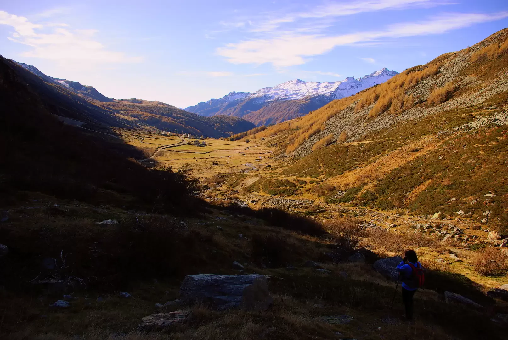
A classic excursion from Madesimo, but of discreet technical difficulty: although well signposted by the yellow Trekking Valle Spluga trail markers, its culminating section is rather exposed and should not be underestimated. A well-known vantage point, Pizzo Spadolazzo stands at the centre between Valle Spluga, the Madesimo basin and the Swiss Val Niemet.
Description
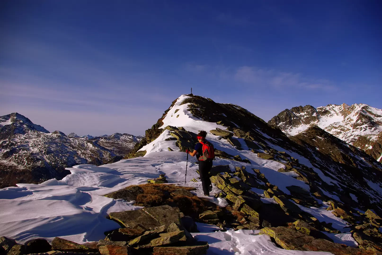
From the forecourt 1656 m, continue along the dirt track and, shortly after a bridge, take the well-marked path on the right to Rifugio Bertacchi and Lake Emet. The well-trodden track climbs diagonally until it reaches a section of the slope between two streams; from here the path begins to gain altitude with a series of regular hairpin bends with a not excessive gradient. A few tens of metres of the path carved into the rock to form an artificial ledge precede a crossing of the most conspicuous stream (emissary of Lake Emet); a few more bends, with a diminished gradient, quickly lead to the Rifugio Bertacchi 2172 m, located on a hump dominating the Madesimo basin. Continue on the level parallel to - and higher than - the shore of Lago d'Emet 2144 m, reaching some huts with a fountain: then the path begins to climb towards Passo d'Emet. After a few hundred metres, a signpost indicates to the left the direction to follow [ignore the identical painted signs continuing to the right]: climb up a little valley - a little further on occupied by a small, shallow lake - following its bottom. A wooden post is placed at the point where one must start climbing steeply to the left. More or less at the invisible Italy/Switzerland border line, the path initially runs over steep pastures, but then - invisible from a distance - creeps along characteristic gullies and small valleys that cross the vast, steep slopes. Having definitely entered Swiss territory, we gradually move onto the eastern side of the mountain; the path - reduced to a track - becomes very steep among the accumulations of very mobile stones that make up the final section of the anticima, preceding the culminating crest. A few dozen metres of solid rock - a very exposed section - lead to the summit cross of Pizzo Spadolazzo 2722 m. Panorama over the entire Valle Spluga, the Suretta group and the little-known peaks of the Val Niemet. Return along the outward route. If there is snow at the beginning of the season, most of the signs are invisible, and one must rely on the well-placed cairns of stones. The summit ridge may be impassable due to the presence of a ledge to the south, which is not very prominent but has a poor base on the rock.
.Photo gallery
Comments (0)
Sign in to leave a comment