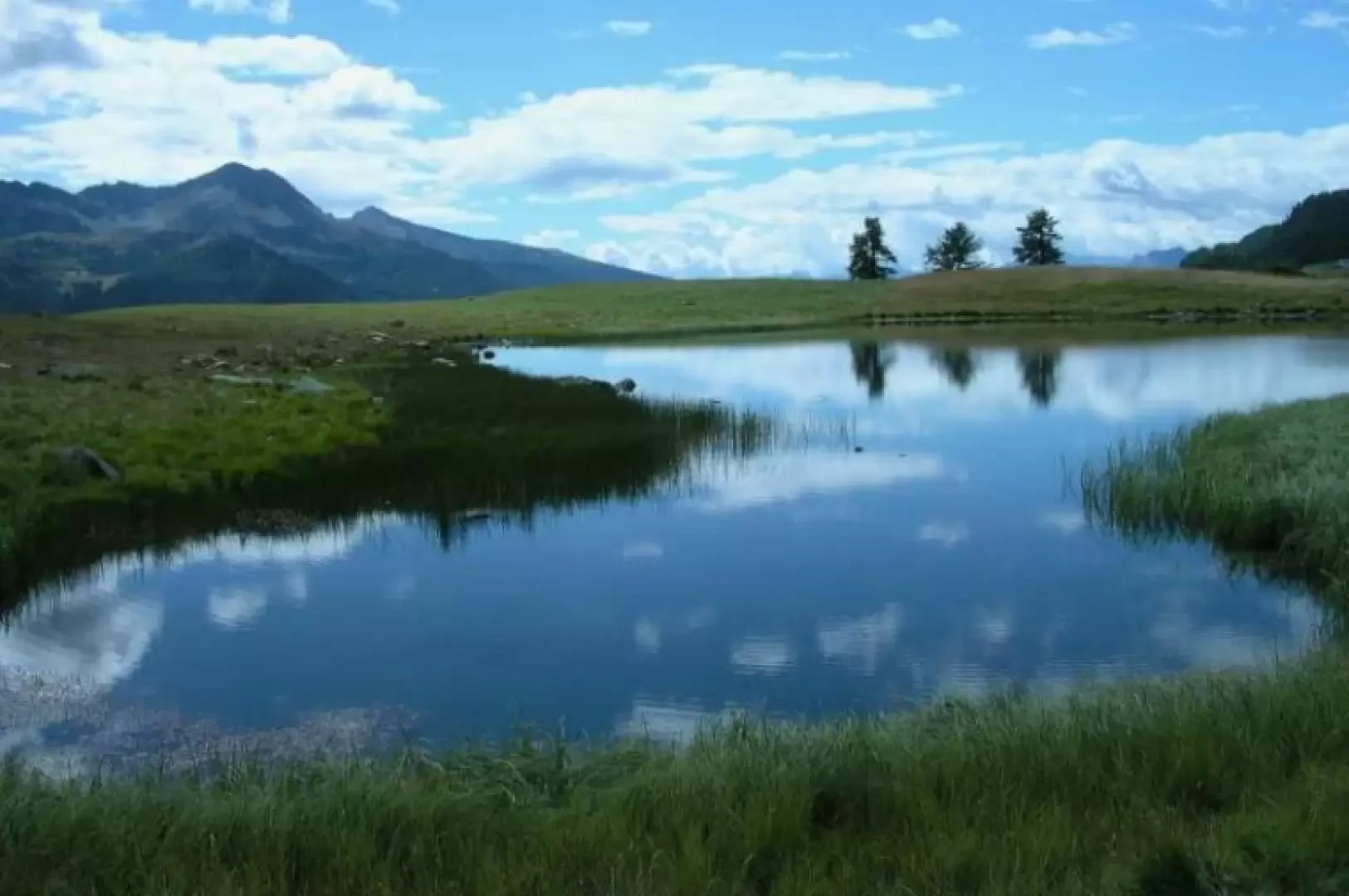
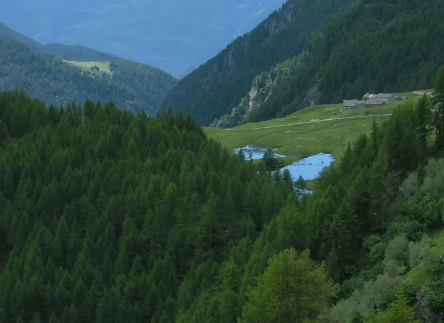
Lac de Cortina, from Valmartin

Edited by:
Gian Mario Navillod
Introduction
This pleasant hike leads to Lake Cortina, a little-known body of water in which the mountains separating Valtournenche from the Ayas valley are reflected. During the ascent, you will come across several abandoned rural constructions and the marks left on the land by the construction of the hydroelectric plants: the old penstocks that descended from Cignana, the track of the trolley that brought materials there. The return can be made along the ascent route or, extending it by half an hour, by following the Alta Via 1 signs for the Cignana dam. In this case, it is advisable to walk the entire length of the crowning wall of the dam and then descend into the valley below.
Description
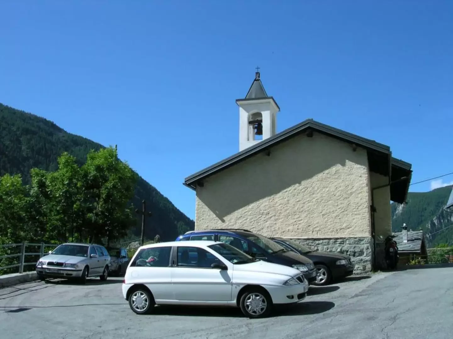
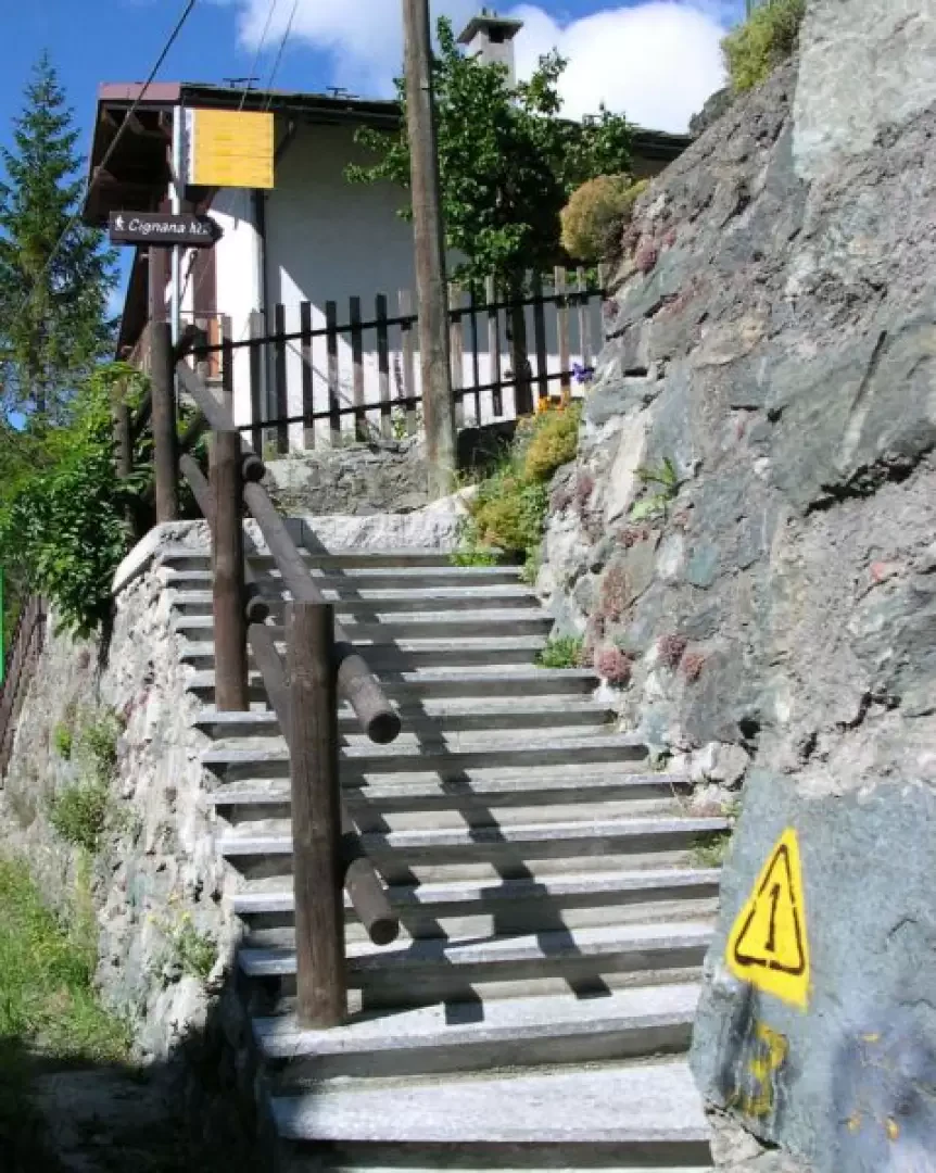
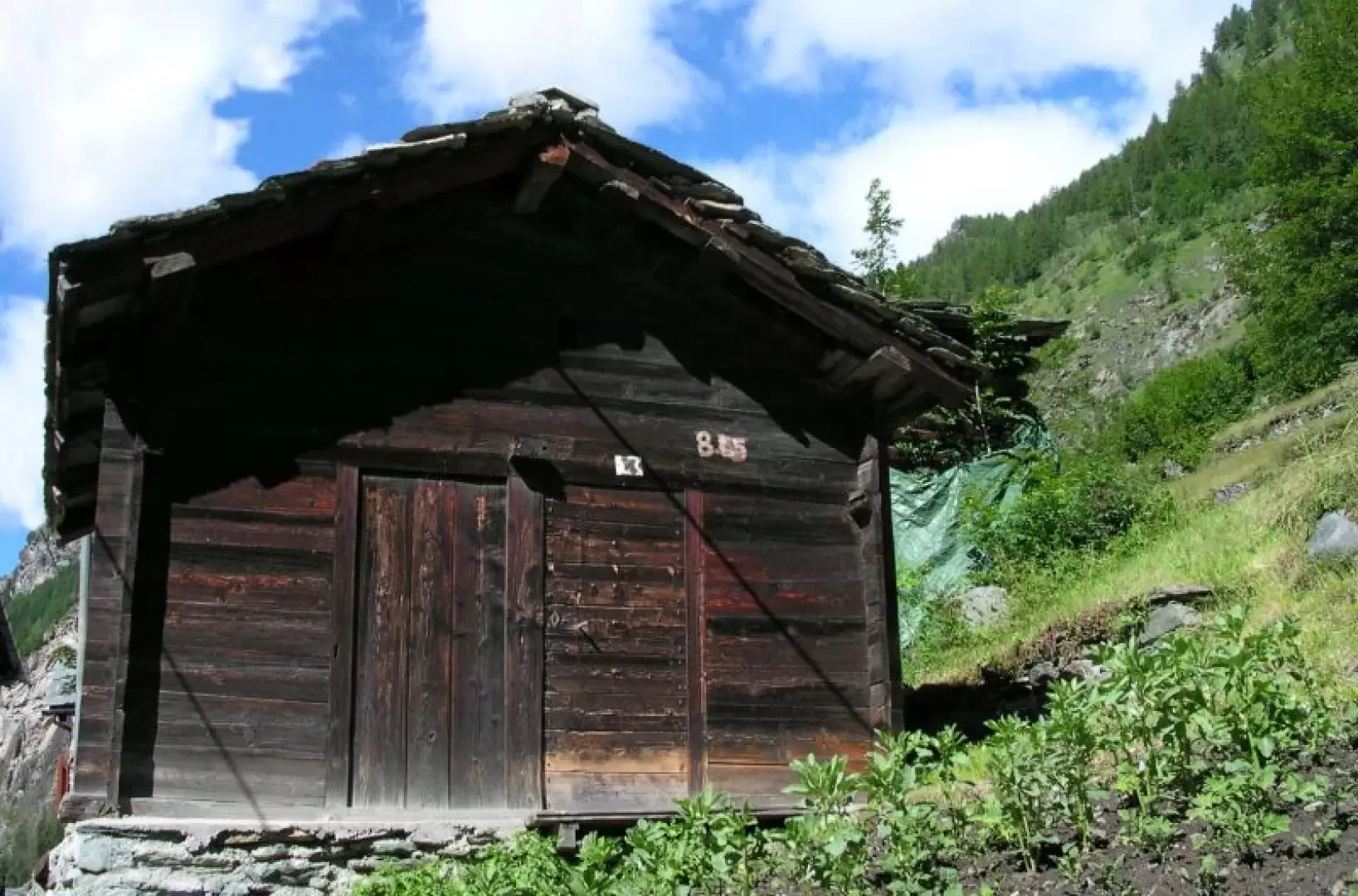
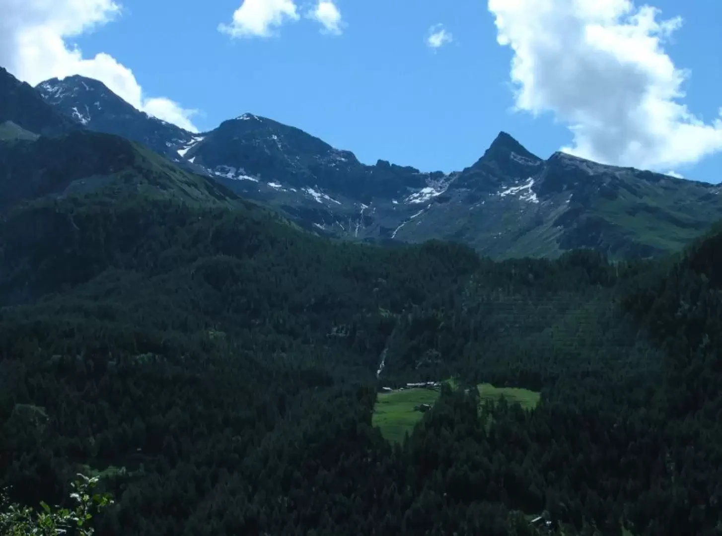
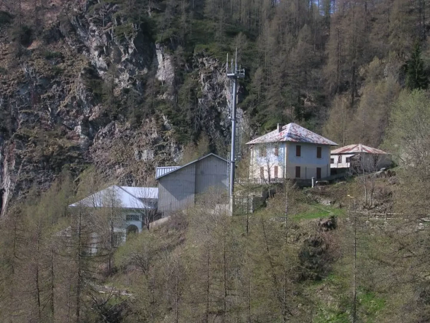
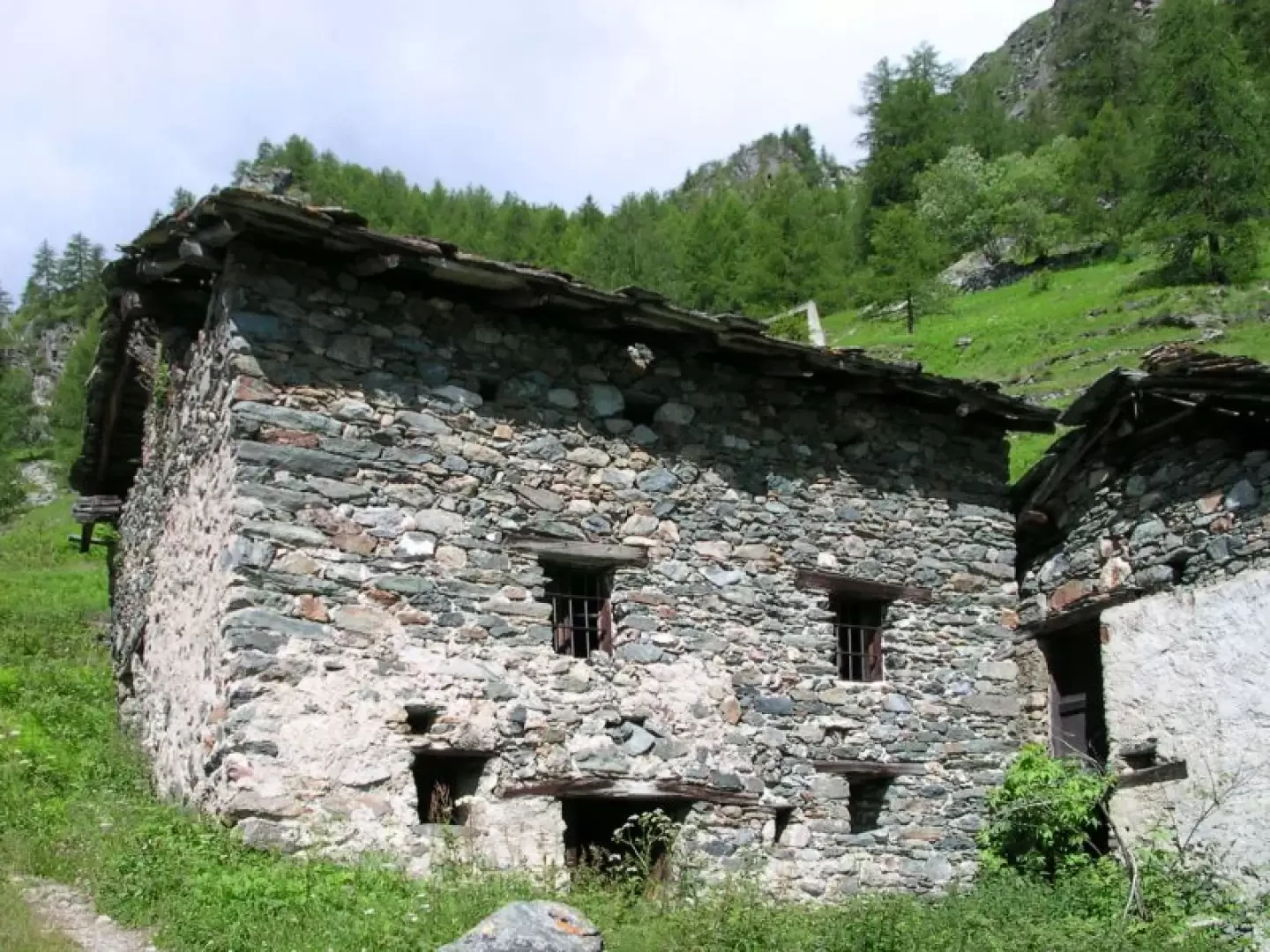
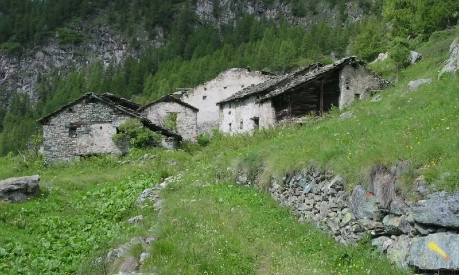
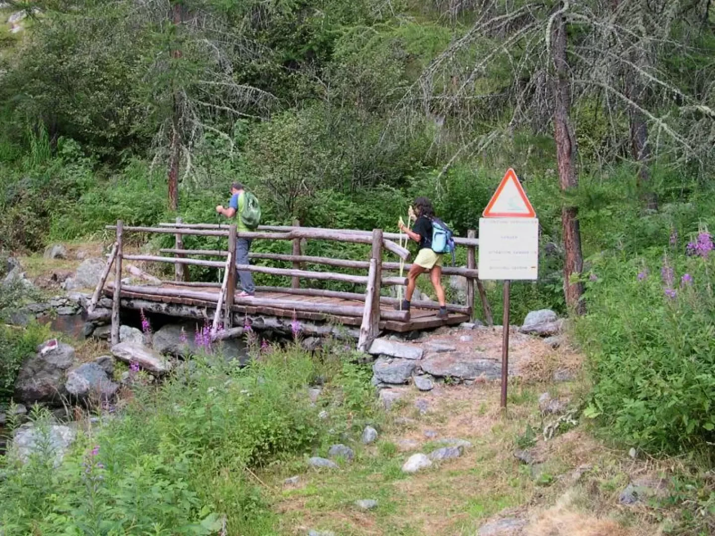
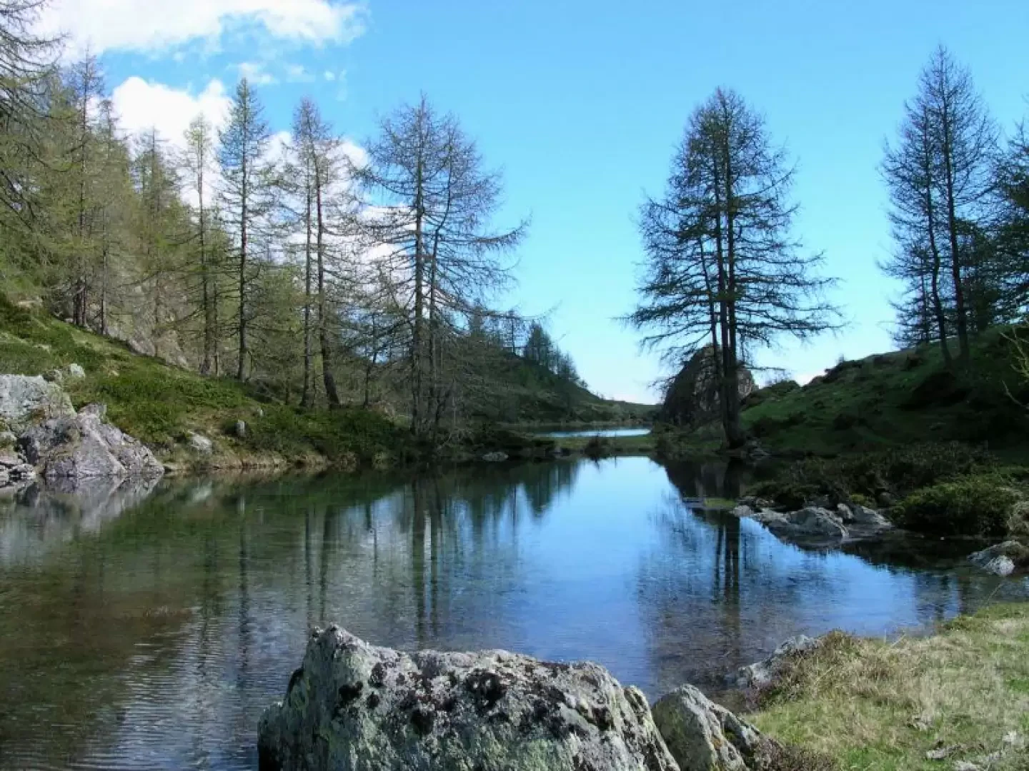
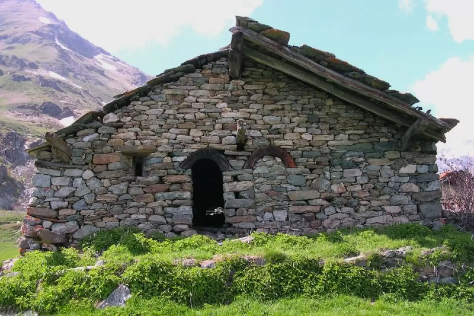
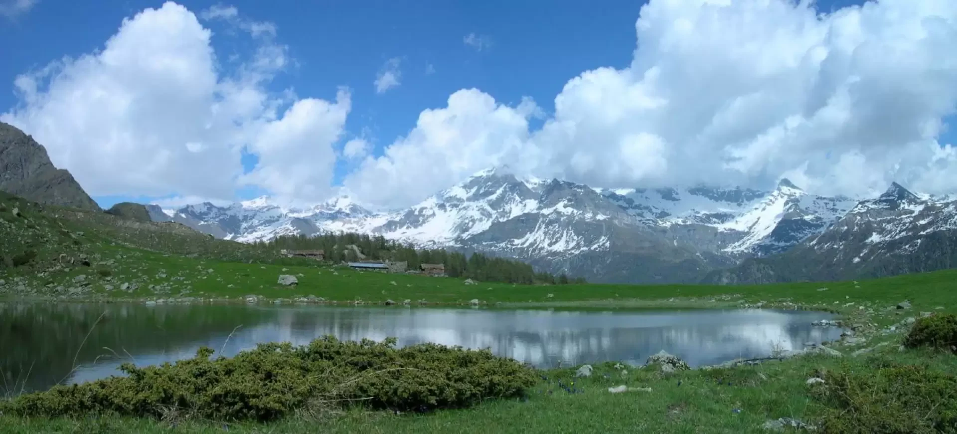
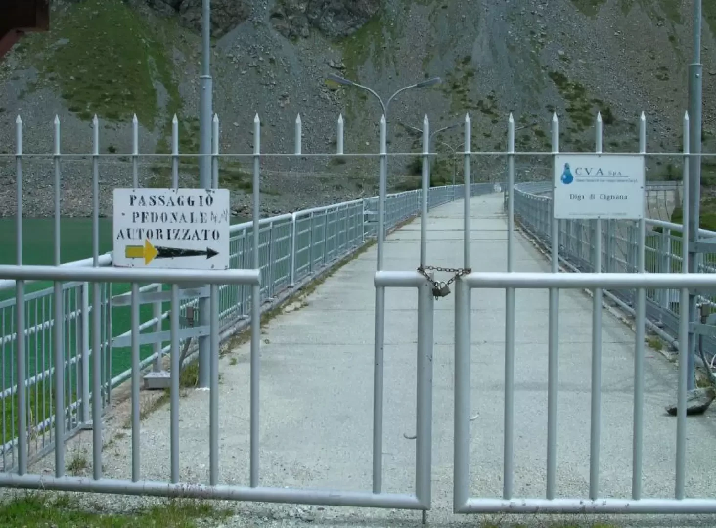
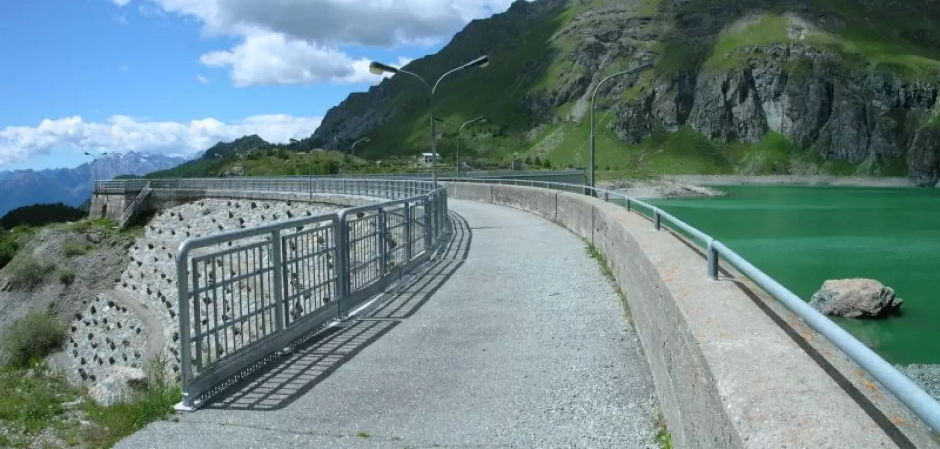
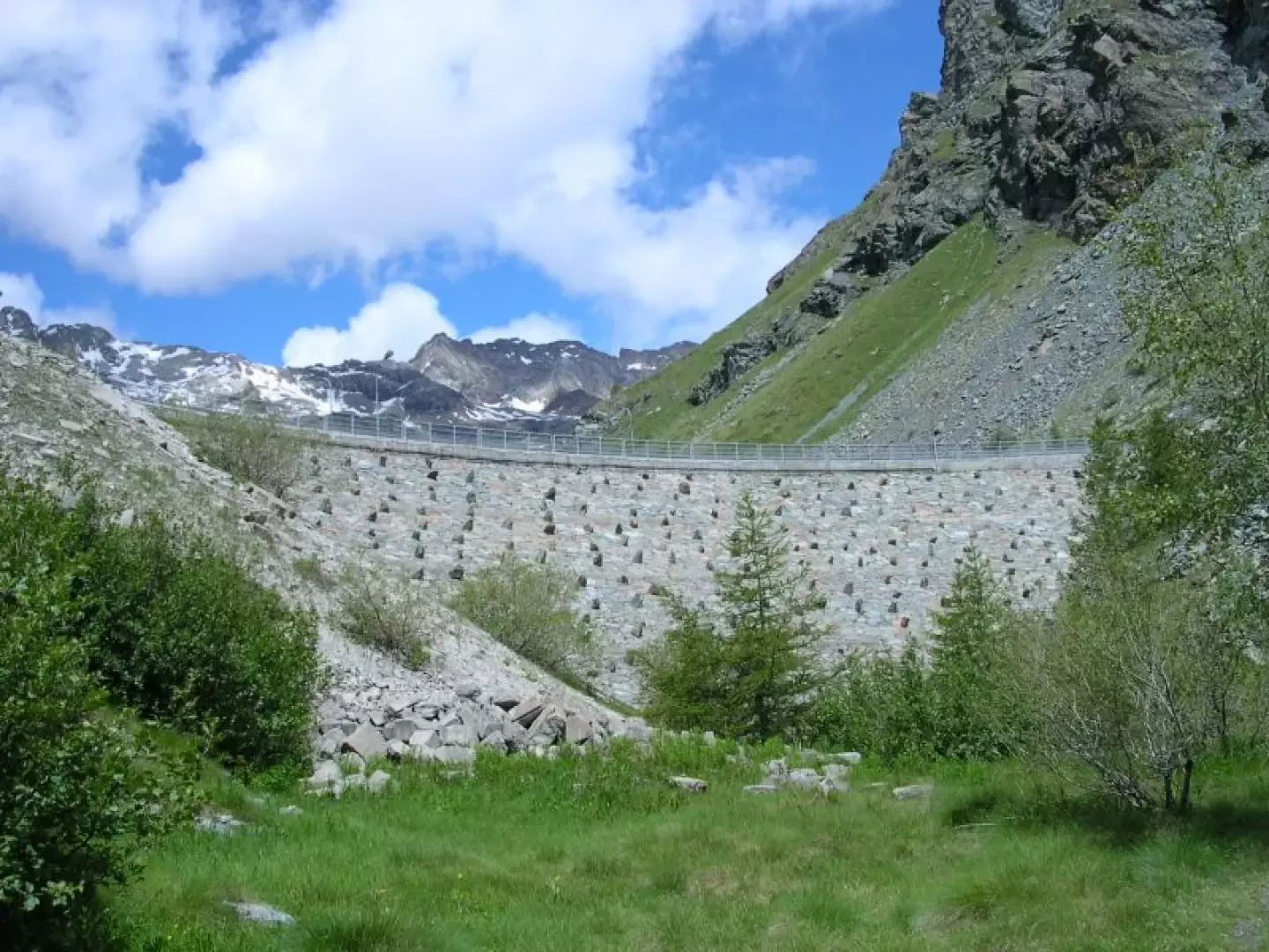
From the Valmartin chapel, continue along the tarmac road for about twenty steps until you reach the stairway where the path to the Cignana dam begins. Following the yellow markers, one crosses the entire historic centre of the hamlet that preserves interesting examples of rural architecture: the greniers built with larch boards where foodstuffs were stored and the rascards used as barns and for threshing grain. Almost at the end of the village, when you catch a glimpse of the Maen pond glinting in the sunlight, you ascend to the right, quickly gaining height behind the houses. The path is completely paved, about a metre wide and with the stones smoothed by the prolonged passage of men and animals. At the crossroads to Maen, the first trees are encountered: mainly hazelnuts, once used to make baskets and panniers, then ash trees with very hard wood and a few cherry trees whose leaves, just before they fall, dot the forest with bright red patches. The path narrows slightly, where there are no retaining walls upstream or downstream it climbs slightly recessed and narrowed by low dry stone walls. The scrub becomes thicker, the damp environment favours the growth of alders and some maples, nettle and mountain geranium thrive in the undergrowth. After the fork to Barmasse, the forest thins out. A long panoramic traverse is followed, from which the village of Valtournenche can be seen. One can distinguish the tennis court covering the swimming pool and on the right, high above, the Promindoz meadows, a clearing that forms a bright green spot entirely surrounded by the darker green of the forest that is only interrupted above the Cheneil basin. On the Promindoz vertical, the tapering silhouette of the Becca Trecaré can be seen, and to its left the snow-covered valley that separates the Grand Tournalin from the Petit Tournalin. Almost at the end of this pleasant, moderately sloping section, one crosses a scrub of larch trees within which the undergrowth consists almost entirely of epilobes. Among the trunks slightly blackened by an old forest fire, you can glimpse the buildings of the former Promoron pumping station where water from the Perrères power station was pumped up to the Cignana dam. From the path, the Maen plateau, at the bottom of which the Marmore stream widens into a small artificial lake, can be seen from above. Towards the south, the horizon is closed off by the squat silhouette of the Barbeston, whose summit resembles the profile of a sleeping person; to the right, the jagged peaks of Mont Ruvic and Cima Nera can be seen. Coming out of the scrub, one crosses an uncovered slope where the pinkish colour of the dog roses is contrasted by the intense yellow of the inflorescences of the Barbeston yew. You pass over a wooden footbridge and after a few bends you reach Promoron where you meet the cycle path a couple of metres wide leading to the Perrères hydroelectric power station. It is a pleasant route to take by bicycle: it follows the route of the little train that connected the two plants and thanks to some tunnels and a beautiful arched bridge made of laminated wood, you can ride along the entire side of the valley with a gradient close to zero. The view from Promoron is very beautiful, you can see all the peaks of the upper Valtournenche from Motta di Plété to Punta Trecaré, on the horizon glistening in the sun the Ventina glacier with the limestone towers of the Cime Bianche in front. To the right the Roisetta then the Becca d'Aran, the Grand Tournalin, recognisable by the dent formed by its double peak, the Piccolo Tournalin and the Punta Trecaré, right on the vertical of the village of Cheneil. The path clearly separates two different worlds, on the right two rural buildings built in stone and wood, classic examples of traditional Valle d'Aosta architecture, on the left the industrial buildings built in the first half of the 20th century for the exploitation of hydroelectric power with metal roofs and large plastered walls. From the small iron bridge over the now demolished penstock, one can take in the whole of these heterogeneous buildings at a glance. On the right is the large building that housed the pumps, with its imposing architecture and massive edges of dressed stone. On the left the watchman's house and the arrival station of the cable car that connected the Maen power station with Promoron, built of exposed reinforced concrete. Still further to the left, the old buildings with slate roofs, the stone slabs used in Valdostan roofing, mute witnesses to an agricultural world that disappeared at the end of the 20th century. Continue along the path until you plunge into the shade of the larches. Under a rocky wall is a concrete anchorage: it is from this point that one of the cables of the cableway used during the work to replace the old penstocks connecting the Cignana dam with the Maen hydroelectric power station departed. The path in this section still retains its original paving, made up of large and small stones placed side by side and smoothed by repeated passages of mountaineers and hikers. After a few bends, almost in view of the village of Falegnon, a mission cross dating from 1958 can be seen on the right. At the side of the path are bushes of junipers and rhododendrons. They used to be uprooted to allow the growth of a few more fistfuls of grass; now, with the abandonment of the high pastures, these shrubs once again cover the meadows on which they stand out in form and colour. We cross the plateau where the village of Falegnon (1925m) lies, a group of houses located at the junction of five paths. Almost all of them are built of plastered stone, with the exception of the first on the right, which has a room built of larch boards in the form of a grenier. The last one on the left going out towards Cignana is a rascard built with larch logs at the top. Cattle used to find shelter in the stone-built ground floor. One of the village buildings has an unusual small covered farmyard. On leaving the village, there is a wooden Alta Via 1 sign indicating the altitude of this small group of houses. In a few minutes you reach the crossroads from which the path to the lake of Cortina and the village of Mont Perron branches off to the left. Following the marker (2), descend for a few tens of metres until you reach the bottom of the valley, cross a small wooden bridge and take the little path that climbs to the right, leaving the main path that heads towards the village of Mont Perron. Climb a steep slope cut by several hairpin bends and then enter the gorge carved by the Cignana stream. On the other side of the gorge, the Alta Via 1 trail up to the Cignana dam is clearly visible. For a stretch, the two paths climb parallel, then, after crossing the band of rocks that plunge down to the stream below, you come to a wide clearing where the path swerves abruptly to the south, plunging into the shade of the forest. In the light shade of the larches, lush undergrowth grows in which blueberries, rhododendrons and mountain flowers fill the eyes with colour and the nose with fragrance. After a short stretch of false ground, the trail gradually begins to climb. At the exit of the forest, we encounter the fairy ponds, two ephemeral lakes that fill with clear water at the thaw or after heavy rains, but empty and become muddy at the end of the summer and after prolonged periods of drought. We cross the flat pastures that welcome the small village of Cortina: a handful of abandoned rural houses that time and human neglect will reduce to ruins in a few decades. The most interesting house has, or rather, had on its east façade two openings with lintels carved from a curved larch trunk forming an almost perfect vault. Lake Cortina is just a few minutes from the village, and can be reached by crossing the meadows in a southerly direction. From its shores, you can enjoy a splendid panorama of the mountains that divide Valtournenche from the Ayas Valley: behind the village you can see the Gran Sommetta then, clockwise, the white ice cap that covers the Gobba di Rollin, the Roisetta, the Grand Tournalin and gradually all the peaks that almost end at the horizon with Mont Tantané and the Zerbion. In the heart of summer, the silence that permeates these places is interrupted only by the distant barking of the shepherd dogs and the grave sound of the cowbells of the grazing herds. However, this bucolic picture has a downside: towards the end of summer, the improper practice of fertirrigation makes the shores of the lake unapproachable, covered by a layer of stinking slurry shot from the tractors. After the stop at the lake shore, you can return to the car by following the outward path or, extending this excursion by half an hour, by passing through the Cignana dam. To reach the reservoir, follow the dirt road that climbs behind the village of Cortina and reaches the last alpine pasture below the Finestra di Cignana, the pass that leads to Perrères. As this is a piece of Alta Via 1, the signposting is sufficiently clear. The path cuts a few bends in the dirt track, shortening the route and passes close to the Barmasse hut, a private hut, a stage point of the Alta Via 1, which displays singular announcements on the door such as "No Phone No Showers" "For sandwiches if there is time and if there is bread". Many shy hikers, having read the notices, opt for a sandwich en plein air for fear of disturbing the managers. Near the refuge are some abandoned huts built in the days of SIP, the Piedmontese hydroelectric company, and used in more recent times as a summer camp. Inside one of these is a mural painting that deserves a mention in the collection of Valdostan alpine art. It is dated 30 July 1970 and depicts the journey to Cignana by three men, a child, a dog and a large cart loaded with luggage. Inexplicably, the route of Alta Via 1 passes the foot of the wall, depriving tourists of this splendid walk suspended between the emptiness of the Cignana valley and the greenish waters of the lake. Instead, it is advisable to go through the gate that allows pedestrian transit and walk along the entire crowning wall of the basin to then descend into the valley below, on the orographic left, along an unmarked but very evident path. After a few minutes, at an altitude of about 2080m, you reach the Alta Via 1 trail in a panoramic spot dominating the entire Cignana valley. Between the light green of the pastures and the darker patches of trees and bushes, the clear and slender line of the trail stands out. Continuing the descent, after crossing a small stream that cuts across the path, there is a monument to the hen on the left, which deserves a mention in the collection of Valdostan alpine art. It is a slab of stone from which forestry workers have carved a depiction of the queen of the hen house with a few skilful touches; at the foot of the Cignana dam, her descendants still provide fresh egg daily to the caretakers of the plant. It is said that the subject depicted was a bird of prey caught in the instant in which it devours the marmot it has just caught but, as we know, criticism is often fierce. After a level stretch, the beaten earth path passes above the gorge of the Cignana stream. In crossing some scree, short stone steps make the ascent easier and the descent less easy for those with tired knees. You can see on the right, at the bottom of the valley, the bridge that you crossed on the way up, and in a few minutes you reach the crossroads and the village of Falegnon from where you can reach your car on the path taken during the ascent. At one time, the Cignana dam was reached by a trolley pulled by cables that ran on rails laid alongside the penstock. Then, for safety reasons, a cable car was built and finally, at great expense, a special machine dug the underground tunnel from Maen to Cignana, through which both the penstocks and the maintenance and security personnel pass. Upstream of the Promoron pumping station, the route of the now dismantled penstock can still be seen, which joins a little further on with that of the trolleys that went up to the Cignana dam. There are some differences between the altitudes given in this report and those that appear on the trail signs. These are annoying differences but of no practical effect. If an averagely trained hiker climbs 350 metres in an hour, a difference of 35 metres is recovered in just over 5 minutes, a little difference compared to the average duration of these routes. The explanation for this discrepancy is trivial: the car park is slightly uphill, so if you park high up you save a few metres in height difference. The crowning altitude of the dam is 2164 metres so slightly lower than that of the Barmasse hut
.. Bibliography
- Fabrizio Hérin, [[Ai piedi del Cervino]], Martini Multimedia Editore, Saint Vincent 2008, p. 82
- Luca Zavatta, [[Le valli del Cervino]], L'Escursionista Editore, Rimini, 2005
- Maria Cristina Ronc, La valle del Cervino, Torino 1990
Cartografia
- [[Valtournenche, Monte Cervino e Val d'Ayas ovest]], Carta dei sentieri foglio 7, scala 1:25.000, L'Escursionista Editore, Rimini, 2005
- Cervino-Matterhorn and Monte Rosa, Sheet 5, scale 1:50,000, Istituto Geografico Centrale
- Communità Montana Monte Cervino - Sheet 2 or Sheet 3 - scale 1 : 25,000
Photo gallery
Galleria fotografica
We have been there

Edited by:
Ermanno Panara
Laghi di Cortina e Cignana
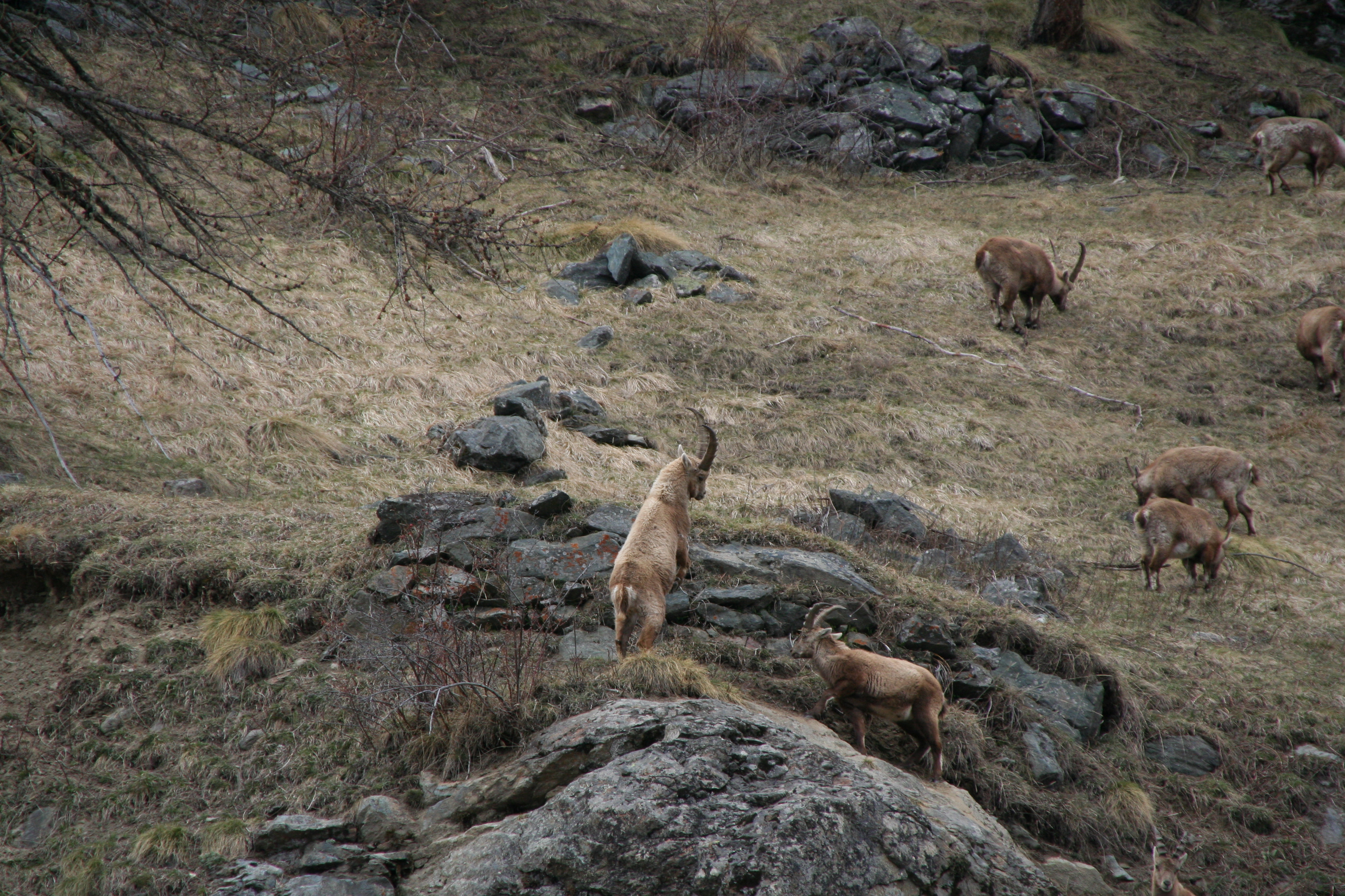
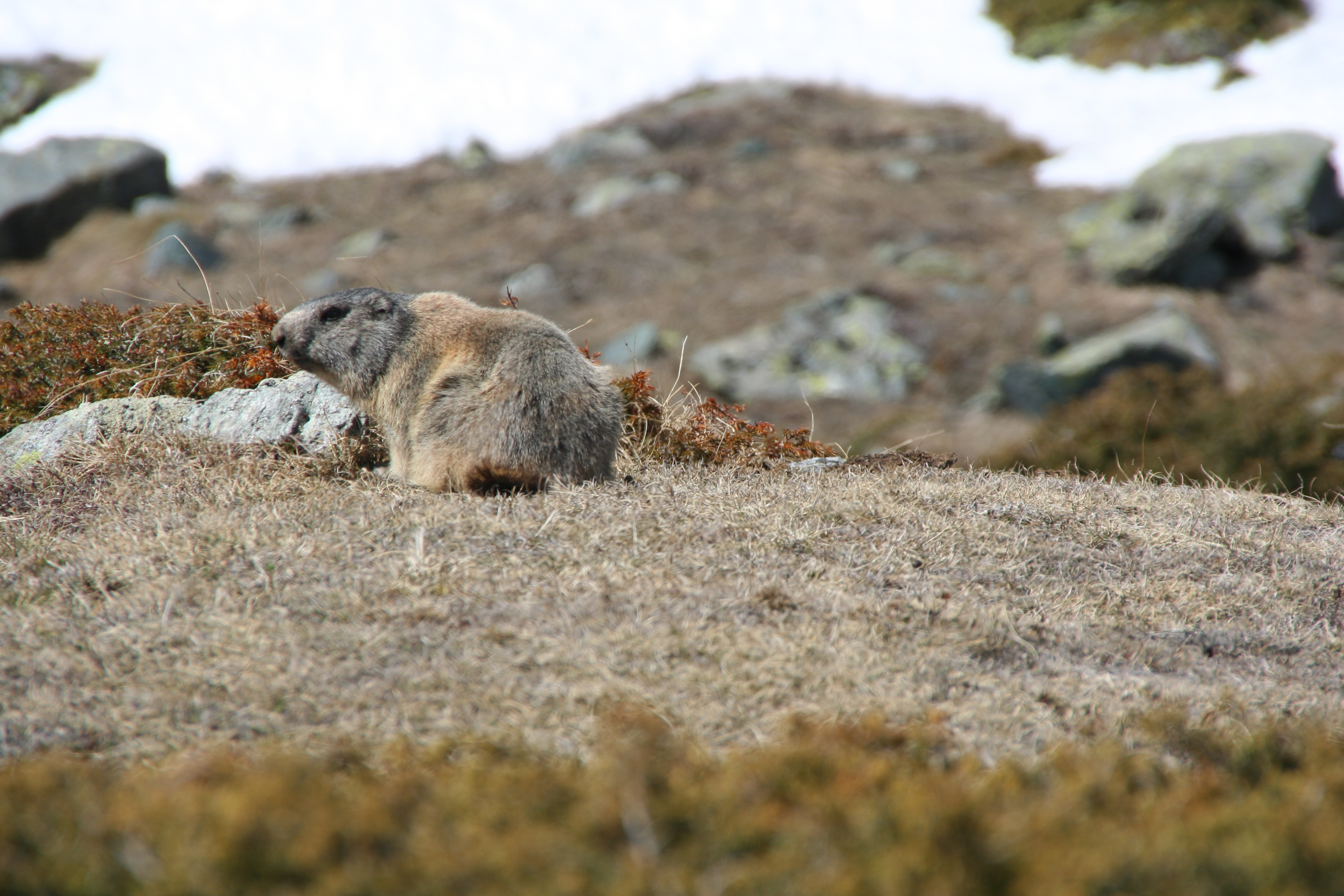
bella gita, incompleta a causa della troppa neve sul sentiero 2, subito dopo il bivio per l'Alta Via 1. Siamo ritornati sui nostri passi e abbiamo seguito il percorso sul sentiero 1, passando prima dal Lago di Cignana e poi il Lago Cortina, e ritorno. Ritorno per il percorso dell'Alta Via, deviando per Maen. Ottime le paline segna via, fino all'arrivo. Problematico il parcheggio, "scroccato" ad un Bar, ripagato però al ritorno con un ottimo tagliere e la tradizionale freschissima birra. Avvistamenti faunistici: Marmota marmota, Capra ibex